| |
[p18]
The Court,
composed as above,
after deliberation,
delivers the following Judgment:
1. By a letter of 25 November 1978, received in the Registry of the Court on
1 December 1978, the Minister of Foreign Affairs of Tunisia notified the
Court of a Special Agreement in the Arabic language signed at Tunis on 10
June 1977 between the Republic of Tunisia and the Socialist People's Libyan
Arab Jamahiriya; a certified copy of the Special Agreement was enclosed with
the letter, together with a translation into French.
2. In the French translation supplied by Tunisia, Articles 1 to 5 of the
Special Agreement read as follows [English translation by the Registry]:
"Article 1
The Court is requested to render its Judgment in the following matter:
What are the principles and rules of international law which may be applied
for the delimitation of the area of the continental shelf appertaining to
the Republic of Tunisia and the area of the continental shelf appertaining
to the Socialist People's Libyan Arab Jamahiriya and, in rendering its
decision, to take account of equitable principles and the relevant
circumstances which characterize the area, as well as the recent trends
admitted at the Third Conference on the Law of the Sea.
Also, the Court is further requested to specify precisely the practical way
in which the aforesaid principles and rules apply in this particular
situation so as to enable the experts of the two countries to delimit those
areas without any difficulties. [p22]
Article 2
Immediately following the delivery of the Judgment by the Court, the two
Parties shall meet to put into effect these principles and rules to
determine the line of delimitation of the area of the continental shelf
appertaining to each of the two countries, with a view to the conclusion of
a treaty in this matter.
Article 3
In the event that the agreement mentioned in Article 2 is not reached within
a period of three months, renewable by mutual agreement, from the date of
delivery of the Court's Judgment, the two Parties shall together go back to
the Court and request such explanations or clarifications as may facilitate
the task of the two delegations, to arrive at the line separating the two
areas of the continental shelf, and the two Parties shall comply with the
Judgment of the Court and with its explanations and clarifications.
Article 4
A. The proceedings shall consist of written pleadings and oral argument.
B. Without prejudice to any question that may arise relating to the means of
proof, the written pleadings shall consist of the following documents:
(1) Memorials to be submitted to the Court and exchanged between the two
Parties within a period not exceeding eighteen (18) months from the date of
the notification of the present Special Agreement to the Registrar of the
Court.
(2) Counter-Memorials to be submitted by both Parties to the Court and
exchanged between them as follows: the Republic of Tunisia shall submit its
Counter-Memorial within a period of six (6) months from the date on which it
receives from the Court notification of the Memorial; the Socialist People's
Libyan Arab Jamahiriya shall submit its Counter-Memorial within a period of
eight (8) months from the date on which it receives from the Court
notification of the Memorial.
(3) If necessary, additional written pleadings to be submitted to the Court
and exchanged within periods to be fixed by the Court at the request of
either Party or, if the Court so decides, after consultation between the two
Parties.
C. The question of the order of speaking for the oral argument shall be
decided by mutual agreement between the Parties and whatever order of
speaking may be adopted, it shall be without prejudice to any question
relating to the burden of proof.
Article 5
This Special Agreement shall enter into force on the date on which the
instruments of its ratification are exchanged and shall be notified to the
Registrar of the Court by both Parties or by either of them."[p23]
3. Pursuant to Article 40, paragraph 2, of the Statute, and to Article 39,
paragraph 1, of the Rules of Court, a certified copy of the notification and
of the Special Agreement was forthwith transmitted to the Government of the
Socialist People's Libyan Arab Jamahiriya. By a letter of 14 February 1979,
received in the Registry of the Court on 19 February 1979, the Secretary of
Foreign Affairs of the Socialist People's Libyan Arab Jamahiriya made a like
notification to the Court, enclosing a further certified copy of the Special
Agreement in the Arabic language, together with a translation into English.
4. In the English translation supplied by the Libyan Arab Jamahiriya,
Articles 1 to 5 of the Special Agreement read as follows:
"Article 1
The Court is requested to render its Judgment in the following matter:
What principles and rules of international law may be applied for the
delimitation of the area of the continental shelf appertaining to the
Socialist People's Libyan Arab Jamahiriya and to the area of the continental
shelf appertaining to the Republic of Tunisia, and the Court shall take its
decision according to equitable principles, and the relevant circumstances
which characterize the area, as well as the new accepted trends in the Third
Conference on the Law of the Sea.
Also, the Court is further requested to clarify the practical method for the
application of these principles and rules in this specific situation, so as
to enable the experts of the two countries to delimit these areas without
any difficulties.
Article 2
Following the delivery of the Judgment of the Court, the two Parties shall
meet to apply these principles and rules in order to determine the line of
delimitation of the area of the continental shelf appertaining to each of
the two countries, with a view to the conclusion of a treaty in this
respect.
Article 3
In case the agreement mentioned in Article 2 is not reached within a period
of three months, renewable by mutual agreement from the date of delivery of
the Court's Judgment, the two Parties shall together go back to the Court
and request any explanations or clarifications which would facilitate the
task of the two delegations to arrive at the line separating the two areas
of the continental shelf, and the two Parties shall comply with the Judgment
of the Court and with its explanations and clarifications.
Article 4
(a) The proceedings shall consist of written pleadings and oral argument.
(b) Without prejudice to any question which may arise relating to the means
of proof, the written pleadings shall consist of the following documents:[p24]
First — Memorials to be submitted to the Court and exchanged between the two
Parties, within a period not exceeding (18) eighteen months from the date of
the notification of this Agreement to the Registrar of the Court.
Second — Counter-Memorials to be submitted to the Court by both Parties and
exchanged between them as follows:
The Republic of Tunisia shall submit its Counter-Memorial within a period of
(6) six months from the date on which it receives from the Court
notification of the Memorial; the Socialist People's Libyan Arab Jamahiriya
shall present its Counter-Memorial within a period of (8) eight months from
the date on which it receives from the Court notification of the Memorial.
Third - If necessary, additional written pleadings to be submitted to the
Court and exchanged within periods to be fixed by the Court, at the request
of either Party, or, if the Court so decides, after consultation between the
two Parties.
(c) The question of the order of speaking for the oral argument shall be
decided by mutual agreement between the two Parties and whatever order of
speaking is accepted it shall not prejudice any question relating to the
presentation of proof.
Article 5
This Agreement shall enter into force on the date of exchange of the
instruments of its ratification and shall be notified to the Registrar of
the Court by the two Parties or by either of them."
5. Pursuant to Article 40, paragraph 3, of the Statute and to Article 42 of
the Rules of Court, copies of the notifications and Special Agreement were
transmitted to the Secretary-General of the United Nations, the Members of
the United Nations and other States entitled to appear before the Court.
6. Since the Court did not include upon the bench a judge of Tunisian or of
Libyan nationality, each of the Parties proceeded to exercise the right
conferred by Article 31, paragraph 3, of the Statute to choose a judge ad
hoc to sit in the case. On 14 February 1979 the Libyan Arab Jamahiriya
designated Mr. Eduardo Jimenez de Arechaga, and the Parties were informed on
25 April 1979, pursuant to Article 35, paragraph 3, of the Rules of Court
that there was no objection to this appointment; on 11 December 1979 Tunisia
designated Mr. Jens Evensen, and on 7 February 1980 the Parties were
informed that there was no objection to this appointment.
7. By Orders of 20 February 1979 and 3 June 1980 respectively time-limits
were fixed for the filing of a Memorial and a Counter-Memorial by each of
the two Parties, and the Memorials and Counter-Memorials were duly filed
within the time-limits so fixed, and exchanged between the Parties pursuant
to the Special Agreement.
8. By a letter from the Prime Minister of the Republic of Malta dated 28
January 1981 and received in the Registry of the Court on 30 January 1981,
the Government of Malta, invoking Article 62 of the Statute, submitted to
the Court a request for permission to intervene in the case. By a Judgment
dated 14 April 1981, the Court found that that request of Malta could not be
granted. [p25]
9. By an Order dated 16 April 1981, the President of the Court, having
regard to Article 4 (b) (3) of the Special Agreement, quoted above, fixed a
time-limit for the filing of Replies by the two Parties, and such Replies
were filed and exchanged within the time-limit fixed.
10. On 16 to 18 September, 21 to 25 September, 29 September to 2 October, 5
to 9 October, 13 to 15 October, and 19 to 21 October 1981, the Court held
public sittings at which it was addressed by the following representatives
of the Parties:
For Tunisia: H.E. Mr. Slim Benghazi,
Professor Sadok Belaďd,
Professor Robert Jennings, Q.C.,
Professor Rene-Jean Dupuy,
Professor Michel Virally,
Professor Georges Abi-Saab,
Professor Yadh Ben Achour,
Professor Pierre-Marie Dupuy,
Professor Robert Laffitte,
Professor Carlo Morelli,
Professor Habib Lazreg.
For the Libyan Arab Jamahiriya:
H.E. Mr. Kamel H. El Maghur,
Professor D. W. Bowett, Q.C.,
Professor Herbert W. Briggs,
Professor Claude-Albert Colliard,
Mr. Keith Highet,
Professor Antonio Malintoppi,
Sir Francis A. Vallat, K.C.M.G., Q.C.,
Professor Omar Hammuda,
Dr. Claudio Vita-Finzi.
11. Dr. Frank A. Fabricius was called as an expert by the Libyan Agent,
pursuant to Articles 57 and 63 to 65 of the Rules of Court. He was examined
in chief by Professor D. W. Bowett and was cross-examined by Professor M.
Virally.
12. On 14 October 1981 the Court held a sitting in camera at which the Agent
of Tunisia showed a film on "The Tunisian Shelf and the Gulf of Gabes : the
Low-tide Elevations". The Agent of the Libyan Arab Jamahiriya had previously
been afforded the opportunity of studying the film, and had indicated that
he did not find it necessary to object to the showing of the film.
13. In the course of the hearings questions were put to both Parties by
Members of the Court. Prior to the close of the hearings, oral or written
replies to those questions were given by the Agents of the Parties.
14. The Governments of the United States of America, the Netherlands,
Canada, Argentina, Malta and Venezuela, in reliance on Article 53, paragraph
1, of the Rules of Court, asked to be furnished with copies of the pleadings
in the case. By letters of 24 November 1980, after the views of the Parties
had been sought, and objection had been raised by one of them, the Registrar
informed those Governments that the President of the Court had decided that
the pleadings in the case and documents annexed would not, for the present,
be made available to States not parties to the case. On 14 September 1981
the Court [p26] decided, after ascertaining the views of the Parties
pursuant to Article 53, paragraph 2, of the Statute, that the pleadings
should be made accessible to the public with effect from the opening of the
oral proceedings, and they were thus at the same time made available to the
States mentioned above.
*
15. In the course of the written proceedings, the following Submissions were
presented by the Parties:
On behalf of the Republic of Tunisia:
in the Memorial:
"On the basis of the factual and legal considerations set out in the
Memorial submitted by the Republic of Tunisia, may it please the Court to
adjudge and declare:
I. In reply to the first question put in Article 1 of the Special Agreement
of 10 June 1977:
1. The delimitation contemplated in that Article (hereinafter referred to as
'the delimitation') is to be effected in such a way, taking into account the
physical and natural characteristics of the area, as to leave to each party
all those parts of the continental shelf that constitute a natural
prolongation of its land territory into and under the sea, without
encroachment on the natural prolongation of the land territory of the other;
2. The delimitation must not, at any point, encroach upon the area within
which Tunisia possesses well-established historic rights, which is defined
laterally on the side toward Libya by line ZV-45°, and in the direction of
the open sea by the 50-metre isobath;
3. The rule defined in paragraph 1 above is to be applied taking into
account that as a result of the geomorphological peculiarities of the region
it has been possible to establish that the natural prolongation of Tunisia
certainly extends eastwards as far as the areas between the 250-metre and
300-metre isobaths, and south-eastwards as far as the zone constituted by
the Zira and Zuwarah Ridges;
4. In the areas situated to the east and southeast of the region defined
above, the delimitation is to take account of all the relevant circumstances
which characterize the area, and in particular:
(a) the fact that the eastern coastal front of Tunisia is marked by the
presence of a body of islands, islets and low-tide elevations which form a
constituent part of the Tunisian littoral;
(b) the fact that the general configuration of the coasts of the two States
is reproduced with remarkable fidelity by the bathymetric curves in the
delimitation area and that this fact is simply a manifestation of the
physical and geological structure of the region; that in consequence the
natural prolongation of Tunisia is oriented west-east, and that of Libya
southwest-northeast;
(c) the potential cut-off effect for Tunisia which could result from the[p27]particular angulation of the Tuniso-Libyan littoral in combination with
the position on the coast of the frontier point between the two States;
(d) the irregularities characterizing the Tunisian coasts, resulting from a
succession of concavities and convexities, as compared with the general
regularity of the Libyan coasts in the delimitation area;
(e) the situation of Tunisia opposite States whose coasts are relatively
close to its own, and the effects of any actual or prospective delimitation
carried out with those States
.
II. In reply to the second question put in Article 1 of the Special
Agreement of 10 June 1977:
1. The delimitation should lead to the drawing of a line which would not
appreciably depart from the lines which result from taking into account the
geomorphological factors peculiar to the region, in particular the existence
of a crestline constituted by the Zira and Zuwarah Ridges and of the general
orientation of the natural prolongations of the territories of the two
countries toward the abyssal plain of the Ionian Sea;
2. The delimitation line could either:
(a) be constituted by a line drawn at the Tuniso-Libyan frontier parallel to
the bisector of the angle formed by the Tuniso-Libyan littoral in the Gulf
of Gabes (cf. para. 9.25 of this Memorial); or
(b) be determined according to the angle of aperture of the coastline at the
Tuniso-Libyan frontier, in proportion to the length of the relevant coasts
of the two States (cf. paras. 9.30-9.34 of this Memorial)";
the Counter-Memorial:
"On the basis of the factual and legal considerations set out in the
Counter-Memorial submitted by the Republic of Tunisia, may it please the
Court to adjudge and declare:
I. In reply to the first question put in Article 1 of the Special Agreement
of 10 June 1977:
1.The delimitation contemplated in that Article (hereinafter referred to as
'the delimitation') is to be effected in such a way, taking into account the
physical and natural characteristics of the area, as to leave to each Party
all those parts of the continental shelf that constitute a natural
prolongation of its land territory into and under the sea, without
encroachment on the natural prolongation of the land territory of the other;
2. The delimitation must not, at any point, encroach upon the area within
which Tunisia possesses well-established historic rights, which is defined
laterally on the side toward Libya by line ZV-45°, and in the direction of
the open sea by the 50-metre isobath;
3. The delimitation must also be effected in conformity with equitable
principles and taking account of all the relevant circumstances which
characterize the case, it being understood that a balance must be
established between the various circumstances, in order to arrive at an
equitable result, without refashioning nature;[p28]
4. The rule defined in paragraphs 1 and 3 above is to be applied taking into
account that as a result of the geomorphological peculiarities of the region
it has been possible to establish that the natural prolongation of Tunisia
certainly extends eastwards as far as the areas between the 250-metre and
300-metre isobaths, and south-eastwards as far as the zone constituted by
the Zira and Zuwarah Ridges;
5. In the area situated to the east and south-east of the region defined
above, the delimitation is to take account of all the other relevant
circumstances which characterize the area, and in particular:
(a) the fact that the eastern coastal front of Tunisia is marked by the
presence of a body of islands, islets and low-tide elevations which form a
constituent part of the Tunisian littoral;
(b) the fact that the general configuration of the coasts of the two States
is reproduced with remarkable fidelity by the bathymetric curves in the
delimitation area and that this fact is simply a manifestation of the
physical and geological structure of the region; that in consequence the
natural prolongation of Tunisia is oriented west-east, and that of Libya
southwest-northeast;
(c) the potential cut-off effect for Tunisia which could result from the
particular angulation of the Tuniso-Libyan littoral in combination with the
position on the coast of the frontier point between the two States;
(d) the irregularities characterizing the Tunisian coasts, resulting from a
succession of concavities and convexities, as compared with the general
regularity of the Libyan coasts in the delimitation area;
(e) the situation of Tunisia opposite States whose coasts are relatively
close to its own, and the effects of any actual or prospective delimitation
carried out with those States.
II. In reply to the second question put in Article 1 of the Special
Agreement of 10 June 1977:
1. The delimitation should lead to the drawing of a line which would not
appreciably depart from the lines which result from taking into account the
geomorphological factors peculiar to the region, in particular the existence
of a crestline constituted by the Zira and Zuwarah Ridges and of the general
orientation of the natural prolongation of the territories of the two
countries toward the abyssal plain of the Ionian Sea;
2. The delimitation line could either:
(a) be constituted by a line drawn at the Tuniso-Libyan frontier parallel to
the bisector of the angle formed by the Tuniso-Libyan littoral in the Gulf
of Gabes (see para. 9.25 of the Tunisian Memorial); or
(b) be determined according to the angle of aperture of the coastline at the
Tuniso-Libyan frontier, in proportion to the length of the relevant coast of
the two States (see paras. 9.30-9.34 of the Tunisian Memorial)";
in the Reply:
"The Tunisian Government maintains in full the submissions of its
Counter-Memorial and respectfully requests the Court to reject the sub-[p29] missions of Libya in so far as they are contrary to the Tunisian submissions."
On behalf of the Socialist People's Libyan Arab Jamahiriya:
in the Memorial:
"In view of the facts set forth in Part I of this Memorial, the statement of
the law contained in Part II, and the arguments applying the law to the
facts as stated in Part III of this Memorial ;
Considering that the Special Agreement between the Parties requests the
Court to render its Judgment as to what principles and rules of
international law may be applied for the delimitation of the area of the
continental shelf appertaining to the Socialist People's Libyan Arab
Jamahiriya and to the area of the continental shelf appertaining to the
Republic of Tunisia, and requests the Court to take its decision according
to equitable principles, and the relevant circumstances which characterize
the area, as well as the new accepted trends in the Third Conference on the
Law of the Sea;
May it please the Court, on behalf of the Socialist People's Libyan Arab
Jamahiriya, to adjudge and declare:
1. The concept of the continental shelf as the natural prolongation of the
land territory into and under the sea is fundamental to the juridical
concept of the continental shelf and a State is entitled ipso facto and ab
initio to the continental shelf which is the natural prolongation of its
land territory into and under the sea.
2. Any delimitation should leave as much as possible to each Party all those
parts of the continental shelf that constitute such a natural prolongation.
3. A delimitation which gives effect to the principle of natural
prolongation is one which respects the inherent ipso jure rights of each
State, and the assertion of such rights is therefore in accordance with
equitable principles.
4. The direction of natural prolongation is determined by the general
geological and geographical relationship of the continental shelf to the
continental landmass, and not by the incidental or accidental direction of
any particular part of the coast.
5. In the present case the continental shelf off the coast of North Africa
is a prolongation to the north of the continental landmass, and therefore
the appropriate method of delimitation of the areas of continental shelf
appertaining to each Party in this specific situation is to reflect the
direction of this prolongation northward of the terminal point of the land
boundary.
6. Application of the equidistance method is not obligatory on the Parties
either by treaty or as a rule of customary international law.
7. Whether the application of a particular method of delimitation is in
accordance with equitable principles is to be tested by its results.
8. The equidistance method is in itself neither a 'rule' nor a 'principle'
and [p30] is not necessarily 'equitable' since its application under
particular circumstances may lead to inequitable results.
9. A principle or method of delimitation which disregards the ipso jure
title of a coastal State to the continental shelf constituting the natural
prolongation of its land territory is, ipso facto, illegal and necessarily
inequitable.
10. In the present case, given the particular geographical configuration,
the equidistance method would result in a delimitation of the continental
shelf which would be inequitable, inappropriate, and not in conformity with
international law.
11. The baselines promulgated by Tunisia in 1973 are not opposable to Libya
for the purposes of the delimitation and the results of giving effect to
them would in any event be inappropriate and inequitable.
12. For the purpose of achieving an equitable delimitation, the whole of the
sea-bed and subsoil beyond the low-water mark along the coast of each Party
is to be taken into account";
in the Counter-Memorial:
"In view of the facts set forth in Part I of the Libyan Memorial, the
statement of the law contained in Part II, and the arguments applying the
law to the facts as stated in Part III of the Libyan Memorial; and
In view of the observations concerning the facts as stated in the Tunisian
Memorial and statement of law as therein contained, and the additional facts
and the statement of law contained in this Counter-Memorial;
Considering that the Special Agreement between the Parties requests the
Court to render its Judgment as to what principles and rules of
international law may be applied for the delimitation of the area of the
continental shelf appertaining to the Socialist People's Libyan Arab
Jamahiriya and to the area of the continental shelf appertaining to the
Republic of Tunisia, and requests the Court to take its decision according
to equitable principles, and the relevant circumstances which characterize
the area, as well as the new accepted trends in the Third Conference on the
Law of the Sea;
May it please the Court, rejecting all contrary claims and Submissions set
forth in the Tunisian Memorial,
To adjudge and declare as follows:
1. The concept of the continental shelf as the natural prolongation of the
land territory into and under the sea is fundamental to the juridical
concept of the continental shelf, and a State is entitled ipso facto and ah
initio to the continental shelf which is the natural prolongation of its
land territory into and under the sea.
2. The natural prolongation of the land territory of a State into and under
the sea which establishes its ipso jure title to the appurtenant continental
shelf is determined by the whole physical structure of the landmass as
indicated primarily by geology.
3. Submarine ridges on the sea-bed, even if and where ascertained, which [p31]do not disrupt the essential unity of the continental shelf provide no scientific basis for a legal principle of delimitation.
4. The 'fishing rights' claimed by Tunisia as 'historic rights', even if and
where ascertained, are in any event irrelevant to shelf delimitation in the
present case.
5. The direction of natural prolongation is determined by the general
geological and geographical relationship of the continental shelf to the
continental landmass, and not by the incidental or accidental direction of
any particular part of the coast.
6. In the present case the continental shelf off the coast of North Africa
is a prolongation to the north of the continental landmass, and therefore
the appropriate method of delimitation of the areas of continental shelf
appertaining to each Party in this specific situation is to reflect the
direction of this prolongation northward of the terminal point of the land
boundary.
7. The practical method for the application of the principles and rules of
international law in this specific situation is therefore to continue the
reflection of the direction of the natural northward prolongation from the
outer limit of the territorial sea, at least as far as the parallel where
there occurs a significant change in the general direction of the Tunisian
coast which might reasonably be required to be taken into account in order
to achieve a delimitation respecting the relevant circumstances in
accordance with equitable principles, without affecting the rights of States
not Parties to these proceedings.
8. Any delimitation should leave as much as possible to each Party all those
parts of the continental shelf that constitute its natural prolongation.
9. A delimitation which gives effect to the principle of natural
prolongation is one which respects the inherent ipso jure rights of each
State, and the assertion of such rights is therefore in accordance with
equitable principles. A principle or method of delimitation which
disregards the ipso jure title of a coastal State to the continental shelf
constituting the natural prolongation of its land territory is, ipso facto,
illegal and necessarily in-equitable.
10. Whether the application of a particular method of delimitation is in
accordance with equitable principles is to be tested by its results.
11. For the purpose of achieving an equitable delimitation, the whole of the
sea-bed and subsoil beyond the low-water mark along the coast of each Party
is to be taken into account.
12. While the concept of proportionality is not applicable to the
geological and juridical appurtenance of continental shelf which confers
ipso jure entitlement on a State, it may properly be used as a criterion to
evaluate the effect of geographical features on a delimitation in marginal
areas.
13. Application of the equidistance method is not obligatory on the Parties
either by treaty or as a rule of customary international law. The
equidistance method is in itself neither a 'rule' nor a 'principle' and is
not [p32] necessarily 'equitable' since its application in particular
circumstances may lead to inequitable results.
14. In the present case, given the particular geographical configuration,
the equidistance method would result in a delimitation of the continental
shelf which would be inequitable, inappropriate, and not in conformity with
international law.
15. The baselines promulgated by Tunisia in 1973 are not opposable to Libya
for the purposes of the delimitation and the results of giving effect to
them would in any event be inappropriate and inequitable";
in the Reply:
"Libya confirms and maintains the Submissions made in its Memorial and
Counter-Memorial, as follows" (whereafter the Submissions as set out in the
Counter-Memorial were reproduced).
16. In the course of the oral proceedings, the following Submissions were
presented by the Parties:
On behalf of the Republic of Tunisia:
at the hearing of 25 September 1981:
"May it please the Court to adjudge and declare:
I. In reply to the first question put in Article 1 of the Special Agreement
of 10 June 1977:
1. The delimitation contemplated in that Article (hereinafter referred to as
'the delimitation') is to be effected in such a way, taking into account the
physical and natural characteristics of the area, as to leave to each party
all those parts of the continental shelf that constitute a natural
prolongation of its land territory into and under the sea, without
encroachment on the natural prolongation of the land territory of the other;
2. The delimitation must not, at any point, encroach upon the area within
which Tunisia possesses well-established historic rights, which is defined
laterally on the side toward Libya by line ZV-450, and in the direction of
the open sea by the 50-metre isobath;
3. The delimitation must also be effected in conformity with equitable
principles and taking account of all the relevant circumstances which
characterize the case, it being understood that a balance must be
established between the various circumstances, in order to arrive at an
equitable result, without refashioning nature;
4. The rules defined in paragraphs 1 and 3 above are to be applied taking
into account that as a result of the geomorphological peculiarities of the
region it has been possible to establish that the natural prolongation of
Tunisia certainly extends eastwards as far as the areas between the
250-metre and 300-metre isobaths, and south-eastwards as far as the zone
constituted by the Zira and Zuwarah Ridges;
5. In the areas situated to the east and south-east of the region defined
above, the delimitation is to take account of all the other relevant
circumstances which characterize the area, and in particular:[p33]
(a) the fact that the eastern coastal front of Tunisia is marked by the
presence of a body of islands, islets and low-tide elevations which form a
constituent part of the Tunisian littoral;
(b) the fact that the general configuration of the coasts of the two States
is reproduced with remarkable fidelity by the bathymetric curves in the
delimitation area and that this fact is simply a manifestation of the
physical and geological structure of the region ; that in consequence the
natural prolongation of Tunisia is oriented west-east, and that of Libya
southwest-northeast;
(c) the potential cut-off effect for Tunisia which could result from the
particular angulation of the Tuniso-Libyan littoral in combination with the
position on the coast of the frontier point between the two States;
(d) the irregularities characterizing the Tunisian coast, resulting from a
succession of concavities and convexities, as compared with the general
regularity of the Libyan coasts in the delimitation area;
(e) the situation of Tunisia opposite States whose coasts are relatively
close to its own, and the effects of any actual or prospective delimitation
carried out with those States.
II. In reply to the second question put in Article 1 of the Special
Agreement of 10 June 1977:
1. The delimitation should lead to the drawing of a line which would not
appreciably depart from the lines which result from taking into account the
geomorphological factors peculiar to the region, in particular the existence
of a crestline determined by the Zira and Zuwarah Ridges, and particularly
by the Zira Ridge, and by the general orientation of the natural
prolongations of the territories of the two countries toward the abyssal
plain of the Ionian Sea.
2. The delimitation line could either:
(a) be constituted by a line drawn at the Tuniso-Libyan frontier parallel to
the bisector of the angle formed by the Tuniso-Libyan littoral in the Gulf
of Gabes (see para. 9.25 of the Tunisian Memorial); or
(b) be determined according to the angle of aperture of the coastline at the
Tuniso-Libyan frontier, in proportion to the length of the relevant coasts
of the two States (see paras. 9.30-9.34 of the Tunisian Memorial)";
at the hearing of 15 October 1981, the Agent of Tunisia stated that the
Government of Tunisia maintained the Submissions made on 25 September 1981.
On behalf of the Socialist People's Libyan Arab Jamahiriya:
at the hearing of 9 October 1981, the Agent of the Libyan Arab Jamahiriya
stated that the Government of the Libyan Arab Jamahiriya confirmed and
maintained its Submissions as set forth in the Libyan Counter-Memorial and
the Libyan Reply;
at the hearing of 21 October 1981 the Agent of the Libyan Arab Jamahiriya [p34] stated that the Government of the Libyan Arab Jamahiriya confirmed and
maintained unchanged its Submissions as set forth in the Libyan
Counter-Memorial.
***
17. It is appropriate to begin with a general description of the
geographical context of the dispute before the Court, that is to say the
general area in which the continental shelf delimitation, which is the
subject of the proceedings, has to be effected. However, one of the issues
between the Parties has been whether it is necessary, before examining a
proposed delimitation, to define the area to be delimited, and if so, what
is the effect of such definition. The Parties have also disagreed quite
markedly over questions of geographical description, particularly with
respect to coastal features; not so much because there is doubt as to the
physical facts (except in some sea-bed areas) but rather because the
relative importance of a geographical feature, and judgment whether it
constitutes a norm or an exception, may vary — or appear to vary — according
to the cartographic scale employed, and according to whether the observer
contemplates such feature in a much wider context or concentrates upon it in
its immediate surroundings.
18. It should be emphasized that the only purpose of the description which
follows is to outline the background, and not to define legally the area of
delimitation nor to say how the Court views the various geographical
features for the purposes of their impact on the legal situation. To the
extent that the definition of any feature may command a conclusion of law
material to the Court's decision, the definition will be provided at the
appropriate point in this Judgment. Similarly, the only purpose of Map No. 1
annexed to the present Judgment is to give a general picture of the
geographical context of the dispute, and no particular significance attaches
to the choice of scale or the presence or absence of any particular
geographical feature.
19. The Republic of Tunisia (hereinafter called "Tunisia") and the Socialist
People's Libyan Arab Jamahiriya (hereinafter called "Libya") are both
situate on the northern coastline of the African Continent, fronting on the
Mediterranean Sea. The more westerly of the two States is Tunisia, lying
approximately between 30° N and 38° N and between 7° E and 12° E. To the
east and south-east of it lies Libya, approximately between 19° N and 34° N
and between 9° E and 25° E. The eastern coast of Tunisia more or less
coincides with the western end of a roughly rectangular indentation, longer
from west to east than its depth from north to south, in the northern
coastline of Africa, the eastern end of which is constituted by the Gulf of
Sirt on the Libyan coast. Thus not far west of the point (Ras Ajdir) at
which the land frontier between Libya and Tunisia commences on the sea
coast, there is a change in the direction of the coastline. If one follows
the coast of Libya towards Tunisia, for some distance before and after the
frontier point, the general line of the coast is somewhat north of [p35]
west; beyond the frontier point, after passing the island of Jerba, one
enters the concavity of the Gulf of Gabes, which leads round to a length of
coastline running roughly north-east to Ras Kaboudia. Then follows the Gulf
of Hammamet, the protrusion (roughly north-eastwards) of Cape Bon, and the
Gulf of Tunis, before the final section of the Tunisian coast, which runs
again somewhat north of west, though some four degrees of latitude further
to the north than the coast on each side of Ras Ajdir.
20. The area in which a continental shelf delimitation will have to be
effected is that lying, very broadly, to the north of the coast on each side
of Ras Ajdir, bounded on the west by part of the Tunisian coast, but
uncon-fined on the east by any visible feature or agreed delimitation line.
Whether the area to be considered includes the territorial sea (claimed to
be a breadth of 12 miles by each of the Parties) or any part thereof, is a
question in controversy between the Parties, as is the question of the
baselines from which Tunisia claims to measure its territorial sea, and that
of certain historic rights claimed by Tunisia. So far as limits seawards are
concerned, no delimitation agreement has been concluded by either Party with
Malta; Tunisia has concluded an Agreement, dated 20 August 1971, with Italy,
effecting the delimitation of the continental shelf between the two
countries, primarily on a median-line basis, but with special arrangements
for the Italian islands of Lampione, Lampedusa, Linosa and Pantelleria. The
line so defined is indicated on Map No. 1 annexed to this Judgment.
21. While the Parties have not concluded any agreement delimiting any part
of the continental shelf, or as to the lateral boundary between their
respective areas of territorial sea, this has not prevented a certain amount
of exploration and exploitation of the continental shelf. Each Party has
granted licences or concessions in respect of shelf areas regarded by the
Party concerned as necessarily appertaining to itself, and a considerable
amount of drilling has taken place. On the Libyan side, the legislative
authorization for this process was Petroleum Law No. 25, and Petroleum
Regulation No. 1 made in virtue thereof, both of which came into effect on
19 July 1955. However, initial development took place onshore, and it was
only in 1968 that the first offshore concession was granted by Libya.
Between 1968 and 1976, 15 wells were drilled in an offshore concession area,
several of which proved productive. In the meantime, Tunisia had granted its
first offshore concession in 1964. A concession granted in 1972 was
expressed to be bounded on the south-east by "the maritime boundary between
Tunisia and Libya", the position thereof being unspecified; and in 1974 the
relevant concession boundary was specified to be part of
"the equidistance line... determined in conformity with the principles of
international law pending an agreement between Tunisia and Libya defining
the limit of their respective jurisdictions over the continental shelf".
[p36]
Map No 1
[p37]
In the same year Libya granted a concession the western boundary of which
was (consistently with a previous concession) a line drawn from Ras Ajdir at
some 26° to the meridian, that is to say, further west than the equidistance
line, so that the result was an overlapping of claims in an area some 50
miles from the coasts. Following protests in 1976 by each Government at the
activities of the other, diplomatic discussions led to the signing of the
Special Agreement of 10 June 1977 by which the matter was to be brought
before the Court. Even after the proceedings before the Court had begun,
further activities by each Party led to protests by the other.
**
22. Each of the Parties filed its own French or English translation, set out
in paragraphs 2 and 4 above, of the original Arabic text of the Special
Agreement on the basis of which the present dispute has been brought before
the Court for settlement. For convenience, the text that will hereafter be
referred to in the present Judgment will be, except where otherwise
indicated, the English translation made by Libya, which was in turn
translated by the Registry into French. That English translation is also
generally consistent with the translation made by the Secretariat of the
United Nations following registration of the Special Agreement pursuant to
Article 102 of the Charter.
23. Under Article 1 of the Special Agreement, the Court is required first to
state "the principles and rules of international law [which] may be applied
for the delimitation of the area of the continental shelf" appertaining to
each of the two countries respectively. The Court is specifically called
upon, in rendering its decision, to take account of the following three
factors, expressly mentioned in the Special Agreement: (a) equitable
principles; (b) the relevant circumstances which characterize the area; and
(c) the new accepted trends in the Third United Nations Conference on the
Law of the Sea. While the Court is, of course, bound to have regard to all
the legal sources specified in Article 38, paragraph 1, of the Statute of
the Court in determining the relevant principles and rules applicable to the
delimitation, it is also bound, in accordance with paragraph 1 (a), of that
Article, to apply the provisions of the Special Agreement. Two of the three
factors referred to are, however, in complete harmony with the
jurisprudence of the Court, as appears from its Judgment in the North Sea
Continental Shelf cases, in which it held that international law required
delimitation to be effected "in accordance with equitable principles, and
taking account of all the relevant circumstances" (I.C.J. Reports 1969, p.
53, para. 101 (C) (1)). With regard to the third, the "new accepted trends",
the Court would recall what it had to say on the subject of the work of the
Third United Nations Conference on the Law of the Sea in the Fisheries
Jurisdiction cases (I.C.J. Reports 1974, p. 23, para. 53, and p. 192, para.
45). It must however take note that the law-making process in this respect
has now progressed much further.[p38]
24. The Court is thus authorized by the Special Agreement to take into
account "new accepted trends" which can be considered, as the term "trends"
suggests, as having reached an advanced stage of the process of elaboration.
The Third United Nations Conference on the Law of the Sea has however not
yet come to an end. The draft convention of 28 August 1981 is not yet the
final text to be submitted for signature. It would no doubt have been
possible for the Parties to have identified in the Special Agreement certain
specific developments in the law of the sea of this kind, and to have
declared that in their bilateral relations in the particular case such rules
should be binding as lex specialis. The Parties have however not been so
specific, and in the light of their replies to a question put by a Member of
the Court on the point, it does not appear that it was their intention to go
so far as to impose additional or supplementary rules on themselves in this
way in the context of this case. According to Tunisia, the "trends", so far
as they do not constitute general international law, are to be taken into
account as "factors in the interpretation of the existing rules". In any
event, however, any consideration and conclusion of the Court in connection
with the application of the "trends" is confined exclusively to the legal
relations of the Parties in the present case. Furthermore, the Court would
have had proprio motu to take account of the progress made by the Conference
even if the Parties had not alluded to it in their Special Agreement; for it
could not ignore any provision of the draft convention if it came to the
conclusion that the content of such provision is binding upon all members of
the international community because it embodies or crystallizes a
pre-existing or emergent rule of customary law.
*
25. A further provision in the Special Agreement requires the Court to
"clarify the practical method for the application of these principles and
rules", that is to say, those it finds applicable to the delimitation, "in
this specific situation, so as to enable the experts of the two countries to
delimit these areas without difficulties". In the instant case, the Parties
have thus not reserved the right to choose the method to be adopted;
instead, they have asked the Court to determine the method for them. In the
course of the oral argument, both Parties agreed that in this respect the
present case would seem to lie between the North Sea Continental Shelf cases
of 1969, in which the Court was asked only to indicate what principles and
rules of international law were applicable to the delimitation, and the
Franco-British Arbitration on the Delimitation of the Continental Shelf of
1977, in which the court of arbitration was requested to decide what was the
course of the boundary between the portions of the continental shelf
appertaining to each of the Parties in the relevant area.
26. In this respect, a preliminary question which falls for decision by the
Court arises out of a disagreement between the Parties as to the
interpretation of Article 1 of the Special Agreement, and to the scope of
the task [p39] entrusted to the Court by that text. From one aspect, the
dispute is whether Article 1 submits to the Court two distinct questions,
namely, first, what are the applicable rules and principles of international
law, and secondly, what is the practical method for their application; or
whether these are simply two facets of a single question. From another
aspect, and expressed in more practical form, the dispute relates to the
degree of precision of the judgment of the Court, and the corresponding
extent or absence of freedom of the Parties and their experts in defining
the line of delimitation.
27. According to Tunisia, the Court is required to specify precisely the
practical way in which the principles and rules should be applied. If a
choice of method is likely to give occasion for disagreement, the Court
itself is to decide the option from both the legal and practical points of
view, so as to avoid any differences of opinion which might arise between
the experts of the two Parties; only a technical task of application would
remain, "leaving no room for any difficulty to arise between the two
countries' experts in point of meaning or of method". The Court is required
to take into account all the elements of fact and law regarding the
practical methods and instruments to be used, up to the ultimate point
before the technical work, the calculation of the co-ordinates of the points
through which the line is to pass and the actual plotting of the line upon
the chart.
28. The Libyan view, however, is that the Court is not authorized to carry
the matter "right up to the ultimate point before the purely technical
work". In general, Libya clearly argues in favour of a more restrictive
interpretation of the Special Agreement. Its contention is that in
clarifying the "practical method" for the application of the principles and
rules of international law, the Court is to indicate the additional
considerations and factors which have to be taken into account and balanced,
but has not been invited to set out the specific method of delimitation
itself. This is the basis of the disagreement about the translation of the
Arabic text of the Special Agreement, inasmuch as Libya contends that the
inclusion by Tunisia of the words "avec precision" in the French translation
is unjustified. This controversy concerns the translation of the Arabic
word rendered by Libya as "clarify" and by Tunisia as "clarifier avec
precision", in the phrase quoted in paragraph 25 above. Another aspect of
the controversy is about the meaning of the phrase "practical method" or
"practical way", which Tunisia interprets as synonymous with "method of
delimitation" and Libya as less specific or precise.
29. The Court does not consider that there is any substantial distinction
between a "method of delimitation" and a "practical method for the
application of... principles and rules in this specific situation, so as to
enable the experts of the two countries to delimit the area". In any event a
careful analysis of the pleadings and arguments of both Parties on the point
leads the Court to conclude that there is here no fundamental difference of
opinion between them. There is only, in the final analysis, a difference of
emphasis as to the respective roles of the Court and of the
[p40] experts of the two countries. The Court, therefore, considers the
whole controversy as of minor importance, since it has in any case to be
precise as to what it decides, and cannot agree with the repeated reference
of Libya to "guidance" as defining the requirement of what the Court should
specify. The Court is of course not asked to render an advisory opinion in
this case, in the sense of Article 65 of the Statute and Article 102 of the
Rules of Court. What the Court is asked to do is to render a judgment in a
contentious case in accordance with Articles 59 and 60 of the Statute and
Article 94, paragraph 2, of the Rules of Court, a judgment which will have
therefore the effect and the force attributed to it under Article 94 of the
Charter of the United Nations and the said provisions of the Statute and the
Rules of Court.
30. Articles 2 and 3 of the Special Agreement make it clear that the Parties
recognize the obligation to comply with the Judgment of the Court. Under
Article 2 of the Special Agreement, for the purpose of implementing the
Judgment of the Court, both Parties are required to meet following its
delivery, in order to apply the principles and rules which the Court will
have defined regarding the delimitation of the area of the continental
shelf, with a view to the conclusion of a treaty in this respect. They are
to meet as quickly as possible after the Judgment is given. This is implied
by Article 3 which contemplates that the Agreement between the Parties
should normally be reached within three months following the Judgment. The
Court's view is that, at that stage, there will be no need for negotiation
between experts of the Parties regarding the factors to be taken into
account in their calculations, since the Court will have determined that
matter. The only task remaining will be the technical one making possible
the drafting of the treaty incorporating the result of the work by the
experts. There is no need for the Court to make any further general finding
as to the interpretation of the Special Agreement in this respect; the
degree of precision which is, in its view, called for, will be apparent when
it comes to indicate the practical method for application of the relevant
principles and rules, later in this Judgment.
*
31. Article 3 of the Special Agreement, just referred to, provides for the
possibility that, in default of agreement, the Parties "shall together go
back to the Court and request any explanations or clarifications which would
facilitate the task of the two delegations" in effecting the delimitation.
This provision has also provoked disagreement between the Parties, since
Libya has expressed the view that "the power under that Article is not
confined to a mere interpretation of the Judgment", as contemplated by
Article 60 of the Statute and Article 98 of the Rules of Court. Tunisia has
objected to this reading of the Special Agreement, contending that it would
have the effect of depriving the Judgment of its "final" character, in
violation of the Statute of the Court. The point might have been regarded as
an academic one at the present stage of the proceedings, were it not that
the Parties'[p41] interpretations of Article 3 of the Special Agreement are
relied upon to support their respective interpretations of Articles 1 and 2.
The Court has however not found it necessary for the purpose of interpreting
these Articles to arrive at a determination of the correct interpretation of
Article 3. Such a determination would in fact be premature; if the Parties
should decide to come back to the Court, any request based upon Article 3 of
the Special Agreement will be dealt with by the Court at that time.
**
32. The character of the sea-bed of the area within which a delimitation has
to be effected has been the subject of very abundant examination by the
Parties, and of detailed scientific studies by their experts during the
written and oral proceedings. At the outset it will be sufficient to note
that this sea-bed area is part of a broader submarine region, i.e., the
submerged portion of a geomorphological entity referred to by the Parties as
the Pelagian Block (or Pelagian Basin), underlying the sea area known as the
Pelagian Sea. It is agreed by the Parties that this entity also includes
land areas within their territories, notably eastern Tunisia south of the
Gulf of Hammamet, and the plain of the Jeffara in south-eastern Tunisia and
northern Libya. Without entering into the question of the correct
geological classification of any feature, the Court notes that this broader
submarine region is inclined at a gentle slope from west to east; it
extends on the north at least as far as a series of large depressions (the
Troughs of Pantelleria, Malta and Linosa), and on the east as far as a
change in slope of the sea-bed discussed in argument under the names of the
"Malta-Misra-tah Escarpment" or the "Ionian Flexure" (approximately 15°
east). A feature to which Tunisia has attached importance is a submarine
valley or depression referred to as the "Tripolitanian Furrow", running
roughly parallel to the Libyan coast between longitude 13° and 15° east
approximately, and which Tunisia regards as a continuation under the sea of
the Gulf of Gabes. Features the existence or importance of which are
particularly controversial between the Parties include: two submarine
ridges, running in an approximately west-east direction, approximately on
the parallels of 33° 20' and 33° 30' north, called by Tunisia the Zira and
Zuwarah Ridges; certain submarine cliffs (falaises) or sharply marked
declivities, at depths of some 150 to 200 metres, marking the edge of an
area called the "Tunisian Plateau" east of the Kerkennah Islands and the
"Mehta-Medina Plateau" covering the banks of Melita and Medina, between 34°
and 35° north and approximately 14° 30' and 15° 30' east. A feature lying
outside the Pelagian Block area, which Tunisia at least regards as of
possible relevance to the delimitation, is an area of markedly greater depth
(some 4,000 metres) east-south-east of Malta, called by Tunisia the "Ionian
Abyssal Plain".
*
33. It is evident that the Pelagian Block is a much wider region than that
which can possibly be available to be delimited between the Parties. The
submerged part of the Block situated under the Pelagian Sea comprises not
only areas which are involved in the decision of the present case, but also
regions which are of no concern with regard to the claims in dispute.
Furthermore, the presence of the territories of other States, including the
Pelagian Islands, and Pantelleria, belonging to the Pelagian Block and
abutting on the Pelagian Sea must not be lost sight of. The northern and
north-eastern parts of the Pelagian Block, where conflicting claims of the
Parties exist, are situated in a region where claims of other States
regarding the same areas have been made or may be made in the future. The
Court has no jurisdiction to deal with such problems in the present case and
must not prejudge their solution in the future.
34. The need for delimitation of areas of continental shelf between the
Parties can only arise within the submarine region in which claims by them
to the exercise of sovereign rights are legally possible according to
international law. Those claims relate, as far as the areas near the coasts
are concerned, to regions which undoubtedly appertain to the one or the
other Party. However, their conflicting claims also overlap in large parts,
though not the whole, of the sea-bed of the Pelagian Sea. It is with
reference to this latter area therefore that the Court will have to indicate
the legal principles and rules and the practical method of delimitation to
be employed in the present case.
35. Libya has suggested taking into account a region which it calls the
"area of concern" bounded, on its eastern side, by a line joining the
Italian island of Lampedusa to the point of the same longitude (12° 36') on
the outer boundary of the Libyan territorial sea. It has not indicated any
northern limit of this area, but on the diagrams in its pleadings the lines
indicating the direction which, according to Libya, the delimitation should
take run almost as far north as the island of Lampedusa. Tunisia, for its
part, rejects the Libyan suggestion of an area of concern as devoid of legal
basis or real utility, and because such region cannot be defined in the
north and north-eastern part of the Pelagian Sea by reference to the rights
of third States which are as yet undetermined. Tunisia agrees, however, that
the region in which the delimitation must be drawn is confined to the
Pelagian Sea, which is bordered by the part of the coasts of Tunisia and
Libya which may be described as adjacent, on each side of the frontier at
Ras Ajdir. To the north, Tunisia regards as not relevant areas bordering on
the Italian-Tunisian delimitation line ; to the east, the Court notes that
the "sheaf of lines" drawn by Tunisia (to be examined in more detail below),
as representing appropriate lines of delimitation, extend on the diagrams in
the Tunisian pleadings approximately as far as the meridian of 15° east. The
Court considers that, for present purposes, these positions of the Parties
will suffice to define the general area relevant for the delimitation.
***
36. Despite its comparatively recent appearance among the concepts of
international law, the concept of the continental shelf, which may be said
to date from the Truman Proclamation of 28 September 1945, has become one of
the most well known and exhaustively studied, in view of the considerable
economic importance of the exploitation activities effected under its aegis.
There is therefore no need for the Court to dwell on its nature and
development, particularly since, as the Parties themselves have noted, there
has proved to be a considerable measure of agreement between them as to the
principles and rules of international law which in general fall to be
applied to a delimitation of areas of continental shelf appertaining to two
adjacent States which (as is the case of Tunisia and Libya) are not parties
to the 1958 Geneva Convention on the Continental Shelf. Since however the
"principles and rules of international law which may be applied" for the
delimitation of continental shelf areas must be derived from the concept of
the continental shelf itself, as understood in international law, the
Parties themselves found it necessary, in the course of the presentation of
their arguments to the Court with a view to defining the rules and
principles for the application of which each of them contended, to discuss
extensively the concept of the continental shelf. In particular, they both
devoted much attention to a consideration which they regarded as not only
pertaining to the essence of the continental shelf but also a major
criterion for its delimitation, namely the "fundamental concept of the
continental shelf as being the natural prolongation of the land domain"
(I.C.J. Reports 1969, p. 30, para. 40). The Parties are in agreement in the
degree of importance they attribute to this concept. The essential issues in
dispute between them relate to the manner in which the principles and rules
deriving from it should be applied to the particular circumstances of the
present case, and to the determination of the factors which have to be taken
into account in order to effect the delimitation.
37. For both Parties, the starting point for a discussion of the applicable
principles and rules has been the Court's Judgment of 20 February 1969 in
the North Sea Continental Shelf cases. The Parties both take the view that,
as in those cases, the delimitation in the present case has to be effected
"by agreement in accordance with equitable principles, and taking account of
all the relevant circumstances, in such a way as to leave as much as
possible to each Party all those parts of the continental shelf that
constitute a natural prolongation of its land territory into and under the
sea, without encroachment on the natural prolongation of the land territory
of the other",
and that among the factors to be taken into account in the negotiations
contemplated between the Parties was
"the element of a reasonable degree of proportionality ... between the
extent of the continental shelf areas appertaining to the coastal State and
the length of its coast measured in the general direction of [p44] the
coastline" (I.C.J. Reports 1969, pp. 53-54, para. 101 (C) (1) and (D) (3)).
38. The present case however illustrates how the application of the
principles and rules enunciated, and the factors indicated, by the Court in
1969 may lead to widely differing results according to the way in which
those principles and rules are interpreted and applied, and the relative
weight given to each of those factors in determining the method of
delimitation. Yet here also the Parties are, to a lesser extent, in accord
: for both Parties it is the concept of the natural prolongation of the land
into and under the sea which is commanding. Where they differ in this
respect is first, as to the meaning of the expression "natural
prolongation", that is to say by reference to what terrestrial unit
(continental landmass or State territory), and by the application of what
criteria, it is to be determined whether a given area is the natural
prolongation of the one State or of the other. Secondly, while there is also
broad agreement between the Parties that a delimitation which leaves as much
as possible to each State those parts of the continental shelf that
constitute its natural prolongation will necessarily be in accordance with
equitable principles, they differ in particular as to the extent to which
considerations other than the dictates of geography, geomorphology and
geology—and specifically considerations of equity — operate to determine
what is the natural prolongation of each State.
39. It is in any event accepted on both sides that equitable considerations
would not justify a delimitation whereby one State was permitted to encroach
on the natural prolongation of the other. However, the relationship between
the concept of the natural prolongation and the need, emphasized by the
Court in 1969, for any delimitation to be effected in accordance with
equitable principles is conceived in a different way by each Party. Since
Libya contends that the natural prolongation is, at least in this case,
determinable as a matter of scientific fact by the application of geological
criteria, equitable principles should play no role in identifying
appurtenant continental shelf based upon the juridical concept of natural
prolongation. Furthermore, for Libya a delimitation which gives effect to
the principle of natural prolongation is necessarily in accordance with
equitable principles, since it respects the inherent rights of each State.
Tunisia agrees that there is no necessary conflict between natural
prolongation and equity, but for a different reason : "the satisfying of
equitable principles in a particular geographical situation" is part of the
process of "the identification of the natural prolongation". The issue
between the Parties in this respect is whether a natural prolongation
defined scientifically without reference to equitable principles is truly a
"natural prolongation" for the purpose of delimitation.
40. For the determination, with the aid of the physical sciences, of the
natural prolongation of a State's land territory into and under the sea, the
terrestrial reference unit is, in the contention of Libya, the continental
landmass ; the "incidental or accidental direction" of any particular coast
[p45] of the continent is in principle to be disregarded. Furthermore, in
Libya's view, what has to be ascertained is the direction of the natural
prolongation, rather than the area of sea-bed which constitutes the
prolongation; and the appropriate method of delimitation is to reflect the
direction of the natural prolongation by drawing a line in that direction
from the terminal point of the land boundary. Tunisia, for its part, accepts
the idea that the "direction" of natural prolongation may be used for the
purpose of determining the orientation of the delimitation line ; however,
it maintains that it is the prolongation of the land territory of the
individual States which is in question, not that of the continent as a
whole. For Tunisia, to adopt the whole landmass as terrestrial reference
unit, and on that basis to exclude from consideration variations in the
direction of the coastline, is to allow geology alone to determine the
natural prolongation, whereas in Tunisia's view considerations of geography,
geomorphology and bathymetry are at least as relevant to the question as are
those of geology.
41. Both Parties consider that the "continental shelf" is an institution of
international law which, while it remains linked to a physical fact, is not
to be identified with the phenomenon designated by the same term -
"continental shelf" - in other disciplines. It was the continental shelf as
"an area physically extending the territory of most coastal States into a
species of platform" which "attracted the attention first of geographers and
hydrographers and then of jurists" (I.C.J. Reports 1969, p. 51, para. 95) ;
but the Court notes that at a very early stage in the development of the
continental shelf as a concept of law, it acquired a more extensive
connotation, so as eventually to embrace any sea-bed area possessing a
particular relationship with the coastline of a neighbouring State, whether
or not such area presented the specific characteristics which a geographer
would recognize as those of what he would classify as "continental shelf".
This widening of the concept for legal purposes, evident particularly in the
use of the criterion of exploitability for determining the seaward extent of
shelf rights, is clearly apparent in the records of the International Law
Commission and other travaux preparatoires of the 1958 Geneva Convention on
the Continental Shelf.
42. It will be recalled that the definition of the continental shelf in
Article 1 of the 1958 Convention is as follows:
"For the purpose of these articles, the term 'continental shelf is used as
referring (a) to the seabed and subsoil of the submarine areas adjacent to
the coast but outside the area of the territorial sea, to a depth of 200
metres or, beyond that limit, to where the depth of the superjacent waters
admits of the exploitation of the natural resources of the said areas: (b)
to the seabed and subsoil of similar submarine areas adjacent to the coasts
of islands."
While the 200-metre limit was chosen partly as corresponding approximately
to the normal outer limit of the shelf in the physical sense, the [p46]
definition of the outer limit of the shelf by reference to the possibility
of exploitation of the sea-bed is clearly open-ended, and emphasizes the
lack of identity between the legal concept of the continental shelf and the
physical phenomenon known to geographers by that name. This definition,
which was according to its terms expressed to be for the purpose of a
convention text, was considered by the Court in its 1969 Judgment to have
been one of those regarded in 1958 as "reflecting, or as crystallizing,
received or at least emergent rules of customary law relative to the
continental shelf" (I.C.J. Reports 1969, p. 39, para. 63). The fact that
the legal concept, while it derived from the natural phenomenon, pursued its
own development, is implicit in the whole discussion by the Court in that
case of the legal rules and principles applicable to it.
43. It was the Court itself in its 1969 Judgment which gave currency to the
expression "natural prolongation" as part of the vocabulary of the
international law of the sea. It should, however, first be recalled that the
geographical and other physical circumstances of that case were different
from those of the present case. In particular the whole relevant area of the
North Sea consisted of continental shelf at a depth of less than 200 metres.
Secondly, it should be borne in mind that, as the Court itself made clear in
that Judgment, it was engaged in an analysis of the concepts and principles
which in its view underlay the actual practice of States which is
expressive, or creative, of customary rules. The concept of natural
prolongation thus was and remains a concept to be examined within the
context of customary law and State practice. While the term "natural
prolongation" may have been novel in 1969, the idea to which it gave
expression was already a part of existing customary law as the basis of the
title of the coastal State. The Court also attributed to that concept a
certain role in the delimitation of shelf areas, in cases in which the
geographical situation made it appropriate to do so. But while the idea of
the natural prolongation of the land territory defined, in general terms,
the physical object or location of the rights of the coastal State, it would
not necessarily be sufficient, or even appropriate, in itself to determine
the precise extent of the rights of one State in relation to those of a
neighbouring State.
44. Both Parties to the present case have in effect based their argument
upon the idea that because a delimitation should, in accordance with the
Judgment in the North Sea Continental Shelf cases, leave to each Party "all
those parts of the continental shelf that constitute a natural prolongation
of its land territory into and under the sea" (I.C.J. Reports 1969, p. 53,
para. 101 (C) (1)), therefore the determination of what constitutes such
natural prolongation will produce a correct delimitation. The Court in 1969
did not regard an equitable delimitation and a determination of the limits
of "natural prolongation" as synonymous, since in the operative clause of
its Judgment, just quoted, it referred only to the delimitation being
effected in such a way as to leave "as much as possible" to each Party the
shelf areas constituting its natural prolongation. The Court also clearly
distinguished [p47] between a principle which affords the justification for
the appurtenance of an area to a State and a rule for determining the extent
and limits of such area: "the appurtenance of a given area, considered as an
entity, in no way governs the precise delimitation of its boundaries" (I.
C.J. Reports 1969, p. 32, para. 46). The Court is therefore unable to accept
the contention of Libya that "once the natural prolongation of a State is
determined, delimitation becomes a simple matter of complying with the
dictates of nature". It would be a mistake to suppose that it will in all
cases, or even in the majority of them, be possible or appropriate to
establish that the natural prolongation of one State extends, in relation to
the natural prolongation of another State, just so far and no farther, so
that the two prolongations meet along an easily defined line. Nor can the
Court approve the argument of Tunisia that the satisfying of equitable
principles in a particular geographical situation is just as much a part of
the process of the identification of the natural prolongation as the
identification of the natural prolongating is necessary to satisfy
equitable principles. The satisfaction of equitable principles is, in the
delimitation process, of cardinal importance, as the Court will show later
in this Judgment, and identification of natural prolongation may, where the
geographical circumstances are appropriate, have an important role to play
in defining an equitable delimitation, in view of its significance as the
justification of continental shelf rights in some cases; but the two
considerations — the satisfying of equitable principles and the
identification of the natural prolongation - are not to be placed on a plane
of equality.
45. Since the Court gave judgment in the North Sea Continental Shelf cases,
a period has elapsed during which there has been much State practice in
this field of international law, and it has been under very close review,
particularly in the context of the Third United Nations Conference on the
Law of the Sea. The term "natural prolongation" has now made its appearance
in Article 76 of the draft convention on the Law of the Sea. At this point,
the Court must thus turn to the question whether principles and rules of
international law applicable to the delimitation may be derived from, or may
be affected by, the "new accepted trends" which have emerged at the Third
United Nations Conference on the Law of the Sea.
46. The Court takes note that the request contained in the Special Agreement
for account to be taken of accepted trends is not considered by the Parties
themselves as authorizing it to decide ex aequo et bono, or to regard these
trends as being necessarily principles and rules of general international
law. The Court has first to ascertain how the Parties themselves identify
the trends at the Third Conference on the Law of the Sea which are to be
regarded as accepted. It has been indicated by the Parties that they
consider as trends relevant to the present case the provisions which have
been incorporated in the successive versions of the Informal Composite
Negotiating Text (ICNT), and in the draft convention on the Law of the Sea
developed from that text. Both Parties refer to the proce-[p48]dure laid
down in United Nations document A/CONF.62/62 of 14 April 1978 which defines,
in paragraphs 10 and 11, the conditions which have to be fulfilled in order
to introduce provisions into the ICNT and, since it changed its name, into
the draft convention.
47. Article 76 and Article 83 of the draft convention are the provisions of
the draft convention prepared by the Conference which may be relevant as
incorporating new accepted trends to be taken into account in the present
case. According to Article 76, paragraph 1,
"the continental shelf of a coastal State comprises the sea-bed and subsoil
of the submarine areas that extend beyond its territorial sea throughout the
natural prolongation of its land territory to the outer edge of the
continental margin, or to a distance of 200 nautical miles from the
baselines from which the breadth of the territorial sea is measured where
the outer edge of the continental margin does not extend up to that
distance."
Paragraphs 2 to 9 of the Article, which deal with details of the outer
limits of the continental shelf, can be disregarded for the purposes of the
present Judgment. While paragraph 10 states that the provisions of the
Article "are without prejudice to the question of delimitation of the
continental shelf between States with opposite or adjacent coasts", the
definition given in paragraph 1 cannot be ignored. That definition consists
of two parts, employing different criteria. According to the first part of
paragraph 1 the natural prolongation of the land territory is the main
criterion. In the second part of the paragraph, the distance of 200 nautical
miles is in certain circumstances the basis of the title of a coastal State.
The legal concept of the continental shelf as based on the "species of
platform" has thus been modified by this criterion. The definition in
Article 76, paragraph 1, also discards the exploitability test which is an
element in the definition of the Geneva Convention of 1958.
48. The principle that the natural prolongation of the coastal State is a
basis of its legal title to continental shelf rights does not in the present
case, as explained above, necessarily provide criteria applicable to the
delimitation of the areas appertaining to adjacent States. In so far as
Article 76, paragraph 1, of the draft convention repeats this principle, it
introduces no new element and does not therefore call for further
consideration. In so far however as the paragraph provides that in certain
circumstances the distance from the baseline, measured on the surface of
the sea, is the basis for the title of the coastal State, it departs from
the principle that natural prolongation is the sole basis of the title. The
question therefore arises whether the concept of the continental shelf as
contained in the second part of the definition is relevant to the decision
of the present case. It is only the legal basis of the title to continental
shelf rights - the mere distance from the coast — which can be taken into
account as possibly having consequences for the claims of the Parties. Both
Parties rely on the principle of natural prolongation: they have not
advanced any argument based on the [p49] "trend" towards the distance
principle. The definition in Article 76, paragraph 1, therefore affords no
criterion for delimitation in the present case.
*
49. With regard to the delimitation of the continental shelf between States
with opposite or adjacent coasts, Article 83, paragraph 1, of the Informal
Composite Negotiating Text of the Third United Nations Conference on the
Law of the Sea (A/CONF.62/WP.10/Rev.2) provided that:
"The delimitation of the continental shelf between States with opposite or
adjacent coasts shall be effected by agreement in conformity with
international law. Such an agreement shall be in accordance with equitable
principles, employing the median or equidistance line, where appropriate,
and taking account of all circumstances prevailing in the area concerned."
But, on 28 August 1981, the President of the Conference presented to the
Conference in Geneva the following proposal to replace Article 83,
paragraph 1:
"The delimitation of the continental shelf between States with opposite or
adjacent coasts shall be effected by agreement on the basis of international
law, as referred to in Article 38 of the Statute of the International Court
of Justice, in order to achieve an equitable solution."
In accordance with the decision taken by the Conference, this proposal has
now acquired the status of part of the official draft convention before the
Conference.
50. In the new text, any indication of a specific criterion which could give
guidance to the interested States in their effort to achieve an equitable
solution has been excluded. Emphasis is placed on the equitable solution
which has to be achieved. The principles and rules applicable to the
delimitation of continental shelf areas are those which are appropriate to
bring about an equitable result; this is a matter which the Court will have
to consider further at a later stage. For the present, the Court notes that
the new text does not affect the role of the concept of natural prolongation
in this domain.
**
51. Having thus set the concept of delimitation by identification of natural
prolongation in what the Court considers to be its proper perspective, the
Court will proceed to examine the contentions of the Parties as to its
application in the present case. In view of the emphasis placed upon it, the
Court will first examine the contentions of the Parties as to the con-[p50] tribution made to the identification of their respective areas of
natural prolongation by geological study of the area to be delimited and of
the neighbouring coastal regions of the two States. The Court will for this
purpose briefly summarize the arguments which the Parties have based upon
the geological structure and history of the area, and the major successive
stages of its geological development as expounded by the counsel,
scientific advisers and experts of the two Parties.
52. To appreciate the Libyan argument, it is first necessary to set out
briefly a comparatively recently developed theory known as "plate
tectonics", presented to the Court by Libya. Before doing so, however, the
Court would mention that Tunisia has criticized the Libyan argument for its
reliance upon that theory. However, the Court notes that the experts
consulted by Tunisia agree with the international geological community on
the basic principles of plate tectonics ; Tunisia has rather disputed some
of the deductions sought to be made from the theory, and contended that the
reference to it is irrelevant in the present case. According to this theory,
the outermost structural shell of the earth, the lithosphere, is segmented
by a network of faults into a number of "plates", which rest upon the next
shell of the earth, the asthenosphere, the boundary between lithosphere and
asthenosphere being defined in terms of temperature (by the isotherm of
1,350°C). The plates making up the lithosphere are about 125 kilometres
thick; they are, for practical purposes, treated as being rigid. The actual
surface of the earth is the continental crust, generally some 30 to 40
kilometres thick; the remainder of the lithosphere is classified as
sub-crustal. The asthenosphere is not rigid, but is an area in which flow
can occur. Each of the plates making up the lithosphere can and does move in
relation to the asthenosphere beneath and in relation to the other plates;
thus at the points or lines of contact between the plates, various kinds of
relative motion may occur.
53. It is the occurrence of this latter phenomenon in late Triassic or early
Jurassic time (some 195 to 170 million years ago) which is regarded by Libya
as the key factor in geological terms in this case; the plate underlying the
continent of Africa, and the Eurasian plate, underlying (inter alia) modern
Europe, then moved apart. When this "rifting" process occurs, the
continental crust and subcrustal lithosphere are stretched; this disturbs
the equilibrium of the relationship between the lithosphere and the
underlying asthenosphere (the isostatic balance) and the consequence is both
a subsidence of the thinned area, and a correlative upward movement of the
immediately underlying asthenosphere, and thus a cooling of the upper part
of the asthenosphere, leading to a contraction (densification) of the
material of the lithosphere. This contraction causes the crust and
lithosphere to subside further; the total subsidence results in the
formation of a depression or basin, which frequently becomes an ocean, in
which successive sedimentary layers are deposited.
54. According to Libya, the Pelagian Block derives its essential nature [p51] from this process, and possesses the characteristic features resulting
from it, namely: the "fall line", a line at which the continental basement
begins to drop or dip in the direction of the sea; then, further seaward, a
progressive thickening of the sedimentary deposits forming or underlying the
coastal plain, in the direction of an area known as the "hinge zone" where
the continental basement falls away in a series of faults and flexures. The
hinge zone marks the line along which the bending and stretching of the
continental crust occurred. In the context of the present case the Court's
attention has been called to the "Permian hingeline" which runs in an
east-west direction through southern Tunisia and northern Libya; in the
region with which the case is concerned, it is represented by the feature
known as the Jeffara flexure.
55. Successive shorelines of the ocean in the basin created by this process
of rifting and subsidence are considered by geologists to have run
approximately east-west at a latitude further to the south than the present
Libyan coast. The northern part of what is now Tunisia therefore at this
time formed part of a long narrow ocean basin, extending originally from the
present-day Sirt Basin to the Atlantic Ocean south of the Straits of
Gibraltar. Very considerable thicknesses of sedimentary deposits accumulated
in the basin, including some of those affording hydrocarbon resources.
Subsequently, however, during the Tertiary era, between 53 and 18 million
years ago, the movement of the African plate continued; the north-western
area of the African plate moved towards the Eurasian plate. The collision of
the plates produced an orogenic zone (an area of mountain building) of a
generally east-west trend, inasmuch as the compression resulting from the
collision resulted in the folding (mainly during Middle Cenozoic time), and
throwing up of (inter alia) the Atlas mountains on the African Continent. As
a result of the overriding of one plate by another, a subduction zone was
also produced, trending east-west. At some stage, apparently prior to the
folding which produced the Atlas mountains, the area which was to become
present-day Tunisia was crossed from north to south by a fault axis (the
"N/S Dorsale" or "north/south axis"), a strip of less subsidence than
neighbouring areas and thus featuring a smaller accumulation of sediments.
None of these developments however affected the area of present-day Libya,
which lies on the stable craton or Saharan platform, and not within zones
either of orogeny or subduction.
56. The above is a simplified account of what was, according to the Parties,
a much more complicated evolution; and the subsequent development of the
western Mediterranean area, while not affecting the basic relationship of
the areas now under consideration, was also highly complicated. Enough has
however been said to indicate why the land territories of Tunisia and Libya
adjoining the Pelagian Block comprise two distinct areas of different
geological history, and consequently presenting markedly different
geological and geographical features. Essentially, the difference between
these areas is that the Saharan platform to the south of the Block, covering
the greater part of Libya and the southern portion of [p52] Tunisia, is
made up of comparatively thin geological formations which have never been
subjected to regular detailed folding. The Atlas area to the west of the
"north/south axis", extending over the whole of western Tunisia, is however
constituted by thick sedimentary deposits, which have undergone very
extensive deformation in the process of development of the Atlas mountains,
varying from "Alpine deformation" — bodily displacements of the whole of the
component mountain masses in a more or less horizontal direction over
distances of several kilometres — to much less intense warping and folding.
Between these two areas lies the Jeff ara coastal plain, a transition zone
covering the hingeline, referred to above, which is also the dividing line
between thick sediments deposited in the open sea and thin sediments
deposited in littoral conditions.
57. The principal contention of Libya is that the area in front of its coast
constituting the Pelagian Block is the "natural prolongation" northward of
the North African landmass to the south, inasmuch as it constitutes a
typical continental margin produced by plate movement and rifting as
described above. This is the argument which in the course of the proceedings
has become epitomized in the expression "the northward thrust" of the
African landmass, a form of words which does not however imply, in Libya's
conception, any notion of movement. Libya maintains that the direction of
the natural prolongation, of Tunisia as of Libya, is northwards, because the
separating movement of the continental plates, which was essentially
north-south oriented, produced a continental margin lying to the north of a
coastline running generally east-west. In Libya's contention, the
subsequent geological events, whereby what is now the greater part of
Tunisia was lifted up out of the sea and the Pelagian Block tilted slightly,
did not disturb the essential relationship of the Block as a projection to
the north of the landmass.
58. Tunisia for its part emphasizes the geological continuity of the
Pelagian Block with the land territory of eastern Tunisia and even, to a
lesser extent, with the Atlas mountain areas west of the "north-south axis"
described above. The various geological zones of Tunisia are aligned
generally west-east; this alignment is typified, according to Tunisia, by
the lines of equal sedimentary thickness (isopach maps), by the existence of
a series of "moles" following a west-east orientation; by the presence of
homogeneous stratigraphic facies in a west-east direction, subject to some
local disturbance by the "north-south axis". Each of these west-east
oriented zones is, according to Tunisia, prolonged into the adjacent sea
area to the east of it.
59. A key feature in both approaches is the Permian hingeline. For Tunisia,
this line constitutes a geological boundary, separating the stable African
Continent or Saharan platform on the south from the Pelagian Block on the
northern, seaward side, and the Jeffara through which it runs is a
transition zone between geologically very different entities. Its presence
is therefore relied on to support Tunisia's contention that the Pelagian
Block [p53] area is the natural prolongation eastwards of Tunisia, and not
the natural prolongation northwards of Libya. For Libya, on the other hand,
the Permian hingeline, being the line marking the division between the
stable plate and the area of subsidence produced by rifting, so far from
being a line of separation between distinct geological areas, confirms by
its presence the continuity between the landmass and the continental margin
which justifies for Libya its categorization of the Pelagian Block as the
natural prolongation northwards of the landmass.
60. The Court has not overlooked that these contentions are not the whole
arguments of the two Parties based on the geology of the area. For example,
Libya has also relied on the presence of the "Sirt Basin rift system", the
significance of which is disputed by Tunisia; there has also been
controversy between the Parties as to the significance of fault areas and of
the existence, at various locations, of diapiric salt formations, that is to
say, salt formations resulting from the penetration by mobile salt of faults
or fissures in overlying strata. Nevertheless, the essential conflict
between the Parties as respects the significance for legal analysis in the
present case of material afforded by geological studies appears to the Court
to be as outlined above. Thus the Court is in effect invited to choose
between two interpretations of "natural prolongation" as a geological
concept which in fact highlight two aspects of geology as a science. On the
one hand, geology involves the study of the components of the earth's
structure as they now are, the analysis and classification of minerals,
rocks and fossils, the observance of trends and continuities; and in harmony
with this approach Tunisia, in so far as it bases its argument on geological
considerations, invites the Court to deduce the "natural prolongation" of
Tunisia from the identity of deposits in the bed of the Pelagian Sea with
those found under the land territory of Tunisia, and the continuation of
strata and features from that territory seawards in a generally west-east
direction. On the other hand, geology in its historical aspect involves
deducing the history of the earth from the physical evidence now present,
and ascertaining, so far as human knowledge permits, what were the processes
and events which gave rise to the existence of the observed features on and
beneath the earth's surface; and it is in this historical spirit that Libya
has pointed to the rifting process which, in Libya's contention, marked the
Pelagian Block with the permanent character of the "natural prolongation"
of the African landmass.
*
61. The conclusion which, in the Court's view, has ineluctably to be drawn
from this analysis is that, despite the confident assertions of the
geologists on both sides that a given area is "an evident prolongation" or
"the real prolongation" of the one or the other State, for legal purposes it
is not possible to define the areas of continental shelf appertaining to
Tunisia and to Libya by reference solely or mainly to geological
considerations. [p54] The function of the Court is to make use of geology
only so far as required for the application of international law. It is of
the view that what must be taken into account in the delimitation of shelf
areas are the physical circumstances as they are today ; that just as it is
the geographical configuration of the present-day coasts, so also it is the
present-day sea-bed, which must be considered. It is the outcome, not the
evolution in the long-distant past, which is of importance.
*
62. The Court now turns to the arguments of the Parties based on
geomorphology and bathymetry. Consistently with its emphasis on the
geological aspect, Libya attributes less value to bathymetry and to analysis
of geomorphological features as methods of determining the extent of natural
prolongation:
"As a fundamental geological concept, the superficial or topographical
characteristics of the shelf — of which bathymetry is the most obvious — are
not true indicators of prolongation."
It does on the other hand consider that "geography supports and confirms
geology, which indicates that the natural prolongation of the landmasses
into and under the sea is to the north". The factors mentioned in support of
this contention are: that the Pelagian Basin area, a geological and
physiographic unit, is a part of the African plate; that it has a distinct
affinity to the African landmass and is a different region from the Atlas
mountain region of Tunisia; and that geological facies data confirm the
northward prolongation and the basic affinity of the shelf to the North
African landmass. This contention as to the consonant indications of geology
and geography is advanced in support of the thesis that the delimitation of
shelf areas is to be effected by a line from the land frontier reflecting
the general northward line of direction. While Libya accepts that the
northward line has at some point to veer eastwards in order to achieve an
equitable result over the entire course of the delimitation, that veering is
not dictated by a change in direction of the natural prolongation, or the
intersection of two distinct natural prolongations, but is to take account
of "a relevant geographical circumstance which characterizes the area", in
order to achieve an equitable result. This implies that, in Libya's
conception, factors of a geographical or geomorphological nature do not
operate to identify separate areas of natural prolongation, but tend solely
to determine the direction of natural prolongation, and hence the direction
of delimitation; equitable principles may however require the result to be
tempered by the influence of other relevant circumstances of a geographical
nature, "to avoid a patently unfair or grossly inequitable result".
[p55]
63. The Tunisian contentions require more detailed consideration at this
point, since Tunisia has a different conception of the relationship of the
"relevant circumstances" to the concept of "natural prolongation". Tunisia's
view is that
"the primary function of 'relevant circumstances'... is to make a possible
contribution towards the determination of a delimitation line, in particular
by providing a method for ascertaining what constitutes the natural
prolongation of the territory of each State".
While the Court will have at a later stage to examine all the "relevant
circumstances" in this case, it is therefore necessary for it to make a
preliminary examination here of those circumstances to which Tunisia has
drawn attention in this specific connection, in order to assess their
contribution to the identification of the natural prolongation of the two
States. In its submissions, Tunisia has contended
"that the general configuration of the coasts of the two States is
reproduced with remarkable fidelity by the bathymetric curves in the
delimitation area and that this fact is simply a manifestation of the
physical and geological structure of the region ; that in consequence the
natural prolongation of Tunisia is oriented west-east, and that of Libya
southwest-northeast".
Its argument has been initially directed to demonstrating what it claims to
be "the deepseated unity between the landmass of Tunisia and the submarine
area abutting upon its eastern coastal front", which makes it possible "to
identify clearly and convincingly the natural prolongation of Tunisian
territory under the sea". Tunisia contends that the marine topography of
the Pelagian Block shows the presence of three major units: a central spur
stretching eastwards as a continuation of the Sahel (the "Tunisian
Plateau"), and, on each side of it, low areas or valleys running eastwards,
one on the north prolonging the Gulf of Hammamet and the other on the south
prolonging the Gulf of Gabes. The latter feature is regarded by Tunisia as a
furrow extending from west to east between the Tunisian Plateau and the
Jeffara coast, which takes the name of "Tripoli-tanian Furrow" opposite the
coast of Libya, and drops progressively towards the Ionian Sea, beyond the
Malta-Misratah escarpment. These structures at sea are also found, it is
claimed, with the same characteristics and the same general orientation, on
the land territory of Tunisia. So far as the Libyan coast is concerned,
Tunisia asserts that the sea-bed off the coast sinks quite rapidly towards
the greater depths in a general southwest-northeast direction. Analysing the
relationship between the two prolongations, Tunisia identifies what it
regards as a number of salient features: primarily the Tripolitanian Furrow
and the "Tunisian Plateau"; the "Rise of Sirt" to the east, divided from the
plateau by a transitional zone described as the "borderland"; and the Zira
and Zuwarah Ridges and Malta-Misratah escarpment, already described.[p56]
64. Much of Tunisia's argument on this aspect of the case has been addressed
to the question of the direction of the natural prolongation or
prolongations in the Pelagian Block: where Libya discerns a pure northward
direction of the prolongation of the landmass, Tunisia observes an eastward
natural prolongation off eastern Tunisia, and a continuity northward or
north-eastward of Libya only as far as the Tripolitanian Furrow. By way of
criterion for delimitation, Tunisia offers specific suggestions as to the
possible natural boundary between the shelf areas. The Tripolitanian Furrow
is put forward as "a true natural submarine frontier". Furthermore, Tunisia
contends, when discussing the practical methods for delimitation, that the
"phenomenon of the reproduction of the shorelines by bathymetric lines, on
either side of the frontier, makes possible the accurate transposition, from
isobath to isobath, of the point representing the frontier which separates
the two territories on the coast and thus enables one to mark the limit of
their respective prolongations following the natural orientation of the
continental shelf in the frontier zone".
After describing the "crestline" formed by the Zira and Zuwarah Ridges,
Tunisia concludes that:
"In this particular case, owing to these noteworthy morphological features,
the 'physical and geological structure' provides, as envisaged by the Court,
a factor making it possible to draw, with a relatively satisfactory degree
of accuracy, the line delimiting those areas which can respectively be
regarded as the prolongation of the territory of each of the two States up
to the 300-metre isobath, and as 'the most natural' prolongation beyond that
isobath."
The essence of the Libyan response to these contentions of Tunisia is to
argue, with the support claimed from scientific evidence, that the shelf
area within the Pelagian Block is an area of fundamental continuity, both
geologically and geomorphologically, and to minimize the importance of the
features noted by Tunisia.
65. Tunisia has also employed an argument of a rather different nature,
though still based upon an analysis of the geomorphological structure of the
Pelagian Block, with a view to demonstrating the direction of natural
prolongation. It has drawn attention to the physiographical definition of
the continental margin to be found, in particular, in paragraph 3 of
Article 76 of the draft convention on the Law of the Sea, which reads:
"The continental margin comprises the submerged prolongation of the landmass
of the coastal State, and consists of the sea-bed and subsoil of the shelf,
the slope and the rise. It does not include the deep ocean floor with its
oceanic ridges or the subsoil thereof."[p57]
It has been contended that the "Malta-Misratah Escarpment" or "Ionian
Flexure" constitutes the slope and the rise forming the continental margin
of Tunisia, and that the Ionian Abyssal Plain beyond it, a roughly
triangular area of greater sea-depth (about 4,000 metres) south-east of
Sicily is the area to which the continental margins of all the surrounding
coastal States converge. Thus in Tunisia's view, it is possible to define
the orientation of each State's continental margin by a line drawn from its
coast to the centre of the Ionian Abyssal Plain. Libya rejects this
argument, observing that there is no necessary correlation between an
abyssal plain and the progression of shelf, slope and rise, and showing that
sedimento-logical data point to that progression being oriented northwards
rather than eastwards.
66. Since the Court is here dealing only with the question of
geomor-phological features from the viewpoint of their relevance to
determine the division between the natural prolongations of the two States,
and not with regard to their more general significance as potentially
relevant circum-stances affecting for other reasons the course of the
delimitation, its conclusion can be briefly expressed. The Court has
carefully examined the evidence and arguments put forward concerning the
existence and importance of the submarine features invoked as relevant for
delimitation purposes. Those relied on by Libya in support of its principal
contention as to the geologically determined "northward thrust" do not seem
to the Court to add sufficient weight to that contention to cause it to
prevail over the rival geological contentions of Tunisia; nor do they amount
independently to a means of identifying distinct natural prolongations,
which would in fact be contrary to Libya's assertion of the unity of the
Pelagian Block. As for the features relied on by Tunisia, the Court, while
not accepting that the relative size and importance of these features can be
reduced to such insubstantial proportions as counsel for Libya suggest, is
unable to find that any of them involve such a marked disruption or
discontinuance of the sea-bed as to constitute an indisputable indication of
the limits of two separate continental shelves, or two separate natural
prolongations. As was noted in argument, so substantial a feature as the
Hurd Deep was not attributed such a significance in the Franco-British
Arbitration of 1977 concerning the Delimitation of the Continental Shelf.
The only feature of any substantial relevance is the Tripolitanian Furrow;
but that submarine valley does not display any really marked relief until it
has run considerably further to the east than the area relevant to the
delimitation (see further paragraph 75 below). Nor does any geographical
evidence as to the direction of any "natural prolongation" assist in
determining the boundaries thereof, however relevant it may be as a
circumstance to be taken into account from the viewpoint of equity.
*[p58]
67. The submarine area of the Pelagian Block which constitutes the natural
prolongation of Libya substantially coincides with an area which constitutes
the natural submarine extension of Tunisia. Which parts of the submarine
area appertain to Libya and which to Tunisia can therefore not be determined
by criteria provided by a determination of how far the natural prolongation
of one of the Parties extends in relation to the natural prolongation of the
other. In the present case, in which Libya and Tunisia both derive
continental shelf title from a natural prolongation common to both
territories, the ascertainment of the extent of the areas of shelf
appertaining to each State must be governed by criteria of international law
other than those taken from physical features.
68. The conclusion that the physical structure of the sea-bed of the
Pelagian Block as the natural prolongation common to both Parties does not
contain any element which interrupts the continuity of the continental shelf
does not necessarily exclude the possibility that certain geomorpho-logical
configurations of the sea-bed, which do not amount to such an interruption
of the natural prolongation of one Party with regard to that of the other,
may be taken into account for the delimitation, as relevant circumstances
characterizing the area, as indicated in this case in Article 1, paragraph
1, of the Special Agreement. In such a situation, however, the physical
factor constituting the natural prolongation is not taken as a legal title,
but as one of several circumstances considered to be the elements of an
equitable solution. The decision whether configurations of this kind exist
within the single continental shelf constituted by the Pelagian Block has
thus to be made, according to the logic of the present Judgment, in
connection with the examination of the relevant circumstances which
characterize the area. The Court has however first to turn to the question
of the equitable principles applicable to delimitation of shelf areas, and
specifically mentioned in the Special Agreement as to be taken into account
in the present case.
*
69. Both Parties have, in their argument before the Court, dealt with the
meaning and significance of equitable principles (in the context of the
delimitation in the present case) in close relationship with the principle
of natural prolongation, and have devoted less attention to the question of
what are the equitable principles to be taken into account. For Tunisia,
however, " 'equitable principles' do not mean equity in the large sense, but
an equitable delimitation which respects as far as may be the actual
physical situation - the natural prolongation from the actual coasts of each
Party", and "the function of equity is to do equity in the particular
geographical circumstances, and faithfully reflect them". In its
Counter-Memorial Tunisia included an additional submission to the effect
that [p59]
"The delimitation must also be effected in conformity with equitable
principles and taking account of all the relevant circumstances which
characterize the case, it being understood that a balance must be
established between the various circumstances, in order to arrive at an
equitable result, without refashioning nature."
Libya's Submissions from the outset have included a paragraph to the effect
that
"A delimitation which gives effect to the principle of natural prolongation
is one which respects the inherent ipso jure rights of each State, and the
assertion of such rights is ... in accordance with equitable principles."
This corresponds to Libya's primary contention, already examined by the
Court, that "a delimitation which is consistent with the physical facts of
natural prolongation cannot possibly be inequitable". Libya considers that,
in this case as in the North Sea Continental Shelf cases, equitable
principles play no role in identifying appurtenant continental shelf based
upon the juridical concept of natural prolongation, and that it is only in
disputed marginal areas between States that title will be based upon natural
prolongation as qualified by equitable principles. Each Party has also
explained why the delimitation for which it contends is equitable, in the
light of the relevant circumstances, and that of its opponent is not.
70. Since the Court considers that it is bound to decide the case on the
basis of equitable principles, it must first examine what such principles
entail, divorced from the concept of natural prolongation which has been
found not to be applied for purposes of delimitation in this case. The
result of the application of equitable principles must be equitable. This
terminology, which is generally used, is not entirely satisfactory because
it employs the term equitable to characterize both the result to be achieved
and the means to be applied to reach this result. It is, however, the result
which is predominant; the principles are subordinate to the goal. The
equitableness of a principle must be assessed in the light of its usefulness
for the purpose of arriving at an equitable result. It is not every such
principle which is in itself equitable; it may acquire this quality by
ref-erence to the equitableness of the solution. The principles to be
indicated by the Court have to be selected according to their
appropriateness for reaching an equitable result. From this consideration it
follows that the term "equitable principles" cannot be interpreted in the
abstract; it refers back to the principles and rules which may be
appropriate in order to achieve an equitable result. This was the view of
the Court when it said, in its Judgment of 1969:
"it is a truism to say that the determination must be equitable, rather is
the problem above all one of defining the means whereby the delimi-[p60]
tation can be carried out in such a way as to be recognized as equitable"
(I.C.J. Reports 1969, p. 50, para. 92).
71. Equity as a legal concept is a direct emanation of the idea of justice.
The Court whose task is by definition to administer justice is bound to
apply it. In the course of the history of legal systems the term "equity"
has been used to define various legal concepts. It was often contrasted with
the rigid rules of positive law, the severity of which had to be mitigated
in order to do justice. In general, this contrast has no parallel in the
development of international law; the legal concept of equity is a general
principle directly applicable as law. Moreover, when applying positive
international law, a court may choose among several possible interpretations
of the law the one which appears, in the light of the circumstances of the
case, to be closest to the requirements of justice. Application of equitable
principles is to be distinguished from a decision ex aequo et bono. The
Court can take such a decision only on condition that the Parties agree
(Art. 38, para. 2, of the Statute), and the Court is then freed from the
strict application of legal rules in order to bring about an appropriate
settlement. The task of the Court in the present case is quite different: it
is bound to apply equitable principles as part of international law, and to
balance up the various considerations which it regards as relevant in order
to produce an equitable result. While it is clear that no rigid rules exist
as to the exact weight to be attached to each element in the case, this is
very far from being an exercise of discretion or conciliation; nor is it an
operation of distributive justice.
*
72. The Court has thus examined the question of equitable principles, which,
besides being mentioned in the Special Agreement as the first of the three
factors to be taken into account, are, as the Court has emphasized, of
primordial importance in the delimitation of the continental shelf; it has
also dealt with the third of the factors mentioned in the Special Agreement,
the "new accepted trends" in the Third Conference on the Law of the Sea. The
second factor must now be considered, that of the "relevant circumstances
which characterize the area"; and again, it is not merely because they are
mentioned in the Special Agreement that the Court must have regard to them.
It is clear that what is reasonable and equitable in any given case must
depend on its particular circumstances. There can be no doubt that it is
virtually impossible to achieve an equitable solution in any delimitation
without taking into account the particular relevant circum-stances of the
area. Both Parties recognize that equitable principles dictate that "the
relevant circumstances which characterize the area" be taken into account,
but differ as to what they are. The Special Agreement moreover confers on
the Court the task of ascertaining what are the relevant circumstances and
assessing their relative weight for the purpose of achieving [p61] an
equitable result. It is evident that the first and most essential step in
this respect is to determine with greater precision what is the area in
dispute between the Parties and what is the area which is relevant to the
delimitation.
73. It should first be recalled that exclusive rights over submarine areas
belong to the coastal State. The geographic correlation between coast and
submerged areas off the coast is the basis of the coastal State's legal
title. As the Court explained in the North Sea Continental Shelf cases the
continental shelf is a legal concept in which "the principle is applied
that the land dominates the sea" (I.C.J. Reports 1969, p. 51, para. 96). In
the Aegean Sea Continental Shelf case the Court emphasized that
"it is solely by virtue of the coastal State's sovereignty over the land
that rights of exploration and exploitation in the continental shelf can
attach to it, ipso jure, under international law. In short, continental
shelf rights are legally both an emanation from and an automatic adjunct of
the territorial sovereignty of the coastal State." (I.C.J. Reports 1978, p.
36, para. 86.)
As has been explained in connection with the concept of natural
prolongation, the coast of the territory of the State is the decisive
factor for title to submarine areas adjacent to it. Adjacency of the sea-bed
to the territory of the coastal State has been the paramount criterion for
determining the legal status of the submerged areas, as distinct from their
delimitation, without regard to the various elements which have become
significant for the extension of these areas in the process of the legal
evolution of the rules of international law.
74. The coast of each of the Parties, therefore, constitutes the starting
line from which one has to set out in order to ascertain how far the
submarine areas appertaining to each of them extend in a seaward direction,
as well as in relation to neighbouring States situated either in an adjacent
or opposite position. The only areas which can be relevant for the
determination of the claims of Libya and Tunisia to the continental shelf in
front of their respective coasts are those which can be considered as lying
either off the Tunisian or off the Libyan coast. These areas form together
the area which is relevant to the decision of the dispute. The area in
dispute, where one claim encroaches on the other, is that part of this whole
area which can be considered as lying both off the Libyan coast and off the
Tunisian coast.
75. Nevertheless, for the purpose of shelf delimitation between the Parties,
it is not the whole of the coast of each Party which can be taken into
account; the submarine extension of any part of the coast of one Party
which, because of its geographic situation, cannot overlap with the
extension of the coast of the other, is to be excluded from further
consideration by the Court. It is clear from the map that there comes a
point on the coast of each of the two Parties beyond which the coast in
question no longer has [p62] a relationship with the coast of the other
Party relevant for submarine delimitation. The sea-bed areas off the coast
beyond that point cannot therefore constitute an area of overlap of the
extensions of the territories of the two Parties, and are therefore not
relevant to the delimitation. In the view of the Court, in the present
context that point on the Tunisian coast is Ras Kaboudia; on the Libyan
coast it is Ras Tajoura. The Court cannot, therefore, take into
consideration such parts of the sea-bed of the Pelagian Block as lie beyond
those points. As for the boundaries to seaward of the area relevant for the
delimitation, these are not at present material and will be considered only
in relation to the criterion of proportionality, for the purposes of which
such boundaries will have to be defined. The conclusion that these areas are
not legally relevant to the delimitation between the Parties does not
however lead to the conclusion by way of corollary that the whole area
bounded by the coasts of both countries and by such seaward boundaries is
reserved in its entirety for division between Libya and Tunisia. As
mentioned above, the rights of other States bordering on the Pelagian Sea
which may be claimed in the northern and north-eastern parts of that area
must not be prejudged by the decision in the present case.
*
76. Both Parties have of course included among the elements which, they
submit, should be taken into account as "relevant circumstances which
characterize the area", the factor which was referred to in the Court's
Judgment in the North Sea Continental Shelf cases as " the general
configuration of the coasts of the Parties, as well as the presence of any
special or unusual features" (I.C.J. Reports 1969, p. 54, para. 101 (D)
(1)). In its submissions, Tunisia has specified as some of the relevant
circumstances the presence of islands, islets and low-tide elevations
forming part of the eastern coastal front of Tunisia; the manifestation in
the bathy-metric curves in the area of the physical and geological structure
of the region; the potential cut-off effect for Tunisia which could result
from the particular angulation of the Tuniso-Libyan littoral in combination
with the position on the coast of the frontier point; the irregularities
characterizing the Tunisian coasts, as compared with the general regularity
of the Libyan coasts in the relevant area; the situation of Tunisia,
opposite States whose coasts are relatively close to its own, and the
effects of any actual or prospective delimitation carried out with those
States. In its pleadings, Tunisia has also mentioned as relevant its claimed
historic rights and claimed that in appropriate cases economic and
historical particularities as well as geological and geographical factors
may be included as relevant circumstances. The question of the "cut-off
effect" arises only in the context of the application of a geometrical
delimitation method, such as that of equidistance, whereby the delimitation
line is directly governed by points on the coasts concerned, or in relation
to a line drawn from the frontier point on the basis of a predetermined
direction, such as the northward line contended for by Libya. Since that
line has not been upheld [p63] by the Court, and the equidistance method
is, as will be explained, also not applicable in this case, the "cut-off
effect" is not here a relevant circumstance.
77. On the other hand, Libya's conception of the relevant circumstances is
stated in more restricted terms: those circumstances are primarily twofold,
namely the geological structure of the shelf and its relation to the
adjoining landmass, and the geographic configuration of the coasts. During
the oral proceedings counsel for Libya also mentioned a number of
particularly relevant circumstances or factors, divided into six categories:
the fact that the two States are adjacent, separated by a generally
north-south land frontier; the fact that the shelf area is continuous, with
an essentially homogeneous character; the general configuration of the
coasts of the Parties; the existence of segments of coasts which are not
relevant; and, as a related factor, the existence of actual or prospective
delimitations with third States in the region; the existence of a number of
legislative acts by both Parties, relating to fishing, the territorial sea,
and petroleum concessions; and the existence of petroleum fields or wells
within the relevant area.
78. While the initial part of the Tunisian coast, westwards from Ras Ajdir,
runs for some distance in approximately the same direction as the Libyan
coast, the most marked characteristic of the coast, discussed at length by
the Parties, is that it subsequently changes direction, so as to run roughly
southwest-northeast. This aspect of the geographical situation as it exists
in the area relevant to the decision is legally significant, in the context
of the present examination of the application of equitable principles, as
one of the relevant circumstances which characterize the area. The change in
direction may be said to modify the situation of lateral adjacency of the
two States, even though it clearly does not go so far as to place them in a
position of legally opposite States.
79. The body of "islands, islets and low-tide elevations which form a
constituent part of the Tunisian littoral", referred to in the Tunisian
Submissions, is a feature closely related to the claim of Tunisia to
historic rights in connection with the fixed and sedentary fisheries in this
area, to be dealt with below. Independently of that question, however, the
presence of the island of Jerba and of the Kerkennah Islands and the
surrounding low-tide elevations is a circumstance which clearly calls for
consideration. Libya has contended that
"in arriving at the general direction of the coastlines, the Island of
Djerba invites omission, since it is clearly an exceptional feature and its
inclusion would introduce irrelevant complications. Similarly, the Kerkennah
Islands should be excluded since they occupy little more than 180 square
kilometres".
This observation is made in a section of the argument devoted to the
question, first raised in fact by Tunisia, of whether the one State or the
[p64] other is favoured by nature, or the reverse, as regards its
coastline; an argument which the Court does not consider to be relevant
since, even accepting the idea of natural advantages or disadvantages, "it
is not such natural inequalities as these that equity could remedy" (I.C.J.
Reports 1969, p. 50, para. 91). However that may be, the Court cannot accept
the exclusion in principle of the island of Jerba and the Kerkennah Islands
from consideration. The practical method for the delimitation to be
expounded by the Court hereafter is in fact such that, in the part of the
area to be delimited in which the island of Jerba would be relevant, there
are other considerations which prevail over the effect of its presence; the
existence and position of the Kerkennah Islands and surrounding low-tide
elevations, on the other hand, are material.
80. The Court has already (paragraph 68 above) alluded to the possibility
that certain geomorphological configurations of the sea-bed, which do not
amount to an interruption of the natural prolongation of one Party with
regard to that of the other, may be taken into account as a circumstance
relevant for an equitable delimitation, and the Court has thus to
re-examine, from this standpoint, the sea-bed features discussed between the
Parties such as the Zira and Zuwarah Ridges, the Tripolitanian Furrow, and
the Malta-Misratah Escarpment (see paragraphs 32 and 66). The principal
feature which could, in the Court's view be taken into account as a relevant
circumstance is the Tripolitanian Furrow. As has been shown, it is not such
a significant feature that it interrupts the continuity of the Pelagian
Block as the common natural prolongation of the territory of both Parties,
so as to amount to a "natural submarine frontier". The greater part of it,
and the most significant from a geomorphological aspect, lies beyond Ras
Tajoura, which was indicated above as the bound of the area relevant for the
delimitation. It is a feature of such a kind, and so positioned
-comparatively near, and running roughly parallel to, the Libyan coast —
that unless it were such as to disrupt the essential unity of the
continental shelf so as to justify a delimitation on the basis of its
identification as the division between areas of natural prolongation, it
would be an element inappropriate for inclusion among the factors to be
balanced up with a view to equitable delimitation.
*
81. The "relevant circumstances which characterize the area" are not limited
to the facts of geography or geomorphology, either as a matter of
interpretation of the Special Agreement or in application of the equitable
principle requiring all relevant circumstances to be taken into account.
Apart from the circumstance of the existence and interests of other States
in the area, and the existing or potential delimitations between each of the
Parties and such States, there is also the position of the land frontier, or
more precisely the position of its intersection with the coastline, to be
taken into account. In that connection, the Court must in the present case
consider a number of alleged maritime limits resulting from the conduct of
[p65] the States concerned. It has further to give due consideration to the
historic rights claimed by Tunisia, and to a number of economic
considerations which one or the other Party has urged as relevant.
*
82. The absence of maritime boundaries formally agreed upon between the
Parties constitutes one of the difficulties of the present case, since the
delimitation of the continental shelf should start from the outer limit of
the territorial sea, in accordance with a principle of international law
em-bodied in Article 1 of the 1958 Geneva Convention on the Continental
Shelf and Article 76, paragraph 1, of the draft convention on the Law of the
Sea. Since there has never been any agreement between Tunisia and Libya on
delimitation of the territorial sea, contiguous zones, exclusive economic
zones, or the continental shelf, the undisputed land frontier between the
Parties established by a convention becomes a circumstance of considerable
relevance.
83. The present course of the land frontier between Libya and Tunisia dates
from 1910. Both countries had been under Turkish suzerainty since the middle
of the 16th century. Until 1881, when Tunisia was proclaimed a French
protectorate, the limits between the Tunisian Regency and the "vilayet" of
Tripoli were simply internal circumscriptions of the Ottoman Empire. In 1886
and 1892 overtures were made between France and Turkey with a view to a
delimitation. Later on, the boundary, previously located at the fort in the
middle of Al-Biban lagoon, at the mouth of the Wad Fessi, was moved
eastwards in the direction of the Wad Moqta, and became de facto established
at its present site of Ras Ajdir; this led to the conclusion of the
"Convention relative ŕ la frontičre entre la regence de Tunis et le vilayet
de Tripoli" of 19 May 1910, between the Bey of Tunis and the Emperor of the
Ottomans. Article 1 of the Convention states that the initial part of the
line follows a general direction north-south ; a glance at the map attached
to the text of the Convention, however, shows that the general direction of
the line as a whole is rather northeast-southwest.
84. The Convention duly entered into force and the frontier thus
established became that between the Regency of Tunis under French
protectorate and the Italian colony of Tripolitania after Turkey had ceded
that region to Italy. Following decolonization, the 1910 frontier became
that between the independent States of Tunisia and Libya. It had moreover
been expressly confirmed by the Treaty of Friendship and Neighbourly
Relations concluded on 10 August 1955 between the French Republic (on behalf
of Tunisia) and the United Kingdom of Libya, implicitly confirmed by the
Treaty of Fraternity and Neighbourly Relations between the United Kingdom of
Libya and the Kingdom of Tunisia, of 7 January 1957, which was amended and
completed by the Establishment Convention of 14 June 1961, and expressly
confirmed by an exchange of letters at the time of signing of that
Establishment Convention. The boundary remained [p66]
unchanged throughout the vicissitudes of the two World Wars, and it
exemplifies the principle declared in the 1964 Cairo Resolution of the
Organization of African Unity, according to which "all Member States pledge
themselves to respect the borders existing on their achievement of national
independence". This rule of continuity ipso jure of boundary and territorial
treaties was later embodied in the 1978 Vienna Convention on Succession of
States in respect of Treaties. Thus the permanence and stability of the land
frontier is one of the points where the Parties are in full agreement. No
issue was raised by the Parties concerning its validity; Libya has indicated
that it furnished the history of the frontier prior to 1910 simply to "put
into focus the parallel attempted Tunisian/French thrust to the east" which
allegedly occurred later in relation to maritime areas.
85. The Court regards the 1910 Convention as important for the
consideration of the present case, because it definitively established the
land frontier between the two countries. The Court is however not able to
accept the suggestion based upon it in the Libyan Memorial that the
"boundary on the seaward side of Ras Ajdir would continue, or could be
expected to continue" in the northward direction of the land frontier. Both
Parties have agreed in recognizing the relevance of the land boundary
starting-point; this only reinforces the significance of Ras Ajdir as a
basic point of reference. In this sense the Court believes that the 1910
Convention constitutes a relevant circumstance for the delimitation of the
continental shelf between the two Parties.
86. The relevance of Ras Ajdir is underlined by the fact that it was the
starting-point in past endeavours by the two Parties to establish by
unilateral claims certain partial maritime delimitations. Indeed Ras Ajdir
is the starting point of two such attempts relating to lines projecting
seawards: the ZV (Zenith vertical) 45° line north-east claimed by Tunisia;
and the northward line claimed by Libya to be a continuation seawards of the
last segment of the land frontier, under Petroleum Law No. 25 of 1955, and
Regulation No. 1 thereof. Ras Ajdir is also the point of departure of the
line perpendicular to the coast proposed by Italy in 1914, and of the line
of 26° north-east which had been followed by the two Parties in the granting
of concessions for the exploration and exploitation of mineral resources
during the period 1964-1972.
87. The Court will proceed to consider one by one the various lines
mentioned in the preceding paragraph. The first two lines were not expressly
agreed upon, but established initially by unilateral action. The Court would
therefore observe at the outset that an attempt by a unilateral act to
establish international maritime boundary lines regardless of the legal
position of other States is contrary to recognized principles of
international law, as laid down, inter alia, in the Geneva Conventions of
1958 on the Law of the Sea, especially the Convention on the Territorial Sea
and the Contiguous Zone and the Convention on the Continental Shelf, which
provide that maritime boundaries should be determined by agreement [p67]
between the Parties. This principle has been retained in the draft
convention on the Law of the Sea. In 1951 the Court, in the Fisheries case,
held that:
"The delimitation of sea areas has always an international aspect; it cannot
be dependent merely upon the will of the coastal State as expressed in its
municipal law. Although it is true that the act of delimitation is
necessarily a unilateral act, because only the coastal State is competent to
undertake it, the validity of the delimitation with regard to other States
depends upon international law." (I.C.J. Reports 1951, p. 132.)
*
88. The ZV 45 ° line was presented by Tunisia as the last segment of the
delimitation, based on the 50-metre isobath, as far north as the parallel of
Ras Kaboudia, of what Tunisia claims to be the zone of its historic rights
over sedentary and other fisheries since time immemorial. In the Tunisian
pleadings it was repeatedly claimed that the ZV 45° line drawn from the land
frontier at Ras Ajdir, at an angle of 45° in a north-easterly direction, as
far as the intersection with the 50-metre isobath, was established by the
Instruction of the Director of Public Works of 31 December 1904 on the
Navigation and Sea Fisheries Department. Article 62 of the Instruction did
in fact define the areas of surveillance for the fishing of sponges and
octopuses, within which the administrative authorities exercised exclusive
power of making regulations and control, and in defining Zone 4 it made
reference to "a line drawn north-east from Ras Ajdir to the intersection
with the 50-metre depth line". The first express mention of the ZV 45° line
appears in the Decree of 26 July 1951, reorganizing the Legislation on
Fishery Control, Article 3 (b) of which contains a specific reference to the
line in question, in the following terms:
"(b) From Ras Kaboudia to the Tripolitanian frontier, the sea area bounded
by a line which, starting from the end of the 3-mile line described above,
meets the 50-metre isobath on the parallel of Ras Kaboudia and follows that
isobath as far as its intersection with a line drawn north-east from Ras
Ajdir, ZV 45°."
89. The 1951 Decree, though dealing with an exclusive fisheries zone
reserved for vessels flying the French or Tunisian flags only, was the real
legislative source of the ZV 45° line. Tunisian Law No. 62-35 of 16 October
1962 repealed Article 3 of the 1951 Decree and instituted a new territorial
sea regime. From Ras Kaboudia to the Tuniso-Libyan frontier, the territorial
sea was the part of the sea bounded by a line which, starting from the
end-point of the 12-nautical-mile line delimiting the territorial sea on the
other side of Ras Kaboudia, intersected, on the Ras Kaboudia [p68]
parallel, the 50-metre isobath, and then followed that isobath to its point
of intersection with a line running from Ras Ajdir in a northeasterly
direction, ZV 45°. This was a short-lived provision, because Tunisian Law
63-49, of 30 December 1963 redefined the territorial sea as
"from the Tunisian/Algerian frontier to the Tunisian/ Libyan frontier and
around the adjacent islands, the area of the sea lying between low-water
mark and a parallel line drawn six miles to seaward, with the exception of
the Gulf of Tunis, which, within the line Cape Farina-Plane Island-Zembra
Island-Cape Bon, falls wholly within the said sea".
The area within the 50-metre isobath from Ras Kaboudia to the intersection
of that isobath with a line drawn north-east from Ras Ajdir, ZV 45°, was now
defined as part of a reserved zone "contiguous to the Tunisian territorial
sea as defined above, within which only vessels flying the Tunisian flag
may be authorized to fish".
90. The existence of the ZV 45° line may have been implied by the 1904
Instruction, but was expressly stated only by the 1951 Decree. Those were in
any event unilateral acts, internal legislative measures, which were never
the subject of agreement by Libya. Diplomatic correspondence containing
references to the 45° line prior to 1951 has been quoted in the Libyan
pleadings, but this contributes only to cast doubts on the acceptance of the
line by the States then in control of neighbouring territories. The Court
concludes that the Tunisian ZV 45° north-east line, originally intended only
as the limit of an area of surveillance in the context of specific fishery
regulations, constitutes a unilateral claim, but was never a line plotted
for the purpose of lateral maritime delimitation, either in the seas or on
the continental shelf below them. Taking all the stages of the
Tunisian-Libyan relations into account, up to the time when the Special
Agreement was concluded, the ZV 45° north-east line is not opposable to
Libya, even as a mere inchoate maritime boundary between the two countries.
*
91. Tunisia put forward its claim to a maritime boundary along the ZV 45°
line in the framework of legislation for the protection of its fishing
interests. It was, however, in the context of legislation relating to its
interests in the field of hydrocarbons that Libya advanced its claim to a
maritime boundary running in a northerly direction, "in the general
direction of the land boundary established by the 1910 Convention". On 21
April 1955, Libya issued a Petroleum Law (Law No. 25 of 1955), followed by
Petroleum Regulation No. 1 of 15 June 1955, both published in the Official
Gazette of the Kingdom of Libya; the Regulation, issued pursuant to Article
24 of the Law, provided for the publication of an [p69] official map,
attached to the Regulation "for the purpose of the Petroleum Law 1955", and
on which "the international frontiers, petroleum zones and the grid" were to
be indicated. Article 3 of the 1955 Law established a division of the
territory of Libya into four petroleum zones; its Article 4, paragraph 1,
included the following provision:
"This Law shall extend to the seabed and subsoil which lie beneath the
territorial waters and the high seas contiguous thereto under the control
and jurisdiction of the United Kingdom of Libya. Any such seabed and subsoil
adjacent to any Zone shall for the purpose of this Law be deemed to be part
of that Zone."
The Regulation defined more fully the zones set out in the Law. The
definition of the relevant zone (the Province of Tripolitania) made no
express reference to a maritime or continental shelf boundary with Tunisia.
However, the official map which is attached to the Regulation, a map on the
very small scale of 1:2,000,000, shows a dashed-and-dotted line (the symbol
used on the map for "Territorial Boundaries") running from Ras Ajdir due
north, seawards to the edge of the map, a distance of some 62.9 nautical
miles. A similar line, also to the edge of the map but projecting noticeably
farther out to sea, also runs due north, from the border with Egypt.
92. Both the Law and the Regulation which followed it are purely internal
legislative acts, intended to identify domestic zones for the petroleum
exploration and exploitation activities of Libya, and could, in view of the
admission by Libya itself during the oral proceedings that the Law does not
purport to be an "act of delimitation", hardly be considered even as a
unilateral claim for maritime lateral boundaries with Tunisia. Moreover,
paragraph 1 of Article 4 of the Law refers to the "seabed and subsoil which
lie beneath the territorial waters and the high seas contiguous thereto
under the control and jurisdiction" of Libya; there is no evidence that
Libya had claimed control and jurisdiction over a contiguous zone of about
50 nautical miles beyond the territorial sea prior to the time the Law was
enacted. Furthermore, the facts of the case do not, in particular, allow any
assumption of acquiescence by Tunisia to such a delimitation; indeed its
manifested attitude excludes the possibility of speaking of such
acquiescence. There is no doubt that Libya in 1955, by enacting the
Petroleum Law and Petroleum Regulation No. 1, purported to claim sovereign
rights over shelf resources; but the mere indication on the map of the line
in question is not sufficient even for the mere purpose of defining a formal
claim at the level of international relations to a maritime or continental
shelf boundary. For these reasons the Court finds that the line referred to
by the Libyan Legislation of 1955 is not opposable to Tunisia, that the ZV
45° line is not opposable to Libya and that neither can be taken into
consideration for the purposes of this Judgment.
**[p70]
93. In the view of the Court, a line which does have a bearing upon the
questions with which it is concerned is the third line mentioned in
paragraph 86 above, the line designed to be "normal" or "perpendicular" to
that section of the coast where the land frontier begins. According to
Libya, this line emerged from the attitude of Italy, which, having
succeeded Turkey in the exercise of sovereignty over Tripolitania, refused
to accept the line at 45° as lateral delimitation of the maritime fishery
zones claimed by the authorities of the neighbouring Protectorate. An
incident occurring in 1913, when an Italian torpedo boat arrested three
Greek fishing vessels in an area claimed by Tunisia to fall within the zone
delimited by the ZV 45° line, gave Italy occasion to propose a delimitation
line between Libyan and Tunisian sponge-banks, drawn perpendicularly to what
was considered to be the direction of the coastline at Ras Ajdir. In any
event, Italy developed this delimitation line, which became a sort of tacit
modus vivendi, more formally in 1919, with the issuance of Instructions for
the Surveillance of Maritime Fishing in the waters of Tripolitania and
Cyrenaica, which provided that:
"As far as the sea border between Tripolitania and Tunisia is concerned, it
was agreed to adopt as a line of delimitation the line perpendicular to the
coast at the border point, which is, in this case, the approximate bearing
north-north-east from Ras Ajdir."
94. In order to avoid the danger of friction that might arise from the
difficulty of establishing the precise position of a foreign vessel near the
frontier, the Italian authorities established two eight-mile buffer zones at
the two ends of the Libyan coast, within which vessels flying foreign flags
and not holding a licence from the Italian authorities would be liable to be
ordered away but not seized. Both Parties during the oral proceedings
recognized that a de facto compromise or provisional solution had been
achieved by means of the buffer zone, which operated for a long time without
incident and without protest from any side. The line was reaffirmed in 1931
by the Italian authorities in Libya. Such was then the situation which
existed in this respect when both countries became independent. The exact
angle of inclination of the "normal" or "perpendicular" line was never
spelled out by the Italian regulations, which merely referred to a
perpendicular to the coast as being on "the approximate bearing
north-north-east".
95. The Court considers that the evidence of the existence of such a modus
vivendi, resting only on the silence and lack of protest on the side of the
French authorities responsible for the external relations of Tunisia, falls
short of proving the existence of a recognized maritime boundary between the
two Parties. Indeed, it appears that Libya is not in fact contending that it
had that status, but rather that the evidence that such a line was employed
or respected to a certain extent is such as to deprive the ZV 45° line of
credibility. But in view of the absence of agreed and clearly specified
maritime boundaries, the respect for the tacit modus vivendi, [p71] which
was never formally contested by either side throughout a long period of
time, could warrant its acceptance as a historical justification for the
choice of the method for the delimitation of the continental shelf between
the two States, to the extent that the historic rights claimed by Tunisia
could not in any event be opposable to Libya east of the modus vivendi line.
*
96. Lastly, in this connection, the Court could not fail to note the
existence of a de facto line from Ras Ajdir at an angle of some 26° east of
north, which was the result of the manner in which both Parties initially
granted concessions for offshore exploration and exploitation of oil and
gas. This line of adjoining concessions, which was tacitly respected for a
number of years, and which approximately corresponds furthermore to the line
perpendicular to the coast at the frontier point which had in the past been
observed as a de facto maritime limit, does appear to the Court to
constitute a circumstance of great relevance for the delimitation. Since
this is a matter closely bound up with the practical method of delimitation,
the Court will examine the nature and genesis of the line when it comes to
that part of the Judgment.
*
97. The next important feature, relevant for the delimitation, which the
Court must examine is the existence of an area off the coasts of Tunisia
over which it claims historic rights deriving from long-established fishing
activities. In this connection, it will however also be convenient to note
what are the areas claimed by Tunisia as its internal waters and territorial
sea, and in particular the baselines from which the breadth of the
territorial sea area is measured; the position of those baselines is, it is
claimed by Tunisia, justified by the link of those areas with the "land
domain" constituted by the long-established fixed fisheries. Libya has
contended in its submissions that these baselines
"are not opposable to Libya for the purposes of the delimitation and the
results of giving effect to them would in any event be inappropriate and
inequitable".
For the purpose of comparing areas of continental shelf in the light of the
criterion of proportionality, it is Libya's view that "the entire area of
sea-bed and subsoil beyond the low-water mark" of each State must be taken
into account. The Court has been furnished with calculations showing that
the inclusion, or exclusion, for this purpose of the areas claimed by
Tunisia as internal waters or territorial sea makes a very marked difference
in the ratios resulting from any foreseeable delimitation line. Tunisia,
while contending that the baselines are in any event opposable to Libya for
lack of timely protest on its part, argues that their "main justification"
is [p72]the existence of historic waters over the zone of fixed fisheries.
It will therefore be convenient to deal with the questions of the historic
rights, the baselines, and the test of proportionality, in relation to each
other.
98. The historic rights claimed by Tunisia derive from the long-established
interests and activities of its population in exploiting the fisheries of
the bed and waters of the Mediterranean off its coasts: the exploitation of
the shallow inshore banks for fixed fisheries for the catching of swimming
species, and of the deeper banks for the collection of sedentary species,
namely sponges. According to Tunisia, the antiquity of this exploitation,
and the continuous exercise both of proprietary rights by the inhabitants of
Tunisia over the fixed fisheries, and of rights of surveillance and control,
amounting to the exercise of sovereign rights, by the Tunisian authorities,
over the fisheries of both kinds, coupled with at least the tacit toleration
and recognition thereof by third States, has resulted in the acquisition by
Tunisia of historic rights over a substantial area of sea-bed. Accordingly,
Tunisia claims that the delimitation of the continental shelf between itself
and Libya must not encroach at any point upon the area within which Tunisia
possesses such historic rights. Libya, however, in addition to denying the
possibility in general of excluding certain sea-bed areas from
consideration, as noted above, claims that in so far as the area claimed
might overlap with the natural prolongation of Libya's land territory, a
fishing practice of one State cannot in principle prevail over the inherent
and ab initio rights of another State in respect of its natural
prolongation. Furthermore, while not denying the existence of the fishing
practices relied on, Libya questions whether the rights claimed to have been
enjoyed amount to an exercise of sovereignty, whether they have been
exercised over a single identifiable homogeneous area, and whether there has
been such international recognition as is alleged by Tunisia.
99. Much of Tunisia's argument in connection with its historic fishing
activities has been devoted to pointing out and illustrating a parallel
between the modern recognition of the rights of the coastal State over its
natural extension into and under the sea, and the asserted recognition by
third States of Tunisia's acquisition of rights over the banks and shoals
off its coasts which, because of their exceptional geographical character,
were capable of being exploited centuries before the continental shelf
became of economic and legal significance. Tunisia claimed to have exercised
sovereignty over these areas, and cited in support legislative acts and
other indicia of the exercise of supervision and control dating back to the
time "whereof the memory of man runneth not to the contrary". There is
insistence on Tunisia's part that these rights have been recognized for
centuries by other States. Such exercise of sovereignty has even led to, and
is evidenced by, the acquisition of possessory rights by Tunisian nationals
over the areas of fixed fisheries; so far as the sedentary fishing areas are
[p73] concerned, while these have at times been exploited by non-Tunisians,
this has been under concessions or licences granted, or subject to
conditions fixed, by the Tunisian authorities. All these areas have been
claimed as "historic rights" under customary international law. The main
thrust of the argument of Tunisia would seem to be to emphasize that the
exploitation of these islands and the shoals surrounding them is a
demonstration that they belong to the Tunisian landmass and are its
extensions under the sea; indeed, that the offshore areas are "submerged
Tunisia". Tunisia argues that there is a striking coincidence between the
status of "the Tunisian sedentary fisheries and the way they fit into the
theory of the continental shelf", and claims that this should have an impact
on the delimitation of the continental shelf, saying that
"the historic titles which Tunisia acquired in the course of centuries have
come to anticipate the appearance of the legal concept of natural
prolongation, and after the appearance of that concept in international
law, those titles have come to be the manifestation of part of the
prolongation. So far from contradicting the natural prolongation, they
afford the most apt illustration of it... drawn from history".
Tunisia also attempts to prove that
"the delimitation of the continental shelf must logically take account of
the objective situation created from time immemorial by Tunisia's historic
rights in the Gulf of Gabes, which ... constitutes one of the oldest and
most natural manifestations of natural prolongation".
The Court is of the view that, although parts of the areas in question are
not part of the continental shelf in the legal sense, which starts beyond
the territorial sea, the sea-bed of the region of internal waters within the
Tunisian baselines and of the territorial sea is the natural prolongation of
the land territory in the physical sense.
100. In so far as the question of historic fishing rights is raised in
connection with the concept of "natural prolongation", it no longer falls
for consideration in view of the Court's findings on that matter
(paragraphs 67-68 above). The historic rights remain however to be
considered in themselves. Historic titles must enjoy respect and be
preserved as they have always been by long usage. In this connection, it may
be recalled that, when the 1958 Conference on the Law of the Sea had
occasion to consider the matter, it adopted a resolution entitled "Regime of
historic waters", which was annexed to the Final Act, requesting the General
Assembly to arrange for a study of the topic. In 1959, the Assembly adopted
a resolution requesting the International Law Commission to take up the
study of the "juridical regime" of historic waters, including historic bays.
The International Law Commission has not yet done so. Nor does the draft
convention of the Third Conference on the Law of the Sea contain any
detailed provisions on the "regime" of historic waters: there is neither a
definition of the concept nor an elaboration of the juridical regime of
"historic [p74] waters" or "historic bays". There are, however, references
to "historic bays" or "historic titles" or historic reasons in a way
amounting to a reservation to the rules set forth therein. It seems clear
that the matter continues to be governed by general international law which
does not provide for a single "regime" for "historic waters" or "historic
bays", but only for a particular regime for each of the concrete, recognized
cases of "historic waters" or "historic bays". It is clearly the case that,
basically, the notion of historic rights or waters and that of the
continental shelf are governed by distinct legal regimes in customary
international law. The first regime is based on acquisition and occupation,
while the second is based on the existence of rights "ipso facto and ab
initio". No doubt both may sometimes coincide in part or in whole, but such
coincidence can only be fortuitous, as in the case of Tunisia where the
fishing areas cover the access to its continental shelf, though only as far
as they go. While it may be that Tunisia's historic rights and titles are
more nearly related to the concept of the exclusive economic zone, which may
be regarded as part of modern international law, Tunisia has not chosen to
base its claims upon that concept.
101. In any event, other considerations are governing. For the purpose of
exercising sovereign rights over submarine areas before the coasts of a
State, the term "continental shelf", as defined in Article 1 of the 1958
Geneva Convention on the Continental Shelf, is used as referring to the
sea-bed and subsoil of the submarine areas "outside the area of the
territorial sea". This definition was regarded by the Court, in its
Judgment in the North Sea Continental Shelf cases, as part of customary
international law. There is no doubt that it is generally accepted, as may
be seen from, inter alia, the text of Article 76 of the draft convention on
the Law of the Sea. By their national legislation both Parties have fixed 12
nautical miles as the outer limit of their territorial sea, measured from
the baselines determined by them. The Court has already noted (paragraph 89
above) that the Tunisian Law of 30 December 1963 claimed the whole of the
Gulf of Tunis as territorial sea; round the remainder of the coast the outer
limit was a line six miles seaward of low-water mark. In 1973, however,
Tunisia promulgated a law (Law No. 73-49 of 2 August 1973) declaring the
existence of a territorial sea of a breadth of 12 miles, calculated from
baselines constituted by
"the low-water mark and ... straight baselines drawn in the direction of the
Shebba shores and to the Kerkennah Islands where sedentary fisheries are to
be found, and the closing lines of the Gulf of Tunis and of the Gulf of
Gabes".
The law went on to declare that the waters of the Gulf of Tunis and of the
Gulf of Gabes were "internal waters". A Decree of 3 November 1973 provided
more detailed definition of the position of the baselines, which involve,
inter alia, the closing of the Gulf of Gabes by a straight line. As [p75]
explained above, Libya considers that those lines are not opposable to Libya
and that "the results of giving effect to them would in any event be
inappropriate and inequitable".
102. In sum, the Court notes that the question of Tunisia's historic rights
may be relevant for the decision in the present case in a number of ways. In
the first place, there is the principal contention of Tunisia based on its
historic fishery rights:
"The delimitation must not, at any point, encroach upon the area within
which Tunisia possesses well-established historic rights ..."
Secondly, the ZV 45° line, advanced as a maritime boundary, is based upon
legislation and practice in connection with the exercise of those rights
within an area defined, in part, by that line. The Court has already given
its findings in respect of the ZV 45° line (paragraph 95 above). Thirdly,
the rights in respect of the fixed fisheries for the capture of mobile
species, as distinct from the sponge fisheries, are relied on as
justification for the drawing of straight baselines for measurement of
territorial waters; that matter will be dealt with below. It should however
be noted here that Tunisia's claim that the areas between those baselines
and low-water mark should be excluded from the proportionality calculations
is based upon the contention that the continental shelf, as a legal concept,
excludes the area of sea-bed under the territorial sea and under internal
waters within the baselines. Thus the areas to be excluded are not
co-extensive with the area claimed as that of historic rights; only what are
claimed as areas of internal waters or territorial sea are to be excluded.
It follows that the validity of the historic rights is not a problem
directly relevant to the proportionality question.
103. The Parties are, as noted earlier in this Judgment (paragraph 36), in
agreement as to the need to take into account
"the element of a reasonable degree of proportionality, which a delimitation
carried out in accordance with equitable principles ought to bring about
between the extent of the continental shelf areas appertaining to the
coastal State and the length of its coast measured in the general direction
of the coastline" (I.C.J. Reports 1969, p. 54, para. 101 (D) (3)),
and the Court considers that that element is indeed required by the
fundamental principle of ensuring an equitable delimitation between the
States concerned. The differences between the Parties are as to which coasts
should be taken into account, and whether or not the whole areas of sea-bed
below low-water mark are to be compared. As far as the coasts are concerned,
the finding of the Court is set out in paragraphs 74-75 above; there remains
the question of the sea-bed areas. It is clear that in the circumstances of
many, if not most, delimitations between adjacent States, the assessment of
proportionality will produce results which are hardly [p76]
different, whether the areas of sea-bed beneath territorial and internal
waters are included or omitted from consideration. If both States claim
territorial waters of the same breadth, around coasts of generally similar
configuration, and calculated from baselines determined on the same general
basis, then the relative proportions to each other of the areas of
continental shelf stricto sensu appertaining to each State are likely to be
broadly the same as the relative proportions of the sea-bed areas
comprising both the continental shelf and the bed of the territorial sea
and internal waters. For this reason, the Court does not consider that any
general rule of law exists which requires the test of proportionality always
to be applied by adopting one of the two methods. In a case such as the
present one in which the two calculations would produce different results,
it is the relevant circumstances of the area which will afford the basis for
determining whether it is the comparison between the more restricted, or
between the more extensive, areas that will determine whether the result is
equitable.
104. In the circumstances of the present case, the Court is not convinced by
the Tunisian contention that the areas of internal and territorial waters
must be excluded from consideration; but in so finding it is not making any
ruling as to the validity or opposability to Libya of the straight
baselines. It should be reaffirmed that the continental shelf, in the legal
sense, does not include the sea-bed areas below territorial and internal
waters; but the question is not one of definition, but of proportionality as
a function of equity. The fact that a given area is territorial sea or
internal waters does not mean that the coastal State does not enjoy
"sovereign rights for the purpose of exploring it and exploiting its natural
resources"; it enjoys those rights and more, by virtue of its full
sovereignty over that area. Furthermore, the element of proportionality is
related to lengths of the coasts of the States concerned, not to straight
baselines drawn round those coasts. The question raised by Tunisia: "how
could the equitable character of a delimitation of the continental shelf be
determined by reference to the degree of proportionality between areas which
are not the subject of that delimitation?" is beside the point; since it is
a question of proportionality, the only absolute requirement of equity is
that one should compare like with like. If the shelf areas below the
low-water mark of the relevant coasts of Libya are compared with those
around the relevant coasts of Tunisia, the resultant comparison will, in the
view of the Court, make it possible to determine the equitable character of
a line of delimitation.
105. Since the Court thus does not find it necessary to pass on the question
of historic rights as justification for the baselines, it is only if the
method of delimitation which the Court finds to be appropriate is such that
it will or may encroach upon the historic rights area that the Court will
have to determine the validity and scope of those rights, and their
opposability to Libya, in the context of a delimitation of the continental
shelf. If [p77] however the method of delimitation thus arrived at,
independently of the existence of those rights, is such that the
delimitation line will undoubtedly leave Tunisia in the full and undisturbed
exercise of those rights - whatever they may be — over the area claimed to
be subject to them, so far as opposable to Libya, then a finding by the
Court on the subject will be unnecessary. Such is in fact, in the view of
the Court, the result of the method of delimitation to be indicated further
on in this Judgment. The fact that the point is made the subject of one of
Tunisia's submissions does not affect the matter; as in the Fisheries case
(I. C.J. Reports 1951, p. 126), the Court considers that the rights claimed
are elements which "may be taken into account only in so far as they would
appear to be relevant for deciding the sole question in dispute", that is to
say, in this context, the practical method for effecting an equitable
delimitation.
***
106. In their pleadings, as well as in their oral arguments, both Parties
appear to have set so much store by economic factors in the delimitation
process that the Court considers it necessary here to comment on the
subject. Tunisia seems to have invoked economic considerations in two ways:
firstly, by drawing attention to its relative poverty vis-ŕ-vis Libya in
terms of absence of natural resources like agriculture and minerals,
compared with the relative abundance in Libya, especially of oil and gas
wealth as well as agricultural resources; secondly, by pointing out that
fishing resources derived from its claimed "historic rights" and "historic
waters" areas must necessarily be taken into account as supplementing its
national economy in eking out its survival as a country. For its part, Libya
strenuously argues that, in view of its invocation of geology as an
indispen-sable attribute of its view of "natural prolongation", the presence
or absence of oil or gas in the oil-wells in the continental shelf areas
appertaining to either Party should play an important part in the
delimitation process. Otherwise, Libya dismisses as irrelevant Tunisia's
argument in favour of economic poverty as a factor of delimitation on any
other grounds.
107. The Court is, however, of the view that these economic considerations
cannot be taken into account for the delimitation of the continental shelf
areas appertaining to each Party. They are virtually extraneous factors
since they are variables which unpredictable national fortune or ca-lamity,
as the case may be, might at any time cause to tilt the scale one way or the
other. A country might be poor today and become rich tomorrow as a result of
an event such as the discovery of a valuable economic resource. As to the
presence of oil-wells in an area to be delimited, it may, depending [p78]
on the facts, be an element to be taken into account in the process of
weighing all relevant factors to achieve an equitable result.
***
108. In the light of the principles and rules of international law
applicable to the delimitation of the continental shelf in the present case
which have been examined and discussed above, and taking into account the
relevant circumstances which have been identified, the Court will now turn
to the second part of its task under the Special Agreement. In the second
paragraph of Article 1 thereof the Court is requested to "clarify the
practical method for the application of those principles and rules in this
specific situation" (Libyan translation), or, in the alternative translation
supplied by Tunisia, to "specify precisely the practical way in which the
aforesaid principles and rules apply in this particular situation". On the
basis of either text, the outcome is to be such as to "enable the experts of
the two countries to delimit those areas without any difficulties". The
Court has already examined the controversy between the Parties as to the
correct interpretation of this text, and the precise role which it was the
intention of the Parties to attribute to the Court (supra, paragraphs 25
ff.). As there stated, the Court's indications of the practical methods must
be of such a degree of precision that the only task remaining will be the
technical one making possible the drafting of the treaty incorporating the
result of the work of the experts entrusted with the drawing of the
delimitation line. The drawing of that line is not part of the function
conferred on the Court by the Parties. It is, however, clear that the fact
that the Parties have reserved for themselves the determination, by treaty,
of the boundary delimiting the two continental shelf areas, does not prevent
the Court from indicating the boundary which, in its view, would result from
the application of such method as the Court may choose for the Parties to
achieve the relevant determination. Furthermore, in the light of the Court's
consideration of the concept of proportionality in paragraph 103 above, it
is clearly not possible for the Court to apply this concept, by way of
touchstone of equitableness, to the method or methods it may indicate,
unless it can arrive at a reasonably clear conception of the extent of the
areas on each side of the eventual line; and it must therefore be able to
define approximately the course of the line which it will be the task of
the experts to plot with accuracy. It is thus on this basis that the Court
will proceed to indicate the method of delimitation deemed appropriate in
this case.
*
109. Before considering the methods of delimitation discussed by the Parties
in argument, the Court thinks it appropriate to make some observations on
the equidistance method. The Court held in the North Sea [p79] Continental
Shelf cases, which also concerned adjacent States, that the equidistance
method of delimitation of the continental shelf is not prescribed by a
mandatory rule of customary law (I.C.J. Reports 1969, p. 46, para. 83 ; p.
53, para. 101). On the other hand it emphasized the merits of this rule in
cases in which its application leads to an equitable solution. The
subsequent practice of States, as is apparent from treaties on continental
shelf boundaries, shows that the equidistance method has been employed in a
number of cases. But it also shows that States may deviate from an
equidistance line, and have made use of other criteria for the delimitation,
whenever they found this a better way to arrive at an agreement. One
solution may be a combination of an equidistance line in some parts of the
area with a line of some other kind in other parts, as dictated by the
relevant circumstances. Examples of this kind are provided by the 1977
arbitration on the Delimitation of the Continental Shelf between France and
the United Kingdom, and by the Convention between France and Spain on the
Delimitation of the Continental Shelves of the two States in the Bay of
Biscay of 29 January 1974. Treaty practice, as well as the history of
Article 83 of the draft convention on the Law of the Sea, leads to the
conclusion that equidistance may be applied if it leads to an equitable
solution ; if not, other methods should be employed.
110. Nor does the Court consider that it is in the present case required, as
a first step, to examine the effects of a delimitation by application of the
equidistance method, and to reject that method in favour of some other only
if it considers the results of an equidistance line to be inequitable. A
finding by the Court in favour of a delimitation by an equidistance line
could only be based on considerations derived from an evaluation and
balancing up of all relevant circumstances, since equidistance is not, in
the view of the Court, either a mandatory legal principle, or a method
having some privileged status in relation to other methods. It is to be
noted that in the present case Tunisia, having previously argued in favour
of a delimitation by the equidistance method for at least some of the area
in dispute, contended in its Memorial that the result of using that method
would be inequitable to Tunisia ; and that Libya has made a formal
submission to the effect that in the present case the equidistance method
would result in an inequitable delimitation. The Court must take this firmly
expressed view of the Parties into account. If however the Court were to
arrive at the conclusion, after having evaluated all relevant circumstances,
that an equidistance line would bring about an equitable solution of the
dispute, there would be nothing to prevent it from so finding even though
the Parties have discarded the equidistance method. But if that evaluation
leads the Court to an equitable delimitation on a different basis, there is
no need for it to give any further consideration to equidistance.
111. The Parties recognize that in international law there is no single
obligatory method of delimitation and that several methods may be applied to
one and the same delimitation. Each of the Parties has indicated, [p80]
with a greater or less degree of precision, the method or methods which in
its view should be employed to effect the delimitation in the present case
in order to comply with the principles and rules of international law
regarded as applicable by each Party and in their interaction as conceived
by that Party. Because of the views it holds as to the role of the Court
under the Special Agreement (paragraph 28), Libya has been less specific
than Tunisia in its arguments on this matter. It has, however, given a
description of a practical method by which, it is said, the principle of
natural prolongation can be applied in this case. The Libyan approach is
first to define the area in which delimitation must be effected, and then to
determine the relevant natural prolongation which, as noted above, is for
Libya the northward thrust or prolongation of the African continental
landmass. The task of the experts appointed by the Parties will be to
construct a line of delimitation which is consistent with the northerly
direction of the natural prolongation and other relevant criteria. In order
to achieve an equitable result over the entire course of the delimitation,
certain relevant geographical circumstances will have to be taken into
account, resulting in the strictly northward direction of the delimitation
being modified. The resulting line is indicated on Map No. 2 appended
hereto.
112. After reserving the area of "historic rights" (paragraph 98 above),
Tunisia has indicated methods of two kinds, which give rise in their
application to the area in question to a "sheaf of lines" of delimitation,
all running in the same general direction across the area of continental
shelf (indicated on Map No. 2 appended hereto). The first group of methods
consists in defining the natural prolongation of the two States on the basis
of geological, geophysical and bathymetric data which, according to
Tunisia, as indicated in paragraph 64 above, themselves define possible
Unes of delimitation. The second group of methods is geometrical, based on
the configurations of the coasts of the two Parties, with a view to
implementing the concepts of the coastal front and of proportionality,
taking account of the relevant circumstances which characterize the area,
and abiding by equitable principles. The second type of method produces
results similar to those of the first, as was in fact the declared intention
of the Tunisian Government in devising the geometrical methods of the second
group.
113. The delimitation method proposed by Libya, on the basis of the
northward direction of natural prolongation, clearly stands or falls with
its basic contentions as to that direction ; since the Court has been unable
to uphold those contentions, no more need be said as to the Libyan method.
The same is true of the Tunisian methods of the first group, since the
geological, geophysical and bathymetric material advanced in support of them
do not, in the Court's view, add up to "relevant circumstances" on which a
delimitation of the kind proposed by Tunisia could be based. In addition,
however, the methods proposed by both Parties give insufficient weight to
one circumstance in particular, and this consideration constitutes an
objection also to the Tunisian geometrical methods, which in any [p81]
Map No. 2
[p82]
event were advanced more as reinforcement of the methods based on other
criteria than as independent propositions. The Court will therefore
indicate what this circumstance is, and how it serves, with the support of
other circumstances which the Parties themselves have taken into account, to
produce an equitable delimitation.
**
114. Any examination of methods, like the examination of applicable rules
and principles, must take as starting-point the particular geographical
situation, and especially the extent and features of the area found to be
relevant to the delimitation. The Court has already explained (supra,
paragraphs 32-35, 75) what it considers to be the relevant area in the
present case; the fact that the Court has found that it is necessary to
define this single area does not, however, imply that the Court considers it
to be an area featuring such geographical homogeneity as to justify the
application of a single method of delimitation throughout its extent. On the
contrary, in the view of the Court, the proper appreciation and taking into
account of the "relevant circumstances which characterize the area" call for
the area close to the coasts of the Parties to be treated differently from
the areas further offshore. The Court will therefore deal with the area as
divided into two sectors. It must, however, be emphasized that such
difference of treatment is ultimately dictated by the primordial requirement
of achieving an overall equitable result.
115. The considerations which dictate this difference of treatment of the
two sectors of continental shelf for the purposes of delimitation are
intimately related to the varying influences of the individual circumstances
characterizing the area, and will be considered below. However, it should be
noted at the outset that the extent of the area to be delimited is such that
the terminal point to seaward of the delimitation line (which, for reasons
explained in paragraph 75 above, cannot be determined with any precision by
the Court) will be at a considerable distance from the nearest point on the
coasts of the two Parties and from the frontier point of Ras Ajdir. Where
the delimitation to be effected is upon such a scale as this, the use of any
one method of delimitation which may seem appropriate, in the light of
relevant circumstances, close to the shores of the States concerned, may
well suffer from the defect noted in 1969 with respect to the equidistance
method, that the distorting effects of certain factors on the course of the
line
"under certain conditions of coastal figuration are ... comparatively small
within the limits of territorial waters, but produce their maximum effect
in the localities where the main continental shelf areas lie further out"
(I.C.J. Reports 1969, p. 37, para. 59),
and "the further from the coastline the area to be delimited, the more
unreasonable are the results produced" (ibid., p. 49, para. 89 (a)). In such
a situation, a possible means (though not the only one) of avoiding an [p83] inequitable result is to employ one method of delimitation up to a given
distance from the coasts, and thenceforth to employ a different method. In
the view of the Court, the situation in the present case calls for an
approach of this kind. Since the determination of the appropriate point at
which one method of delimitation should supplement another is closely bound
up, not only with such circumstances as changes in coastal configurations,
but also with the practical effect of the method chosen for determination of
the initial sector, the Court will first indicate the method it finds to be
applicable for the delimitation of the region closer to the coasts before
examining the question of the changeover point.
116. Since the continental shelf begins, for purposes of delimitation, from
the outer limit of the territorial sea, the starting point for the line of
delimitation in this case must be from the boundary of the territorial sea
off Ras Ajdir, the exact point (and thus the relationship of the
delimitation line to the unsettled lateral boundary of the territorial sea)
depending upon the direction of the line with respect to Ras Ajdir. While
the Court is not called upon to draw any boundary line between the coast and
the outer limit of the territorial sea, it is nevertheless the area
immediately surrounding the starting point of the land frontier on which
the Court must con-centrate its attention with a view to the determination
and appreciation of the relevant circumstances characterizing that area.
**
117. The circumstance alluded to in paragraph 113 above which the Court
finds to be highly relevant to the determination of the method of
delimitation is a circumstance related to the conduct of the Parties. The
Court has already considered the claims made by the Parties, each in favour
of a different line, unilaterally determined but, it is asserted, tacitly
respected or accepted; both the ZV 45° line advanced by Tunisia as a
recognized boundary of a fishing zone, and the direct northward line
asserted as boundary of the Libyan petroleum zones, have been found by the
Court to be wanting in those respects necessary to ensure their
oppo-sability to the other Party. On the other hand, the history of the
enactment of petroleum licensing legislation by each Party, and the grant of
successive petroleum concessions, during the period from 1955 up to the
signing of the Special Agreement, shows that, as noted in paragraph 21
above, the phenomenon of actual overlapping of claims did not appear until
1974, and then only in respect of areas some 50 miles from the coast. A
Tunisian enlarged concession of 21 October 1966 was bounded on the east by a
"stepped" line (a form apparently dictated by the grid/block system for
grant of concessions) the eastern angles of which lay on a straight line at
a bearing of approximately 26° to the meridian. In 1968 Libya granted a
concession (No. 137) "lying to the eastward of a line running south/
southwest from the point 33° 55' N, 12° E to a point about one nautical mile
offshore" the angle thereof viewed from Ras Ajdir being 26°; the western
boundaries of subsequent Libyan concessions followed the same [p84] line,
which, Libya has explained, "followed the direction of the Tunisian
concessions". The result was the appearance on the map of a de facto line
dividing concession areas which were the subject of active claims, in the
sense that exploration activities were authorized by one Party, without
interference, or (until 1976) protests, by the other. The Court does not of
course overlook the fact that the areas to which a legal claim was asserted
by both Parties were more far-reaching; Libya claimed sovereign rights as
far west as the meridian of Ras Ajdir, and Tunisia claimed as far as the ZV
45° line, and in 1974 adopted an equidistance line as south-eastern
boundary of its concessions. The actual situation, however, was that which
has just been described.
118. It should be made clear that the Court is not here making a finding of
tacit agreement between the Parties - which, in view of their more extensive
and firmly maintained claims, would not be possible - nor is it holding that
they are debarred by conduct from pressing claims inconsistent with such
conduct on some such basis as estoppel. The aspect now under consideration
of the dispute which the Parties have referred to the Court, as an
alternative to settling it by agreement between themselves, is what method
of delimitation would ensure an equitable result; and it is evident that the
Court must take into account whatever indicia are avail-able of the line or
lines which the Parties themselves may have considered equitable or acted
upon as such — if only as an interim solution affecting part only of the
area to be delimited. In this connection, the Court notes that Libya, while
emphasizing that the de facto line between the concessions was "at no time
accepted by Libya as the legal line of delimitation", observed that it was
one that did "suggest the kinds of lines that, in the context of
negotiations, might have been put forward for discussion", that is to say,
with a view to achieving an agreed delimitation. Furthermore, the line was
not intended as a delimitation of a fisheries zone, or of a zone of
surveillance. It was drawn by each of the two States separately, Tunisia
being the first to do so, for purposes of delimiting the eastward and
westward boundaries of petroleum concessions, a fact which, in view of the
issues at the heart of the dispute between Tunisia and Libya, has great
relevance.
119. A further relevant circumstance is that the 26° line thus adopted was
neither arbitrary nor without precedent in the relations between the two
States. It should be recalled that in the context of delimitation of the
territorial sea the methods of delimitation, other than equidistance,
examined by the Committee of Experts for the International Law Commission
in 1953 were the continuation in the seaward direction of the land frontier,
the drawing of a perpendicular to the coast at the point of its intersection
with the land frontier, and the drawing of a line perpendicular to the line
of general direction of the coast. The Court has already indicated how, in
the relations between France and Italy during the period when these States
were responsible for the external relations of present-day Tunisia and
Libya, there came into existence a modus vivendi concerning the lateral [p85] delimitation of fisheries jurisdiction expressed in de facto respect for
a line drawn from the land frontier at approximately 26° to the meridian
(paragraph 94, supra), which was proposed on the basis that it was
perpendicular to the coast. It has been argued by Libya that "the drawing
of lines of delimitation which reflect the projection of the territorial
land boundaries into and under the sea is clearly accepted in State
practice" and that at Ras Ajdir a continuation of the land frontier seaward
would be roughly perpendicular to the coast at that point as well as to a
more extensive length of coastal front. Tunisia, however, disagreed that the
evidence of State practice supplied by Libya supports the conclusion sought
to be drawn, as well as the alleged direction of the coast and of the land
boundary.
120. The Court has already explained why the idea that it was the effect of
the 1910 Boundary Convention, which defined the land frontier, to delimit
also the maritime areas off Ras Ajdir, must be rejected (supra, paragraph
85). Divorced from that contention, as well as from the general
geologically-based contention of the northward thrust, the factor of
perpendicularity to the coast and the concept of prolongation of the
general direction of the land boundary are, in the view of the Court,
relevant criteria to be taken into account in selecting a line of
delimitation calculated to ensure an equitable solution ; and while there
is undoubtedly room for differences of opinion between geographers as to the
"direction" of any land frontier which is not constituted by a straight
line, or of any coast which does not run straight for an extensive distance
on each side of the point at which a perpendicular is to be drawn, the Court
considers that in the present case any margin of disagreement would centre
round the 26° line which was identified both by the Parties and by the
States of which they are the territorial successors as an appropriate limit
(see paragraphs 94 and 117 above). It should also not be lost sight of that,
as explained above, the Court is at this stage confining its attention to
the delimitation of the sea-bed area which is closer to the coast at Ras
Ajdir, so that in assessing the direction of the coastline it is legitimate
to disregard for the present coastal configurations found at more than a
comparatively short distance from that point, for example the island of
Jerba.
121. Accordingly, the Court finds that for the initial stage of the
delimitation, seaward from the outer limit of the territorial sea, the
practical method to be applied, taking account of the circumstances which
the Court has identified as relevant, is as follows. There should first be
determined what point on the outer limit of the territorial sea corresponds
to the intersection of that limit with a line drawn from the terminal point
of the land frontier through the point 33° 55' N, 12° E, thus at an angle to
the meridian corresponding to the angle of the western boundary of Libyan
Petroleum Concessions Nos. NC 76, 137, NC 41 and NC 53, which was aligned
with the eastern points of the zig-zag south-eastern boundary of the
Tunisian concession "Permis complementaire offshore du Golfe de Gabčs" (21
October 1966). On the information available to the Court, that angle appears
to be 26° ; it will, however, be for the experts of the Parties to determine
it with exactness. From the intersection point so [p86] determined, the
line of delimitation of continental shelf areas between the Parties should
initially run at that same angle to the meridian. With regard to fishing
rights, the Court has found (paragraphs 90 and 95 above) that it is the
perpendicular to the coast, and not the ZV 45° line advanced by Tunisia,
which is the only lateral boundary opposable to Libya of the area claimed by
Tunisia as subject to historic rights. Accordingly, the Court does not
consider that a delimitation by the method now indicated raises any issue
which would make it necessary for the Court to decide on the validity or
opposability to Libya of the historic rights claimed. As for Libya, it has
reminded the Court that areas off its coasts have also for very many years
been the scene of the exercise of sponge-fishing rights, but has not
expressly submitted that the delimitation may not encroach on such areas; in
any event, it has not claimed to exercise such rights further west than the
line defined by the Italian Instructions of 1919 (paragraph 93 above), that
is to say, the perpendicular to the coast. The 26° line therefore reflects
all appropriate factors; as the line extends further seawards, however,
certain other relevant factors come into play, and it is to consideration
of such factors, and of their effect in determining how far the 26° line
should extend, and what should be the method of delimitation thereafter,
that the Court must now turn.
122. The most evident geographical feature of the coastlines fronting on
that area of shelf relevant for the delimitation is the radical change in
the general direction of the Tunisian coastline marked by the Gulf of Gabes;
and clearly no delimitation of the continental shelf in front of the coasts
of the Parties could be regarded as equitable which failed to take account
of that feature. Both Parties in their argument have recognized the
significance of this circumstance and its influence on the delimitation,
though in different ways. For Tunisia, the relevant circumstance is that the
coasts are at an angle to each other, the apex of the angle being however
not at the frontier point but some distance to the west of it; one of the
geometrical methods proposed by Tunisia derives from a calculation of this
angle, in relation to lengths of coastline regarded as relevant. Thus for
Tunisia the change in direction of the coastline occurs to the south of the
Gulf of Gabes, and this change is advanced as the basis of construction of
a delimitation method, rather than a reason for varying a method, or
diverting a line, established by other means. Libya on the other hand sees
in a change of direction of the Tunisian coastline a reason for qualifying
the rigour of its insistence on the northward direction of any
delimitation: "in order to achieve an equitable result over the entire
course of the delimitation", the "promontory of the Sahel, which brings
about a marked change in direction of the Tunisian coast towards the
northeast" at approximately Ras Yonga, is to be taken into account by the
experts; the northward line should thus be deflected at approximately the
same angle of divergence as the change in direction of the coast.
123. As a result of these contentions, a considerable amount of argument
has been addressed by the Parties to the question of the point at [p87]
which the change in direction of the Tunisian coastline may properly be said
to occur. The Court does not consider that this is a question it is called
upon to decide; the examination of the matter by the Parties seems to the
Court rather to demonstrate that the point - if point there be — at which
the coastline changes direction will not necessarily be the subject of
agreement among geographers or cartographers, and in short cannot be
objectively determined as a matter of fact. Accordingly, if the Court were
merely to indicate, for purposes of delimitation, that the line should
change direction in relation to the point at which the coastline changes
direction, it would be leaving room for extensive disagreement between the
experts of the Parties, which would not necessarily be capable of final
resolution. This would not, it seems to the Court, be a proper discharge of
its duty to indicate the practical method of delimitation in such a way as
to enable the experts to effect the delimitation "without any difficulties".
124. The change in direction of the coast is however a fact which must be
taken into account; and the Court considers that an appropriate point on the
coast to be employed as a reference-point for reflecting that change in the
delimitation, and one which has the advantage of being susceptible of
objective determination as a matter of geography, is the most westerly point
of the Tunisian coastline between Ras Kaboudia and Ras Ajdir, that is to
say, the most westerly point on the shoreline (low-water mark) of the Gulf
of Gabes. Again the precise co-ordinates of this point will be for the
experts to determine, but it appears to the Court that it will be
approximately 34° 10' 30" north. The initial delimitation line indicated by
the Court in paragraph 121 above will therefore extend from the outer limit
of the territorial sea until its intersection with the parallel of latitude
of the point just mentioned on the coast of the Gulf of Gabes. That
delimitation line will then give place to a line at a different bearing, of
which the Court will now indicate the justification and the factors
determining its angulation.
125. The Court has found (paragraphs 117 ff. above) that one of the
circumstances proper to be taken into account in defining the angulation of
the initial line from the outer limit of territorial waters is the existence
of the line employed de facto by each Party dividing their concessions. It
would not, however, be proper to assume that, because the Parties were ready
to adopt this line to demarcate concessions comparatively close inshore,
they would both necessarily accept as equitable its effects further out to
sea, unless it were supposed that in employing it they already had an eye to
the effects on the line of the major change in direction of the coastline
just adverted to; but there is no evidence to warrant this supposition.
Indeed, when in 1974 Tunisia had occasion to describe the south-eastern
boundary of a concession in legislation relating to its transfer, it
determined it, "pending an agreement between Tunisia and Libya", by a
section of an equidistance line between the two States. It may be recalled
that the Tunisian claim to delimitation on an equidistance basis was
reiterated in general terms in 1976. Furthermore, a line drawn per [p88]
pendicular to the coast becomes, generally speaking, the less suitable as a
line of delimitation the further it extends from the coast.
126. The Court has been informed, in the context of the Parties'
explanations of the history of the dispute, of the course of the
equidistance line which was at one time advocated by Tunisia. While that
line was calculated by reference to the baselines unilaterally declared by
Tunisia for the measurement of the breadth of the territorial sea, the Court
takes note that, as a result of the presence of the island of Jerba and the
Kerkennah Islands, an equidistance line drawn without reference to these
baselines is similar in effect to the Tunisian line. An equidistance line
drawn on either basis, in the sector now under consideration, runs at a
general angulation markedly more east of north than 26°, and this is of
material significance. While, as the Court has already explained (paragraphs
109-110), there is no mandatory rule of customary international law
requiring delimitation to be on an equidistance basis, it should be
recognized that it is the virtue — though it may also be the weakness - of
the equidistance method to take full account of almost all variations in the
relevant coastlines. Furthermore, the Court in its 1969 Judgment recognized
that there was much less difficulty entailed in a general application of the
equidistance method in the case of coasts opposite to one another, when the
equidistance line becomes a median line, than in the case of adjacent States
(I.C.J. Reports 1969, pp. 36-37, para. 57). The major change in direction
undergone by the coast of Tunisia seems to the Court to go some way, though
not the whole way, towards transforming the relationship of Libya and
Tunisia from that of adjacent States to that of opposite States, and thus to
produce a situation in which the position of an equidistance line becomes a
factor to be given more weight in the balancing of equitable considerations
than would otherwise be the case.
127. In the view of the Court, the relevant circumstances of the area which
would not be attributed sufficient weight if the 26° line were prolonged
seaward much beyond the 34° parallel of latitude are, first, the general
change in the direction of the Tunisian coast already mentioned; and
secondly, the existence and position of the Kerkennah Islands. The method of
delimitation appropriate to the first sector has been found by the Court to
be the drawing of a straight line at a defined inclination to the meridian;
and the Court considers that a reasonable and equitable result will be
achieved by the drawing of a straight line also, though at a different
angle, throughout the second sector of the delimitation. The only question
to be determined is thus the angle at which that line should run in the
light of the relevant circumstances which characterize the second sector of
the area.
128. The general change in direction of the Tunisian coast may, in the view
of the Court, be regarded as expressed in a line drawn from the most
westerly point of the Gulf of Gabes, already described, to Ras Kaboudia, and
the Court notes that the bearing of this line is approximately 42° to the
meridian. To the east of this line, however, lie the Kerkennah Islands,
surrounded by islets and low-tide elevations, and constituting by their size
[p89] and position a circumstance relevant for the delimitation, and to
which the Court must therefore attribute some effect. The area of the
islands is some 180 square kilometres; they lie some 11 miles east of the
town of Sfax, separated from the mainland by an area in which the water
reaches a depth of more than four metres only in certain channels and
trenches. Shoals and low-tide elevations also extend on the seaward side of
the islands themselves, which are surrounded by a belt of them varying from
9 to 27 kilometres in width. In these geographical circumstances, the Court
has to take into account not only the islands, but also the low-tide
elevations which, while they do not, as do islands, have any continental
shelf of their own, do enjoy some recognition in international law for
certain purposes, as is shown by the 1958 Geneva Conventions as well as the
draft convention on the Law of the Sea. It is not easy to define what would
be the inclination of a line drawn from the most westerly point of the Gulf
of Gabes to seaward of the Kerkennah Islands so as to take account of the
low-tide elevations to seaward of them; but a line drawn from that point
along the seaward coast of the actual islands would clearly run at a bearing
of approximately 62° to the meridian. However, the Court considers that to
cause the delimitation line to veer even as far as to 62°, to run parallel
to the island coastline, would, in the circumstances of the case, amount to
giving excessive weight to the Kerkennahs.
129. The Court would recall however that a number of examples are to be
found in State practice of delimitations in which only partial effect has
been given to islands situated close to the coast; the method adopted has
varied in response to the varying geographical and other circumstances of
the particular case. One possible technique for this purpose, in the context
of a geometrical method of delimitation, is that of the "half-effect" or
"half-angle". Briefly, the technique involves drawing two delimitation
lines, one giving to the island the full effect attributed to it by the
delimitation method in use, and the other disregarding the island totally,
as though it did not exist. The delimitation line actually adopted is then
drawn between the first two lines, either in such a way as to divide equally
the area between them, or as bisector of the angle which they make with each
other, or possibly by treating the island as displaced toward the mainland
by half its actual distance therefrom. Taking into account the position of
the Kerkennah Islands, and the low-tide elevations around them, the Court
considers that it should go so far as to attribute to the Islands a
"half-effect" of a similar kind. On this basis the delimitation line,
seawards of the parallel of the most westerly point of the Gulf of Gabes, is
to be parallel to a line drawn from that point bisecting the angle between
the line of the Tunisian coast (42°) and the line along the seaward coast of
the Kerkennah Islands (62°), that is to say at an angle of 52° to the
meridian. For illustrative purposes only, and without prejudice to the role
of the experts in determining the line with exactness, Map No. 3 is
attached, which reflects the Court's approach.
[p90]
Map No. 3
[p91]
130. How far the delimitation line will extend north-eastwards will, of
course, depend on the delimitations ultimately agreed with third States on
the other side of the Pelagian Sea. The Court has not been called upon to
examine that question. Nevertheless, it is open to the Court to make use,
within the area relevant to the delimitation, of the criterion of
proportionality. For this purpose, it is necessary to determine the seaward
limits of the area to be taken into account, which is bounded by the coasts
of Tunisia as far as Ras Kaboudia and Libya as far as Ras Tajoura. Since, as
explained above (paragraph 104), the essential aspect of the criterion of
proportionality is simply that one must compare like with like, the exact
method of drawing the outer boundaries is not critical, provided the same
approach is adopted to each of the two coasts. In the present case, the
Court considers that the parallel of latitude passing through Ras Kabou-dia,
and the meridian of longitude passing through Ras Tajoura, which have the
advantage of cartographical convenience, will afford appropriate seaward
limits of the areas to be compared. It is legitimate to work on the
hypothesis of the whole of that area being divided by the delimitation line
between Tunisia and Libya; because although the rights which other States
may claim in the north-eastern portion of that area must not be prejudged by
the decision in the present case, the Court is not dealing here with
absolute areas, but with proportions. Indeed, if it were not possible to
base calculations of proportionality upon hypotheses of this kind, it is
difficult to see how any two States could agree on a bilateral delimitation
as being equitable until all the other delimitations in the area had been
effected.
131. The Court notes that the length of the coast of Libya from Ras Tajoura
to Ras Ajdir, measured along the coastline without taking account of small
inlets, creeks and lagoons, is approximately 185 kilometres; the length of
the coast of Tunisia from Ras Ajdir to Ras Kaboudia, measured in a similar
way, and treating the island of Jerba as though it were a promontory, is
approximately 420 kilometres. Thus the relevant coastline of Libya stands in
the proportion of approximately 31:69 to the relevant coastline of Tunisia.
It notes further that the coastal front of Libya, represented by a straight
line drawn from Ras Tajoura to Ras Ajdir, stands in the proportion of
approximately 34:66 to the sum of the two Tunisian coastal fronts
represented by a straight line drawn from Ras Kaboudia to the most westerly
point of the Gulf of Gabes, and a second straight line from that point to
Ras Ajdir. With regard to sea-bed areas, it notes that the areas of shelf
below low-water mark within the area relevant for delimitation appertaining
to each State following the method indicated by the Court stand to each
other in approximately the proportion: Libya 40; Tunisia 60. This result,
taking into account all the relevant circumstances, seems to the Court to
meet the requirements of the test of proportionality as an aspect of equity.
***[p92]
132. Delimitation is the immediate concern of the Court, in respect of which
the Special Agreement between the Parties requests it to lay down the
applicable principles and rules of international law and the method for
their application to the delimitation in the present case. Accordingly, this
Judgment has concerned itself with other questions relating to the general
legal regime of the continental shelf such as the Tunisian claim to
"historic rights" and "fishing zones" only in so far as the Court has found
it necessary to do so for the purpose of that delimitation. In doing so, the
Court has recalled the historic evolution of the concept of continental
shelf, from its inception in the Truman Proclamation of 28 September 1945,
through the Geneva Convention of 1958, through the North Sea Continental
Shelf cases and subsequent jurisprudence, up to the draft convention of the
Third Law of the Sea Conference, and its evolution in State practice, and
the Court has endorsed and developed those general principles and rules
which have thus been established. Clearly each continental shelf case in
dispute should be considered and judged on its own merits, having regard to
its peculiar circumstances; therefore, no attempt should be made here to
overconceptualize the application of the principles and rules relating to
the continental shelf.
133. For these reasons,
The Court,
by ten votes to four,
finds that:
A. The principles and rules of international law applicable for the
delimitation, to be effected by agreement in implementation of the present
Judgment, of the areas of continental shelf appertaining to the Republic of
Tunisia and the Socialist People's Libyan Arab Jamahiriya respectively, in
the area of the Pelagian Block in dispute between them as defined in
paragraph B, subparagraph (1), below, are as follows:
(1) the delimitation is to be effected in accordance with equitable
principles, and taking account of all relevant circumstances;
(2) the area relevant for the delimitation constitutes a single continental
shelf as the natural prolongation of the land territory of both Parties, so
that in the present case, no criterion for delimitation of shelf areas can
be derived from the principle of natural prolongation as such;
(3) in the particular geographical circumstances of the present case, the
physical structure of the continental shelf areas is not such as to
determine an equitable line of delimitation. [p93]
B. The relevant circumstances referred to in paragraph A, subparagraph (1),
above, to be taken into account in achieving an equitable delimitation
include the following:
(1) the fact that the area relevant to the delimitation in the present case
is bounded by the Tunisian coast from Ras Ajdir to Ras Kaboudia and the
Libyan coast from Ras Ajdir to Ras Tajoura and by the parallel of latitude
passing through Ras Kaboudia and the meridian passing through Ras Tajoura,
the rights of third States being reserved;
(2) the general configuration of the coasts of the Parties, and in
particular the marked change in direction of the Tunisian coastline between
Ras Ajdir and Ras Kaboudia;
(3) the existence and position of the Kerkennah Islands;
(4) the land frontier between the Parties, and their conduct prior to 1974
in the grant of petroleum concessions, resulting in the employment of a line
seawards from Ras Ajdir at an angle of approximately 26° east of the
meridian, which line corresponds to the line perpendicular to the coast at
the frontier point which had in the past been observed as a de facto
maritime limit;
(5) the element of a reasonable degree of proportionality, which a
delimitation carried out in accordance with equitable principles ought to
bring about between the extent of the continental shelf areas appertaining
to the coastal State and the length of the relevant part of its coast,
measured in the general direction of the coastlines, account being taken for
this purpose of the effects, actual or prospective, of any other continental
shelf delimitation between States in the same region.
C. The practical method for the application of the aforesaid principles and
rules of international law in the particular situation of the present case
is the following:
(1) the taking into account of the relevant circumstances which
characterize the area defined in paragraph B, subparagraph (1), above,
including its extent, calls for it to be treated, for the purpose of its
delimitation between the Parties to the present case, as made up of two
sectors, each requiring the application of a specific method of
delimitation in order to achieve an overall equitable solution;
(2) in the first sector, namely in the sector closer to the coast of the
Parties, the starting point for the line of delimitation is the point where
the outer limit of the territorial sea of the Parties is intersected by a
straight line drawn from the land frontier point of Ras Ajdir through the
point 33° 55'N, 12° E, which line runs at a bearing of approximately 26°
east of north, corresponding to the angle followed by the north-western
boundary of Libyan petroleum concessions numbers NC 76, 137, NC 41 and NC
53, which was aligned on the south-eastern boundary of Tunisian petroleum
concession "Permis complementaire offshore du Golfe de Gabčs" (21 October
1966) ; from the intersection point so determined, the line of delimitation
between the two continental
[p94] shelves is to run north-east through the point 33° 55' N, 12° E, thus
on that same bearing, to the point of intersection with the parallel passing
through the most westerly point of the Tunisian coastline between Ras
Kaboudia and Ras Ajdir, that is to say, the most westerly point on the
shoreline (low-water mark) of the Gulf of Gabes; (3) in the second sector,
namely in the area which extends seawards beyond the parallel of the most
westerly point of the Gulf of Gabes, the line of delimitation of the two
continental shelves is to veer to the east in such a way as to take account
of the Kerkennah Islands; that is to say, the delimitation line is to run
parallel to a line drawn from the most westerly point of the Gulf of Gabes
bisecting the angle formed by a line from that point to Ras Kaboudia and a
line drawn from that same point along the seaward coast of the Kerkennah
Islands, the bearing of the delimitation line parallel to such bisector
being 52° to the meridian; the extension of this line northeastwards is a
matter falling outside the jurisdiction of the Court in the present case, as
it will depend on the delimitation to be agreed with third States.
In favour: Acting President Elias; Judges Lachs, Morozov, Nagendra Singh,
Mosler, Ago, Sette-Camara, El-Khani, Schwebel and Judge ad hoc Jimenez de
Arechaga;
Against: Judges Forster, Gros, Oda and Judge ad hoc Evensen.
Done in English and in French, the English text being authoritative, at the
Peace Palace, The Hague, this twenty-fourth day of February, one thousand
nine hundred and eighty-two, in three copies, one of which will be placed in
the archives of the Court and the others transmitted to the Government of
the Republic of Tunisia and to the Government of the Socialist People's
Libyan Arab Jamahiriya, respectively
.
(Signed) T. O. Elias,
Acting President.
(Signed) Santiago Torres Bernárdez,
Registrar.
Judges Ago and Schwebel and Judge ad hoc Jimenez de Arechaga append separate
opinions to the Judgment of the Court.
Judges GROS and ODA and Judge ad hoc Evensen append dissenting opinions to
the Judgment of the Court.
(Initialled) T.O.E.
(Initialled) S.T.B. [p95]
Separate opinion of judge Ago
[Translation]
1. I entirely concur in the conclusion reached by the Court in defining as
it has the method to be applied for the delimitation of the respective areas
of continental shelf to be attributed to Tunisia and Libya. I especially
approve the Court's endorsement, by so large a majority, of the idea that
the "area of delimitation" must be considered as composed of two distinct
sectors (para. 14), with the first being predominantly characterized by the
fundamental unity of the east-northeast direction of the Libyan and Tunisian
adjacent coasts, from Ras Tajoura to Ras Ajdir and from Ras Ajdir to the
westernmost point of the Gulf of Gabes, and the second, on the other hand,
by the quasi-opposite relationship of the coasts of the two countries as
from the point last mentioned, at which the Tunisian coast, with the Sahel
promontory, veers north-east in the direction of Ras Kaboudia. As is only
consistent, I am wholly gratified to note that the Court has concluded from
this that it must, for these two sectors, adopt two delimitation lines at
different angles, the first running perpendicular to the coastline and
notionally linking the endpoint of the land frontier with the point where
the line in question intersects the parallel passing through the western
extremity of the Gulf of Gabes (34° 10' 30"), and the second running seaward
from that point at a bearing of 52° to the meridian. For I feel that the
delimitation resulting from the adoption of this broken line in two segments
constitutes, in the light of all the possible factors to be taken into
account in the circumstances, a good illustration of that "equitable
solution" which the final text of Article 83 of the 1981 draft convention on
the Law of the Sea indicates as the result to be attained by a delimitation
carried out between two States with adjacent or opposite coasts.
2. On the other hand, I have a few reservations with regard to the
justification given for the inclination of the line in question, in
particular where its first segment is concerned. The Judgment bases itself
in the first place, for the purposes of that justification, on a finding of
fact: namely that, up to 1974 — considering only the area within 50 miles of
the coastline, one could say up to the present time - the two States
Parties to the dispute spontaneously adopted as the eastern limit of the
Tunisian licences and concessions for hydrocarbon exploration and
exploitation, and as the western limit of the Libyan licences and
concessions, a line running from Ras Ajdir at a bearing of 26° to the
meridian and consequently more or less perpendicular to the coastline. It is
only by way of supplementary justification that reference has also been
made to a historico-juridical argument drawn from the modus vivendi — to
employ the same term as the Judgment [p96]
- which existed between the Powers responsible for the external relations of
the two countries concerned before their accession to independence and was
consecrated by the de facto observation of a boundary between the two
countries' respective maritime jurisdictions over fishing, in particular
sponge-fishing. This boundary also followed a line perpendicular to the
coastline at the point of intersection with the land frontier.
3. Truth to tell, I am unable to share the opinion of the majority of the
Court concerning the alleged absence of any genuine "maritime boundary"
between the two countries during the period preceding decolonization. It is
an established fact that in 1914 Italy, which had acquired sovereignty over
the territories of Tripolitania and Cyrenaica through their cession to it by
the Ottoman Empire under the 1912 Treaty of Lausanne, proposed to the
authorities responsible for the external relations of the Regency of Tunisia
under the French protectorate the adoption as a limit between the maritime
activities of the two countries of a line being the "normal to the general
direction of the coastline" and bearing approximately north-northeast. And
it is likewise an established fact that the Protectorate authorities, when
this proposal had been submitted to them, did not insist on the adoption of
a line bearing north-east at 45° and made no opposition to the
implementation — provisional or otherwise — by the Italian authorities of
the Government of Tripolitania of the maritime boundary they had proposed.
It is not known whether, in the years which followed, there was any exchange
of diplomatic correspondence on the subject between the two countries, but
the conclusive fact appears to me to be that on 16 April 1919 the Italian
Government of Tripolitania and Cyrenaica issued "Instructions for the
surveillance of maritime fishing in the waters of Tripolitania and
Cyrenaica" and that Article 3 of these Instructions - which the Judgment
itself quotes in paragraph 93 - stated literally as follows:
"As far as the sea border [confine di mare] between Tripolitania and Tunisia
is concerned, it was agreed [fu convenuto] to adopt as a line of
delimitation the line perpendicular [normale] to the coast at the border
point, which is, in this case, the approximate bearing north-northeast from
Ras Ajdir."
Given the official and public character of these "Instructions", it is
unthinkable that they should not have been known to the authorities of the
neighbouring Protectorate, which would not have failed to remonstrate with
Tripoli and Rome if the assertion as to what had been "agreed" on the
subject of the "sea border" between Tunisia and Libya had aroused any
objection or disagreement on their part. I also note that the "Instructions"
in question were not confined to recalling the existence of an "agreed" sea
border but extended the boundary for the purposes of fishing surveillance,
along a line perpendicular to the coastline, well beyond the extent of the
three-mile territorial sea. It is of no avail to object against all this
that, over a distance of eight miles on the near side of Tripolitania's
maritime bor-[p97]derline with Tunisia, just as in the case of that of
Cyrenaica with Egypt, the Instructions provided that foreign vessels found
not to possess a fishing licence duly issued by the Italian maritime
authorities would be liable to be ordered away but not to the graver
sanction of seizure. This concession was motivated simply by a desire to
avoid disputes as to the actual position of the vessel at the time of the
infringement and therefore did not affect the determination of the maritime
border in the slightest. As the Judgment recalls in paragraph 94, the
Maritime Director for Tripolitania subsequently had occasion to confirm
these same regulations by the Instructions on maritime surveillance of 25
June 1931, which, once again, did not arouse the least reservation or
objection on the part of the relevant authorities in the Protectorate.
4. In my view, all these facts go to prove the undeniable existence at that
time, on the part of those authorities, of an acquiescence in the proper
sense of the term, connoting consent evinced by inaction or, as MacGibbon
well expresses it, by "silence or absence of protest in circumstances which
generally call for the positive reaction signifying an objection" ("The
Scope of Acquiescence in International Law", British Year Book of
International Law, XXXI, 1954, p. 143) or then again, as Sperduti says, by
"the passivity observed towards a situation by a person ... who had been
entitled to object to it" ("Prescrizione, consuetudine e acquiescenza in
diritto internazionale", Rivista di diritto internazionale, 1961). In the
circumstances, there was nothing surprising in this absence of negative
reaction, considering that the adoption of a sea border representing "the
drawing of a perpendicular to the coast at the point of its intersection
with [the] land frontier" (I.C.J. Reports 1969, p. 34, para. 51)
indisputably constitutes, in relation to a coastline with the
characteristics of the African coast on either side of Ras Ajdir, the most
equitable method of delimitation and the one which best safeguards the
equality of the rights of the two adjacent countries. It is therefore, I
conclude, difficult to deny that, up to the time of Libya's and Tunisia's
accession to independence, it was no mere embryonic maritime boundary,
lacking any definitive effect, that existed between the two countries, but a
genuine delimitation which first and foremost concerned their respective
territorial waters but which also extended considerably farther, if only for
the purpose of delimiting the respective surveillance zones for maritime
fishing.
5. I am accordingly convinced that the order and hierarchy of the arguments
put forward by the Court to justify adoption of the practical method it
selected for indication to the Parties, as governing the determination of
the first segment of the line delimiting the areas of continental shelf
appertaining respectively to Tunisia and Libya, should have been reversed.
The existence of a delimitation extending beyond the outer limit of the
territorial waters, a delimitation which for four decades prior to the
accession of the two States to independence was respected without any
difficulty arising, should, I feel, have been considered as the basic fact
[p98] which it was also incumbent upon the Parties to observe after
independence, by virtue of the same principles of general international law
in the succession of States, and the same principles proclaimed by the
Organization of African Unity, which the Court has evoked where the land
frontier of 1910 is concerned. In saying this, I do not in any way intend to
minimize the importance of the fact that, in granting licences and
concessions for the exploration and exploitation of the hydrocarbon
resources of the subsoil of the sea-bed, the Parties, up to a certain date
and as far as a certain latitude, both kept to the same perpendicular to the
coastline. All I wish to say is that it is this second fact which strikes me
as supplementing and, above all, confirming the first, rather than the
reverse. The continuity noted in the conduct of the Parties concerned,
throughout two distinct successive periods, reveals to my mind that Tunisia
and Libya, when granting licences and concessions for the exploration and
exploitation of the hydrocarbon resources of the subsoil of the sea-bed,
were both implicitly aware of the existence of a particular delimitation
line which had traditionally served as a maritime boundary between them and,
logically, could not but apply also, as duly extended out to a certain
distance from the two adjacent coastlines, to the determination of the new
boundary between the respective areas of continental shelf.
6. In other words, the existence of a roughly continuous line, following a
direction perpendicular to the coastline or, more precisely, a bearing of
26° to the meridian, a line along which, south of the 34th parallel at
least, the licences and concessions granted by the two bordering States are
juxtaposed without overlap, acquires in my view its full proper value, for
the purpose of the desired solution to the problem of delimiting the
respective continental shelf areas of those States, if it is realized that
it is simply grafted upon the other line, already historically and legally
established, which itself constitutes the delimitation of the territorial
waters and the zones of fishing surveillance. In point of fact, it can be
said that just one and the same line is involved. This line, originally
devised to serve certain specific and limited purposes, has in fact simply
been extended more recently to serve new and more important ends; there is
therefore every inherent justification for considering it — in the sector to
which my words relate - as the single delimitation line of the waters,
sea-bed and subsoil between the two neighbouring States. Seen from that
viewpoint, I believe that the reasoning, valid in itself, which has been put
forward in support of the Court's decision - to which, as I have said, I
entirely subscribe - will be seen to emerge reinforced.
(Signed) Roberto Ago. [p99]
Separate opinion of judge Schwebel
I have voted for and generally support the Judgment. However, it is not
clear that the Court is correct in according the Kerkennah Islands only half
effect in the process of delimitation. The Kerkennahs are substantial
islands, close to the Tunisian mainland, divided from it by shallow waters
in whose banks fisheries are fixed; the considerable population has an
ancient and sustained fishing and maritime tradition. Under international
law, the continental shelf includes the sea-bed and subsoil areas adjacent
to the coasts of islands. There is no rule of international law which
affords islands less than their full effect in the delimitation of the
continental shelf; however, in some circumstances it may be equitable to
give islands less than their full effect. It is submitted that, in this
case, the Court has not carried the burden of demonstrating why granting
full effect to the Kerkennahs would result in giving them "excessive
weight".
(Signed) Stephen M. Schwebel. [p100]
Separate opinion of Jimenez de Arechaga FN*
---------------------------------------------------------------------------------------------------------------------
FN*
A synoptical table of contents appears at the end
---------------------------------------------------------------------------------------------------------------------
Part I. Interpretation of the Special Agreement
1. The Parties' Submissions
1. The Parties presented different views as to the role to be performed by
the Court in this case. Tunisia contended that the task of the Court was,
first, to determine the principles and rules of international law applicable
to this delimitation and then, as a second question, to identify and
indicate the practical method or methods to be followed for that
delimitation, and to do so with such clarity and in such detail "as to
enable the experts of the two countries to delimit these areas without any
difficulties". For Tunisia, the role of the experts consists "in the
substantial but technical task of constructing the line of delimitation and
establishing the boundary line". This is to be done within a period of three
months and, during this period, the Parties are to conclude an agreement
providing legal sanction to the line arrived at by the experts on the basis
of the Judgment of the Court.
2. Libya, on its part, advanced a more restrictive view of the role of the
Court, and, consequently, a much larger view of the task of the experts. It
contended that the application by the Parties and their experts of the
principles and rules set forth in the Judgment could not be restricted to a
mere mechanical plotting of co-ordinates or drawing of lines from point to
point. According to Libya, the Court was "invited to indicate the
considerations and factors which should be taken into account" but not "to
indicate a very precise method of delimitation", since this would be, for
all intents and purposes "the same as taking over the task of drawing the
line".
In support of this view Libya recalled that Article 3 of the Special
Agreement mentions the need of a further "agreement" between the Parties,
and pointed out that this instrument is to be interpreted against the
background of the fundamental principle that delimitation is to be settled
by agreement.
3. The divergence of views of the Parties as to the degree of precision
which the judgment of the Court should possess was reflected in their
respective final Submissions, that is to say, in what they asked the Court
to adjudge and declare. In consonance with its interpretation of the Special
Agreement, Libya framed its Submissions in such broad and general terms that
their acceptance would still have left wide room for substantive [p101]
negotiations and for substantial disagreements between the Parties. The
adoption by the Court of Submissions framed in such terms would not have
advanced the settlement of the dispute to any great extent, nor would it
have complied with the requirement of the second section of paragraph 1 of
the Special Agreement, namely:
"to clarify the practical method for the application of these principles and
rules in this specific situation, so as to enable the experts of the two
countries to delimit these areas without any difficulties".
The Tunisian Submissions were, on the contrary, very precise but they asked
the Court to endorse and adopt certain methods of delimitation which, for
reasons of substance, the Court could not accept.
4. What then had to be done in view of this lack of correspondence between
the Parties' Submissions and the task assigned to the Court in the Special
Agreement? The Court has followed its established jurisprudence to the
effect that, in order to determine the precise points which require decision
in the operative part of a judgment, when the case has been brought by
Special Agreement,
"it is rather to the terms of this agreement than to the submissions of the
Parties that the Court must have recourse in establishing the precise points
which it has to decide" ("Lotus" case, P. C.I.J., Series A, No. 10, p. 12).
(Cf. also Serbian Loans case, P.C.I.J., Series A, Nos. 20/21, p. 47; River
Oder case, P.C.I.J., Series A, No. 23, p. 18 and Minquiers and Ecrehos case,
I. C.J. Reports 1953, p. 52.)
2. The Role of the Court and the Subsequent Role of the Experts
5. I concur with the Judgment in preferring the Tunisian interpretation of
the Special Agreement as to the role of the Court and the subsequent role of
the experts. But this conclusion is not, in my view, one to be based on
minor exegetical points such as whether one or two questions have been put
to the Court or whether the words "avec precision" are to be read into the
French translation of the text of the Special Agreement or, finally, whether
there is a real distinction between "practical method of delimitation" and
"practical method for the application of principles and rules that may be
applied for the delimitation".
6. There is a more fundamental reason for preferring the Tunisian
interpretation of the Special Agreement in respect to the role of the Court.
The Libyan interpretation envisages the role of the experts as that of
diplomatic representatives who will negotiate the final delimitation within
a vague and very general framework of pronouncements from the Court
described as mere indications or "guidance". Thus, the Libyan
interpretation of the Special Agreement, combined with the broad
submissions [p102] Libya presented, would in fact have made the
implementation of the Court's Judgment depend upon the subsequent agreement
of the Parties.
7. Confronted with a situation in a case where there were two possible
interpretations of a Special Agreement, one of them making the Judgment
dependent on a subsequent agreement of the Parties, the Permanent Court
decided:
"it is hardly possible to suppose that the Parties intended to adopt a
clause which would be incompatible with the Court's function; as,
accordingly, if it is possible to construe paragraph 2 of Article 2 of the
Special Agreement in such a way as to enable the Court to fulfil its task,
whilst respecting the fundamental conception on which that paragraph is
based, such a construction is the one which must be preferred;
Whereas it is certainly incompatible with the character of the judgments
rendered by the Court and with the binding force attached to them by
Articles 59 and 63, paragraph 2, of its Statute, for the Court to render a
judgment which either of the Parties may render inoperative." (Free Zones of
Upper Savoy and the District of Gex, Order of 6December 1930, P.C.I.J.,
Series A, No. 24, p. 14.)
And in the final Judgment in that case, the Permanent Court reiterated the
same position:
"After mature consideration, the Court maintains its opinion that it would
be incompatible with the Statute, and with its position as a Court of
Justice, to give a judgment which would be dependent for its validity on the
subsequent approval of the Parties." (Free Zones of Upper Savoy and the
District of Gex, Judgment, 1932, P. C.I.J., Series A /B, No. 46, p. 161.)
8. In the light of these pronouncements it must be concluded that, in making
the choice between the two conflicting interpretations of the Special
Agreement, the one to be preferred is that which is compatible with the
character of judgments rendered by the Court and with the binding force
attached to them by Articles 59 and 63, paragraph 2, of the Statute.
It would certainly be incompatible with the Statute and with the Court's
position as a Court of Justice to accept an interpretation of the Special
Agreement leading to a judgment which would not advance the settlement of
the dispute and which would be dependent for its application on the
subsequent agreement of the Parties.
9. However, in my view, the operative part of the Judgment should have been
framed on the basis, not of degrees of latitude or longitude but of concepts
such as the line perpendicular to the coast at Ras Ajdir, going as far as
the parallel of the westernmost point in the Gulf of Gabes, and from that
point successive veerings parallel to the successive inclinations of the
coast of the Tunisian mainland, all of these geographical facts to be
determined by the experts. On the other hand, it should have indicated that
[p103] the perpendicular line applicable for the first sector is that of
22°, because this is the one resulting from the historical records, in
particular the recognition made by the French Resident-General in Tunisia
(cf. para. 90 below).
10. There is no contradiction in indicating in this sector a perpendicular
line defined by degrees as the 22° line because the principles and rules of
international law applicable in this segment of the boundary are, in
themselves, so precise as to result in a concrete line of delimitation
established by history. By proclaiming that 22° line the Court would not
have invaded the function of the experts but would have performed its own
task of determining the existence and applicability of a rule of law which
is, in itself, of absolute precision.
3. The Geographical Scope of Equitable Principles
11. The fundamental rule authorizing the Court to apply equitable principles
in the decision of this case is to be found in the Special Agreement which
provides in its first paragraph that "the Court shall take its decision
according to equitable principles". This authorization refers to the
decision concerning "the delimitation of the area of the continental shelf
appertaining to the Republic of Tunisia and to the area of the continental
shelf appertaining to the Socialist People's Libyan Arab Jamahiriya".
Consequently, it does not place any geographical limitation on the
applicability of equitable principles ; on the contrary, the Special
Agreement refers to the whole area at issue between the Parties and not just
to the marginal or overlapping segments of that area.
12. However, as a consequence of their rigid view of natural prolongation,
both Parties assigned in their written and oral pleadings a limited and
subordinate role to equitable principles in the decision of the case. It is
striking that one of the few manifestations of express agreement by the
Parties during the oral hearings was their coincidence in subordinating
"equitable principles" to their own conceptions of "natural prolongation".
13. The reason for this coincidence was, of course, that both Parties
contended that their respective geomorphological and geological conceptions
of "natural prolongation" should control the delimitation and that equitable
principles should come into play successively and only where the physical
facts of "natural prolongation" were no longer of assistance in determining
the respective limits of the two shelf areas : in other words, equity would
operate merely as a corrective criterion, and only in overlapping, doubtful
or marginal segments of the continental shelf, such as, according to Libya,
in the zone north to the latitude of Ras Yonga, or in what Tunisia described
as the borderland area. But neither Party in its [p104] pleadings regarded
"equitable principles" as a basic principle of law governing the
delimitation of the area as a whole and as its starting point.
14. This approach of the Parties is not in accordance with the principles
and rules of international law declared by the Court in 1969, confirmed by
the 1977 Arbitral Award between the United Kingdom and France and codified
in Article 83 of the draft convention on the Law of the Sea. And, what is
more important, such a position is not in accordance with the terms of the
Special Agreement, as quoted in paragraph 11 above.
15. The Court, in 1969, after it had discarded the principle of
equidistance as a mandatory rule of customary international law, did not
accept that there was a "lacuna" in the law of nations on the subject; it
stated, on the contrary, that "there are still rules and principles of law
to be applied" (I.C.J. Reports 1969, p. 46). It found that the first of
these rules is that delimitation should be agreed or decided in accordance
with equitable principles. The Court referred to "equitable principles" in
the operative part of its 1969 Judgment, under letter (C), when defining
"the principles and rules of international law applicable to the
delimitation". There it assigned the first place and not a secondary or
successive one to "equitable principles", adding afterwards relevant
circumstances, natural prolongation and non-encroachment. So, in the
Court's Judgment, "equitable principles" have pride of place and apply from
the start to the whole area subject to delimitation and not just to marginal
or overlapping segments of that area.
16. A similar position was adopted by the Anglo-French Court of Arbitration
which, far from subordinating "equitable principles" to "natural
prolongation", did the opposite when it stated that it is clear
"from the emphasis on 'equitable principles' in customary law that the force
of the cardinal principle of 'natural prolongation of territory' is not
absolute, but may be subject to qualification in particular situations"
(para. 191).
Consequently, the award proclaimed that the principle of natural
prolongation, having a relative character, is subordinated to the necessity
of reaching an equitable delimitation.
17. Finally, Article 83, paragraph 1, of the draft convention on the Law of
the Sea makes clear that the only goal of delimitation on the basis of
international law is "to achieve an equitable solution". This text does not
place geographical limits nor does it qualify in any other way the equitable
solution which is to be achieved of a dispute concerning "the delimitation
of the continental shelf between States with opposite or adjacent coasts".
[p105]
4. The Meaning of Equity : Equity, Equidistance and Relevant Circumstances
18. The opinion has been expressed that in deciding a case of this nature
the point of departure should always be the line of equidistance, and that
this line should be altered only to the extent that it is found to produce
inequitable results. Naturally, in all cases the decision-maker looks at the
line of equidistance, even if none of the parties has invoked it. But the
question is whether he is obliged to depart from it and confine his task to
the correction or moderation of the line of equidistance to the extent that
it is found to lead to inequitable results.
19. In support of the above opinion it is contended that equity is to be
viewed as a discretionary or moderating influence superadded to the rigour
of formulated law; that it consists in the correction of a general rule when
that rule, by reason of its generality, works hardship in a concrete case
and produces results which are felt to be unfair.
20. There is no denying that this is a current conception of equity, which
may be a correct one in the municipal legal field. However, it is not the
conception of equity applicable to continental shelf delimitation, as
proclaimed by the Court in 1969 and developed by the arbitral tribunal in
1977.
21. Moreover, in order to apply that view of equity to this branch of
international law it would be necessary to assume that equidistance
constitutes the general rule of law which is to be corrected or moderated
in a concrete case in proportion to the unfairness of its results. However,
the 1969 Judgment of the Court proclaimed that equidistance was not a
binding rule of law but merely one method among others which could lead to
an equitable solution in some cases but produce inequitable results in
others. From this Judgment it follows that the above-described conception of
equity is not valid in the field of continental shelf delimitation, by
reason simply of the absence of a general rule of law which is to be
moderated or corrected in its concrete application.
22. What, then, is the meaning of equity in this field? The 1977 Arbitral
Award gave a positive content to the notion of equitable principles as
applicable in this context, by Unking them to the circumstances of each
case. It thus recognized implicitly that each case is necessarily different
from all others, by reason of the varying reciprocal relationship between
the geographical configuration of the coasts concerned and the historical
and political factors which established the land frontiers separating the
States parties to each dispute.
23. And what is more important, that award expressly linked the notion of
equity to those particular circumstances, when it stated:
"this Court considers that the appropriateness of the equidistance method or
any other method for the purpose of effecting an equitable [p106]
delimitation is a function or reflection of the geographical and other
relevant circumstances of each particular case. The choice of the method or
methods of delimitation in any given case, whether under the 1958 Convention
or customary law, has therefore to be determined in the light of those
circumstances and of the fundamental norm that the delimitation must be in
accordance with equitable principles." (Para. 97.)
24. Consequently, in the context of the law of continental shelf
delimitation, the making of the decision "according to equitable
principles", as the Court is ordered to do under the Special Agreement,
compels the judges to determine what are the relevant circumstances in each
specific case and to make an evaluation of their relative importance and
weight. To resort to equity means, in effect, to appreciate and balance the
relevant circumstances of the case, so as to render justice, not through the
rigid application of general rules and principles and of formal legal
concepts, but through an adaptation and adjustment of such principles, rules
and concepts to the facts, realities and circumstances of each case. As was
well stated by the 1977 Court of Arbitration, equity is "to be looked for in
the particular circumstances of the present case" (para. 195). In other
words, the judicial application of equitable principles means that a court
should render justice in the concrete case, by means of a decision shaped by
and adjusted to the relevant "factual matrix" of that case. Equity is here
nothing other than the taking into account of a complex of historical and
geographical circumstances the consideration of which does not diminish
justice but, on the contrary, enriches it.
25. For the notion of justice is not divorced from or opposed to that of
equity. Its having authority to apply equitable principles does not entitle
a court to reach a capricious decision in each particular case, but to reach
that decision which, in the light of the individual circumstances, is just
and right for that case. Equity is thus achieved, not merely by a singular
decision of justice, but by the justice of that singular decision.
26. This conception of equity, not as a correction or moderation of a
non-existent rule of law, but as a "lead rule" well adapted to the shape of
the situation to be measured, is the one which solves the fundamental
dilemma arising in all cases of continental shelf delimitation: the need to
maintain consistency and uniformity in the legal principles and rules
applicable to a series of situations which are characterized by their
multiple diversity.
5. Non-Existence of a Presumption in Favour of Equidistance
27. A second and related view has also been expressed. This gives to
equidistance the rank of a privileged method, enjoying, as it were, a
presumption in its favour, so that it must be applied unless those arguing
[p107] for the rejection of its application succeed in demonstrating that
its results are extraordinary, unnatural or unreasonable. If this
demonstration fails, then, according to this view, equidistance should be
followed strictly.
28. Such a view does not correspond to the law on the subject, as it was
declared in the 1969 Judgment of the Court, developed in the 1977 Arbitral
Award, codified at the Third Conference on the Law of the Sea and
established by the Parties to this case in their Special Agreement.
According to all those precedents no method is privileged or enjoys the
advantage of a presumption in its favour. All are to be judged by their
results and applied only to the extent that they lead to an equitable
solution.
29. The Court in 1969 not only found that equidistance was not obligatory;
it also said that this method was likely to produce inequitable results,
particularly in delimitations between adjacent States. The Court said that
"in certain geographical configurations, which are quite frequently met
with, the equidistance method, despite its known advantages, leads
unquestionably to inequity" (para. 89, emphasis added). And in the opinion
of the Court this occurs when, for instance, there is a concave coast or a
straight coastline with the coasts of adjacent countries protruding
imme-diately at a right angle.
30. Furthermore, the 1977 Award asserted that between the notions of
equidistance and special circumstances there was not the relationship which
exists between a rule and its exceptions, and concluded that Article 6 of
the 1958 Convention "gives particular expression to a general norm" of
customary law requiring the application of equitable principles, as declared
by the Court in 1969. Thus "the question whether another boundary is
justified by special circumstances is an integral part of the rule providing
for application of the equidistance principle" (para. 68). For this reason
the Court of Arbitration rejected the United Kingdom's claim that France had
the onus of proving the existence of special circumstances. This rejection
signifies that there is no presumption in favour of equidistance.
31. The law established in 1969 and 1977 was codified in the successive
texts of the Third Conference on the Law of the Sea. If one compares all
these texts with Article 6 of the 1958 Convention one cannot avoid the
conclusion that the emphasis has been displaced from equidistance to equity,
equidistance being simply one method available among others for reaching an
equitable solution. One of the main protagonists of the Conference,
commenting on the new accepted trends on the subject has stated that at the
Conference, in the various versions of the texts, there was a "toning down
of the significance attached to the median line principle FN1". This "toning
down" has gone so far that the terms "equidistance" or [p108] "median line"
have disappeared altogether from the text of Article 83 of the draft
convention. According to the new text, in order to be applicable, any method
must ensure an equitable solution. Consequently, the onus probandi, the need
to demonstrate the attainment of an equitable result rests equally on those
who advocate equidistance as on those who advocate a different method.
---------------------------------------------------------------------------------------------------------------------
FN1Cited in E. D. Brown, "The Continental Shelf and the Exclusive Economic
Zone: The Problem of Delimitation at UNCLOS III" in Maritime Policy and
Management, 1977, 4, p.
400.
---------------------------------------------------------------------------------------------------------------------
6. New Accepted Trends at the Third UNCLOS
32. Article 83 was recently incorporated in the draft convention, after a
long and protracted negotiation of what became one of the most difficult
"hard core" issues at the Conference. It is true that the significance to be
attached to Article 83 of the draft convention and to previous texts of the
Conference has been questioned on the ground that they cannot be considered
as having already become rules of customary international law.
While the Special Agreement empowers and even obliges the Court to take into
consideration "the new accepted trends at the Third Conference on the Law of
the Sea", both Parties have agreed that the Court is not empowered to regard
as principles and rules of international law new trends merely because they
have emerged during the Conference and have gained a place in the
negotiating texts. They have pointed out that according to the Special
Agreement they must be "accepted trends", in other words, they must be, or
have become, rules of customary international law.
33. There is, however, a certain difference between the Parties. While Libya
has maintained that position strictly, Tunisia has advanced a somewhat
broader interpretation of the clause in the Special Agreement. It observed
that if such an interpretation is rigidly maintained, then "the mention of
this category in the Compromis would have added nothing to the principles
and rules of international law" and consequently, this reference to "new
accepted trends" would have no legal effect at all. The submission was then
made by Tunisia that even if a new accepted trend does not yet qualify as a
rule of customary law, it still may have a bearing on the decision of the
Court, not as part of applicable law, but as an element in the
interpretation of existing rules or as an indication of the direction in
which such rules should be interpreted.
34. This is, in my opinion, the correct view of the Special Agreement and
the only one which assigns practical effect and an independent meaning and
significance to the reference to new accepted trends. As the Court has said,
"no method of interpretation would warrant the conclusion" that this
reference is meaningless (I.C.J. Reports 1971, p. 35). [p109]
35. Therefore, it is legitimate to take into consideration that the whole
process of the Conference is indicative of a new accepted trend, which is to
minimize and "tone down" the role assigned to equidistance in Article 6 of
the 1958 Convention. These Conference texts signify that equidistance is a
method and not a principle; that it is no longer a privileged method or one
having pride of place; that, like all others, it must be judged by its
success in achieving an equitable solution, and, finally, that the
application of equidistance and of equitable principles are not to be viewed
as two distinct and successive phases, nor as requiring that equitable
principles are only to be resorted to after applying equidistance, in order
to correct its result. There is no such succession in time and the process
must be a simultaneous one. All the relevant circumstances are to be
considered and balanced; they are to be thrown together into the crucible
and their interaction will yield the correct equitable solution of each
individual case.
36. Finally, the "toning down" of equidistance has been reflected in the
terms of the Special Agreement, which orders the Court to apply equitable
principles and does not mention equidistance at all. This is confirmed by
the fact that neither of the Parties invoked equidistance in its pleadings
or submissions.
Part II. The Concept of Natural Prolongation
1. The Parties' Contentions
37. The two Parties agreed in considering that the fundamental and most
relevant circumstance in this case consists in the fact that the shelf area
to be delimited constitutes the "natural prolongation" of their respective
territories. The Parties also agreed in that they regard the concept of
"natural prolongation" as one primarily or exclusively determined by certain
physical facts, and their disagreement only appeared at the stage of
identifying the precise facts which constituted, for each of them, the
external evidence of that "natural prolongation". For Tunisia, its "natural
prolongation" was evidenced by the geomorphology of the sea-bed, which, so
it was contended, reproduces the contours of the Tunisian coast, and by its
bathymetry, which provides identifiable limits to the shelf and shows that
its "natural prolongation", with the sequence of shelf, slope and rise, has
an eastwards direction. Libya, on its part, invoked the geological evidence
and the theory of plate tectonics to demonstrate its contentions as to the
affinity between the shelf and the landmass to the south, and thus to show
that the "natural prolongation" occurred in a northerly direction. This it
confirmed by the existence of a fault line and a parallel "hingeline" from
west to east. Both Parties also coincided in considering "natural
prolongation", thus understood, as the unqualified and controlling prin-[p110] ciple or circumstance which should govern, above everything else, the
delimitation of the area.
38. As a result of the position adopted by the two Parties the Court was
placed in the situation of being asked to decide this case exclusively on
the basis of the conflicting scientific evidence presented to it by expert
oceanographers and geologists. Such evidence, even if very ably explained by
the Parties' respective counsel, was not only of a very specialized and
somewhat speculative character, but it was strongly contested by the other
side, not only as to its relevance and interpretation, but also in respect
of the facts alleged in support. The impression gained from the lengthy and
instructive discussion was that the criticism by each Party of the
scientific arguments presented by the other was far stronger and more
convincing than their affirmative contentions. The consequence was that the
Court could not decide the case either on the basis of the data of
bathymetry and geomorphology, disputed as to the facts and running contrary
to judicial precedents and State practice, nor on the basis of a sea-floor
spreading, tectonic plate and continental drift idea which is still a theory
described by one of its proponents as an "essay in geopoetry FN1".
---------------------------------------------------------------------------------------------------------------------
FN1 Hess, as cited by John Noble Wilford, The Mapmakers, New York, 1981, p.
292.
---------------------------------------------------------------------------------------------------------------------
39. Moreover, the case could not be decided by choosing one of the rival
scientific theories of "natural prolongation" for a more fundamental
reason, namely that the basic premise upon which both Parties based their
cases is not, in my view, a correct one. This is so, in the first place,
because the legal concept of continental shelf, as defined by the applicable
rules of international law, is not determined by the facts of "natural
prolongation" as they have been understood and alleged by both Parties. It
is incorrect, furthermore, because continental shelf delimitation is not
governed in an unqualified and exclusive manner by such a notion of "natural
prolongation". For these reasons it must be concluded, as the Court has
concluded, that the decision of this case is to be based on legal
principles, putting aside the expert evidence submitted by the Parties.
2. The Legal Definition of Continental Shelf not Based on Geology or
Geomorphology
40. A definition of the continental shelf was made in Article 1 of the 1958
Convention, a provision which the Court considered in 1969 "as reflecting,
or as crystallizing, received or at least emergent rules of customary
international law relative to the continental shelf" (para. 63). As is
confirmed by its travaux preparatoires, this Article divorced the legal
definition of continental shelf from the geological and geomorphological [p111] facts which were at the origin of the doctrine. It is true, as the
Court recognized in 1969, that "the institution of the continental shelf has
arisen out of the recognition of a physical fact", a physical fact present
in "most coastal States" (para. 95) (or "generally" as the United States
press release of 1945 says) namely, the existence of a species of platform
which extends around the continent until a substantial break in gradient
occurs, leading to abyssal ocean depths.
41. However, in the process of codification and progressive development of
this doctrine, an important element of contemporary codification practice
made itself felt; the interaction between legal experts and governmental
observations. The International Law Commission and the 1958 Conference were
confronted with the observations raised by certain States on whose coasts
the physical facts which were at the origin of the doctrine presented
themselves in a different manner or did not exist at all. Chile, for
instance, observed to the International Law Commission that that country, as
well as other Latin American States on the Pacific coast, had no
continental shelf in the geomorphological or geological sense, or had only
a very narrow one owing to the fact that the sea reached oceanic depths at a
very short distance from the shore. It pointed out that a purely geological
definition of the continental shelf would discriminate against them.
42. In order to deal with this situation, and thus preserve the principle of
equality of coastal States, the International Law Commission, following the
recommendation of an Inter-American Specialized Conference, added the test
of "exploitability" in its final draft, which was discussed and finally
accepted at the 1958 Conference. It is clear from the text of Article 1 that
the right of the coastal State to explore and exploit the submarine areas
adjacent to its coast does not depend on the existence of a continental
shelf in the geological or geomorphological sense. This is confirmed by the
travaux preparatoires, for the International Law Commission commentary to
this Article states:
"the Commission decided not to adhere strictly to the geological concept of
the continental shelf. The mere fact that the existence of a continental
shelf in the geological sense might be questioned in regard to submarine
areas where the depth of the sea would nevertheless permit of exploitation
of the subsoil in the same way as if there were a continental shelf, could
not justify the application of a discriminatory legal regime, to these
regions." (International Law Commission Yearbook, 1956, Vol. II, p. 297,
subpara. 6.)
43. A similar point, which was also considered by the International Law
Commission and the Conference, was raised by Norway, which pointed out that:
[p112]
"There may be a stretch of deep water near the coast and areas of shallow
waters further out. That is for instance the case outside the coast of
Norway ... It would obviously be most unfair if Denmark, Germany, the
Netherlands and the United Kingdom should share between them the whole North
Sea, while Norway should be excluded because of the above-mentioned belt of
deep water." (International Law Commission Yearbook, 1953, Vol. II, p. 261.)
44. This situation was covered when the purely bathymetrical definition of
the shelf, which had been adopted by the Commission in 1953, was modified
and enlarged in 1956 by the addition of the "exploitability" test. In
consequence, treaties were entered into by Norway with other countries
bordering the North Sea, according to whose terms the existence of the
Norwegian trough did not prevent Norway having sovereign rights in the
sea-bed beyond it. All this demonstrates that the facts of geomorphology, as
well as those of geology, did not constitute a controlling factor in the
legal definition of the continental shelf or in the recognition of sovereign
rights for its exploration and exploitation.
3. The 1969 Judgment and the 1958 Definition
45. Both Parties relied extensively on the use of the term "natural
prolongation" employed by the Court in several passages of its 1969
Judgment. They invoked this expression as constituting a sort of definition
of the concept and nature of the continental shelf. However, in the light of
the text and history of Article 1 of the 1958 Convention, the use by the
Court of that formula cannot be interpreted in the sense and with the
meaning attributed to it by the two Parties.
46. Such an interpretation would imply that the Court meant in 1969 to
reject the existence of a continental shelf and to deny the exercise of
continental shelf rights in those cases in which it could not be said (as in
the cases of Chile and Norway) that there was a "natural prolongation", in
the geological or geomorphological sense, of the continental shelf beyond
the shore. That would be attributing to the Court the intention, by using
these terms, of revising or amending the definition contained in Article 1
of the 1958 Convention. This would be unthinkable, when it is also recalled
that the same Judgment proclaimed that Article 1 represented a rule of
customary international law. Consequently, it is not possible to interpret
the term "natural prolongation" in the 1969 Judgment as reintroducing into
the definition of the continental shelf the geological and geomorphological
elements which had been left out by the International Law Commission in 1956
and by the Conference in 1958.
47. If "natural prolongation" were to be interpreted as requiring the
existence of certain facts of geology or geomorphology in order to define
the nature of the continental shelf, this would entail that the existence of
[p113] those physical facts would be decisive for the recognition or denial
of continental shelf rights. The phrase, thus understood, would then put in
question and challenge rights possessed ab initio by virtue of Articles 1
and 2 of the Convention by those States which could not show the existence
of a "natural prolongation" from the geological or geomorphological point of
view. Far from making such a challenge, the Court in 1969 referred, in
general terms, to the right of "the coastal States" in respect of the
"submarine areas concerned" and described it as an inherent right. And it
clearly recognized that a physical shelf was not present in every case,
since it stated that "the continental shelf is, by definition, an area
physically extending the territory of most coastal States into a species of
platform" (para. 95, emphasis added).
48. This interpretation is confirmed by the fact that several Members of the
Court in 1969 had taken an active part in the work of the International Law
Commission and the Geneva Conference, where these questions were discussed.
Others, like Judge Ammoun, cited in his separate opinion the following
quotation from Professor Henkin:
"since geology was not crucial to the legal doctrine, it was difficult to
resist claims of coastal States that had no geological shelf, whether in the
Persian Gulf or in Latin America" (I.C.J. Reports 1969, p. 111, footnote 5).
49. Since geomorphology and geology were not admitted as the tests for the
existence and recognition of the right to explore and exploit adjacent
submarine areas, they cannot constitute by themselves valid grounds or
applicable criteria for continental shelf delimitation. It would be
contradictory to recognize that Chile, Peru or Norway possess continental
shelf rights, as was done in 1958, despite the existence of deep depressions
and regardless of the geological identity of the rock strata, and at the
same time to deny these same rights to State A or to State B, setting a
limit to their continental shelf rights, on the sole ground of the existence
of a trough or depression, or by reason of the sea-bed contour, or of a
certain change in the geological composition of the subsoil.
4. The New Definition in the Draft Convention at the Third UNCLOS Conference
50. It has been said that the Court's formula of "natural prolongation"
received new vigour and a definite physical meaning by its inclusion in
Article 76 (1) of the draft convention at the Third UNCLOS. However, the
phrase "natural prolongation" was incorporated in Article 76 (1) because its
connotation - of a projection seaward from land - was of use in justifying
the extension of the continental shelf doctrine to comprise both [p114] the
continental slope and the continental rise "to the outer edge of the
continental margin". Thus, the Court's formula, with a meaning different
from that attributed to it in the 1969 Judgment, became a trump card for the
States which were successful in advocating at the Conference what has been
described as the "broad shelf school".
51. But the new definition in Article 76 (1) provides, as a second
alternative, that a coastal State is entitled to a continental shelf "to a
distance of 200 nautical miles from the baselines" when the outer edge does
not extend to that distance. This second alternative has, even more
categorically than did Article 1 of the 1958 Convention, done away with the
requirement of a geological or geomorphological continental shelf, thus
destroying the conception of "natural prolongation" advocated by both
Parties in this case. What makes this conclusive is that, despite certain
ambiguities in its drafting, the alternative 200-mile definition is
obviously made independent of the criterion of natural prolongation: in the
second part of the formula, after the word or, the requirement of "natural
prolongation" ceases to apply. This new method of defining the continental
shelf by laying down an agreed distance from the baselines definitively
severs any relationship it might have with geological or geomorphological
facts. The continental shelf extends, regardless of the existence of
troughs, depressions or other accidental features, and whatever its
geological structure, to a distance of 200 miles from the baselines, unless
the outer edge of the continental margin is to be found beyond that
distance.
52. Libya had advanced the argument that while the first part of Article
76, paragraph 1, represents "existing customary law", the second part of the
formula, the distance test, "is not customary law". In my view, if a
distinction is to be made in respect of the legal status of the two criteria
in Article 76 (1), it would have rather to be in the opposite sense. The
extension of the shelf to the outer edge of the continental margin still
encounters some opposition, and on the question of a corresponding payment
of compensation by the States with a broad shelf a final consensus has not
yet been reached (Official Records, UNCLOS III, Vol. VIII, p. 69). On the
other hand, the criterion of "exploitability", which was designed to deal
with the position of coastal States without a geological shelf, but was
dangerously open-ended, has now been replaced by a criterion stated in
terms of distance, which has the same objective. It is safe to assert that
today the distance test of 200 miles has abrogated the exploitability test
and consequently must be considered as having already crystallized as a
rule of customary international law.
53. This is so because the exploitability test was formulated in Article 1
[p115] of the 1958 Convention, which the Court considered in 1969 to
represent a rule of customary international law. A rule of customary
international law, judicially recognized as such, has been abrogated or
superseded by a new definition. In order to have this abrogating effect the
new rule must necessarily partake of the nature of a rule of customary law.
Only a legal rule may abrogate a pre-existing one. This is confirmed by the
observation that it would be unthinkable that a State would try to exploit
the submarine areas off the coasts of another State at less than 200
nautical miles from the shore, claiming in doing so that such an area "lies
beyond the edge of the continental margin". This leads to another accepted
new trend at the Third UNCLOS Conference.
5. The Exclusive Economic Zone and Shelf Delimitation
54. A confirmation of this conclusion and a further divorce from geological
and geomorphological requirements results from another accepted trend at the
Third UNCLOS, which is the widespread recognition of an Exclusive Economic
Zone comprising the sea-bed and subsoil and the superjacent waters up to 200
miles from the baselines. In that area the coastal State has sovereign
rights, for the purpose of exploring and exploiting all natural resources.
The provisions of the negotiating texts and of the draft convention, and the
consensus which emerged at the Conference, have had in this respect a
constitutive or generating legal effect, serving as the focal point for and
as the authoritative guide to a consistent and uniform practice of States.
The proclamation by 86 coastal States of economic zones, fishery zones or
fishery conservation zones, made in conformity with the texts of the
Conference, constitutes a widespread practice of States which has hardened
into a customary rule, an irreversible part of today's law of the sea.
55. It is significant that in the 1977 Arbitration, France contended that
the 1958 Convention on the continental shelf was no longer in force by
reason of the consensus on the Exclusive Economic Zone arrived at at the
Third UNCLOS. The Tribunal could not accept this extreme view, but it is
difficult to deny that, at least in the case of continental shelves not
extending beyond 200 miles, the notion of the continental shelf is in the
process of being assimilated to, or incorporated in that of the Exclusive
Economic Zone (cf. Arts. 56 (3) and 60 of the draft convention).
56. As this process reaches its conclusion, the facts alleged by the Parties
to govern delimitation of their continental shelves will completely lose any
possible relevance or raison d'ętre. At least in the large majority of
normal cases, the delimitation of the Exclusive Economic Zone and that of
the continental shelf would have to coincide. The reason is that both of
these delimitations are governed by the same rules, as is shown by the fact
that at [p116] the Third UNCLOS the corresponding Articles 74 and 83 are
identical, and have been discussed jointly. This being so, and since
delimitation would then comprise not just the sea-bed and subsoil, but also
the super-jacent waters for fishery rights and other uses, it would be even
less justifiable to take into account geological and geomorphological
factors of the sea-bed in order to effect such delimitation.
6. The Real Meaning of "Natural Prolongation" in the 1969 Judgment
57. The question which remains to be answered is what was the positive
meaning attributed by the Court to the phrase "natural prolongation" used in
numerous passages of the 1969 Judgment. The insistent use of this expression
by the Court arose from the fact that all the Parties in the North Sea
Continental Shelf cases constantly relied upon the principle of natural
prolongation (para. 43 of the Judgment). But the Court, while accepting the
concept, did not agree with the interpretation given to it by the Parties.
In rejecting the Danish and Dutch interpretation, the Court gave a clear
idea of its own understanding of the formula, when it stated, in the crucial
paragraph 44 of the Judgment:
"As regards equidistance, it clearly cannot be identified with the notion of
natural prolongation or extension, since, as has already been stated
(paragraph 8), the use of the equidistance method would frequently cause
areas which are the natural prolongation or extension of the territory of
one State to be attributed to another, when the configuration of the
latter's coast makes the equidistance Une swing out laterally across the
former's coastal front, cutting it off from areas situated directly before
that front."
58. This statement makes it quite clear that for the Court "natural
prolongation" is a concept divorced from any geomorphological or geological
requirement and that it merely expresses the continuation or extension
seawards of each State's coastal front. It means that the continuation of
the territory into and under the sea has to be based on the actual
coastline, as defined by the land frontiers of the States in question, since
it is from the actual coastline of each State that the land territory
continues into and under the sea. Consequently, the basic corollary of
"natural prolongation" is the need to avoid the "cutting-off" of areas
"situated directly before that front". For this reason the Court referred in
paragraph 95 to the fact of "the appurtenance of the shelf to the countries
in front of whose coastline it lies" and in paragraph 58 it reiterated that
"a lateral equidistance line often leaves to one of the States concerned
areas that are a natural prolongation of the territory of the other".
59. Thus, the meaning attributed to the expression "natural prolonga-[p117] tion" in the 1969 Judgment, when properly analysed, is that it
signifies the continuation or extension of the coastal front of the
territory of every coastal State into and under the sea, "via the bed of its
territorial sea" (para. 43), a territorial sea to which all maritime States
are entitled. This "natural prolongation" exists in every case, whatever may
be the characteristics of depth or geological composition of the sea-bed.
To enjoy continental shelf rights all that a State needs is a coastal front
to the sea, which is then naturally prolonged "via the bed of the
territorial sea". And the "most natural prolongation" is that which
continues or extends more directly into the sea and is not "cut off" by the
extension or prolongation of the coastal front of another State. From this
meaning of "natural prolongation" results the corresponding principle which
both Parties in this case have recognized to be the other side of the coin
of the principle of "natural prolongation": the principle of
"non-encroachment", a fundamental principle of equity to be examined later.
7. Geological Structure in the 1969 and 1977 Judgments
60. It is true that, as pointed out in the hearings, the Court referred, in
the operative part of the 1969 Judgment, to "the physical and geological
structure, and natural resources, of the continental shelf areas involved".
But these factors were not mentioned under letter (C) of the operative part,
which prescribes the principles and rules of international law governing the
delimitation of shelf areas, but were mentioned separately of "natural
prolongation", under letter (D), which indicates the factors which may "be
taken into account" by the Parties "in the course of the negotiations". In
other words, these physical and geological facts were not placed by the
Court among the legal rules which govern or determine delimitation, as has
been claimed in this case, but as factors which the Parties may take into
account in negotiating their delimitation.
61. And there is a world of difference between the two situations. Physical
features such as depressions, channels, sea-bed contours, geological
structure, etc., cannot by themselves govern the determination of
continental shelf boundaries. Likewise, natural land features, such as
valleys, mountain crests, river thalwegs, etc., cannot by themselves
determine boundaries between States. We would otherwise retrogress to the
dangerous doctrine of "natural frontiers", which Rousseau demolished when he
observed "qu'elles aboutissaient ŕ faire de l'ordre politique l'ouvrage de
la nature". Those natural features can only become dry land boundaries when
they have been subject to human occupation or have been agreed in treaties
entered into by the neighbouring States as constituting their political
frontiers.
62. But the area of the sea-bed and subsoil is barren of human population
and cannot be acquired by occupation; consequently, the political [p118]
and historical factors which have led to the establishment of natural
frontiers on land are not present in the sea-bed. This means that
conti-nental shelf boundaries based solely on geological or geomorphological
facts may only result from the agreement of the interested States, since
there is no rule of international law prescribing the use of these features
as dividing boundaries. And this is the reason for the distinction in
para-graphs (C) and (D) in the operative part of the 1969 Judgment.
63. Likewise, the 1977 award refused to accept the Hurd Deep Fault Zone as a
"feature capable of exercising a material influence on the determination of
the boundary" (para. 107), stating that this feature "is placed where it is
simply as a fact of nature, and there is no intrinsic reason why a boundary
along that axis should be the boundary" (para. 108). Moreover, the Court of
Arbitration added that:
"to attach critical significance to a physical feature like the Hurd
Deep-Hurd Deep Fault Zone in delimiting the continental shelf boundary in
the present case would run counter to the whole tendency of State practice
on the continental shelf in recent years" (para. 107).
64. When referring to State practice the Court of Arbitration probably had
in mind not just the agreements made by Norway which disregarded the
Norwegian trough, but also unilateral acts such as decrees and concessions
which have been granted by numerous States which disregard deep depressions,
including trenches and submarine canyons, and incorporate them as part of
their shelf. This is the case, for instance, of the Soviet Union, Norway off
its northern coast, Brazil, Venezuela, Canada and the United States off the
coasts of California. (Prescott, The Political Geography of the Oceans, pp.
159-160 and E. D. Brown, The Legal Regime of Hydrospace, pp. 18 ff.)
Part III. The Equitable Principle of Non-Encroachment
65. In the operative part, letter (C), of its 1969 Judgment, the Court
proclaimed the principles of "natural prolongation" and "non-encroachment"
as two correlative principles, when it concluded that delimitation had to be
effected:
"in such a way as to leave as much as possible to each Party all those parts
of the continental shelf that constitute a natural prolongation of its land
territory into and under the sea, without encroachment on the natural
prolongation of the land territory of the other" (para. 101 (C)
66. It is common ground between the Parties that there are here two [p119]
fundamental and complementary conditions, since the principle of
non-encroachment is inherent in the principle of natural prolongation; the
two are inextricably interwoven, and one is a reflection of the other.
However, the Parties have expressed a fundamental disagreement as to how the
principle of non-encroachment ought to be interpreted.
1. The Parties' Divergent Interpretations
67. Libya understands it is a prohibition upon either State crossing over to
the other side of the appropriate line running seaward from the territorial
sea-boundary, stating as the rationale of the principle, thus understood,
that coastal States will not tolerate a sea-bed area immediately in front of
their coasts being used by a foreign power.
68. Tunisia has taken issue with this interpretation, observing that by
means of a series of semantic shifts, Libya
"goes on to deduce a prohibition against encroachment on areas of
continental shelf in front of the coasts of Libya, which, I think it will be
agreed, is something quite different from the encroachment on the natural
prolongation... Yet the Libyan Reply systematically uses the expression,
encroachment of the shelf in front of the Libyan coasts, as synonymous with
encroachment on the natural prolongation of Libya's land territory".
2. The Correct Interpretation of the Principle
69. The solution of this disagreement is to be found in the meaning which is
to be attributed to the correlative notion of "natural prolongation". If,
as stated above, the Court used this expression to describe the continuation
of the coastal front of every coastal State, and not with a geological or
geomorphological meaning, then the "non-encroachment" in front of and close
to the coasts of a State is the correct interpretation of the principle. It
is true that there may be geographical configurations in which a boundary
line cannot avoid "cutting across" the coastal front of one State or of
both. But the principle of non-encroachment, being an equitable principle,
is not a rigid one. It admits a corrective element, which is the factor of
distance from the coast. If the above-described geographical situation
occurs, then the "cutting-off" effect should be allowed to take place at a
point as far as it may be possible to go, seawards, from the coastal front
of the affected State.
70. This interpretation is confirmed by the very raison d'ętre of the
institution of the continental shelf as it appeared and developed in the
middle of the present century. The reason which explains the wide and
immediate acceptance of the doctrine was not so much the possibility it
offered of exploiting the natural resources of the shelf, but rather the
fact that it authorized every coastal State to object to the exploitation of
the [p120] sea-bed and subsoil in front of its coasts being undertaken by
another State. At that time, only a handful of industrialized States
possessed the technology required for such exploitation. Yet, all coastal
States accepted the doctrine without hesitation mainly because of its
negative consequences, namely, that it prevented a rush and grab for sea-bed
resources being undertaken by a few States on the basis of the Grotian dogma
of "freedom of the seas". It is for this reason that the 1958 Convention
does not subordinate the acquisition ab initio of sovereign rights to actual
exploitation or occupation, or even to a proclamation of these rights.
3. The German Proposal and the Reaction at the 1958 Conference
71. It is instructive in this connection to recall what happened at the 1958
Conference when the Federal Republic of Germany proposed to declare that
"anyone is free to explore and exploit the subsoil of the sea outside the
territorial sea" (Official Records, Vol. VI, p. 126). This proposal was
forcefully and unanimously rejected. The strongest objection was made by the
delegate from Peru, who pointed out that such a view:
"would produce the absurd consequence that a State could exploit the natural
resources of the continental shelf at a short distance from the coast of
another State" (ibid., p. 11).
Other delegations criticized the proposal on similar grounds, observing
that:
"it was necessary for a coastal State to protect itself against the
possibility that other States might undertake exploitation of its
continental shelf at short distance from its shores" (Lebanon, p. 14)
"There would be a great ado if one State started exploiting the submarine
resources within a very short distance of the coast of another State without
first obtaining its agreement" (Brazil, p. 36)
since
"One of those realities [of international life] was that no State could
countenance the presence of foreign installations in a zone immediately
opposite its coastal defences." (Argentine, p. 43.)
In a similar vein, it was pointed out that:
"the exploitation of the natural resources of the continental shelf was
generally connected with the erection of permanent installations which
necessarily entailed the exercise of a State's authority" (USSR, p. 20)
[p121]
and such exploitation
"might - particularly where the extraction of petroleum was concerned -
interfere with deposits within that territory. Both legally and politically,
the presence of installations belonging to a foreign State would constitute
a constant threat to the security of the coastal State" (Vietnam, p. 24).
72. Already the Truman Proclamation had invoked in its preamble the need for
"self-protection" which "compels the coastal nation to keep close watch over
the activities off its shores which are of the nature necessary for the
utilization of these resources". There was, therefore, an immediate and
almost instinctive rejection by all coastal States of the possibility that
foreign States, or foreign companies or individuals, might appear in front
of their coasts, outside their territorial sea but at a short distance from
their ports and coastal defences, in order to exploit the sea-bed and erect
fixed installations for that purpose.
73. Thus, the fact that a trough or ridge may appear close to the shoreline
of a State, or that the strata of rock may be similar to that of certain
sediments in another land territory, cannot be valid grounds for attributing
a certain area of shelf to a certain State to the detriment of another "in
front of whose coastline it lies" (para. 95 of the 1969 Judgment). This is
the proper meaning of "natural prolongation" and of the correlative
principle of "non-encroachment" of that natural prolongation.
4. The Principle of Non-Encroachment and Its Effects in the Present Case
74. In the light of the foregoing, none of the extreme positions claimed or
suggested by the Parties - neither the prolongation northward of the
terminal point of the land boundary, nor the eastward line determined by the
crest of the ridges — could be accepted as compatible with the basic
principles of international law on continental shelf delimitation, as
expressed in the concepts of "natural prolongation" and "non-encroachment".
75. Encroachment is particularly to be avoided when a proposed boundary
line brings a foreign State too close to the main ports of the other. The
reason is that, as Judge Jessup recalled in his separate opinion in the
North Sea Continental Shelf cases, quoting from the German pleadings:
"From the point of view of exploitation and control of such submarine
areas, the decisive factor is not the nearest point on the coast, but the
nearest coastal area or port from which exploitation of the seabed and
subsoil can be effected. The distance of an oil, gas or mineral deposit from
the nearest point on the coast is irrelevant for practical purposes, even
for the laying of a pipe-line, if this point on the coast does not offer any
possibilities for setting up a supply base [p108] for establishing a
drilling station or for the landing of the extracted product." (I.C.J.
Reports 1969, pp. 67-68.)
The two boundaries suggested in the Memorials of the two Parties come too
close to the main ports which are the basis for their respective offshore
exploitation: Sfax on the Tunisian coast and Tripoli on the Libyan one.
76. It is therefore necessary to examine what other principles and rules of
international law on the subject and what other relevant circumstances of
fact in the case may lead to an intermediate solution that, while
respecting the principles of "natural prolongation" and
"non-encroachment", as properly understood, will effect a more appropriate
and equitable balance between the respective claims and interests of the
Parties.
Part IV. Historic Fishery Rights
1. Existence of Historic Fishery Rights
77. A circumstance which is relevant to the shelf delimitation which is the
object of the present case is the existence of historic rights with respect
to sponge fisheries. Historic fishery rights have been invoked by Tunisia
with respect to two kinds of fishery: the sedentary sponge fisheries and the
fisheries which are conducted by means of fixed installations in the shallow
waters close to the Kerkennah Islands and the El-Biban shoals. Only the
first type of fishery is relevant for the delimitation, since the second
takes place too close to the shore to have any influence upon it. The
existence of Tunisian rights over sponge fisheries has not been questioned
by Libya.
78. While Tunisia has been the party emphasizing the relevance of historic
rights with respect to sponge fisheries, Libya has also demonstrated that
it has possessed and exercised rights identical with those of Tunisia with
respect to the sponge fishery off the coasts of Tripolitania. The
Tripolitanian fishermen have exploited sponge banks off their coasts at
least since 1893 and rights of surveillance over sponge fisheries were
invoked and exercised off the Tripolitanian coast after the Italian
annexation in 1911. When becoming the authority in Tripolitania, the
Italian Government regulated sponge fisheries off that coast in a manner
analogous to that adopted by the French Protectorate in Tunisia. And these
rights over sponge fisheries were recognized by the French Protectorate,
whose authorities stated that the two "nations concerned had the strict
right of exercising surveillance over the sponge-banks situate well outside
the boundaries of their territorial waters".
2. Relevance of Historic Fishery Rights to Continental Shelf Delimitation
79. Generally speaking, the existence of historic fishery rights is a
circumstance which is relevant to continental shelf delimitation. The
travaux[p123] preparatoires of Article 6 of the 1958 Convention, where the
notion of "special circumstances" originated, leave no doubt that fishery
rights in general were then considered as one of the "special circumstances"
which might influence delimitation. (Official Records of the 1958
Conference, Vol. VI, p. 93.)
80. The argument has been propounded that the 1958 Convention on the
Territorial Sea and the Continental Shelf, as well as the Third UNCLOS draft
convention refer to historic rights only in the context of territorial sea
delimitation, but not of that of the continental shelf. The explanation,
however, is simple. It is not that historic rights are irrelevant or
unimportant for shelf delimitation, but that there are, in this case,
besides the historic factor, other special circumstances equally relevant.
Consequently, the historic factor is included in the wider formula of
"special circumstances", as the travaux preparatoires of 1958 indicate, and
is undoubtedly contained within the broad terms of the Special Agreement:
"the relevant circumstances which characterize the area ".
81. And the relevance of historic rights with respect to sponge fisheries is
decisive in this particular case, when account is taken of the fact that the
taking of sponges adhering to the sea-bed constitutes a form of
exploitation of one of the natural resources of the shelf, according to
Article 2, paragraph 4, of the Continental Shelf Convention — a provision
which the Court found in 1969 to be part of customary international law. The
taking of sponges, as of other living resources permanently attached to the
seabed at the harvestable stage was considered by the International Law
Commission and defined in the 1958 Convention, not as a sedentary fishery,
but as a form of shelf exploitation, as much as is the extraction of oil or
of gas. Consequently, the taking of sponges in the area was really an
exploitation of shelf resources, which began in Tunisia and Tripolitania in
the last century, and continued into the present century, thus long
antedating the Truman proclamation.
82. It has been contended, however, that since continental shelf rights are
defined as rights owned "ab initio", then those historic rights which were
acquired before the Truman proclamation should be set aside, and denied the
nature of continental shelf rights, since they were not acquired "ab initio"
but from occupation. This objection is fallacious. Naturally, rights with
respect to sponge fisheries could only result from occupation because the
"ab initio" doctrine did not appear until 1958. It was adopted at the Geneva
Conference as a means of protecting coastal States which had not made a
proclamation of their continental shelf rights and had no means of exploring
or exploiting their resources. However, when the continental shelf doctrine
was first enunciated, its proponents, including President Truman's advisers,
found support in the existence of historic fisheries involving exploitation
of natural resources attached to the sea-bed. A new [p124] legal concept,
consisting in the notion introduced in 1958 that continental shelf rights
are inherent or "ab initio", cannot by itself have the effect of abolishing
or denying acquired and existing rights. That would be contrary to
elementary legal notions and to basic principles of intertemporal law. It
would be absurd to contend that the Truman proclamation or the 1958
Convention abolished or disregarded pre-existing rights over the
conti-nental shelf, when, on the contrary, they embodied or assimilated
those rights into the new doctrine.
83. Other minor objections have been made with respect to the relevance and
decisive character which must be attributed in this case to the taking of
sponges from the sea-bed. It has been pointed out that these activities were
carried out not by nationals of the Tunisian Protectorate or of Tripolitania
but mostly by foreigners. This does not mean, however, that sovereign rights
of the respective countries are not involved. Gas and oil exploration and
exploitation are likewise generally carried out by foreign companies; yet no
one denies the sovereign rights of the coastal State which has granted the
required concessions, licences or permits for those activities.
84. A similar objection is that sponge taking was only carried out in
certain sparsely located banks. However, mineral resources are also
extracted from certain sparsely located wells, but the sovereign rights of
the coastal State extend to the whole area over which exploration permits
are granted. In both cases what determines the political and economic
interests of the coastal State is the control over offshore resources,
rather than the control over an area.
3. The Tunisian Claim for a ZV 45° Line
85. The conclusion to be drawn from the foregoing is that there was in the
area to be delimited an exploitation of shelf resources which was carried
out in parallel by two sovereignties: Tunisia under French protectorate and
Tripolitania under Italian administration. It was a contiguous shelf
exploitation, and, as a consequence of the frequent problems that inevitably
arose, a modus vivendi was reached, which constituted in fact a tacit shelf
delimitation.
86. Tunisia has claimed that the area of its historic fishery rights over
sponges "is defined laterally on the side towards Libya by the line ZV 45°"
(Submission I.2). It is true that in 1902 the Tunisian authorities claimed
that line as the easternmost lateral limit of their "zone de surveillance"
over sponge fisheries. The record presented to the Court explains, however,
the reason why the French authorities claimed the ZV 45 ° line before 1910
but dropped that claim in 1911 and afterwards. When the French authorities
thought, before 1910, that the land frontier would follow the Wadi Fassi,
the prolongation of that boundary into the sea had a 45° angulation (as [p125] shown by Map No. 8 in the Libyan Memorial). But when the French
authorities succeeded in 1910 in extending the land frontier to the Wadi El
Mokta, the prolongation of that new land frontier into the sea had a
different and considerably smaller angulation and the thesis of the
prolongation of the land frontier was no longer convenient to Tunisia. This
was the reason given by the Resident-General in Tunisia in a letter to Prime
Minister and Foreign Minister Doumergue, to justify his recommendation not
to insist on the 45° line based on the prolongation of the land frontier.
4. The Orfeo Incident: French Protest and Italian Answer
87. The record also shows that after the annexation of Tripolitania by
Italy, the Tunisian claim for a ZV 45° line was consistently and firmly
opposed by the Italian authorities, and that such opposition resulted in the
establishment of a regime different from that of the ZV 45° line. An
important part of that record is the correspondence filed by Libya relating
to the incident between Tunisian and Italian authorities arising out of the
arrest of three Greek fishing boats possessing Tunisian fishing licences,
made by the Italian torpedo boat Orfeo on 26 August 1913. The arrest was
made at a point 11° 42' 14" east of the Greenwich meridian, that is to say,
within the ZV 45° line claimed by Tunisia.
88. The French authorities, through their embassy in Rome, presented to the
Italian Foreign Ministry a formal protest stating that "the sponge-bank
where the Greek vessels were carrying on their trade belongs to the body of
banks over which the Tunisian Fisheries Department exercise surveillance".
In consequence, the Note Verbale added that:
"the Government of the Protectorate can in these circumstances only maintain
its assertion of its rights, which are directly infringed by the seizure of
vessels fishing with a Tunisian licence on a bank recognized to be
Tunisian".
89. The answer to the preceding communication was given by the Italian
Government in a Note Verbale of 2 October 1913 which reads in part:
"Since a delimitation must exist between the water, and the sponge-banks
thereof, appertaining to the Regency of Tunis and those of Tripolitania, the
Ministry of Colonies has instructed the Governor of Tripolitania, for the
time being and awaiting for the question to be settled by agreement between
the two Governments, to limit his jurisdiction on sponge-fishing westwards
within a straight line that, starting from the coastal boundary point with
Tunisia, extends on the [p126] sea normally to the direction of the coast
at that point. That line, bearing approximately north-northeast, would
appear provisionally to settle the question in the most natural and
equitable way without compromising, even in a seaward direction, the rights
of the two Governments over the sponge-banks appertaining to each of them
respectively."
90. The record does not contain any reply from the Tunisian authorities to
this communication. However, Libya has furnished two documents from French
archives which explain why no answer was given. The first is an official
letter of 2 February 1914 from the Resident-General in Tunis to the French
Prime Minister and Minister for Foreign Affairs, M. Doumer-gue, referring to
the arrests made by the Orfeo, where he examines "the position of the point
of capture in relation to the imaginary line marking the maritime boundary
of Tunisian and Tripolitanian waters". The Resident-General compares the ZV
45° line with the Italian line "starting from the Tunisian frontier and
extending seawards NNE at right angles to the direction of the coast at this
point", asserting that "the discrepancy of 23° between the Italian and
Tunisian delimitations is of some importance". This constitutes a
significant recognition by the French authorities of the fact that the
perpendicular line proposed by the Italian administration was that of 22°.
The official Note concludes by saying:
"There would thus be an evident advantage if the French Government could
cause the Royal Government to accept as the limit of the Tuniso-Tripolitan
waters a line starting from the frontier pyramid taking the direction N 45°
E, but the question is not sufficiently important for us to insist on the
maintenance of a possession which is not supported by tangible signs, and we
can do no more than refer to Your Excellency's judgment as to whether one
should not accept as the offshore boundary ('frontičre de mer') the line
perpendicular to the general direction of the coast which has been indicated
by Italy, as being a rational solution to a dispute which it is important to
settle and for which the evidence is not sufficiently precise."
91. Libya has also presented a personal letter dated 29 January 1914, from
the Resident-General to the French Prime Minister and Minister for Foreign
Affairs, M. Doumergue, where, referring to the preceding official
communication, he states that he had examined with Navy experts
"the question of our maritime frontier, and we agreed that it was necessary
to modify the conclusion in the report which is to be addressed to you, and
which, when in the form of a minute, called on you to insist that our line
should be made to prevail over the Italian line".[p127]
The following reason is stated in explanation of this change of position:
"Our line was roughly the prolongation of our land frontier. However, when
that frontier was modified by the Treaty of Tripoli, we did not prolong the
new line seaward. If the Italians were to draw it, the line would be more
advantageous to them than a perpendicular to the general direction of the
coast. It would give them part of the channel leading to the pocket of
3-metre depths, whereas at present they regard as theirs part of the pocket,
but none of the channel."
5. The French-Italian "Modus Vivendi"
92. In the light of these documents, counsel for Libya contended in the
hearings that "the situation which had arisen following the Italian Note of
1913 and the silence observed by the Franco-Tunisians" signified that the
provisional solution suggested by Italy "had been tacitly accepted by the
Franco-Tunisians". Undoubtedly the French Prime Minister and Minster for
Foreign Affairs, advised by the French Resident-General in Tunisia, was
fully competent to decide not to insist on the diplomatic claim which had
been submitted to the Italian Government and thus tacitly accept the Italian
proposal. A further indication of the tacit acceptance of the Italian line
is that the Italian instructions of 16 April 1919, on the surveillance of
maritime fishing in the waters of Tripolitania and Cyrenaica provided in
Article 3 that:
"As far as the sea border between Tripolitania and Tunisia is concerned, it
was agreed to adopt as a line of delimitation the line perpendicular to the
coast at the border point, which is, in this case, the approximate bearing
north-northeast from Ras Ajdir." (Emphasis added.)
It is significant that on the frontier of Cyrenaica with Egypt the same
Article establishes a line east-north-east but no mention is made of the
existence of an agreement.
93. Counsel for Tunisia, in replying to these contentions, pointed out that
the Italian Instructions of 1919 created on each of the Tunisian and
Egyptian borders of Libya a buffer zone in the following terms:
"I establish that the lines of delimitation mentioned above be moved in a
direction parallel to their own selves, until the first shall have as its
point of origin Ras Makabez FN1 ... In such a way there will be two areas of
about eight miles each, the one toward Tunisia, included within the two
lines with a NNE direction, passing one through Ras Ajdir and the other
through Ras Makabez; and that toward Egypt..."
------------------------------------------------------------------------------------------------------------
FN1 Ras Makabez is located seven nautical miles east of Ras Ajdir.
------------------------------------------------------------------------------------------------------------
[p128]
Counsel also stated that:
"If one carefully examines the extent of this buffer zone and compares it
with the ZV 45°, it will be found that the zone in question covered almost
the whole sea area adjacent to the ZV 45° line."
He then argued that:
"in its concern to avoid conflicts with Tunisia, Italy attributed to the
area claimed by its neighbour a special nature, a nature different from that
of the waters over which the Italian authorities intended to exercise their
full sovereignty. In that area Italian ships could not seize foreign fishing
boats."
In conclusion, he asserted that:
"these instructions were the result of the firm attitude of the French
authorities, and the subsequent desire of Italy to find what it called a
provisional solution, a compromise. This compromise, which was lacking in
certitude but was nevertheless fruitful, since no further incident occurred,
was to continue until the end of the second world war."
94. In analysing more deeply the nature of what counsel for Tunisia had
described as a provisional solution or a compromise which lasted until the
end of the Second World War, counsel for Libya observed that the Italian
Instructions provided with respect to the buffer zones that:
"in these two areas, although the conditions for prohibition of fishing and
the right to perform an on board inspection are still standing, the boats
flying a foreign flag and not in possession of the Italian maritime
authorities' permit shall not be seized, but rather ordered away, unless the
position of the site within the borders where such boats were fishing
illegally can be demonstrated in an irrefutable manner even afterwards".
Consequently, the buffer zone was not excluded from Italian naval
jurisdiction, since foreign boats could be detained and inspected and
ordered off, "which certainly presupposed that the waters of the buffer zone
were Italian waters, because you may only order a vessel out of a zone which
belongs to you". Furthermore, if the incident had occurred beyond all doubt
within the limits, the Italian naval units "were under orders to proceed to
seizure; the tolerance was not to continue if the location of the
infringement had been irrefutably established".
95. Both Parties thus recognized before the Court that a de facto
compromise, a provisional solution or "modus vivendi" had been achieved by
means of the buffer zone. But clearly the buffer zone proclaimed in the
Italian Instructions presupposed the existence of Tripolitanian and not
Tunisian jurisdiction up to the end of that buffer zone, that is to say, [p129] laterally as far as the line perpendicular to the coast at Ras Ajdir,
and seawards as far as the more removed sponge banks. A map furnished by
Tunisia shows that the dense sponge banks off the Tripolitanian coast
extended to the north well beyond the 34th parallel. Consequently, that
perpendicular line extending beyond the 34th parallel constituted the
compromise or the "modus vivendi" for the delimitation of the surveillance
of sponge fishing in the area. Other documents emanating from the French
authorities in Tunisia recognized that such surveillance of sponge fishing
was effectively exercised by the Italian authorities in Tripolitania, since
in these documents reference is made to "the frequent presence of Italian
torpedo boats, which pursue (foreign fishermen) as soon as they cross the
boundary".
6. Equitable Reasons which Compel Respect for the Historic Lateral
Delimitation
96. There are fundamental reasons of equity and of law which compel respect
for the historic lateral delimitation established along the perpendicular
line NNE from Ras Ajdir. The most important of these equitable reasons was
forcefully stated by counsel for Tunisia, in the following terms:
"where any part of that zone has from time immemorial been exclusive to one
of the coastal States, as in the case of Tunisia, the equities surely demand
that it remain so; not just for the positive reason of respecting those
rights as they are today, but even more so because it is unthinkable that an
area which has from time immemorial been exclusive to one State should as a
result of the determination of the boundary of sea-bed and subsoil rights,
now and henceforward become the exclusive fishery of the other State. That
result cannot be right in law or equity."
97. It is obvious that this elementary principle of equity cannot operate
only to the benefit of Tunisia, but must be equally valid for both Parties.
As has been well said, "the principle in equity is that if a party invokes
an argument against the opposing party, the argument must carry equal weight
against itself". It is therefore unthinkable, to borrow the term used by
Tunisian counsel, that the delimitation which existed during the colonial
period should be revised or abolished and that a part of the shelf which was
for almost 50 years exploited and controlled by Tripolitanian authorities
should be transferred to Tunisia. Italian torpedo boats excluded from that
area Tunisian sponge-fishing boats or foreign sponge fishermen possessing a
Tunisian licence. This exclusion constituted an act of sovereignty and, as
was contended in the Tunisian pleadings, such exploitation and [p130]
control resulted in the acquisition and exercise of sovereign rights over
the continental shelf.
98. Both Parties were asked the question whether, if one Party has
demonstrated possession of historic fishery rights over sedentary species in
certain specified waters, it is possible to attribute to the other Party the
exclusive right to exploit the mineral resources of the shelf below the
sea-bed to which the sedentary species are attached. Tunisia, after
invoking paragraphs 1, 2 and 4 of Article 2 of the 1958 Convention, and
Article 77 of the draft convention on the Law of the Sea, answered in the
negative:
"It follows that, in the modern Law of the Sea, the exclusive rights of
fishing of sedentary species, and the exclusive rights over the non-living
resources, cannot be dissociated and belong to two different States. Such a
division would furthermore involve insurmountable difficulties in practice."
Libya, for its part, answered the same question in the affirmative, because:
"to allow an existing fishery for sedentary species to set the geographical
limits of the continental shelf boundary would be ... tantamount to
allowing prior rights, acquired by a form of occupation, to override the
inherent de jure rights of a coastal State based upon natural prolongation".
After indicating several instances in State practice of "vertical
superimposition of rights", it pointed out that the incompatibility between
fishing for sedentary species and oil-drilling might be avoided by
directional drilling, by abstention from oil drilling or by compensation for
the loss of catch.
99. The uniqueness which characterizes the sovereign rights of the coastal
State with respect to all the natural resources of the shelf indicates that
a dual regime, as suggested by Libya, cannot result from the rules of
general international law. There may be examples in State practice of a
"vertical superimposition of rights" but they can only result from special
agreements accepted by the Parties and are not imposed by the general rules
of international law which the Court is called upon to identify as
applicable in the present case. Consequently, it is impossible to accept
that, if one of the Parties to this case has demonstrated the existence of
historic fishery rights over sedentary species in certain specified waters,
the other Party can be recognized as having the exclusive right to exploit
the mineral resources of the shelf below the sea-bed to which the sedentary
species are attached. These equitable considerations determine the
impossibility of accepting as the line of continental shelf delimitation in
that area any line other than a straight line starting from Ras Ajdir and
extending seawards beyond the 34th parallel perpendicularly to the direction
of the coast at Ras Ajdir.[p131]
7. Reasons of Law which Compel Respect for the Historic Lateral Delimitation
100. Most African States, including the Parties to the case, have accepted
the status quo of colonial boundaries at the time of independence. According
to the resolution adopted by the African States in Cairo in 1964, the
Assembly of African Heads of State and Government, "solemnly declare that
all Member States pledge themselves to respect the borders existing on their
achievement of colonial independence". The terms of this pledge determine
its applicability not just to those borders established by treaty or
existing on dry land. It also includes boundary arrangements and even tacit
compromises concerning maritime frontiers which divide zones of sedentary
fisheries.
101. Tunisia has accepted that the principle of stability of African
colonial frontiers as well as the principle of State succession apply to
this delimitation, despite the fact that this is a maritime boundary, and
one not established by treaty but resulting from the conduct and the history
of the relations of the former colonial powers. In the memorandum the
Government of Tunisia circulated to the Secretary-General of the United
Nations, the OAU and the Arab League, and to diplomatic missions accredited
in Tunis, on 3 May 1976, referring to the ZV 45° line, it stated:
"5. On this basis, and according to the preamble and Article III of the
Charter of the Organization of African Unity which stipulate that African
States should recognize the borders resulting from their independence, and
the stability of such borders, the sea boundaries delimitation referred to
in paragraph 2 is unalterable.
6. On the other hand, international practices and jurisprudence are
unanimous in that the new State which replaces the colonial power (as is the
case with both Tunisia and Libya) is bound, and shall continue to be bound,
by any agreements fixing boundaries which may have been concluded by the
colonial power."
It results from the foregoing that both principles of international law
invoked by Tunisia in the above memorandum, namely, the colonial uti
possidetis agreed by the African States and the principles of State
succession compel respect for the delimitation resulting from the
French-Italian "modus vivendi".
102. The objection is made that the record does not contain positive
evidence of the express acceptance by the authorities of the Tunisian
Protectorate of the perpendicular line. This is true, but this is not the
crucial point. The decisive and material points are, first, that there is
conclusive evidence that the Italian authorities exercised effective
surveillance of sponge fisheries off the Tripolitanian coasts, laterally,
to the 22° line and seawards, beyond the 34th parallel; second, that during
a period of more than 30 years the Franco-Tunisian authorities did not
oppose but acquiesced in such an exercise of effective surveillance; third,
that sponge [p132] fisheries constitute a form of shelf exploitation avant
la lettre; fourth, that such surveillance confers sovereign rights over the
sea-bed of the area in question, as convincingly contended in the Tunisian
pleadings; fifth, that it would be unthinkable for the Court to assign to
one Party an area which was controlled by the other for more than 30 years,
and, finally, that the international law principles of uti possidetis of
African boundaries and of succession of States in respect to frontier
delimitation also apply to the colonial delimitation of sponge fisheries, as
was contended by Tunisia, with respect to the ZV 45° line, in its memorandum
of 3 May 1976. Even if one denies the existence of an agreement, there was a
de facto delimitation for the exploitation of sea-bed areas which was
acquiesced to and thus it is one which the Court cannot now revise or
ignore. Libyan proven historic rights are as worthy of respect as those
invoked by Tunisia.
Part V. Geographical Configuration
1. General Relevance of the Circumstance
103. Geographical configuration, that is to say the relationship between the
coasts of the States in dispute, is undoubtedly a most relevant
circumstance in any continental shelf delimitation. The Court said in its
1969 Judgment:
"the principle is applied that the land dominates the sea ; it is
consequently necessary to examine closely the geographical configuration
of the coastlines of the countries whose continental shelves are to be
delimited" (I.C.J. Reports 1969, p. 51, para. 96).
And the 1977 Court of Arbitration stated that the validity of any method "as
a means of achieving an equitable delimitation of the continental shelf is
always relative to the particular geographical situation" (para. 84).
2. Substantive Inequity of Equidistance in this Case
104. By reason of the geographical configuration of the coasts of the
respective countries the line of equidistance would in this case produce
inequitable and disproportionate results to the detriment of Libya. This
line would impinge on the basic principle of non-encroachment, producing a
cutting-off effect by pulling the line too close to Tripoli, from which port
all offshore oil exploration and exploitation is made by that country. This
cutting-off effect was taken into account and rejected by the Court in 1969.
It is true that the specific effect which the Court rejected in the North
Sea Continental Shelf cases was the cutting off of the German coast
resulting [p133] from the combined effect of the two equidistance lines
with the Netherlands and Denmark, which pulled the boundary inwards in the
direction of the concavity of the German coast. In this case, the concavity
of the Gulf of Gabes would not influence the line of equidistance, because
the islands of Jerba and Kerkennah control that line.
105. However, with respect to the 1969 Judgment, the Arbitral Award of 1977
made the following pertinent remark:
"Although its observations on this aspect of 'adjacent States' situations
were directed to the particular content of a concave coastline formed by the
adjoining territories of three States, they reflect an evident geometrical
truth and clearly have a more general validity."
This is confirmed by the fact that in 1969, when deciding against the
binding character of the method of equidistance, the Court had before it
various maps and diagrams, not limited to the case of concave coasts, which
illustrated the inequitable results produced by certain geographical
configurations, if the equidistance method was applied rigorously in all
cases of adjacent States. One of these illustrations is the geographical
situation of Haiti and the Dominican Republic, which is shown in the map
appearing in the second volume of Pleadings in that case, at page 28. The
geographical relationship between the coasts of these two States is very
similar to that existing in the present case, with one coast protruding at a
right angle to the other and the presence of an island which, like
Kerkennah and Jerba, swings considerably the equidistance line to the
detriment of Haiti.
106. When introducing this map Professor Jaenicke, Agent and Counsel of the
Federal Republic of Germany, stated that it illustrated:
"the effect which the configuration of the coast has on the direction of the
equidistance line if it is drawn for a boundary between countries lying
adjacent to one another, a so-called lateral boundary. I mentioned that a
very striking example of how much the equidistance line diverts the boundary
before the coast of another State is the actual geographical situation
before the coast of the Dominican Republic and Haiti ... The fact that the
coast of the Dominican Republic projects here for some miles causes a
diversion of the equidistance line to quite a considerable extent." (I.C.J.
Pleadings, North Sea Continental Shelf, Vol. II, p. 27.)
107. The Court expressly took into account these maps and diagrams, saying:
"It would however be ignoring realities if it were not noted at the same
time that the use of this method, partly for the reasons given in paragraph
8 above and partly for reasons that are best appreciated by[p134] reference
to the many maps and diagrams furnished by both sides in the course of the
written and oral proceedings, can under certain circum-stances produce
results that appear on the face of them to be extraordinary, unnatural or
unreasonable." (Para. 24, emphasis added.)
And in paragraph 8 of the Judgment, the Court did not refer exclusively to
the case of concave coasts, for it said that:
"The effect of concavity could of course equally be produced for a country
with a straight coastline, if the coasts of adjacent countries protruded
immediately on either side of it."
Again in paragraph 59 the Court made express reference to the maps and
diagrams when it stated:
"As was convincingly demonstrated in the maps and diagrams furnished by the
Parties, and as has been noted in paragraph 8, the distorting effects of
lateral equidistance lines under certain conditions of coastal configuration
are nevertheless comparatively small within the limits of territorial
waters, but produce their maximum effect in the localities where the main
continental shelf areas lie further out."
108. This observation of the Court refers to the well-known fact that the
effect of any distorting geographical feature upon adjacent countries by the
use of the equidistance method is automatically magnified the greater the
distance from the shore. Counsel for the Federal Republic of Germany had
referred in this context to "the extreme, and even sometimes bizarre,
results reached by strictly applying the equidistance method" (I.C.J.
Pleadings, Vol. II, p. 57), which "can only be properly applied at short
distances from the coast" (ibid., p. 62). In this particular case the
distorting effect would be such that Tunisian islands of no more than 180
square kilometres would attract about 2,000 square kilometres of shelf area.
And if account is taken, as it should be, of the shelf area acquired by
Tunisia by its 1973 law, five years after the critical date when the dispute
arose, the equidistance line would give to Tunisia 70 per cent of the
disputed area, leaving to Libya less than one-third of it. This would not be
an "equitable solution" as required by the applicable law codified in the
new accepted trends at the Third UNCLOS.
3. Procedural Inequity of Equidistance in this Case
109. The Court is not confronted in this case with the procedural situation
existing in the North Sea Continental Shelf or Anglo-French cases, where one
side advocated equidistance, the other pointed out its inequity in the case
and the Court or the Tribunal rejected that method or varied it by
diminishing its effects. Here the two Parties are in agreement that the [p135] equidistance method not only is not of general application, but must be
discarded in this particular case, on the ground that it does not lead to
equitable results. Moreover, the Parties have admitted, in the Special
Agreement, the existence of relevant circumstances and have imposed upon the
Court the obligation to take them into account in its decision; the
existence of these circumstances logically excludes the application of the
equidistance method.
110. While Tunisia had invoked this method in the diplomatic correspondence
prior to the submission of the case to the Court, it abandoned that position
completely in its Memorial and subsequent Pleadings. This had irreversible
consequences. The Court has not received arguments for or against the
general applicability of this method or concerning its geographical details
in the particular circumstances of this case, other than a brief rejection
in the Libyan Memorial, on the grounds of its inequitable results. For the
Court to resort proprio motu to a method not advocated but strongly rejected
by both sides would not only take the Parties by surprise, but it would
imply deciding the case without the benefit of the Parties' assistance, and
without having afforded them the opportunity of submitting arguments for or
against its applicability to this particular geographical configuration.
These would have included complicated issues of fact, such as a deeper
analysis of the legality of the baselines, the effect of the islands and
low-tide elevations on the line and the geographical determination of the
controlling points. In this respect it is of significance that there have
appeared marked divergences as to the effect to be given to islands and
low-tide elevations in the opinions which advocate equidistance in the
present case. This illustrates the danger of applying equidistance motu
proprio. These are not mere procedural objections, but involve important
considerations with respect to the right of defence in judicial proceedings
and the reception of the Court's Judgment by the Parties.
4. The Configuration of the Tunisian Coastline
111. The most important geographical feature to take into account as a
relevant circumstance in this case is that the Tunisian coast, which extends
from Ras Ajdir to the west in a general direction facing north-east, turns
at a certain point in the Gulf of Gabes, in a north-northeast direction. The
line perpendicular to the coast established historically by the colonial
Powers extends to the sponge fishing banks located further from the shore
line. However, if that perpendicular line were to continue in the same
north-northeast direction, after the point at which the Tunisian coast
turns, then an effect of encroachment would be produced, particularly in
respect of the port of Sfax, the banks and shoals of the Kerkennah Islands
[p136] and the promontory of the Sahel. Account must be taken, therefore,
of the change of direction of that coast as it turns inside the Gulf of
Gabes and then runs to the north-east.
112. In order to take into account this relevant geographical circumstance,
and reflect the configuration of the Tunisian coast, a veering to the east
should be introduced in the line of delimitation, parallel to the line of
that coast. The first point at which such a change of direction begins to
occur is in the neighbourhood of a locality in the Gulf of Gabes named "la
Skira", some 15' north of the 34th parallel. This coastal configuration
should in my view have been taken into account by a first veering of the
line of delimitation at this latitude, reflecting exactly the same angle of
divergence which exists in the direction of the coastline. The exact
location of the parallel where the change of direction occurs and the angle
of inclination should have been left, in my view, to be determined by the
experts of the Parties.
113. Further to the north, at the latitude of Ras Yonga, the eastwards
projection of the Tunisian coast is accentuated and, consequently, a second
veering of the line of delimitation should have taken place, reflecting
again exactly the change of direction of the Tunisian coast at this
latitude. Such a veering, the exact angle of which should have been left to
be determined by the experts, would maintain within Tunisian jurisdiction
the banks and shoals of the Kerkennah Islands and all the sponge banks
traditionally exploited under the surveillance of Tunisian authorities.
114. This means that the historic rights over sponge fishing traditionally
exercised by Tunisia, as well as those of Libya, would be respected and
preserved in the continental shelf delimitation. But these historic rights,
based as they are on prolonged exercise, and having an exceptional
char-acter, by their very nature, cannot be invoked or used as having a
potential effect which would make them capable of a projection seaward, and
thus as the basis for more extended and different maritime claims. Historic
rights must be respected and preserved, but as they were and where they
were, that is to say, within the limits established by usage and history. In
particular, to transform these historic waters into internal or territorial
waters in order to project a further claim to a continental shelf beyond
them is unjustified.
115. An objection has been made to the above veering. It has been pointed
out that this solution would only take into account the inclination of the
Tunisian coast, while ignoring the south-easterly inclination of the Libyan
coast. An immediate answer is that the alteration in the perpen-dicular line
established by history is only caused by the inclination of the Tunisian
coast, which, if ignored, would produce an effect of encroachment. A
further reply is that the suggestion that exact consideration should be
given to both coasts is, really, only another way of advocating the
application of the equidistance method, which is unacceptable in this case
for the reasons already given. Finally, the point is made that after the
34th parallel the two coasts cease to be adjacent and become opposite. This,
[p137] from a geographical point of view, is not so. After the 34th
parallel, as well as before, the areas of shelf to be delimited lie off and
not between the coasts of the two countries. This means that this is not a
delimitation between opposite States but one which continues to be a lateral
delimitation between adjacent States. This conclusion is confirmed by the
findings of the 1977 arbitral award. In that case, the two States were
opposite in the Channel area but the Court of Arbitration considered that in
the Atlantic region, where the areas of shelf lie off, rather than between
their two coasts, an analogy could be drawn with a lateral delimitation. The
Court of Arbitration said:
"in the Atlantic region the situation geographically is one of two laterally
related coasts, abutting on the same continental shelf... Indeed, the Court
notes that so evident is this lateral relation of the two coasts,
geographically, that both Parties in their pleadings saw some analogy
between the situation in the Atlantic region and the situation of 'adjacent'
States." (Para. 241.)
5. The Test of Proportionality
116. In the North Sea Continental Shelf cases, the Court indicated as a
possible pertinent factor in negotiations what it described as:
"a reasonable degree of proportionality which a delimitation effected
according to equitable principles ought to bring about between the extent of
the continental shelf appertaining to the States concerned and the lengths
of their respective coastlines" (I.C.J. Reports 1969, p. 52, para. 98).
117. The 1977 Court of Arbitration in the Anglo-French dispute rejected what
it described as "nice calculations of proportionality" and refined this
concept into a test of the equity of the results reached in a delimitation,
saying:
"In short, it is disproportion rather than any general principle of
proportionality which is the relevant criterion or factor. The equitable
delimitation of the continental shelf is not, as this Court has already
emphasized in paragraph 78, a question of apportioning — sharing out — the
continental shelf amongst the States abutting upon it. Nor is it a question
of simply assigning to them areas of the shelf in proportion to the length
of their coastlines; for to do this would be to substitute for the
delimitation of boundaries a distributive apportionment of shares ...
Proportionality, therefore, is to be used as a criterion or factor relevant
in evaluating the equities of certain geographical [p138] situations, not
as a general principle providing an independent source of rights to areas of
continental shelf." (Para. 101.)
In the light of this pronouncement, proportionality is linked with the
application of equitable principles, and its function is to test the
equitable character of the method of delimitation used, in the light of the
results to which it leads. It constitutes a test to be applied ex post facto
to the results obtained through the appreciation of the relevant
circumstances, and not a relevant circumstance or independent factor in
itself.
118. Moreover, it is necessary to establish clearly and with fairness the
basic premises which need to be adopted in order to make a comparison of
proportionality possible. The first of these premises concerns the area to
be taken into consideration. In this respect the Judgment defines it as
delimited by Ras Kaboudia and Ras Tajoura and this appears as generally
acceptable. Another premise is the measurement of the length of the relevant
coasts. In this respect the 1969 Judgment is clear when it states that the
coastlines are to be measured
"according to their general direction in order to establish the necessary
balance between States with straight, and those with markedly concave or
convex coasts, or to reduce very irregular coastlines to their truer
proportions" (I.C.J. Reports 1969, p. 52, para. 98).
119. The most serious disagreement concerns the determination of the areas
of shelf covered by waters appertaining to each Party which are to be taken
into account in order to make this comparison. Libya has contended that in
evaluating the effect of a proposed shelf delimitation one should consider
all areas of shelf, whether under the waters of the high seas, the waters of
exclusive fishing zones, the waters of the territorial sea and even any
internal waters lying beyond the actual coast. Tunisia, basing its argument
on the legal definition of the continental shelf as lying beyond the
territorial sea, has contended, on the contrary, that territorial and
internal waters are not to be taken into account in any comparison of
equitable results.
120. This is not an issue that could be decided in the abstract and in a
general way, but must be decided - as other questions involved in an
equitable delimitation — in the light of the circumstances of the particular
case. One such circumstance has to do with the baselines adopted by Tunisia
in 1973. These baselines are, to say the least, of doubtful legality since
they do not conform to the only restriction established by the Court's
Judgment of 1951 in the Norwegian Fisheries case, namely, that the
baselines should follow the general direction of the coast. These
baselines, with a seaward point going as far as El-Mzebla, form a triangle
which lies against the concavity of the Gulf of Gabes and which is not just
different but opposite to the general direction of the coast. Furthermore,
these [p139] baselines are drawn on the basis of low-tide elevations, some
of which are always below water while the applicable rules of international
law forbid their use unless lighthouses or similar installations have been
built upon them. It is obvious that lightbuoys on the water cannot fulfil
this requirement nor is there any record of stationary fishing gear that
far out to sea.
121. However, the legality of these baselines is not the question to be
decided here. What is important is whether these baselines are opposable to
Libya for the purposes of the application of the proportionality test. This
question is determined conclusively by the fact that these baselines were
proclaimed by Tunisia in 1973, five years after the critical date when the
dispute arose, and that the 1973 law and decree modified radically the
pre-existing Tunisian laws which did not constitute these waters either as
internal or as territorial. Tunisia thus unilaterally appropriated a large
expanse of the disputed continental shelf and this makes it difficult to
claim with fairness that such an area should not be counted and should be
left out of any comparison with the portion of shelf which each party will
obtain from the Court's Judgment. In the Minquiers and Ecrehos case the
Court said that acts subsequent to the critical date should be taken into
consideration "unless the measure in question was taken with a view to
improving the legal position of the Party concerned" (I.C.J. Reports 1953,
p. 59). And this is the case here.
122. Furthermore, it would seem that in a case such as the present, which is
different in this respect from the North Sea Continental Shelf cases in that
there is an enormous difference between the areas of water claimed as
internal and territorial by each Party, it would be inequitable not to take
into account, for the overall evaluation of fairness and proportionality,
the whole expanse of water, on the sole ground that legally the continental
shelf begins at the outer limit of the territorial sea. To do so would be to
commit -the sin of formalism; to allow that form of inequity which the
Romans called subtilitas, that is to say, an exaggerated adherence to the
strict letter of the law when equity demands a broader approach for the
purposes of comparison.
123. Taking the above into account, a line as the one suggested of 22° with
a veering parallel to that of the Tunisian coast, would have resulted in
assigning to each Party almost 50 per cent of the area in dispute. Such a
line of delimitation would thus have complied with the test of a reasonable
degree of proportionality, and have achieved an equitable result.
Part VI. The Judgment's Final Conclusions
124. It results from the foregoing that I have certain doubts and
divergences concerning some of the final conclusions in the operative part
of the Judgment. In particular, it seems to me that not sufficient
significance has [p140] been attributed to the 22° historic line and that a
veering of 52° is too pronounced.
However, since I concur fully with most of the Court's legal reasoning, and
the above indicated differences do not result in too great a disagreement
with respect to the line of delimitation, I consider that I ought not to
press these differences and doubts to the point of dissenting from the
Court's decision.
(Signed) Eduardo Jimenez de Arechaga [p141]
Synoptical Table
|
|
|
Paragraphs |
|
Part I. |
Interpretation of the Special Agreement |
1-36 |
|
1. |
The Parties' submissions
|
1-4 |
|
2. |
The role of the Court and
the subsequent role of the experts
|
5-10 |
|
3. |
The geographical scope of
equitable principles
|
11-17 |
|
4. |
The meaning of equity:
equity, equidistance and relevant circumstances
|
18-26 |
|
5. |
Non-existence of a
presumption in favour of equidistance
|
27-31 |
|
|
6.
New
accepted trends at the Third UNCLOS
|
32-36 |
|
|
|
|
|
PartII. |
The
Concept of Natural Prolongation |
37-64 |
|
1. |
The Parties' contentions |
37-39 |
|
2. |
The legal definition of
continental shelf not based on geology or geomorphology |
40-44 |
|
3. |
The
1969
Judgment and the
1958
definition |
45-49 |
|
4. |
The new definition in the
draft convention at the Third UNCLOS Conference |
50-53 |
|
5. |
The Exclusive Economic
Zone and shelf delimitation |
54-56 |
|
6. |
The real meaning of
"natural prolongation" in the
1969
Judgment |
57-59 |
|
7. |
Geological structure in
the 1969
and
1977
Judgments |
60-64 |
|
|
|
|
|
Part
III. |
The
Equitable Principle of Non-Encroachment |
65-76 |
|
1. |
The Parties' divergent
interpretations |
67-68 |
|
2. |
The correct interpretation
of the principle |
69-70 |
|
3. |
The German proposal and
the reaction at the
1958
Conference |
71-73 |
|
4. |
The principle of
non-encroachment and its effects in the present case |
74-76 |
|
|
|
|
|
Part
IV. |
Historic Fishery Rights |
77-101 |
|
1. |
Existence of historic
fishery rights |
77-78 |
|
2. |
Relevance of historic
fishery rights to continental shelf delimitation |
79-84 |
|
3. |
The Tunisian claim for a
ZV 45°
line |
85-86 |
|
4. |
The
Orfeo
incident: French protest
and Italian answer |
87-91 |
|
5. |
The French-Italian
"modus vivendi" |
92-95 |
|
6. |
Equitable reasons which
compel respect for the historic lateral delimitation |
96-99 |
|
7. |
Reasons of law which
compel respect for the historic lateral delimitation |
100-102 |
|
|
[p 142] |
|
|
Part
V. |
Geographical Configuration |
103-123 |
|
1. |
General relevance of the
circumstance |
103 |
|
2. |
Substantive inequity of
equidistance in this case |
104-108 |
|
3. |
Procedural inequity of
equidistance in this case |
109-110 |
|
4. |
The configuration of the
Tunisian coastline |
111-115 |
|
5. |
The test of
proportionality |
116-123 |
|
|
|
|
|
Part
VI. |
The
Judgment's Final Conclusions |
124 |
[p143]
Dissenting opinion of judge Gros
[Translation]
I have voted against the Judgment as a whole, for reasons which I shall set
forth as succinctly as possible.
1. On account of the importance of the Court's interpretation of its role
under the Special Agreement, I shall deal with this point first (the text of
the Special Agreement is to be found in the recapitulation at the beginning
of the Judgment, para. 2).
The problem that arose for the Court was that of the extent of its
competence to answer the Parties' request as formulated in the Special
Agreement which is the sole source of that competence. It is apparent from
the positions taken up in the pleadings and at the hearing that the Parties
disagree as to the precise scope of the request. More is in fact involved
than a minor difference in the interpretation of Articles 2 and 3 of the
Special Agreement, which are the subject of debate (Judgment, paras. 29 f.);
the contention argued for by Libya is based on the denial of a principle
which is vital for the Court: namely, that the Court is a judicial body the
exercise of whose judicial power is governed by the Statute and the Rules.
It is of course open to two States, by means of a Special Agreement, to give
the Court a wider jurisdiction than is contemplated by the treaties in force
between them or, in the formulation of their request, to limit the Court's
competence to one or more specific points of law or certain specific facts.
But what Libya claims to find in the Special Agreement is something quite
different. This was disclosed by the replies given by the two States on 21
October 1981 to the question I put on 15 October 1981. In order to reduce
the dimensions of this opinion, I shall not reproduce that exchange but
simply draw the appropriate conclusions from it.
2. Concerning as it did the "binding force" of the judgment to be given, the
question sought to draw the attention of the Parties to the rules to be
found in the Charter, the Statute and the Rules of Court, as well as the
practise of the Court. The first text is Article 94, paragraphs 1 and 2, of
the Charter, which binds Members of the United Nations to "comply with the
decision" of the Court (para. 1), and contemplates action by the Security
Council in case of a Party's refusal to do so (para. 2). The other
applicable texts on the subject of the binding force are Article 59, Article
60 and Article 61, paragraph 3, of the Statute, and Article 94, paragraph 2,
of the Rules of Court, which reiterate the rule of the Charter that every
judgment binds the parties to comply with it. Libya's reply to my question
makes no reference whatever to the obligations deriving from these texts for
every State Member of the United Nations; the preamble to that reply takes
as sole reason for acknowledging the binding force of the future judgment
the Special Agreement, as interpreted by Libya: [p144]
"Bearing in mind that Libya and Tunisia have agreed in Article 3 of the
Special Agreement... to 'comply with the judgment of the Court and with its
explanations and clarifications', the position of Libya is as follows:"
(emphasis added).
Thus Libya represented everything as flowing solely from the text of the
Special Agreement, without any mention of the rules in the Charter and
Statute, and it did so deliberately: Libya did not refer to the obligation
to respect and carry out the Court's judgment, as laid down in the Charter
and Statute, because that would have undermined its contention that the
Special Agreement provides for referral, after the Court has delivered
judgment, to an unfettered agreement between the Parties which could thus
adjust the terms of the Judgment. The Judgment will indeed be a decision of
the Court but, for Libya, its binding force only exists to the extent that
["Bearing in mind that..."] it has "agreed" to comply with it by an
undertaking given to Tunisia, not to the Court. In giving that reply, Libya
was simply confirming what is, for that Party, a basic contention, namely
that the final delimitation of the continental shelf must be effected by
agreement. The Court should have brought this to light in the Judgment and
gone on to remove all uncertainty, which has not been done in such a way as
to bring home to the Parties the Court's view of the extent of its
jurisdiction in the present case: "the seising of the Court is one thing,
the administration of justice is another" (Nottebohm, I.C.J. Reports 1953,
p. 122).
3. Article 2 of the Special Agreement connotes merely an obligation to
negotiate the transference to a map of the delimitation decision taken by
the Court, no more. Article 3 confirms this limited scope of the
"agreement" by making provision for "explanations and clarifications" which
would "facilitate the task of the two delegations, to arrive at the line
separating the two areas of the continental shelf ...". The reference to an
agreement postulates an obligation to negotiate, which does not run counter
to Libya's argument that the Special Agreement entails agreement being
reached between the Parties. But what agreement is really involved?
The obligation to negotiate has been well defined by the Court in a passage
of an Advisory Opinion which has become a locus classicus:
"The Court is indeed justified in considering that the engagement incumbent
on the two Governments... is not only to enter into negotiations, but also
to pursue them as far as possible, with a view to concluding agreements ...
But an obligation to negotiate does not imply an obligation to reach an
agreement..." (Railway Traffic between Lithuania and Poland, Advisory
Opinion, 1931, P. C.I.J., Series A /B, No. 42, p. 116; and cf. also the
confirmation of this in the 1969 Judgment, I.C.J. Reports 1969, pp. 47 f.,
at para. 85, sub (a), and para. 87.)
The limits of the obligation are simple: to negotiate in a reasonable [p145]manner and in good faith in order to achieve a result acceptable to both
Parties, but without being obliged to reach agreement at any price. The
obligation to negotiate is an obligation as to conduct, the definition of
which in each case involves "standards" or "guidelines" deriving from the
nature of the specific object of negotiation and flowing from international
custom or practice; they are thus legal in origin and scope, while not,
strictly speaking, being legal rules or principles within the meaning of
Article 38 of the Statute of the Court. But they are not political or purely
factual elements with no legal colouring; quite the reverse — since their
existence depends upon their recognition by States as factors in resolving
their dispute. In the present context, I need hardly recall, the negotiating
would revolve upon a judgment of the Court, and thus on binding rules of
law.
4. For the record, it is worth mentioning the principle of good faith, which
may be construed in this instance as the obligation so to conduct oneself
that the negotiations are meaningful, that is to say, that the judgment is
carried out. There is no negotiation if each party, or either party, insists
on its own position and refuses ever to contemplate any softening or change
(cf. I.C.J. Reports 1969, p. 48, para. 87 in fine, and the Lake Lanoux Award
of 16 November 1957, ILR 1957, esp. pp. 133-138). Various passages in the
oral arguments go to show that such might be the outcome of the contention
that the final delimitation can only be established by an agreement, so that
the findings communicated by the Court are merely "guidance". The Judgment's
criticism on this specific point (paras. 29 f.) ought consequently, in my
view, to have been rounded off by envisaging all the consequences of a
contention which the Court should have ruled out of order.
5. The point is that by taking up such a position, contradicted by Tunisia,
Libya was interpreting the Special Agreement as if that instrument were
capable of amending the rules of the Charter and Statute, and that is
something which goes to the heart of the Court's judicial role. It has been
argued that two States can always agree by treaty to modify their legal
situation and that the judgment could not make an exception to this rule.
This is a somewhat simplistic view of things when what the situation calls
for is a decision whether the Court, being thus warned of the intentions of
a party, can keep silent in the face of such an opinion. The question was
whether, before the judgment which the Parties asked the Court to deliver
and which must be binding on them, the Special Agreement could validly have
reserved for them the right wholly or partly to modify the Court's
jurisdictional act. That is an unacceptable notion for the Court, which does
not give States opinions but declares to them, with binding force, what it
holds to be the law applicable to the dispute submitted to it. And, having
been warned that one of the States felt able to disregard this, while the
other State took the opposite position, the Court ought to have asked itself
whether it might not thereby be prevented from properly exercising its
judicial function. In the Judgment delivered in the Free Zones case on 7
June 1932 (P.C.I.J., Series A/B, No. 46, p. 161), the Court said: [p146]
"After mature consideration, the Court maintains its opinion that it would
be incompatible with the Statute, and with its position as a Court of
Justice, to give a judgment which would be dependent for its validity on the
subsequent approval of the Parties."
The Court ought therefore to have rejected the Libyan contention outright
and to have declared that, apart from the drawing upon a map of the line
already determined, nothing was negotiable in the Judgment it has delivered
on the determination of the areas of continental shelf appertaining to the
Parties; this has not been done (cf. paras. 26 and 29 of the Judgment).
6. The absence of precision in the Judgment with respect to the binding
force of the judicial decision it contains is just as serious with respect
to Article 3 of the Special Agreement (cf. Judgment, para. 31).
Article 60 of the Statute makes provision for a request for interpretation
"as to the meaning and scope" of judgments of the Court, upon the request of
any party. If the two States in question had had in mind a request for
interpretation, Article 3 of the Special Agreement would have been
superfluous; it is consequently to be supposed that that article was meant
to pave the way to some other eventuality than interpretation. The Court has
declined to meet this problem which, in my view, also controlled the
argument as to how far its Judgment was to be taken as binding. It has been
urged that what is entailed is a request for interpretation, or something
more than or short of that. For various reasons, it is regrettable to have
remained in this uncertainty. If Article 3 is a weakened version of Article
60 of the Statute, the question of its lawfulness arises - in the acutest
way, moreover, since Article 60 allows "any party", and thus a single party,
to submit a request for interpretation, whereas Article 3 provides that the
two Parties "shall together go back to the Court and request...", which
seems to imply the necessity of an agreement to go back and an agreement as
to the points to be explained or clarified. The Court having refused to
consider this problem I cannot deal with it in full, since it may actually
arise within three or six months, but in so far as Article 3 of the Special
Agreement, according to one interpretation of it, clinches the contention
that the negotiation of the line to be drawn following delivery of judgment
is in the hands of the Parties, without the Judgment being truly "final"
(the word employed in Article 60 of the Statute), I find it necessary to
dissociate myself both from the Court's refusal to pronounce upon this point
of law and from the possible sequels of this abstention. Of these the most
serious is that the protection afforded by paragraph 2 of Article 94 of the
Charter in the event of a refusal to comply with a judgment would
effectively be suspended, if not cancelled, should it not be possible for
one Party alone to go back to the Court for an interpretation after a
refusal by the other Party based on Article 3, which, according to the
interpretation alluded to above, would enable it to say that there was no
need for explanations or clarifications and that the Special Agreement laid
down an obligation to negotiate, but not to reach agreement (cf. paras. 3-5
above). [p147]
7. While the task of ensuring the success of negotiations on the drawing of
the line on the map has not expressly been conferred upon the Court, it does
have that of ensuring full respect for its decision; yet no precise bounds
have been set to the claim, constantly asserted by one Party in the course
of the proceedings, to possess a competence of its own to negotiate how the
line is to be drawn. It is the Special Agreement which has determined, in
Article 3, the relationship between the Parties with respect to the drawing
of the delimitation line following the delivery of judgment, and with
respect to the eventuality of an interpretation of the Judgment. The twofold
refusal to examine whether that Article 3 is in conformity with Article 94
of the Charter and with Article 60 of the Statute leaves the Parties in
confusion, and the supposed negotiations without any certain limits. For my
part, I have no doubt that for the Court the two Articles referred to above
prevail over any divergent construction of Article 3 of the Special
Agreement. The argument that negotiations are to be held as to how the line
shall be drawn, going so far as to modify the delimitation laid down in the
Judgment, supposes that by the Special Agreement the two States waived their
obligation to "comply with the judgment of the Court and with its
explanations and clarifications" (Art. 3 in fine). Since Tunisia does not
accept this argument, the Court ought to have settled the issue, i.e., the
problem of the binding force of the Judgment, and thereby to have made clear
what it was prepared to accept of the Parties' intentions, from the
viewpoint of a proper understanding of its judicial role and the protection
afforded by its Statute to States that bring cases before it. The Court had
stated in 1963 that its Judgments must "remov[e] uncertainty from [the
Parties'] legal relations" (I. C.J. Reports 1963, p. 34).
There could clearly be other difficulties with regard to Article 3 of the
Special Agreement and its precise interpretation, but the question with
which I have dealt here seems to me the major one, and there was nothing to
prevent the Court from removing the uncertainty.
8. One word concerning the argument advanced to the effect that the
situation created by the Special Agreement is analogous to that in the North
Sea Continental Shelf cases, where the Court remitted the dispute for
negotiation between the Parties: it suffices to recall that nothing in the
course of those cases occasioned the slightest doubt as to the solemn
intentions of all the Parties to comply with the Judgment, and the Special
Agreement provided that "the Governments ... shall delimit the continental
shelf... by agreement in pursuance of the decision requested from the
International Court of Justice". There was nothing in this to bring the
Special Agreement into conflict with the Statute of the Court, since the
application of the legal rules was reserved for the Parties by the request.
The ways in which the Court was seised of the 1969 cases and the present
case were entirely different.
*
9. In the second place, I find myself in disagreement with the Judgment in
respect of the way in which the Court set about the search for an [p148]
equitable delimitation of the continental shelf areas as between the
Parties, which I find contrary to the concept of the role of equity in the
delimitation of a continental shelf adopted by the Court in its 1969
Judgment.
10. To take paragraphs 83-101 of the 1969 Judgment, they contain various
indications as to the applicable substantive rules and also the factors to
be taken into consideration; more especially, the Court affirms the inherent
right of every coastal State to its area of continental shelf, with the
corollary that apportionment is not what is called for, the obligation not
to refashion geography, that of not encroaching upon any other State's area
of continental shelf, the role of natural prolongation, the absence of any
one method of delimitation solely applicable, the need to balance the
equities, the ascertainment of the effects of particular geographical
features, examination of the physical and geological structure and of the
natural resources. All this was summed up as follows:
"in short, it is not a question of applying equity simply as a matter of
abstract justice, but of applying a rule of law which itself requires the
application of equitable principles, in accordance with the ideas which have
always underlain the development of the legal regime of the continental
shelf in this field, namely:
(b) the parties are under an obligation to act in such a way that, in the
particular case, and taking all the circumstances into account, equitable
principles are applied, - for this purpose the equidistance method can be
used, but other methods exist and may be employed, alone or in combination,
according to the areas involved" (I.C.J. Reports 1969, p. 47, para. 85).
And the 1969 Judgment provided in its operative provisions that all these
rules and factors must be taken into consideration. The competence of the
Court, in the matter of delimitation, is definitely limited by this
obligation to apply the rules of law and the relevant factors listed in that
paragraph 85; it is a non-discretionary competence, not freedom to act as
the Court pleases. Not only is a goal - equitable delimitation - laid down,
which intrinsically is merely to pose the problem without providing the
solution, but the rules and means for reaching it are also specified; such
is not the method which has been followed by the Court in the present case.
11. Thus the Court contents itself in paragraphs 113 and 114 of the Judgment
with some generalities on the equidistance method without giving the reasons
why it has not been employed. Moreover, there is no prior examination to
justify such a decision, when the Court, in acting in this way, contradicts
the indications it gave on this point in 1969. The reasons referred to in
the first lines of paragraph 89 of the 1969 Judgment for discarding
equidistance, which "in certain geographical conditions [could lead]
unquestionably to inequity", were based on particular geographical
configurations and on their unquestionably inequitable effect,[p149] two
factors that require examination. Yet in the present case nothing was done
to investigate the precise effect on an equidistance line of the relevant
geographical features in the area of continental shelf under consideration,
the "unreasonable" (the word used in para. 89) results which the
equi-distance method might produce and any modifications to be therefore
envisaged. If the Court stated in 1969 that the concurrent use of various
methods could, in certain situations, enable the desired equitable solution
to be achieved, there was, precisely, all the more necessity to try several
methods, certainly including equidistance in the sector close to the coast
and farther out, to compare their effects, to investigate whether
disproportionate effects resulted from this, that or the other relevant
geographical feature, to weigh the equities and only to decide in full
possession of the facts. This was not done, and this lack of a systematic
search for the equitable has produced a result the equity of which remains
to be proved.
12. The Court's first task was thus to see what an equidistance line would
produce in order to identify the "extraordinary, unnatural or unreasonable"
result to which, it is said, this method might lead.
These adjectives, selected in the 1969 Judgment (para. 24), indicate the
very exigent conditions to be met, and paragraph 96 of that Judgment
emphasizes that "pronounced configurations" deserve the same consideration
as normal or ordinary configurations. "Extraordinary, unnatural and
unreasonable" are conditions that relate to the possible effects of the
geographical configuration of the coastline, which must be "examine[d]
closely", while keeping in mind the other rule that there can be no
"question of completely refashioning nature" (paras. 85-92 of the
Judgment). I do not think it necessary to dwell upon the extremely precise
and detailed observations in the 1969 Judgment and would merely say that the
relevant Tunisian coastline is as simple as could be wished, short of being
entirely straight, and that the few particular features along that coastline
do not produce "extraordinary, unnatural or unreasonable" results. It should
be noted that the entire Gulf of Gabes region, of which the Parties did not
leave one element unglossed, has no particular effect on the plotting of an
equidistance line, any more than the island of Jerba. To consider that the
junction of the north-south segment of the Tunisian coast with its
west-northwest segment can be held unreasonable or even unnatural is
astonishing (cf. a comparable situation in the delimitation of the
continental shelf between Spain and France effected by the Treaty of 29
January 1974). It is thus not from the aspect of the coastline that a
difficulty might arise in the first sector; the sector more to seaward is no
more complicated and the effects of an equidistance line are normal,
provided no attempt is made to refashion geography.
13. A court of justice only has recourse to equitable principles if faced
with a legal situation such that the result obtained by applying the rules
of law on the delimitation between two States of an area of continental
shelf appears inequitable on account of the presence in the area under
consi-deration of geographical features the effect of which is
disproportionate to [p150] their relevance and the necessity of their
employment for the delimitation. A court of justice does not modify a
delimitation because it finds subjectively that it is less advantageous to
one party than to the other, for this would be to embark upon the vain task
of equalizing the facts of nature; it notes, having taken into consideration
all the factors contemplated by the applicable law, that some of those
factors, which are relevant, have disproportionate or inordinate effects
which, perhaps, may generate inequity — which remains to be demonstrated.
Only then, after this has been shown to be the case, comes the problem of
balancing the equities as between the two Parties (contrary to what is
stated in paras. 70 f. of the Judgment) and their application to the
construction of the delimitation line.
14. The 1969 Judgment holds "the consequences of a natural geographical
feature" to be inequitable where, because of its size and the remoteness of
an area from the coast, an irregularity in the coastline would have a
magnified effect upon an equidistance line (I.C.J. Reports 1969, p. 49,
para. 89 (a)). I find it impossible to point to a single "natural
geographical feature" on the Tunisian coast that meets this double
criterion: the construction of the line is governed in the north by the
Kerkennah Islands and in regard to the southern coast by specific points on
the coasts of the Parties. Islands separated from the coast by an area of
shoals less than 12 miles wide, which is the case of the Kerkennahs, are not
an abnormal geographical feature and must be employed as base points for
lines of delimitation. In its Decision of 30 June 1977, the Court of
Arbitration posed the question of inequity in the case of the Scilly Isles,
taking account of the distortion in the direction of a line based on the
Scillies (more than 31 miles from the coast) instead of a point on the coast
of the United Kingdom, as compared with the direction of a line generated
from the westernmost point of the French island of Ushant (cf. the
principles stated and their application to the geographical facts in paras.
238-245 and 248252 of the Decision). I shall quote only one sentence which,
to my mind, also serves to define the present problem:
"The question is whether, in the light of all the pertinent geographical
circumstances, that fact [the mere presence of the Scilly Isles in the
position in which they lie] amounts to an inequitable distortion of the
equidistance line producing disproportionate effects on the areas of shelf
accruing to the two States." (Para. 243 in fine.)
Let us pose the same question with respect to the Kerkennah Islands. The
Judgment imposes a half-effect after finding that these islands are highly
material. Without dwelling upon the contradiction between this assessment
and the refusal to draw the proper conclusion from it, I would simply say
that the map does not appear to me to reveal any disproportionate effects
on a delimitation line which would be due solely to the presence of these
material islands in the position in which they he, while refraining from
comment as to the existence of an inequitable deviation from a line which
the Court has derived ex nihilo. Where the balance of interests is
concerned, in this instance, a difference of some thousands of [p151]
square kilometres have tipped the scales to the detriment of one of the
Parties, so that the methods behind this "equity" merited some serious
checking.
15. Even applying, as the Judgment does, the idea that any method is as good
as another for the delimitation of a continental shelf if it enables an
equitable delimitation to be reached, it is necessary that the delimitation
be equitable for both Parties - a conditio sine qua non — and the manner in
which the Court has searched for what is equitable never included, by way of
checking the method it had decided to adopt, any strict verification of the
equity of the results in accordance with the indications given by the 1969
Judgment for the purpose of ascertaining whether an equidistance line is
equitable. No method should be exempt from this control, when equity is
involved. After contenting itself with a single method, the prolongation of
the land frontier — even leaving aside the imprecisions of reasoning on
which this method has been grounded in the present case -, the Court failed
to crosscheck the equity of the results and confined itself to assertions
unchecked by other methods, which it ought at least to have attempted to
apply, even if it had eventually — though only after serious consideration -
discarded them. It is not enough to say that the equidistance method would
not have resulted in the most equitable delimitation, when the conditions
for excluding it were neither ascertained to exist nor even given proper
thought and the Court has failed to examine the extraordinary, unnatural and
unreasonable results of its own manner of proceeding. In the Court's
approach, the geographical configuration of the coasts relevant to the
delimitation was left on one side, and the examination proceeded by
estimates of directions and proportions, with a priori postulates being
substituted for actual cartographic fact (cf., for example, para. 133 of the
Judgment). All the geographical elements of the actual situation were
ignored, from the viewpoint of their relevance not only to the delimitation
but to verification of the equitable solution claimed to be reached with the
aid of other techniques. In sum, the Tunisian coastline was effaced, and the
Court reasoned as if some geographical features did not exist — it then
found there was no need to calculate their possible effects on the
delimitation to see whether they resulted or not in inequi-table
disproportion through their presence in the places where nature had put
them. This is a perfect example of trying to unmake geography.
16. When the Court, in its 1969 Judgment, did not rest content with saying
that a continental shelf delimitation should be carried out in accordance
with equitable principles, but amassed safeguards by characterizing equity
as the application of some lengthily expounded rules and principles of law,
taking account of carefully specified factors, it was defining its
conception of the role of equity in the delimitation of the continental
shelf. While the Court is entitled to change its conception of equity in
comparison with the 1969 Judgment, the use of a few quotations from that
Judgment does not suffice to prove that no such change has taken place. What
is in issue here is the substance of the law applicable to the delimitation
of the continental shelf, not the old or novel formulae [p152] employed but
the decisions taken and the reasons given in the present Judgment ; and it
is on those points that I differ entirely from the present views of the
Court.
To simplify, I need only begin with a few general remarks. The question is :
exactly what meaning should be ascribed to equity in the delimitation of
continental shelf areas, leaving aside all discussion of equity in
municipal law, equity in the philosophy of law and the diversity of
possible equities ? A court only decides the case before it without being
able to deliver judgments of principle with a general scope. Here, equity is
the goal, and the way to reach that goal is to apply to the relevant facts
such legal methods and reasoning as are suited to the various factors that
go to make up that unique phenomenon which is the case referred to the
court.
17. The present Judgment has chosen to divide the areas said to be in
dispute, i.e., those where the claims of the Parties overlap, while
declaring that this division produces the equitable result prescribed by the
international law of delimitation. The ideological basis is made shaky by
various elements which I shall briefly point out in subsequent paragraphs,
but the main thrust of the Judgment's approach seems to be that, equity
being the goal, proportionality is the method - the Court even says
"principle" - for reaching it ; and the Court makes general use of it
throughout the present Judgment. This goes much farther than the remark in
the 1969 Judgment, under (D) (3) of the operative paragraph, indicating
proportionality as a verifying factor in the case of a delimitation carried
out in accordance with equitable principles, but not as a method for
achieving that end. Similarly, the Decision of 30 June 1977 by the Court of
Arbitration stresses this minor status of proportionality : "It is rather a
factor to be taken into account in appreciating the effects of geographical
features on the equitable or inequitable character of a delimitation"
(para. 99) - and in various places the Court of Arbitration declared that,
whatever the method used for achieving an equitable delimitation, that
delimitation "is a function or reflection of the geographical and other
relevant circumstances of each particular case" (para. 97). The present
Judgment drastically alters the restricted role which properly belongs to
the proportionality factor, and the justice of the calculations it employs
is not borne out by any of the precautions taken in a delimitation which
took account of the proportionality of the areas concerned (cf. sketch-maps
1, 2 and 3 in the article by Jose Luis de Azc!!!ârraga on the delimitation
effected by the treaty between France and Spain, Rivista espańola de derecho
international, Vol. XXVIII, pp. 131-138).
As between these two ways of looking at the matter there is a difference
which, to my mind, is fundamental : the present Judgment has ruled out the
geological argument and effaced the geographical configuration, and has
chosen to draw lines of direction which no principle dictates and to adopt
angles without justifying their selection in terms of any relevant facts.
This is a novel approach which departs from the conception of equity
expressed by the 1969 Judgment and applied by the 1977 Decision ; is it
still a conception of equity ? [p153]
18. There is a profound gulf between an equitable solution to a problem of
continental shelf delimitation which is founded upon the rules of law
applicable to relevant facts accurately and fully taken into account, and an
equitable solution which is founded upon subjective and sometimes divided
assessments of the facts, regardless of the law of delimitation, through an
eclectic approach to a result unrelated to the extant factors and without
any verification other than calculations prompted by chance of coincidence.
That is a solution not through equity, but through a compromise sought at
one and the same time between the claims of the Parties and the opinions
held within the Court.
On the occasion of the Judgments of 25 July 1974 (Fisheries Jurisdiction,
United Kingdom v. Iceland and Federal Republic of Germany v. Iceland,
Merits) and the Advisory Opinion of 3 January 1975 (Western Sahara), I
stated my views on the sort of amicable conciliation attempted by the Court
(see I.C.J. Reports 1974, pp. 148 f. and I.C.J. Reports 1975, pp. 7577).
The same observation holds good in this case. The present Judgment discloses
more than any other consideration the quest for a solution equalizing the
interests of the two States. There would be nothing objectionable in this
if one were confronted here with an "equality within the same plane" or with
that "geographical situation of quasi-equality" which calls for "abating the
effects of an incidental special feature from which an unjustifiable
difference of treatment could result" (I.C.J. Reports 1969, p. 50, para.
91). These again are very precise conditions to be fulfilled before seeking
to equalize the balance of interests, and they are not satisfied in the
factual circumstances of this case; the formula of quasi-mathematical
equality by which the Judgment proceeds does not correspond to the relevant
facts and is not substitute for a delimitation method based on the actual
configuration of the coasts of the two Parties instead of coastlines as
transformed by estimates of angles or directions in a veritable
reconstruction of geography.
19. Much more is here involved than a difference of opinion as to how equity
should be conceived: what is at issue is the decision dividing a continental
shelf between two States which requested that it be delivered in accordance
with the law. If a State claiming a right to an area of continental shelf
really possesses that right such as it describes it, it is not equity to
deprive it of it but an error of law, and therein lies a far-reaching
complaint since the judgments of the Court are irreversible as between the
Parties. Equity is not a sort of independent and subjective vision that
takes the place of law. The Judgment states that there can be no question in
the instant case of applying ex aequo et bono. Statements are one thing, the
effective pronouncements of the Judgment are another. For the foregoing
reasons, and those I give below, it is not equity which has struck me as
presiding over the construction of the Judgment.
20. The first "historical justification" of the line adopted by the Court is
devoid of either historical or juridical relevance. It involves justifying
the maintenance of a limit fixed unilaterally by Italian Instructions of 16
April 1919 issued by the governor of the colony with a view to the
introduction of [p154] a regime for the surveillance of fishing and coastal
traffic, a text which became ineffective with the advent of the 1940 war ;
this was a strictly functional limit lacking all pretension to be anything
else, for at a period when the territorial waters were three miles broad, as
the text points out, it was for the purposes of this special policing of
fishery concessions and local traffic that it was extended into the high
seas. How is it possible to believe that a specialized maritime limit
extending into the high seas could, at the period in question, have been
tacitly accepted as dividing areas of the high seas which were not by any
token subject to the sovereignty of States as then defined by international
law ? This is a succession of unfounded hypotheses and impossible juridical
conceptions. Well may the Court now regard a "historical" buffer zone as a
modus vivendi de facto : legally speaking, it is still nothing more than it
was between 1919 and 1940, that is, the unilateral claim of one State to
surveillance of its sedentary fisheries. Retroactively to cast the mantle of
historical justification over this zone -which is, besides, an imprecise
area, for it is not defined on the map — is a misuse of words which voids
them of all import (cf. paras. 93-95 of the Judgment, dealing with these
Instructions of 1919, which were based on an alleged agreement, neither
identified nor dated, and "approximately" delineate an area of surveillance
without giving any co-ordinates : complete text in Ann. 43 to Libyan
Counter-Memorial, Vol. II). Tunisia has never ascribed to that demarcation
any other meaning than related to the necessary surveillance of the
respective sedentary fisheries of the two States; one cannot pass from this
to the notion of the boundary of territorial waters, and from the latter to
the notion of the boundary of continental shelf areas, as if the confusion
of categories were forensically acceptable.
The fact that the Parties have never reached agreement on the boundary of
their territorial waters, right up to the present time when they have
formally claimed in court that to do so lies within their competence, should
have given the Court pause before it proceeded to construct this unforeseen
consensus between two States which are purported to have thus, without
realizing it, already settled their continental shelf delimitation problem
long before they began negotiating about the boundary or referred the
matter to the Court.
21. The second justification indicated by the Judgment in support of that
segment of the line delimiting the continental shelf as between the Parties
which runs 26° north-east from the starting-point of Ras Ajdir is the "line
of adjoining concessions" of the two States which "corresponds furthermore
to the line perpendicular to the coast at the frontier point" (Ras Ajdir) :
that makes quite a few correspondences. The historical boundary elucidated
in the previous paragraph coincides with the limit deriving from the
perpendicular to the coast, which in turn coincides with the line between
the concessions delineated by each of the two Parties. From these chance
encounters the Judgment deduces something more than mere factual concordance
: namely proof of the equitable character of the line delimiting the
continental shelf as between the Parties. Each line purportedly consolidates
the other : the historical, the perpendicular, the
[p155] line between concessions. One general comment first: a line cannot
consolidate anything if it is fragile, and the sum of controversial theses
remains a controversy. The historical line, as we have seen, represents an
outdated demarcation for the policing of sedentary fisheries which cannot
have any influence on a continental shelf delimitation line, which must be
sought within its own appropriate legal framwork. The perpendicular to the
coastline is a method of which the Court has not made any scientific use in
the present Judgment, since it discloses no serious study of a perpendicular
to a coastline which has moreover remained unspecified; what the Court has
been able to adopt is not a genuine perpendicular, which would necessarily
have to begin by delimiting the two Parties' territorial waters — competence
for which is not conferred by the Special Agreement and is formally refused
by the Parties —, but an angle of 26°. So there has been no employment of
the coastal-perpendicular method — neither line nor coastline is relied on.
There is just an allusion to a coincidence between an undrawn line and an
approximate angle — nothing is demonstrated.
22. So there remains the third argument from concordance: the line between
the concessions. The line of the concessions is something other than a
continental shelf limit and Tunisia, for its part, has formally indicated
that "pending an agreement between Tunisia and Libya defining the limit of
their respective jurisdictions over the continental shelf" (Judgment, para.
21), one licence-limit was defined by an equidistance line. It cannot
tenably be argued that the Libyan concession line enjoys any validity
whatsoever vis-ŕ-vis Tunisia, which, by its conduct, its attempts to
negotiate the limit of the continental shelf, and finally its recourse to
the Court, has constantly shown that there was no accepted or acceptable
limit as between the two States. The Court rightly declares that a line of
concessions is a non-opposable unilateral act; all that Tunisia's conduct
can be seen as implying is that it has been waiting for delimitation to be
effected by negotiations or by the Court, and to deduce from that attitude,
from the failure of every attempted negotiation and from the submission of
the matter to the Court that Tunisia, without realizing it and while
expressing the reverse (Judgment, para. 21 in fine), has accepted the Libyan
concession line is an error of law which destroys this basis for the initial
segment employed by the Court. The Court's first finding was enough,
moreover: no unilateral act for the delimitation of the continental shelf on
the part of an interested State is opposable to another interested State —
that is an axiom of international relations, and to assert the opposite
would destroy the very basis of the theory of the continental shelf
according to which it is to be delimited by agreement between the parties or
by way of adjudication. That point is beyond the shadow of a doubt. But if
the Libyan concession line is not opposable to Tunisia, by what coincidence
does it become the delimitation line of the continental shelf and, on that
account, opposable to Tunisia? The transformation of the unilateral into the
equitable remains unexplained. The Judgment has taken on this point a
position which, in my view, is opposed to the applicable rules of law. [p156]
23. The same remark applies to the second angle of direction discovered by
the Judgment for application to the sector farther out to sea. The angle of
52° supposed to represent a "veering" of the coast shows the persistent
effacement of the relevant coasts; at that position it is the Kerkennahs
which influence any delimitation, not directions of the coastline. As for
the reasoning given in paragraphs 128 and 129 of the Judgment in order to
justify the angle of 52°, it merely serves to demonstrate that any
calculation chosen for the purpose can be substituted for the facts of
geography.
24. The fact that the Judgment relies on such controversial and fragile
arguments for the deduction of a line is disquieting in itself; history is
silent, all that the present reveals is conflicting claims, and the
construction of the equitable is no longer based on anything but unfounded
calculations and assertions as to the facts of the case, the visible
factors, the rules of the applicable law. But the gravest conclusion is
that, as thus conceived, the Judgment does not provide a just solution to
the problem posed. To term a limit and its motivation equitable is no
sufficient proof of equity; a judgment is only equitable if it establishes
the law between the parties. This Judgment falls short of the mark, because
the Court has not managed to present a solution which truly balances the
interests of the Parties, and as the solution is not equitable for one, it
cannot be equitable for the other. In seeking equality when the two States
are not on the same plane, proportionality in arbitrary calculations, and
in ignoring the relevant geographical peculiarities and their effect on the
delimitation, the Judgment has strayed into subjectivism.
For the past ten years or so, States have been less and less inclined to
present themselves before the Court; when they have voluntarily chosen to
come, the Court must answer their request and declare the law, not attempt a
conciliation by persuasion which does not belong to the Court's judicial
role, as long ago defined by the Court itself.
(Signed) Andre Gros.
[p157]
Dissenting opinion of judge Oda FN*
---------------------------------------------------------------------------------------------------------------------
FN*
A synoptical table of contents appears at the end.
---------------------------------------------------------------------------------------------------------------------
1. To my profound regret, I find myself unable to share the views of the
Court on many essential points. First of all, the Court fails, in my view,
to arrive at a proper appreciation of the "trends" at the Third United
Nations Conference on the Law of the Sea, and interprets them simply by
looking at a few provisions now standing in the draft convention. The Court
largely ignores the changes that have occurred in the concept of the
continental shelf and the impact that the new concept of the Exclusive
Economic Zone may have on the exploitation of submarine mineral resources.
It will be surprising to any student of the law of the sea to find that the
words "Exclusive Economic Zone" appear only once in this lengthy Judgment,
and then only in connection with historic sedentary-fishing rights (para.
100). Secondly, the Court suggests as the positive principles and rules of
international law to apply in this case only equitable principles and the
taking into account of all relevant circumstances (para. 133, A). This
merely amounts to an uninformative rearrangement of the terms of the main
question put to it. It appears simply to suggest the principle of
non-principle. The Judgment does not even attempt to prove how the
equidistance method, which has often been maintained to embody a rule of
law for delimitation of the continental shelf, would lead to an inequitable
result. Indeed, it gives that method rather short shrift. Furthermore, the
line suggested by the Court in dealing with the practical method to be
employed in application of the (unspecified) principles is not grounded on
any persuasive considerations. It is in particular entirely obscure why it
should feature a veering point at the parallel of the most westerly point on
the coastline of the Gulf of Gabes. The Judgment appears, to my eyes, simply
as one appropriate to a case ex aequo et bono such as might have been
decided, if the Parties so agreed, in accordance with Article 38, paragraph
2, of the Statute. But the present case is certainly not one of that kind.
Thus I feel bound to submit my own analysis of it, and, since it is my duty
to found my assertions, this will involve going into considerable detail
upon most of the essential points.
2. My analysis will be presented in the following order: Chapter I — Trends
at the Third United Nations Conference on the Law of the Sea and the status
of the draft convention on the Law of the Sea; Chapter II - The traditional
concept of the continental shelf; Chapter III - Sedentary fisheries and
historic rights; Chapter IV - New trends in the concept of [p158] the
continental shelf; Chapter V — Impact of the concept of the exclusive
economic zone on the concept of the continental shelf; Chapter VI -Trends in
the delimitation of the continental shelf/exclusive economic zone at the
Third United Nations Conference on the Law of the Sea; Chapter VII —
Principles and rules of the delimitation of the continental shelf/exclusive
economic zone; Chapter VIII - Practical method suggested.
Chapter I. Trends at the Third United Nations Conference on the Law of the
Sea and the Status of the Draft Convention on the Law of the Sea
Section I. "Trends" as Interpreted by Tunisia and Libya
3. The Court had been requested, under Article 1, paragraph 1, of the
Special Agreement signed by Tunisia and Libya on 10 June 1977, to render its
judgment as to "Quels sont les principes et rčgles du droit international
qui peuvent ętre appliques pour la delimitation" (according to the French
text supplied by Tunisia), or "What principles and rules of international
law may be applied for the delimitation" (according to the English text
furnished by Libya), of the area of the continental shelf appertaining to
Tunisia and the area of the continental shelf appertaining to Libya, and in
rendering its judgment the Court (according to the Tunisian text) is
required "de tenir compte" of equitable principles and the relevant
circumstances which characterize the area, as well as the "tendances
recentes admises", or (according to the Libyan text), "the Court shall take
its decision according to equitable principles, and the relevant
circumstances which characterize the area, as well as the new accepted
trends" in the Third United Nations Conference on the Law of the Sea (UNCLOS
III). I use these French expressions in addition to the English ones because
of alleged discrepancies between the translations made from the original
Arabic into French by Tunisia and into English by Libya. Putting the last
part first, it seemed clear that it would be indispensable, in ascertaining
"the principles and rules of international law" to apply for the
delimitation of the continental shelf, to take account of "equitable
principles" and of "the relevant circumstances which characterize the area".
However, the Parties professed to have divergent interpretations of the
meaning of the "tendances recentes admises" or "the new accepted trends" at
UNCLOS III, and of the role these should play in determining the "principles
and rules of international law".
4. There were certain differences of opinion between Tunisia and Libya as to
how the "tendances recentes admises" or "the new accepted trends" had taken
shape. According to Tunisia, replying to a question I put to the Parties at
the hearing on 9 October 1981: [p159]
"The Conference itself has determined the process whereby the negotiating
texts examined by it become admitted trends in the law of the sea. Thus in
1978 (A/CONF.62/62 of 13 April 1978) it decided to identify the outstanding
issues still requiring negotiation, which signified that any non-contested
provision of the Informal Composite Negotiating Text (ICNT), or any the
contestation of which had been deferred, constituted a trend admitted at
that date (which was the case with the concept of the exclusive economic
zone, the regime of islands, etc.).
The process of identifying the hard-core issues calling for further
negotiation and consultation with a view to reaching compromise solutions,
which would be adopted by consensus or be found generally acceptable, led
to the specification of seven issues of which one was the delimitation of
maritime boundaries between adjacent and opposite States. This means that
Articles 74 and 83 of the 1977 ICNT did not, at that stage, constitute
trends admitted by the Conference.
The Conference had also laid down a process for the revision of the ICNT
whereby a provision could only be modified if the new wording were adopted
by a consensus or found by the "college" of the Conference to be likely to
offer a substantially improved prospect of a consensus.
Thus this procedure, decided by consensus at a plenary sitting of the
Conference, does not leave any room at all for individual interpretation of
what may constitute an admitted trend. It is the Conference itself which
decides what is admitted, among the points which had been left over for
discussion, and its decision is expressed in the form of amendment of the
negotiating text, known as the ICNT in the initial phase and as the draft
convention (informal text) in the second phase. Finally, the officialization
of the draft convention decided at the latest session definitively
reinforced and crystallized the trends admitted within the Conference, which
now cover the whole of the draft."
Thus Tunisia considered the provisions of the draft convention on the Law of
the Sea (A/CONF.62/L.78) as reinforcing and crystallizing the "tendances
r!!!ecentes admises". Libya, on the other hand, took the following view in
its reply:
"The process by which new trends were accepted in the conference was the
'consensus method' - which may or may not represent the position of each
State on the point. 'Consensus' is a device to permit an appearance of
agreement where voting would not. 'Consensus' may be influential in
development of a rule of customary international law, but adoption of a
provision by 'consensus' at an international conference does not by itself
create such a rule."[p160]
Libya thus did not make clear its views on how the draft convention
reflected new trends at UNCLOS III, but it does not apparently seem to have
been its opinion that the actual provisions of the draft convention
necessarily represented the "trends" of UNCLOS III. What is more, in 1977,
when the Special Agreement between Tunisia and Libya was concluded, the
decision of UNCLOS III recorded as A/CONF.62/62, and quoted by Tunisia, had
not yet been taken. Thus it must be pointed out that both in 1977, the time
of the conclusion of the Special Agreement, and in 1981, the time of the
hearing, no common interpretation existed as to what would reflect the
"tendances r!!!ecentes admises" or "the new accepted trends".
5. If the trends of UNCLOS III or the provisions of the draft convention on
the Law of the Sea had become established principles and rules of
international law, particularly so far as concerns the delimitation of the
continental shelf, the Court would naturally have been bound to take them
into consideration in its judgment, even if it had not explicitly been asked
to do so by the provisions of the Special Agreement. However, neither
Tunisia nor Libya made the semantically contradictory suggestion that the
"tendances" or "trends" as such formed part of the principles and rules of
international law. Instead, Tunisia stated:
"The Tunisian Government considers that the 'recent trends admitted' can
form part of the principles and rules of international law to the extent
that they may already have given rise to a sufficiently abundant practice to
be considered as customary rules." (Emphasis added.)
Libya, on the other hand, stated:
" 'Consensus' may be influential in development of a rule of customary
international law, but adoption of a provision by 'consensus' at an
international conference does not by itself create such a rule";
and
"New accepted trends, within the meaning of Article 1 of the Special
Agreement, fall within the purview of the principles and rules of
international law for the purposes of that Article only if and so far as the
Court concludes that they are generally accepted by States so as to have
become principles and rules of customary international law." (Emphasis
added.)
6. If the trends of UNCLOS III or the very provisions of the draft
convention on the Law of the Sea had not achieved the status of established
rules and principles of international law, how should the Court have taken
them into account under the Special Agreement of 1977? Tunisia stated:[p161]
"The 'recent trends admitted' which have not yet reached the threshold of
customary law are nevertheless to be taken into consideration within the
framework of Article 1, paragraph 1, of the Special Agreement, not as
elements of the applicable law, for the two Parties are in agreement that
the reference to these trends does not confer upon the Court a power to
decide ex aequo et bono, but as factors in the interpretation of the
existing rules."
On the other hand, Libya stated simply: "[I]t is for the Court to decide
what weight should be given to any 'new accepted trends'." In view of these
cautious interpretations, and given the care taken by both Parties to
qualify even such limited endorsement as they accord the provisional results
of the Conference, it would seem that the express reference to the trends of
UNCLOS III in the Special Agreement of 1977 did not, in 1981, have such
great significance as is generally thought or may once have been expected.
The Court was not requested in delivering its Judgment to take the trends of
UNCLOS III into account as an element separate from the principles and rules
of international law, but was simply asked to have due regard to those
trends as material to aiding an understanding of what the principles and
rules of international law are. Yet it would have been natural for the
Court, even without any request to that effect, to pay due regard to recent
developments seen during the past decade in the course of the deliberations
of the United Nations Sea-bed Committee and UNCLOS III, which may reflect
the principles and rules of international law today.
7. Furthermore, since some provisions of the draft convention on the Law of
the Sea were often referred to, both in the pleadings and at the hearing, in
connection with the delimitation of the continental shelf, it would have
been appropriate for the Court to express its general view on the status of
that document in relation to the principles and rules of international law,
and more especially to the development of that branch of the law of the sea
concerned with lateral delimitation. Such a pronouncement would have
involved the Court as a whole in a closer analysis of prevailing trends than
it has seen fit to perform, and such an analysis, as I see it, ought to have
led it to a more fundamental conclusion than underlies its judgment, and to
a correspondingly different approach. As this analysis is essential to an
explanation of my position, I propose to begin it by first sketching out how
the draft convention was prepared.
Section II. The "Consensus" Formula of the Third United Nations Conference
on the Law of the Sea
8. On 16 November 1973 the United Nations General Assembly, by General
Assembly resolution 3067 (XXVIII), adopted by 117-0-10 votes, dissolved the
United Nations Committee on the Peaceful Uses of the Sea-bed and the Ocean
Floor beyond the Limits of National Jurisdiction (Sea-bed Committee), which
had been functioning for the previous six [p162]
years, and confirmed the decision taken by General Assembly resolution 3029
A (XXVII) to hold UNCLOS III from the end of 1973 onwards. In proposing the
draft of this resolution to the Plenary Meeting, the First Committee on 25
October 1973 approved the following "gentlemen's agreement":
"Recognizing that the Conference at its inaugural session will adopt... its
procedures, including its rules regarding methods of voting, and bearing in
mind that the problems of ocean space are closely interrelated and need to
be considered as a whole and the desirability of adopting a Convention on
the Law of the Sea which will secure the widest possible acceptance,
[The General Assembly] expresses the view that the Conference should make
every effort to reach agreement on substantive matters by way of consensus;
that there should be no voting on such matters until all efforts at
consensus have been exhausted; and further expresses the view that the
Conference at its inaugural session will consider devising appropriate means
to that end." (A/C.1/PV.1936 (provisional).) (Emphasis added.)
9. However, at the first (organizational) session of UNCLOS III, held in
December 1973, no agreement was reached on the rules of procedure. Efforts
to achieve an agreement during the inter-sessional meetings in February and
June 1974 were also in vain. Difficulties mainly concerned the voting
procedure, which, the delegates considered, might determine the character of
the text to be adopted. The rules of procedure, discussions on which were
prolonged for more than a week at the second session in Caracas, were
finally adopted by the Conference on 27 June 1974. Just before their
adoption, Mr. H. S. Amerasinghe, the President of UNCLOS III, read out the
following declaration, which was adopted by consensus:
"Bearing in mind that the problems of ocean space are closely interrelated
and need to be considered as a whole and the desirability of adopting a
convention on the law of the sea which will secure the widest possible
acceptance,
The Conference should make every effort to reach agreement on substantive
matters by way of consensus and there should be no voting on such matters
until all efforts at consensus have been exhausted." (UNCLOS III, Official
Records, Vol. I, p. 52.)[p163]
Section III. Negotiating Texts
10. In the course of the second session, held in Caracas in 1974, which was
actually the first substantive session, a great number of proposals was
presented on subjects relating to the general problem of the law of the sea.
The Secretariat of the Conference prepared a Working Paper of the Second
Committee: Main Trends, the purpose of which was to "reflect in generally
acceptable formulations the main trends which have emerged from the
proposals submitted" either to the Sea-bed Committee or to the Conference
itself and were to form a basis for its future work (A/CONF.62/ C.2/WP.1,
UNCLOS III, Official Records, Vol. III, p. 106).
11. At the third session, in 1975, there were very few official sessions of
either the plenary or the three main committees. On 18 April 1975, the only
day of substantive discussions at the plenary meetings, the President
suggested that the chairmen of the three main committees should each prepare
a single negotiating text covering the subjects entrusted to his committee,
to take account of all the formal and informal discussions held thus far. It
was understood that the texts would not prejudice the position of any
delegation, and would not represent any negotiated text or accepted
compromise, and that they would be a basis for negotiation (UNCLOS III,
Official Records, Vol. IV, p. 26). Thereafter all the efforts of the
chairmen of the three main committees were directed towards the preparation
of such draft articles. Of course individual delegates were likely to have
submitted suggestions for inclusion in these draft articles, but no
consultations or negotiations among the delegates, or between the delegates
and the respective chairmen, were reported at all. However, on the final day
of the session, i.e., 9 May 1975, the President stated that the chairmen of
the three main committees had each drafted a single negotiating text (ibid.,
p. 27). The Informal Single Negotiating Text (ISNT) (A/CONF.62/WP.8; ibid.,
pp. 137 ff.) was circulated at the close of the session. The ISNT was a mere
compilation of the draft articles prepared and submitted separately by the
chairmen of the three main committees, without even a continuous
through-numbering of the articles belonging to the three separately prepared
parts.
12. A note placed by the President of the Conference at the beginning of the
ISNT explained its character very well:
"In his concluding statement [on 18 April 1975]... the President stressed
that the single text should take account of all the formal and informal
discussions held so far, would be informal in character and would not
prejudice the position of any delegation nor would it represent any
negotiated text or accepted compromise. It should, therefore, be quite clear
that the single negotiating text will serve as a procedural device and only
provide a basis for negotiation. It must not [p164] in any way be regarded
as affecting either the status of the proposals already made by delegations
or the right of delegations to submit amendments or new proposals." (Ibid.
p. 137.)
The introduction to Part II, covering the subjects entrusted to the Second
Committee and written by the Chairman of the Second Committee, reads in part
as follows:
"The particular nature of this text did not allow the retention of all the
trends reflected in document A/CONF.62/C.2/WP.1 [Working Paper: Main Trends,
as referred to in para. 10 above] and in other proposals submitted either to
the Committee on the Peaceful Uses of the Sea-Bed and the Ocean Floor beyond
the Limits of National Jurisdiction or to the Conference. The aim of the
Conference in adopting the new method for the future stage of its work would
have been defeated had all trends been retained in this text. It was
possible to amalgamate some of the alternative formulations but in other
cases it was necessary to choose between conflicting proposals. In certain
cases, a middle course was adopted.
The justification for the task entrusted to me is to be found in the
particular nature of the single negotiating text as defined by the President
and in the need to have a working instrument on the basis of which the
process of negotiations can be intensified. I have endeavoured to
accomplish this task to the best of my ability and express the hope that it
will fulfil the purposes for which it was requested by the Conference."
(Ibid., p. 153.)
13. At the beginning of the fourth session, in the spring of 1976, the
President of the Conference indicated that the next step should be the
preparation by the chairmen of the three main committees of a revised single
negotiating text in respect of each of their committees, and that this
revised text would reflect, as far as possible, the result of the informal
negotiations which had already taken place. Almost all the deliberations at
this session were, in fact, held during informal meetings in camera, but
various groups, regional or functional, also held a number of informal
consultations. No report was submitted to the plenary meeting by the
chairmen of the three main committees, and no single report on the work of
the working groups within the main committees is to be found. What is clear
is that on the last day of the session the Revised Single Negotiating Text
(RSNT), consisting of three separate texts, with again separately numbered
articles submitted by each of the three committees, was circulated
(A/CONF.62/WP.8/Rev.l; UNCLOS III, Official Records, Vol. V, [p165] pp. 125
f.). The note by the President, attached to this text, reads in part as
follows:
"These texts have been prepared entirely on their own responsibility [i.e.,
that of the chairmen of the three committees] and will have no other status
than that of serving as a basis for continued negotiation without prejudice
to the right of any delegation to move any amendments or to introduce any
new proposals. The texts must not be regarded as committing any delegation
or delegations to any of their provisions." (Ibid.)
14. During the fifth session, in the summer of 1976, there was not one
official meeting of the Second Committee. All the deliberations concerning
general problems of the law of the sea were held in informal meetings of the
committee or in its negotiating groups. However, the report by the Chairman
of the Second Committee, presented to the Plenary, reflects a general idea
of the work which had been done in the Second Committee during this session.
Six important subjects were given priority in this session and entrusted to
five different negotiating groups for discussion, among them being
"Definition of the outer edge of the continental margin" and "De-limitation
of the territorial sea, the exclusive economic zone and the continental
shelf between adjacent or opposite States". (Ibid., Vol. VI, p. 136.)
15. For the sixth session, in 1977, there are also very few documents
describing the deliberations on the subject, but immediately after the
adjournment of this session the Informal Composite Negotiating Text (ICNT)
(A/CONF.62/WP.10; ibid., Vol. VIII) was circulated, in which, for the first
time, articles were consecutively numbered from 1 to 303. A memorandum by
the President of the Conference, attached to the ICNT reads, in part, as
follows:
"It was understood that while the President would be free to proffer his own
suggestions on the proposed provisions of any part of the composite text, in
regard to any matter which fell within the exclusive domain of a particular
chairman that chairman's judgement as to the precise formulation to be
incorporated in the text should prevail. The adoption of this procedure was
a recognition of the fact that each chairman was in the best position to
determine, having regard to the negotiations that had taken place, the
extent to which changes in his revised single negotiating text should be
made in order to reflect the progress achieved in the course of negotiations
where, in the chairman's opinion, such progress justified changes in the
revised single negotiating text and also to decide, even where the
negotiations had not resulted in substantial agreement, whether such
progress as had been achieved warranted changes which would be conducive to
the [p166] ultimate attainment of general agreement. It was also understood
that, so far as issues on which negotiations had not taken place were
concerned, there should be no departure from the revised single negotiating
text unless it was of a consequential character. This understanding was
scrupulously observed in the course of the preparation of the informal
composite negotiating text. There is no question, therefore, of joint
responsibility being assumed for the provisions of the text by the
President and the chairmen of the three committees. The chairman of each
committee bears the full responsibility for those provisions of the
informal composite negotiating text which are the exclusive and special
concern of his committee. This is not an enunciation of a new doctrine of
collective irresponsibility.
The Conference also agreed that the composite negotiating text would be
informal in character and would have the same status as the informal single
negotiating text and the revised single negotiating text and would,
therefore, serve purely as a procedural device and only provide a basis for
negotiation without affecting the right of any delegation to suggest
revisions in the search for a consensus. It would be relevant to recall here
the observation made in my proposals regarding the preparation of this text
that it would not have the character and status of the text which was
prepared by the International Law Commission and presented to the Geneva
Conference of 1958 and would, therefore, not have the status of a basic
proposal that would stand unless rejected by the requisite majority.
Special attention was given, in the course of the preparation of the
informal composite negotiating text, to the need for co-ordination between
the different parts of the revised single negotiating text where there
appeared to be contradictions or unnecessary repetition." (A/
CONF.62/WP.10/Add.l; ibid, p. 65.)
16. The seventh session in 1978 needed two weeks to agree on the
organization of the work of the session and on 12 April 1978 it adopted the
report of the General Committee (A/CONF.62/61) as amended. (Decisions
printed as A/CONF.62/62; UNCLOS III, Official Records, Vol. X, p. 6.) It was
agreed that this session should give priority to the identification and
resolution of the outstanding core issues and that the Conference should
also discuss and resolve all other issues which remained outstanding.
Negotiating groups of limited size, but in which all delegations were free
to participate, were established to deal with seven hard-core issues, which
included the subjects "Definition of the outer limits of the Continental
Shelf and the question of payments and contributions with respect to the
exploitation of the continental shelf beyond 200 miles; Definition of the
outer limits of the continental shelf and the question of revenue sharing"
and "Delimitation of maritime boundaries between adjacent and opposite
States and settlement of disputes thereon". It was [p167] further agreed
that any modifications or revisions of the ICNT should be made in the
following ways:
"10. Any modifications or revisions to be made in the Informal Composite
Negotiating Text should emerge from the negotiations themselves and should
not be introduced on the initiative of any single person, whether it be the
President or a Chairman of a Committee, unless presented to the Plenary and
found, from the widespread and substantial support prevailing in Plenary, to
offer a substantially improved prospect of a consensus.
11. The revision of the Informal Composite Negotiating Text should be the
collective responsibility of the President and the Chairmen of the main
committees, acting together as a team headed by the President. The Chairman
of the Drafting Committee and the Rapporteur-General should be associated
with the team as the former should be fully aware of the considerations that
determined any revision and the latter should, ex officio, be kept informed
of the manner in which the Conference has proceeded at all stages." (A/
CONF.62/62; ibid., p. 8.)
17. The seventh session, in the spring of 1978, and the resumed seventh
session, in the summer of 1978, did not succeed in revising the ICNT, though
a number of reports of committees and negotiating groups were presented at
plenary meetings. Apart from the fact that the plenary held several formal
meetings to discuss substantive matters in the spring, most of the
discussions are believed to have taken place either at informal meetings of
the committees or in the negotiating groups. The reports presented at the
plenary meetings indicated that it was extremely difficult to reach
agreement on outstanding issues in any committee or negotiating group.
18. Towards the end of the eighth session, held in the spring of 1979,
letters from various regional groups were addressed to the President of the
Conference, and several reports of committees and negotiating groups were
presented to the Plenary, which held several formal meetings to deal with
them. At the close of the eighth session, on 27 April 1979, the President
and the chairmen of the main committees, together with the Chairman of the
Drafting Committee and the Rapporteur-General, met, in conformity with
paragraphs 10 and 11 of the decisions taken by the Conference on 12 April
1978 regarding the organization of work, as quoted in paragraph 16 above, to
consider revision of the ICNT. The subject-matter that the team was expected
to deal with was the outcome of the work of the negotiating groups on
certain hard-core issues. According to the explanatory memorandum of the
President of the Conference attached to the ICNT/Revision 1:[p168]
"[The team]... recognized that it had to assume the responsibility of
determining what criteria to apply in deciding whether a given text enjoyed
widespread and substantial support in Plenary and, therefore, offered a
substantially improved prospect of consensus. The President, it was
recalled, had reiterated that the very nature of the concept of a package
deal must mean that no delegation's position on a particular issue would be
treated as irrevocable until at least all the elements of the 'package' as
contemplated had formed the subject of agreement. Every delegation,
therefore, had the right to reserve its position on any particular issue
until it had received satisfaction on other issues which it considered to be
of vital importance to it.
The team recognized that the discussion in Plenary had proceeded on the
basis of the reports made by the Chairmen of Committees and Negotiating
Groups and of the proposals and suggestions placed by them before the
Plenary. In those circumstances, it did not feel empowered to consider any
proposals not covered by these reports for the purpose of determining
whether they commanded sufficient support in the Plenary to justify their
incorporation in any revision at this stage. The President recalled that he
had very clearly stressed in the Plenary that all outstanding proposals and
issues would receive further consideration and that the revision
contemplated would remain a negotiating and not a negotiated, text. It was
accordingly agreed that the proper description of the status of the text
could best be conveyed by the title 'Informal Composite Negotiating
Text/Rev.l'.
The team agreed that it was most important that the President should stress,
in this explanatory memorandum, that it had been able to address itself only
to the texts placed before the Plenary by the respective Chairmen and by the
President and that, accordingly, as the President had already recognized in
the Plenary, many issues and proposals had not yet received adequate
consideration and should form the subject of further negotiation during the
resumed session." (A/CONF.62/WP.10/Rev.l, pp. 18 f.)
Thus the first revision of the ICNT was prepared as Informal Composite
Negotiating Text/Revision 1 (A/CONF.62/WP.10/Rev.l), on 28 April 1979.
Further efforts were made at the resumed eighth session, in the summer of
1979, when a number of reports were received by the Plenary from the
regional groups and the negotiating groups, as well as from the committees.
19. At the ninth session, in the spring of 1980, the Conference was able to
carry negotiations to the stage where, after a formal debate in the Plenary
on some reports from various groups, the collegium (previously called the
team) found itself in a position to undertake the second revision,
[169] thus producing Informal Composite Negotiating Text/Revision 2 (A/
CONF.62/WP.10/Rev.2). In the explanatory memorandum by the President of the
Conference, it was stated:
"To avoid any misunderstanding as to the status of the second revision which
is now presented, the President would wish to emphasize that it must be
regarded as a negotiating text which provides, in the best judgement of the
collegium, a better basis of negotiation and one that offers a substantially
improved prospect of a consensus." (Ibid, p. 22.)
20. During the resumed ninth session, in the summer of 1980, the results of
the negotiations on outstanding issues in the main committee and in the
Plenary were discussed during the general debate, and the collegium took
note of those results and of the statements made in the course of the
general debate. The conclusions reached by the collegium were reflected in
the revision of the ICNT/Revision 2, and the collegium unanimously decided
to adopt the title "Draft Convention (Informal Text)" for this third
revision (A/CONF.62/WP.10/Rev.3). It was stated in the explanatory
memorandum by the President that the observations made by him with regard
to the nature of the ICNT/Revision 2 would apply with equal force to this
new text. In other words, the draft convention (Informal Text) was not a
negotiated text but still remained a "negotiating text", i.e., a basis for
negotiation which had not itself been negotiated, and therefore was not to
be represented as a set of proposals already enjoying a measure of
multilateral acceptance.
Section IV. Draft Convention on the Law of the Sea
21. At the resumed tenth session, in the summer of 1981, the text of the
draft convention was revised as the draft convention on the Law of the Sea
(A/CONF.62/L.78) and the Conference recognized that the text as so revised
would no longer be an informal text. It would now be
"the official Draft Convention, subject to the following three conditions:
First, the door would be kept open for the continuation of consultations
and negotiations on certain outstanding issues. The results of these
consultations and negotiations, if they satisfy the criterion in A/ CONF.62/
62, will be incorporated in the Draft Convention by the collegium without
the need for formal amendments.
Secondly, the Drafting Committee will complete its work and its further
recommendations, approved by the Informal Plenary, will be incorporated in
the text.
Thirdly, in view of the fact that the process of consultations and [p170]
negotiations on certain outstanding issues will continue, the time has,
therefore, not arrived for the application of Rule 33 of the Rules of
Procedure of the Conference. At this stage, delegations will not be
permitted to submit amendments. Formal amendments may only be submitted
after the termination of all negotiations." (Ibid., p. xix.)
Thus even the 1981 draft convention is not yet a finalized text to be put to
the Conference at its final stage for adoption.
22. Although the document entitled "Draft Convention on the Law of the Sea",
which started as a paper suggested by the President of UNCLOS III, now has
the status of an official document of the Conference, the draft still
requires various procedures and ample time before it can eventuate in treaty
law. It is expected that the "informally" edited draft convention on the Law
of the Sea as a whole will be put to a vote or, preferably, adopted by
consensus (or acclamation) at one of the sessions of the Conference to be
held in 1982. Even if the Conference agrees to adopt this comprehensive
text, it will still have to be signed by the plenipotentiary delegates of
States. Even after being signed by States, the Convention must still be
ratified in order to become effective. According to Article 308 of the draft
convention, the Convention will enter into force 12 months after the date
of deposit of the sixtieth instrument of ratification or accession, but of
course this article itself may be changed before being finally adopted by
the Conference. Whether or not the obtaining of the specified number of
ratifications will be difficult was, of course, not a matter for the Court
to estimate. Although there is no doubt that when that number of
ratifications has been obtained the Convention will be binding upon those
States which have ratified or acceded to it, even this does not necessarily
mean that the text of the Convention will then have embodied or crystallized
pre-existing or emergent rules of customary law. (Cf. I.C.J. Reports 1969,
p. 41, para. 69.)
23. It is however possible that, before the draft of a multilateral treaty
becomes effective and binding upon the States parties in accordance with its
final clause, some of its provisions will have become customary
international law through repeated practice by the States concerned. In
this connection, certain provisions of the draft convention, which have been
inherited from the provisions of the 1958 Conventions on the Law of the Sea,
may of course be regarded as already representing customary international
law. In addition, what has been formulated with almost worldwide
co-operation throughout the decade may contribute to the development of
customary international law, quite apart from the entry into force of the
draft as treaty law. However, the simple fact that the draft convention was
prepared on the basis of the consensus formula adopted at UNCLOS III, and
that this document was formalized at the suggestion of the President of the
Conference and was declared as being no longer an [p171] informal text, can
hardly mean that the provisions of the draft convention are now regarded or
should be regarded as reflecting the principles and rules of international
law.
24. In UNCLOS III it was tacitly agreed that all items should be dealt with
as a "package", and the suggestion of strict adherence to the consensus
method as an axiomatic procedure has been closely followed. Such procedure
and method is an experiment without precedent in the history of
international law, and thus UNCLOS III can be described as a great
laboratory or workshop of international law. The experiment started in an
age when the ocean, occupying two-thirds of the globe, which had hitherto
been considered mainly as an area for communication and the transport of
goods between nations, began to attract the interest of all nations as an
arena for the acquisition of natural resources. To the extent that the ocean
was utilized only for purposes of communication and transport, there had
been no cause to exclude interests other than one's own. In the present day,
however, interests in the resources of the ocean, inevitably reflecting
individual national goals, have become mutually exclusive. In these changed
circumstances, what was really necessary was a new vision of the ocean to
replace the longstanding concept of the freedom of the seas which had been
valid during the age of maritime traffic. In point of fact, all the efforts
deployed in the great workshop of UNCLOS III have been directed towards
constructing an imposing edifice representing a regime of the ocean likely
to be voted into existence irrespective of what it may bode for the future.
Unable to cling to the aim of true world harmony, the delegates have felt
compelled to content themselves with cobbling together a patchwork of ideas
which are not necessarily harmonious. I would be the last person to
underestimate the difficulty of securing acceptance of an entirely coherent
vision, but as the views of some individual nations are bound to be
sacrificed in the end, I have to say that such a sacrifice would only be
worth making for the sake of such a vision.
25. As can be seen from the process whereby the ISNT, the RSNT and the ICNT
were drafted, the draft convention on the Law of the Sea started as simply a
compilation of texts separately presented by the three main committees of
UNCLOS III on their own individual responsibility. In 1975, working in
complete isolation, not only from one another but also from the majority of
the member States, each chairman had to prepare the ISNT as a first draft of
the series in the few weeks granted to him. Each chairman simply borrowed
some provisions from the 1958 Conventions on the Law of the Sea, some of
which, on the basis of long-term practice, had been considered established
as customary rules without much reconsideration of their merits, or picked
up some completely new institutions, which being formally or informally
presented to the Sea-bed Committee or UNCLOS III, put forward a political
compromise to settle strongly-opposed national interests which had by that
time not received any exten-[p172] sive discussion. Few efforts have been
made to align these notions with the longstanding rules of customary
international law, and a somewhat shortsighted political compromise is
reflected in the so-called "package deal". This statement of mine is not
meant to blame or criticize the persons engaged in the preparation of the
draft at UNCLOS III, but is made simply to indicate the process of the
preparation of the negotiating texts. Thus while neither collaboration among
the main committees nor exhaustive studies by the delegates had presided
over the completion of the first draft, in other words the ISNT, thereafter
efforts to closely examine each provision were sometimes considered as
hampering the progress of the Conference, again because of the "package
deal" procedure and the consensus method. The delegates, discouraged from
dealing with the various proposals put before them, and, despite their
probably feeling some doubts and dissatisfaction, had to co-operate for the
sake of building up a new uniform text. Thus we now have the draft
convention on the Law of the Sea. Whether the result produced by this great
laboratory of international law will prove to be really workable is
something that will have to be judged in the future. The Court was not in a
position, at least while the experiment was still going on in the
laboratory, to depend on a half-finished product, and did not have to regard
a simple glance at the formulated text of the draft convention as indicative
of established or embryonic principles and rules of international law.
26. As stated before, there was at least agreement between the two Parties
that the new (UNCLOS) trends could be applicable in the present case only to
the extent that they had become customary international law. In this light,
the above outline and summing up of the UNCLOS process should suffice to
show that the Court did not have to attach great importance to the actual
provisions of the draft convention on the Law of the Sea, at least at the
stage they have reached at the beginning of 1982. Thus the Court should have
sought enlightenment from UNCLOS III not in those provisions alone, but much
rather in the progress of the discussions underlying them. By the same
token, it should have cast the net wider and based its considerations of
trends in the law of the sea over the past few decades on an altogether
broader survey. In order to understand the trends in the law of the sea over
the past few decades, in the context of the present case, it is extremely
important to realize, for one thing, that the concept of the continental
shelf has fluctuated for the past ten years or so and, for another, that the
introduction of the new concept of the exclusive economic zone was
calculated to have a great impact on the concept of the continental shelf.
[p173]
Chapter II. The Traditional Concept of the Continental Shelf
Section I. Early Claims to the Continental Shelf and Scholarly Views Thereon
1. Pre-history of the claims to the continental shelf
27. To deal with the delimitation of the continental shelf in early 1982,
when the status of the 1981 draft convention on the Law of the Sea is not
yet certain and it cannot, therefore, be regarded as a sure guide, it is
essential to reflect upon how the concept of the continental shelf has
emerged and become established in international law and to plot the curve of
its development. The term "continental shelf" was not unknown even to
lawyers before the Second World War. In the late 1930s, learning that a
foreign fleet might be sent to the Eastern Bering Sea for the scientific
investigation of salmon, the fishing industry on the Pacific coast of the
United States successfully sought to have Bills introduced into Congress for
the extension of the territorial seas, with a view chiefly towards
monopolizing fishing sites. Accordingly a Bill passed by the Senate on 5 May
1938 provided that United States jurisdiction was to extend to all the
waters and submerged land adjacent to the coast of Alaska lying within the
limits of the continental shelf having a depth of water of 100 fathoms
(approximately 200 metres) (US, S.3744, 75th Congress, 3rd Sess. (1938); 83
Congressional Records, IV, 4260,6423). No action was taken on this Bill by
the House of Representatives prior to adjournment. Further Bills were
introduced in both Houses of Congress in order to extend jurisdiction, not
so much in terms of the continental shelf, but rather by reference to
certain geographical features, such as a depth of water of 100 or 200
fathoms. Nothing came of those Bills either.
28. However, the regime of the continental shelf had never constituted a
part of international law prior to 1945. In this respect, mention should be
made of the arbitral award given by Lord Asquith of Bishopstone in 1951 in a
dispute between a British oil company and the Ruler of Abu Dhabi
(International Law Reports, 1951, pp. 144 ff.). The question at issue was
whether the British company which had been granted an exclusive oil
concession covering the territory of Abu Dhabi should simultaneously have
been granted an exclusive oil concession covering the continental shelf. The
award rejected the contention of the British company that the concept of the
continental shelf as territory of the coastal State was an accepted fact,
particularly in 1939, when the company had been granted the concession, and
that Abu Dhabi therefore could not grant it to others. This award clearly
indicated the fallacy of considering the continental shelf as belonging
ipso jure to the coastal State. It was thus a fortiori impossible to regard
the continental shelf as being ipso facto subject to the jurisdiction of the
coastal State within the ambit of any positive international law. [p174]
29. The methods for extracting oil advanced so far in the period after the
Second World War that it became possible to build artificial installations
out to sea. The possibility of exploiting resources, especially petroleum,
contained in the continental shelf attracted the attention of the world. A
number of States made claims to their offshore submerged areas with a view
to securing the resources contained therein. The United States proceeded by
claiming the submarine areas described in the well-known Truman Proclamation
of 1945:
"I, Harry S. Truman, President of the United States of America do hereby
proclaim the following policy of the United States of America with respect
to the natural resources of the subsoil and sea bed of the continental
shelf.
Having concern for the urgency of conserving and prudently utilizing its
natural resources, the Government of the United States regards the natural
resources of the subsoil and sea bed of the continental shelf beneath the
high seas but contiguous to the coasts of the United States as appertaining
to the United States subject to its jurisdiction and control..."
It was obviously the aim of the United States to prevent other States from
drawing near the United States coast for the purpose of exploiting
submarine mineral resources. It was at the same time indicated by the
government authorities that, within the meaning of the Proclamation, the
term "continental shelf" applied to areas where the sea-bed lay at depths
not exceeding 100 fathoms. Many other coastal States followed this
precedent, probably because they would have much to gain and nothing to lose
by claiming the resources off their coasts. Some States asserted that the
continental shelf formed part of their national territory ; others claimed a
limited jurisdiction over the shelf for the purposes of exploitation of its
resources; while still others claimed ownership of the resources contained
in the continental shelf. All these claimants, however, in one way or
another, asserted an exclusive right to certain limited areas of the subsoil
beneath the high seas. The areas defined as being subject to the control of
their respective coastal States were sometimes measured in terms of
distance from the coast. However, the 100-fathom isobath, as employed in
the United States claim, or the 200-metre isobath became commonly
understood as being the limit of the continental shelf.
2. Scholarly views on the continental shelf doctrine prior to the 1958
United Nations Conference on the Law of the Sea
30. While the concept of the continental shelf was quite new to
international law in the post-war period, there were many arguments about
it among scholars until the Convention on the Continental Shelf was adopted
by the United Nations Conference on the Law of the Sea in 1958. These
arguments may have been overtaken by events, but awareness of them enhances
understanding of the basic character of the concept. Views[p175] on the
status of submarine areas varied greatly from scholar to scholar. Some
simply took the concept of the continental shelf for granted, while others
used borrowed ideas and views. Perhaps because of their lack of confidence
in formulating a cohesive doctrine, many were content simply to list the
various views on the subject. Hence it was not easy in the post-war period
to glean from any scholar any solidly grounded views which could properly be
considered as valid support for a claim to the continental shelf. This
difficulty was aggravated by the failure of some publicists to make
sufficiently clear distinction between lex lata and lex ferenda.
31. As often pointed out, there were certain precedents for the
exploitation of submarine areas, and some scholars discussed the status of
the latter in this connection. During the last century a coal mine which
extended far out to sea was excavated off the coast of Cornwall. The
decision of Sir John Patteson, arbitrator, in 1856 was that the right to own
all mines and minerals lying under the high seas was vested in the Crown
and, to give effect to the recommendation of the arbitrator, the Cornwall
Submarine Mines Act was enacted in 1858 (21 & 22 Vic., Chap. 109, p. 624).
As another example, the use of the subsoil beneath the sea had attracted a
great deal of attention since the project of building a tunnel between
England and France was first mooted in the 1870s. No question was raised as
to the right of these two countries to build a tunnel under the high seas.
These two examples indicate that there was nothing in international law
prohibiting the utilization of the subsoil for the purposes of the
exploitation of resources or communication.
In these cases the legal status of the submarine area was never discussed
except in relation to their actual use; that is, there was no examination of
the concept in the abstract. No claim to anything more than a tunnel or a
mine had ever been asserted in relation to submerged areas. It was well
understood that the jurisdiction of the coastal State could be extended into
the tunnel or the mine, though only so long as they might exist, but that it
would not extend to any of the submarine areas as a whole. It should be
noted that the principle of the occupation of submarine areas as terra
nullius was taken to be applicable only to a coal mine or a tunnel.
32. Oppenheim-Lauterpacht held that the subsoil of the sea could be occupied
only by the construction of a tunnel extending from the territory of the
coastal State (International Law, Vol. I, 8th ed., 1955, p. 630). The views
maintained by Colombos are expressed in his statement that
"[i]t would ... be unreasonable to withhold recognition of the right of a
littoral State to drive mines or build tunnels in the subsoil, even when
they extend considerably beyond the three-mile limit of territorial waters,
provided that they do not affect or endanger the surface of the sea"
(International Law of the Sea, 4th ed., 1959, p. 62).[p176]
H. A. Smith understands the principle of occupation to mean the building of
a tunnel or the digging of a coal mine (The Law of the Sea, 3rd ed., 1959,
p. 82). This view was widely held by scholars (such as Kelsen and Gidel) who
concluded that submarine areas were terra nullius. A fair inference to be
drawn from these views was that there was no principle of international law
to prevent the driving of a tunnel or a mine through submarine areas, and
that jurisdiction thereover would be vested exclusively in the excavating
State. Those publicists did not seem to have considered the principle of
occupation or control of submarine areas in general, and it is open to doubt
whether their description of submarine areas as terra nullius ever really
reflected the true state of affairs. In any case, explanation of the use of
submarine areas in terms of occupation of terra nullius appears both
superfluous and misleading. The doctrine of occupation in international law
had generally been invoked solely for the exercise of State jurisdiction,
quite independently of simple use of the area. The fact that submarine areas
could be utilized for transportation by means of tunnels and explored for
exploitation by means of mines should not have led to the conclusion that
the entire submarine area could be possessed by a State in terms of the
occupation of terra nullius. If the areas were indeed terra nullius, it
might have been maintained that submarine areas in general would be
possessed by any State, by virtue of contiguity or geographical identity,
whenever a tunnel or a coal mine was constructed. But, so far as we know,
few scholars considered the territoriality of submarine areas in general.
Hence it can be concluded that submarine areas were never viewed as an area,
like a landmass, that could be acquired by a State. These scholars who
presupposed that the submarine areas were terra nullius seemed to adopt an
incorrect approach to the problem.
33. The claim to the continental shelf initiated by the United States in
1945 was different from certain of the precedents mentioned above, and was
quite unique under international law in the way that not the use of the
specific part of the submarine regions, but the exercise of exclusive
jurisdiction over vast areas of the high seas, was claimed by the coastal
State for the purpose of exploiting the mineral resources in the areas
beneath them.
34. Realizing that the doctrine of the continental shelf required
theoretical underpinning in order to enable the coastal State to reserve to
itself exclusive jurisdiction over the exploitation of submarine mineral
resources, some scholars maintained that the continental shelf belonged
ipso jure to the coastal State. This idea of the continental shelf as being
ipso jure subject to the jurisdiction of the coastal State had its roots in
the geological unity or geographical contiguity of the continental shelf in
relation to the coast. Those specialists who favoured this idea, however,
were not always consistent, since they had to attach some legal significance
to unilateral declaratory claims to the continental shelf. [p177]
First, according to one view, the submarine shelves were appropriated by a
unilateral proclamation. But, if effective control was required for the
acquisition of a terra nullius, the continental shelf could not have been
possessed by any State, given the then state of development of technology.
Accordingly the concept of notional occupation was introduced. A different
view was also suggested, to the effect that, while the continental shelf was
not appropriated by an individual proclamation, customary law had evolved
from the great number of proclamations concerning the shelf. This doctrine
emphasized that, since no objection had been lodged by other States to
dispute such claims, they had been tacitly accepted, effective control being
dispensed with as a pre-requisite to effective appropriation. Some scholars
were of the opinion that the doctrine of the continental shelf, while not
yet expressive of a norm of general customary law, could be considered as
embodying a norm of general customary international law in fieri, in statu
nascendi. Without reference to customary international law, a similar
conclusion was reached by some who maintained that the competence of the
coastal State to regulate the exploitation of natural resources in the
offshore submerged lands was now one of the general principles of law
recognized by civilized nations, and therefore a rule of existing
international law. These doctrines presupposed a theory of continental
shelf rights based on the contiguity or continuity of the area with the
coast, which was, in fact, obviously something new to international law.
Secondly, there was also a group of scholars who were reluctant to admit
that the continental shelf had so far been subject to the control and
regulation of the coastal State. While not denying the possibility that the
continental shelf might be susceptible to occupation, they did not believe
that current attempts at control were sufficient to meet international
standards for the acquisition of the space. All of those who relied either
upon the significance of proclamations or upon effective occupation seemed
to depend, perhaps subconsciously, on a premise that the space contained
within the continental shelf must be conceived of as terra nullius in the
existing international legal order. The continental shelf was analogized to
a dry landmass which could be the object of national possession. This
premise, by removing the submarine areas from the sphere of law pertaining
to the high seas, implied that there was a point in time at which the
continental shelf ceased to be terra nullius and became national territory.
A number of publicists had not the slightest doubt of the validity of their
own assumption of the analogy of submarine areas to the landmass.
35. There was, further, a different scholarly view which maintained that the
submarine areas had always been tacitly regarded as an international realm
which could never be possessed by any State. According to it, the submarine
areas, like the superjacent waters, were not terra nullius, and there was no
reason for subjecting the two domains to radically different regimes.
Theoretically, just as each State had been free to catch fish, so it had
always been free to utilize the resources contained in the subsoil under the
high seas, either by "driving out" from the coast under its jurisdiction,[p178] or by installations embedded in the floor of the sea. But no State
could incorporate submarine areas beneath the high seas into its national
territory. It necessarily followed that any doctrine of acquisition or
appropriation was a radical break with the traditional development of
international law. It was thus suggested that by introducing the regime of
the continental shelf in the post-war period the attempt was being made to
effect a revolutionary change in the principle of the freedom of the high
seas, which previously had prevented any State from exercising jurisdiction
over that area.
36. I presume that one of the characteristics of the legal doctrine on the
continental shelf advocated by a number of scholars after the Second World
War was that the claim to exclusive control and jurisdiction of the coastal
State over the submarine areas was substituted for the demand for use of the
submarine resources. The doctrine of the continental shelf — that is, the
claim to exclusive control — was restricted by some to the simple
legalization of national exploitation of the shelf's mineral resources.
While any doctrine which would make it impossible to utilize the natural
resources would certainly be undesirable, it should be noted that the
exploitation of submarine areas beneath the high seas had not been
prohibited under international law. The scholars in question simply
overlooked the fact that a regime of the continental shelf would not
necessarily be required for the actual exploitation of submarine areas.
Secondly, most scholars were not fully alert to the fact that exploitation
of submarine resources being conducted in the high seas came under the head
of use of the sea and, while failing to deal with such exploitation in
connection with the regime of the high seas, they tended to discuss simply
the status of the sea-bed or the subsoil for this exploitation. Yet if the
resources beneath the high seas had created any difficulties in
international law, this would have been simply for the reason that the mode
of utilization might sometimes hinder other uses of the seas, such as
navigation or fishing.
Section II. Basic Concept of the Continental Shelf in the 1958 Convention on
the Continental Shelf
1. Draft prepared by the International Law Commission
37. While the regime of the continental shelf as lex lata had been discussed
by many scholars, primarily from the theoretical point of view, the United
Nations International Law Commission endeavoured to establish a lex ferenda
for the monopolistic exploitation by coastal States of offshore submarine
resources. Since 1950, the question of the continental shelf had been
treated by the Commission as one of the most important parts of the regime
of the high seas. The received concept underlying the regime of the
continental shelf had gone largely unchallenged in the course of seven
years' debate by the Commission. The Commission never ques-[p179]tioned
the advisability of endorsing it as a basis of positive lex ferenda. On the
other hand, the views of the Commission on the outer limit of the
continental shelf fluctuated continually throughout this seven-year period,
and no firm decision could be taken on this point.
38. At its 1950 session, the International Law Commission took the view that
a coastal State could exercise control and jurisdiction over the sea-bed and
subsoil of the submarine area off its coast in order to explore and exploit
the natural resources existing there. It held that the continental shelf was
not to be considered as either res nullius or res communis, and that the
right of a coastal State was independent of the concept of occupation.
39. The fundamental principle contained in the 1951 draft did not differ in
nature from what had been discussed in 1950, and was stated as follows:
"Article 2
The continental shelf is subject to the exercise by the coastal State of
control and jurisdiction for the purpose of exploring it and exploiting its
natural resources." (International Law Commission Yearbook, 1951, Vol. II,
p. 141.)
Thus the exercise of control and jurisdiction for the purpose of exploring
the continental shelf and exploiting its natural resources was held to fall
within the competence of each coastal State. The Commission, however,
remained consistent in excluding the treatment of submarine areas as res
nullius, hence in defining the right of the coastal State over the
continental shelf without reference to the notion of occupation or any
formal assertion by the sovereign State. It further rejected the proposition
that any number of proclamations over the previous decade would have created
new customary law. It took the position that
"[i]t is sufficient to say that the principal of the continental shelf is
based upon general principles of law which serve the present-day needs of
the international community" (ibid., p. 142).
In the 1951 draft the continental shelf was defined as covering submarine
areas "where the depth of the superjacent waters admits of the exploitation
of natural resources of the sea-bed and subsoil". The Commission considered
that "technical developments in the near future might make it possible to
exploit resources of the sea-bed at a depth of over 200 metres", and,
moreover, that
"the continental shelf might well include submarine areas lying at a depth
of over 200 metres but capable of being exploited by means of [p180]
installations erected in neighbouring areas where the depth does not exceed
this limit" (International Law Commission Yearbook, 1951, Vol. II, p. 141).
40. In its 1953 draft, however, the International Law Commission, mindful of
the need for clear definition of the outer limit of the continental shelf,
adopted a depth of 200 metres as the sole criterion, taking the view that
"the text previously adopted does not satisfy the requirement of certainty
and ... is calculated to give rise to disputes" (International Law
Commission Yearbook, 1953, p. 213). For the rest, the 1953 draft followed
the basic idea adopted in 1951, except that the right of control and
jurisdiction was replaced by "sovereign rights", and Article 2 was
accordingly framed in the following terms:
"The coastal State exercises over the continental shelf sovereign rights for
the purpose of exploring and exploiting its natural resources." (Ibid.,
Vol. II, p. 212.)
41. In its 1956 final draft the Commission reaffirmed this basic concept of
sovereign rights for the purpose of exploring the continental shelf and
exploiting its natural resources, and retained the last-mentioned position,
in identical terms, as Article 68 (International Law Commission Yearbook,
1956, Vol. II, p. 264). It was understood that the rights conferred upon the
coastal State covered all rights necessary for and connected with the
exploration and exploitation of the natural resources of the continental
shelf and that such rights included jurisdiction in connection with the
prevention and punishment of violations of the law. The rights of the
coastal State were to be exclusive in the sense that, if it did not exploit
the continental shelf, it was only with its consent that anyone else might
do so. The following views expressed by the Commission in 1956 are worth
quoting in order properly to understand the fundamental concept of the
continental shelf:
"(7) The rights of the coastal State over the continental shelf do not
depend on occupation, effective or notional, or on any express
proclamation.
(8) The Commission does not deem it necessary to expatiate on the question
of the nature and legal basis of the sovereign rights attributed to the
coastal State. The considerations relevant to this matter cannot be reduced
to a single factor. In particular, it is not possible to base the sovereign
rights of the coastal State exclusively on recent practice, for there is no
question in the present case of giving the authority of a legal rule to a
unilateral practice resting solely upon the will of the States concerned.
However, that practice itself is considered by the Commission to be
supported by considerations of law and of fact. In particular, once the
seabed and the subsoil have become an object of active interest to coastal
States with a view to the exploration and exploitation of their resources,
they cannot be considered as res nul-[p181] lius, i.e., capable of being
appropriated by the first occupier. It is natural that coastal States should
resist any such solution. Moreover, in most cases the effective exploitation
of natural resources must presuppose the existence of installations on the
territory of the coastal State. Neither is it possible to disregard the
geographical phenomenon whatever the term — propinquity, contiguity,
geographical continuity, appurtenance or identity — used to define the
relationship between the submarine areas in question and the adjacent
non-submerged land. All these considerations of general utility provide a
sufficient basis for the principle of the sovereign rights of the coastal
State as now formulated by the Commission." (International Law Commission
Yearbook, 1956, Vol. II, p. 298.)
With regard to the outer limit of the continental shelf, however, the
Commission's draft was again revised in 1956 so as to cover not only areas
within the 200-metre isobath but also areas outside it, provided that
exploitation of the natural resources there remained feasible:
"Article 67
[T]he term 'continental shelf is used as referring to the seabed and subsoil
of the submarine areas adjacent to the coast but outside the area of the
territorial sea, to a depth of 200 metres (approximately 100 fathoms) or,
beyond that limit, to where the depth of the superjacent waters admits of
exploitation of the natural resources of the said areas." (Ibid., p. 264.)
2. The regime of the continental shelf adopted in the 1958 Convention on the
Continental Shelf
42. At the Geneva Conference on the Law of the Sea of 1958, most, but
certainly not all, States entered upon the deliberations without questioning
the global concept of the continental shelf, and any argument regarding the
fundamental status of this submerged area was soon dropped. Whether the
right to be vested in the coastal State should be sovereign or exclusive was
strenuously debated. The most important question, however, related not to
the formal description but to the substance of that right. The provision of
the draft of the International Law Commission was taken as it stood in
Article 2, paragraph 1, of the Convention on the Continental Shelf, so we
again find:
"The coastal State exercises over the continental shelf sovereign rights for
the purpose of exploring it and exploiting its natural resources."[p182]
43. However, a few new paragraphs were added to this basic concept of the
continental shelf during the deliberations of the Conference. Paragraph 3
as it now stands was introduced at the suggestion of Cuba and was adopted by
41-7-12 votes at the Fourth Committee; it had, however, already been clearly
stated in the 1956 commentary on the Commission's draft. Article 2,
paragraph 3, thus now reads as follows:
"The rights of the coastal State over the continental shelf do not depend on
occupation, effective or notional, or on any express proclamation."
Article 2, paragraph 2, states:
"The rights referred to in paragraph 1 of this article are exclusive in the
sense that if the coastal State does not explore the continental shelf or
exploit its natural resources, no one may undertake these activities, or
make a claim to the continental shelf, without the express consent of the
coastal State."
This paragraph was based on an Argentine proposal already adumbrated in the
commentary on the 1956 draft and adopted by a 36-6-25 vote, and to a certain
extent on a Yugoslav suggestion, adopted by 37-5-24. It might well be said,
however, that the Yugoslav intention was not properly reflected because its
proposal had been to the effect that "if the coastal State does not exercise
the rights under paragraph 1,... no one may claim to its continental shelf
without its express agreement" (emphasis added). Only the latter part of the
Yugoslav proposal was incorporated by the Drafting Committee into the text
of the Convention. It appears that this error in drafting was due to the
fact that in the minds of many delegates the concept of the right of each
coastal State over the continental shelf had become limited to the sole
notion of active exploration and exploitation of the shelf's resources. At
any rate, it is submitted that paragraph 2 should be interpreted as meaning
that anyone is prevented from exploiting the resources contained in the
continental shelf off the coast of the State without the express consent of
that State, and that any State is prevented from claiming title to this
continental shelf in terms of prescription or occupation or for any other
reason, even in the case where the coastal State has not undertaken any
exploitation of these resources.
44. The 1958 Convention on the Continental Shelf paved the way to control of
the continental shelf. There was some doubt whether this Convention had
simply codified existing customary rules or promulgated a new legal norm.
However, it had certainly disposed of various theoretical controversies
concerning individual claims by many States to submarine areas off their
shores.
45. With regard to the outer limit of the continental shelf, France, Greece,
Italy and the United States of America at the 1958 Conference had hesitated
to accept the provision that the limit of the continental shelf be [p183]
measured by such an uncertain criterion as "exploitability". They had
favoured the depth of 200 metres, but a proposal by France to this effect
(A/CONF.13/C.4/L.7) was rejected. Yugoslavia, the United Kingdom, India,
Canada and the Netherlands had proposed that it might be preferable to
specify a depth-line of 550 metres, as being nearer to the deepest edge of
the continental shelf and more likely to result in an agreement which could
remain unaltered for a considerable period (A/CONF.13/ C.4/L.12 as amended,
L.24/Rev.l, L.29/Rev.l, L.30 as amended, L.32); their proposals were,
however, either withdrawn or rejected. On the other hand, the proposal of
the Republic of Korea, simply suggesting the "ex-ploitability" criterion
(A/CONF.13/C.4/L.11), and that of Panama, suggesting inclusion of the
continental slope within the definition of the continental shelf (A/CONF.
13/C.4/L.4), were both also rejected. Finally, the original draft prepared
by the International Law Commission, with an additional clause concerning an
island (which will be explained later in para. 149), was adopted, 51-9-10.
France, Germany, Italy, Japan and the Netherlands opposed the original
draft. Again, at the plenary meeting, the French delegate tried to remove
the concept of exploitability from the original text, but in vain. Thus the
width of the continental shelf was provided for as follows:
"Article I
... the term 'continental shelf is used as referring (a) to the seabed and
subsoil of the submarine areas adjacent to the coast but outside the area of
the territorial sea, to a depth of 200 metres or, beyond that limit, to
where the depth of the superjacent waters admits of the exploitation of the
natural resources of the said areas; (b) to the seabed and subsoil of
similar submarine areas adjacent to the coasts of islands."
46. It must be said that the reference to the "exploitability" concept had
been so framed as to express the very opposite of the Conference's
intention, which had clearly been to sanction extension of the limit of the
(legal) shelf beyond the 200-metre isobath to where the depth of the
superjacent waters ceased to admit of the exploitation of the natural
resources. However, even on that reading, much ambiguity remained over the
interpretation of the criterion of exploitability. There was insufficient
realization of the consequences of the fact that each coastal State was free
to grant to any foreign country or foreign nationals the right to explore
its continental shelf or to exploit the natural resources therein contained.
Hence coastal States without sufficiently advanced technology could always
encourage foreign investment or technical assistance with a view to
exploration and exploitation of the resources contained within the
continental shelf, their claim to which, beyond the 200-metre isobath, would
thus be ipso facto substantiated. Thus understood, the concept of
exploitability had to be continuously reinterpreted in terms of the most
advanced standards of [p184] technology in the world. The logical outcome
of this is, finally, that the exploitation of submarine resources beyond
even the 200-metre depth must always be reserved to "the coastal State",
which is empowered to claim any area where the depth of the superjacent
waters admits of exploitation. Implicitly, therefore, all the submarine
areas of the world were divided among the coastal States by this 1958
Convention on the Continental Shelf. Solely the problem of delimitation
remained. It is unlikely that such an interpretation was what the delegates
at the Conference actually thought they were approving. Generally speaking,
most of them seem to have been under an erroneous impression that thanks to
this exploitability test, exploration and exploitation beyond the 200-metre
isobath would only gradually become permissible in parallal with the
progress of marine technologies.
Section III. Development of Ideas concerning Delimitation of the Continental
Shelf
1. Draft prepared by the International Law Commission
47. In order to understand the proper method for delimitation of the
continental shelf in the case of adjacent or opposite States, as provided
for in the Convention on the Continental Shelf, we have to return to the
1945 Truman Proclamation, which stated:
"In cases where the continental shelf extends to the shores of another
State, or is shared with an adjacent State, the boundary shall be determined
by the United States and the State concerned in accordance with equitable
principles."
"Equitable principles" in relation to delimitation of the continental shelf
of opposite or adjacent States were mentioned in several of the unilateral
declarations subsequently made by States.
48. At its second session, in 1950, the International Law Commission agreed
that boundaries should be established where two or more neighbouring States
were interested in the same continental shelf. The draft prepared in 1951
contained the following provision:
"Article 7
Two or more States to whose territories the same continental shelf is
contiguous should establish boundaries in the area of the continental shelf
by agreement. Failing agreement, the parties are under the obligation to
have the boundaries fixed by arbitration." (International Law Commission
Yearbook, 1951, Vol. II, p. 143.)
It was also proposed that, if agreement were not reached and a prompt
solution was needed, the interested States should be under an obligation to
[p185] submit to arbitration ex aequo et bono. The term "arbitration" was
used in the widest sense and included possible recourse to the International
Court of Justice. Meeting objections raised by some governments, Professor
J. P. A. Fran!!!cois, Special Rapporteur on this subject in the
International Law Commission, was inclined to replace arbitration ex aequo
et bono by the procedure of conciliation, and thus suggested the following
provision:
"Article 7
Two or more States to whose territories the same continental shelf is
contiguous should establish boundaries in the area of the continental shelf
by agreement. Failing agreement, the parties are under the obligation to
submit the dispute to conciliation procedure." (A/CN.4/60, p. 129.)
49. The Committee of Experts on Certain Technical Questions concerning the
Territorial Sea met in April 1953 in response to the request by the Special
Rapporteur. The question put by the Special Rapporteur was as follows:
"How should the (lateral) boundary line be drawn through the adjoining
territorial sea of two adjacent States? Should this be done
A. By continuing the land frontier?
B. By a perpendicular line on the coast at the intersection of the land
frontier and the coastline?
C. By a line drawn vertically on the general direction of the coastline?
D. By a median line? If so, how should this line be drawn? To what extent
should islands, shallow waters and navigation channels be accounted for?"
(A/CN.4/61/Add.l, English Annex, p. 6.)
The reply to this question by the Committee of Experts was as follows:
"1. After thoroughly discussing different methods the Committee decided that
the (lateral) boundary through the territorial sea - if not already fixed
otherwise — should be drawn according to the principle of equidistance from
the respective coastlines.
2. In a number of cases this may not lead to an equitable solution, which
should be then arrived at by negotiation." (Ibid., pp. 6 f.)
In this connection the Committee of Experts made the following
observations:
"The Committee considered it important to find a formula for drawing the
international boundaries in the territorial waters of [p186] States, which
could also be used for the delimitation of the respective continental
shelves of two States bordering the same continental shelf." (Ibid., p. 7.)
In parentheses, the narrative must here be interrupted in order to point out
that the Court, in the present Judgment (see para. 119) seems to have
overlooked the conclusions of this Committee by simply stressing the
questions which that body had had put to it by the Special Rapporteur of the
International Law Commission.
50. In 1953, the International Law Commission, apparently on the basis of
the recommendations of the Committee of Experts, proposed the formulation
of a general rule based on the principle of equidistance, recognizing that,
while that principle was to provide the general rule, it would be subject to
modification in cases where another boundary line was justified by special
circumstances. The text suggested by the Commission in 1953 for the case of
adjacent States was as follows:
"Article 7
1. [The case of opposite States]
2. Where the same continental shelf is contiguous to the territories of two
adjacent States, the boundary of the continental shelf appertaining to such
States is, in the absence of agreement between those States or unless
another boundary line is justified by special circumstances, determined by
application of the principle of equidistance from the base lines from which
the width of the territorial sea of each of the two countries is measured."
(International Law Commission Yearbook, 1953, Vol. II, p. 213.)
The commentary by the Commission on this provision reads as follows:
"[W]hile ... the rule of equidistance is the general rule, it is subject to
modification in cases in which another boundary line is justified by special
circumstances. As in the case of the boundaries of coastal waters, provision
must be made for departures necessitated by any exceptional configuration of
the coast as well as the presence of islands or of navigable channels. To
that extent the rule adopted partakes of some elasticity." (Ibid., p. 216.)
51. The International Law Commission further revised the text in 1956, as
follows:
"Article 72
1. [The case of opposite States]
2. Where the same continental shelf is adjacent to the territories of two
adjacent States, the boundary of the continental shelf shall be determined
by agreement between them. In the absence of agreement, [p187]and unless
another boundary line is justified by special circumstances, the boundary
shall be determined by application of the principle of equidistance from the
baselines from which the breadth of the territorial sea of each of the two
countries is measured." (International Law Commission Yearbook, 1956, Vol.
II, p. 264.)
The commentary attached to the provision stated:
"As in the case of the boundaries of the territorial sea, provision must be
made for departures necessitated by any exceptional configuration of the
coast, as well as the presence of islands or of navigable channels. This
case may arise fairly often, so that the rule adopted is fairly elastic."
(Ibid., p. 300.)
The International Law Commission also proposed, in Article 73 of the draft,
that any dispute arising out of the interpretation or application of the
regime of the continental shelf should, in principle, be submitted to the
International Court of Justice.
2. Article 6 of the Convention on the Continental Shelf
52. At the Geneva Conference in 1958, Venezuela could not accept the idea
that, if there were no agreement, the boundary line should, as a general
rule, be the equidistance line, because the situations which existed in
different parts of the world were too various to justify the adoption of any
such general rule. Accordingly, Venezuela suggested that "the boundary of
the continental shelf ... shall be determined by agreement between them or
by other means recognized in international law" (A/CONF.13/C.4/ L.42). For
different reasons, Yugoslavia proposed deletion of the words "and unless
another boundary line is justified by special circumstances" from the 1956
draft (A/CONF.13/C.4/L.16) because, according to it, that criterion was
vague and arbitrary and likely to give rise to misunderstanding and
disagreement. The Yugoslav delegate asked whether, and how, such special
circumstances were enumerated in international law, and who should be
charged with interpreting their application. The proposals of both Venezuela
and Yugoslavia were rejected by the Fourth Committee. The United Kingdom
proposed the following provision:
"In the case of adjacent States, the boundary of the submarine areas ...
shall, in the absence of agreement on any other boundary, be determined by
the application of the principles of equidistance from the nearest points of
the baselines from which the breadth of the territorial sea of each of the
two States is measured." (A/CONF.13/ C.4/L.28.)
According to the British delegation —
"[T]he median line would always provide the basis for delimitation. If both
the States involved were satisfied with the boundary provided by the median
line, no further negotiation would be necessary; if a [p188] divergence
from the median line appeared to be indicated by special circumstances,
another boundary could be established by negotiation, but the median line
would still serve as the starting point." (UNCLOS I, Official Records, Vol.
VI, p. 92.)
After some queries had been raised by France and the Netherlands as to
whether such agreements would be limited to cases where there were special
circumstances, the United Kingdom proposal was withdrawn in favour of the
Netherlands proposal, in which the United Kingdom joined as co-sponsor
(A/CONF.13/C.4/L.23). This joint proposal was in fact substantially
identical with the relevant provision of the 1956 draft of the International
Law Commission and was finally adopted by the Fourth Committee by 29-16-9
votes. Thus Article 6 of the Continental Shelf Convention came into being.
"Article 6
1. Where the same continental shelf is adjacent to the territories of two or
more States whose coasts are opposite to each other, the boundary of the
continental shelf appertaining to such States shall be determined by
agreement between them. In the absence of agreement, and unless another
boundary line is justified by special circumstances, the boundary is the
median line, every point of which is equidistant from the nearest points of
the baselines from which the breadth of the territorial sea of each State is
measured.
2. Where the same continental shelf is adjacent to the territories of two
adjacent States, the boundary of the continental shelf shall be determined
by agreement between them. In the absence of agreement, and unless another
boundary line is justified by special cir-cumstances, the boundary shall be
determined by application of the principle of equidistance from the nearest
points of the baselines from which the breadth of the territorial sea of
each State is measured..."
53. Some suggestions were made during the 1958 Conference as to what
"special circumstances" would mean in this context. The United Kingdom
explained that —
"Among the special circumstances which might exist there was, for example,
the presence of a small or large island in the area to be apportioned; he
suggested that, for the purposes of drawing a boundary, islands should be
treated on their merits, very small islands or sand cays on a continuous
continental shelf and outside the belts of territorial sea being neglected
as base points for measurement and having only their own appropriate
territorial sea. Other types of special circumstances were the possession by
one of the two States concerned of special mineral exploitation rights or
fishery rights, or the presence of a navigable channel; in all such cases, a
deviation [p189] from the median line would be justified, but the median
line would still provide the best starting point for negotiations." (UNCLOS
I, Official Records, Vol. VI, p. 93.)
Although restricted to the case of opposite States, there was also a
proposal by Italy, which read as follows:
"Where in the proximity of coasts which are opposite to each other there are
islands belonging to the said continuous continental shelf, in the absence
of agreement, the boundary is the median line every point of which is
equidistant from the low-water line along the coast of the said States,
unless some other method of drawing the said median line is justified by
special circumstances." (A/CONF.13/C.4/L.25/ Rev.l.)
This Italian proposal was rejected by 3-31-18 votes at the Fourth
Committee. No other argument is to be found in the records of the
Conference on what the "special circumstances" could be which might justify
a line other than the equidistance line.
54. With regard to the compulsory settlement by the International Court of
Justice of any dispute concerning the continental shelf, the Netherlands
suggested that the following clause be added:
"In the case of judicial proceedings relating to the application of Article
72, the [International] Court [of Justice] shall have power to decide ex
aequo et bono whether a boundary line other than that defined in that
article is justified by special circumstances." (A/ CONF.13/C.4/L.62.)
This provision was adopted by the Fourth Committee following a roll-call
vote of 33-15-14. Both Tunisia and Libya abstained from voting. At the
plenary meeting, this provision was put to a vote only after the Optional
Protocol of Signature concerning the Compulsory Settlement of Disputes had
been adopted and, though obtaining 38-20-7 votes, it was rejected as it had
failed to achieve the required majority of two-thirds of the Conference.
Thus, contrary to the original intention of the International Law
Commission, the settlement of disputes concerning the delimitation of the
continental shelf did not become subject to compulsory settlement, either by
the International Court of Justice or by any other means, under the
Convention on the Continental Shelf, in that compulsory settlement was
provided for only in a seperate instrument: the Optional Protocol. In fact,
though the Convention on the Continental Shelf came into force on 10 June
1964, the Optional Protocol had not yet become effective. [p190]
55. Thus the Convention on the Continental Shelf suggests the determination
of the boundary of the continental shelf between opposite or adjacent States
by agreement, without providing for any compulsory settlement of disputes.
In so doing, it confers on a principle of general law, concerning the
settlement of disputes, priority over any principles or rules that may be
applicable to the particular subject-matter, without saying what those may
be. Thus there is no compelling principle of delimitation which must be
respected by the terms of such agreement as may be reached. Hence the
Convention refrains from mentioning any specific principle or rule until it
comes to the event of failure to agree. But this, in my view, does not mean
that the Conference intended deliberately to belittle the importance of such
principles or rules during the process of reaching agreement. On the
contrary, considering that it must have had some doctrinal basis for the
second sentence of each paragraph of Article 6,I suggest that the
Conference meant to provide guidance both before as well as after the
ascertainment of any failure to agree (both being phases in which there is
an "absence of agreement"). The implicit intention of Article 6 was
therefore, I believe, most probably to the following effect: whether in the
case of agreement or impartial third-party determination, the principles and
rules of international law to be applied should be that, unless another
boundary line is justified by special circumstances, the boundary in the
case of adjacent States should be determined by application of the
equidistance principle. In other words, the Convention may be interpreted to
mean that it suggested the "equidistance/special-circumstances" method as a
normal basis of agreement as well as of third-party determination. Certainly
some difficulties still remain in determining whether another boundary line
is justified by special circumstances or not, and this too should have been
a matter for negotiation between the parties or for decision by a third
party. This applies with particular force if there does not exist any
established rule as to what is meant by "special circumstances".
Section IV. Significance of the 1969 Judgment of the Court
1. The continental shelf as a rule of customary international law
56. The argument as to whether the concept of the continental shelf was
valid only as between States parties to the 1958 Convention on the
Continental Shelf, which became effective on 10 June 1964, or had been
generally accepted as customary international law, was ended by the
Judgment of the Court in 1969, when the Court stated that:
"19. ... [T]he rights of the coastal State in respect of the area of
continental shelf that constitutes a natural prolongation of its land
territory into and under the sea exist ipso facto and ab initio, by virtue
of its sovereignty over the land, and as an extension of it in an exercise
[p191] of sovereign rights for the purpose of exploring the seabed and
exploiting its natural resources." (I.C.J. Reports 1969, p. 22.)
The concept of the continental shelf was thus given a firm place in the
framework of customary international law. However, it is extremely important
to note that the substance or content of the rights enjoyed by the coastal
State were not newly fashioned by the 1969 Judgment. The Court qualified the
rights of the coastal States, in the same way as provided in the Convention,
stating as follows:
"19.... In short, there is here an inherent right. In order to exercise it,
no special legal process has to be gone through, nor have any special legal
acts to be performed. Its existence can be declared ... but does not need to
be constituted. Furthermore, the right does not depend on its being
exercised. To echo the language of the Geneva Convention, it is 'exclusive'
in the sense that if the coastal State does not choose to explore or exploit
the areas of shelf appertaining to it, that is its own affair, but no one
else may do so without its express consent." (Ibid.)
57. The phrase "ipso facto and ab initio" should not be interpreted as
meaning anything other than what is expressed in the 1958 Convention. In
spite of this phrase, such a right of the coastal State, not being effective
retroactively, did not exist "ipso facto and ab initio" prior to the time
when the regime of the continental shelf found itself in the realm of
customary international law. The Court did not give any additional
interpretation to the concept of the continental shelf, but simply declared
the right defined by the 1958 Convention to be one established under
customary international law without necessarily depending upon the specific
provisions of that Convention. The concepts of "ipso facto and ab initio"
were employed by the Court in 1969 simply to strengthen the regime of the
continental shelf, which had not yet achieved a firm status in international
law. The Court observed:
" 100.... This regime furnishes an example of a legal theory derived from a
particular source that has secured a general following. As the Court has
recalled in the first part of its Judgment, it was the Truman Proclamation
of 28 September 1945 which was at the origin of the theory, whose special
features reflect that origin. It would therefore not be in harmony with this
history to over-systematize a pragmatic construct the developments of which
have occurred within a relatively short space of time." (Ibid., p. 53.)
The Court stated, as quoted above, the concept that "the continental shelf
... constitutes a natural prolongation of its land territory into and under
the sea" and repeated that the "shelf area is the natural prolongation [of
the land domain] into and under the sea" (para. 39). It also talked of "the
more fundamental concept of the continental shelf as being the natural
prolon-[p192]gation of the land domain" (para. 40), and of "the natural
prolongation of continuation of the land territory or domain, or land
sovereignty of the coastal State, into and under the high seas via the
bed..." (para. 43). In the context of the 1969 Judgment the outer limit of
the continental shelf was not at issue, the North Sea being a shallow sea
with the exception of the (irrelevant) Norwegian Trough, and thus the area
beyond the 200-metre depth of water was not dealt with at that time. Just as
the 1958 Convention on the Continental Shelf did not reveal any precise idea
as to the outer limit of the continental shelf, so the 1969 Judgment did not
attempt to define the outer limit, or the full expanse of the continental
shelf, by use of the concept of "natural prolongation". No, that concept was
used simply to justify the appurtenance to the coastal State of the
continental shelf geographically adjacent to it.
58. In this connection I would further point out that the fact that the
continental shelf was given a firm place in the framework of customary
international law did not necessarily mean that the actual provisions of the
Convention on the Continental Shelf reflected customary international law.
In its 1969 Judgment, the Court, partly for the reason that reservation may
not be allowed for Articles 1 -3 of the Convention, held the view that —
"63.... [T]hese three articles [Articles 1-3] [are] the ones which, it is
clear, were then regarded as reflecting, or as crystallizing, received or at
least emergent rules of customary international law relevant to the
continental shelf, amongst them the question of the seaward extent of the
shelf; the juridical character of the coastal State's entitlement; the
nature of the rights exercisable; the kind of natural resources to which
these relate; and the preservation intact of the legal status as high seas
of the waters over the shelf, and the legal status of the superjacent
air-space." (I.C.J. Reports 1969, p. 39.)
I submit that this statement went too far in saying that "received or at
least emergent rules of customary international law" had appeared not only
with regard to the juridical character of the coastal State's entitlement
and the nature of the rights exercisable, but also with regard to some other
aspects. I shall have occasion below to refer to the problem regarding the
kind of natural resources to which these rights relate.
2. Meaning of Article 6 of the Convention on the Continental Shelf
59. The Court stated in its 1969 Judgment that Article 6 of the Convention
on the Continental Shelf, which provides for the application of the
principle of equidistance in the case of another boundary not being
justified by special circumstances, did not embody or crystallize any
pre-existing emergent rule of customary law and could not be binding upon
the States which were not parties to the Convention (ibid., p. 41, para.
69). The Court stated as follows: [p193]
"55.... [I]t is clear that at no time was the notion of equidistance as an
inherent necessity of continental shelf doctrine entertained. Quite a
different outlook was indeed manifested from the start in current legal
thinking." (I.C.J. Reports 1969, p. 35.)
It was further of the view that —
"58.... But in fact, whereas a median line divides equally between the two
opposite countries areas that can be regarded as being the natural
prolongation of the territory of each of them, a lateral equidistance line
often leaves to one of the States concerned areas that are a natural
prolongation of the territory of the other." (Ibid., p. 37.)
Minimizing the meaning of the principle of equidistance as provided for in
Article 6 of the Convention, the Court seemed to find significance in the
requirement of agreement between the parties and in equitable principles,
both of which are also provided for in Article 6 of the Convention. The
Court stated:
"55.... It was, and it really remained to the end, governed by two beliefs;
— namely, first, that no one single method of delimitation was likely to
prove satisfactory in all circumstances, and that delimitation should,
therefore, be carried out by agreement (or by reference to arbitration); and
secondly, that it should be effected on equitable principles. It was in
pursuance of the first of these beliefs that in the draft that emerged as
Article 6 of the Geneva Convention, the [International Law] Commission gave
priority to delimitation by agreement, — and in pursuance of the second
that it introduced the exception in favour of 'special circumstances'. Yet
the record shows that, even with these mitigations, doubts persisted,
particularly as to whether the equidistance principle would in all cases
prove equitable." (Ibid., pp. 35 f.)
"72.... In the first place, Article 6 is so framed as to put second the
obligation to make use of the equidistance method, causing it to come after
a primary obligation to effect delimitation by agreement. Such a primary
obligation constitutes an unusual preface to what is claimed to be a
potential general rule of law. Without attempting to enter into, still less
pronounce upon any question of jus cogens, it is well understood that, in
practice, rules of international law can, by agreement, be derogated from in
particular cases, or as between particular parties, — but this is not
normally the subject of any express provision, as it is in Article 6 of the
Geneva Convention. Secondly the part played by the notion of special
circumstances relative to the principle of equidistance as embodied in
Article 6, and the very considerable, still unresolved controversies as to
the exact meaning and scope of this notion, must raise further doubts as to
the potentially norm-creating charac-ter of the rule." (Ibid, p. 42.)[p194]
"85.... It emerges from the history of the development of the legal regime
of the continental shelf, ... that the essential reason why the equidistance
method is not to be regarded as a rule of law is that, if it were to be
compulsorily applied in all situations, this would not be consonant with
certain basic legal notions which, ... have from the beginning reflected the
opinio juris in the matter of delimitation; those principles being that
delimitation must be the object of agreement between the States concerned,
and that such agreement must be arrived at in accordance with equitable
principles." (I.C.J. Reports 1969, p. 46.)
60. According to my understanding, the ostensible solution of suggesting
that, since there is no obligatory rule applicable in all cases, the
delimitation is to be effected by agreement, is no solution at all. As I
have pointed out above (para. 55) in my analysis of Article 6 of the
Convention on the Continental Shelf, the rule calling for delimitation by
agreement remains simply a rule concerning procedure and cannot constitute a
principle or rule of delimitation. Neither is there anything specific to
delimitation in the requirement to reach such agreement in accordance with
equitable principles, while the declaration that use of the equidistance
method must be denied the status of a rule of law on account of some a
priori incompatibility with this requirement is a dictum that could only be
justified if it had been proved that the line reflecting equitable
principles could not be, or could only by coincidence be, an equidistance
line. Suffice it to say that a rule may be a rule, even a paramount rule,
and yet not have to be "compulsorily applied in all situations".
61. The Court in 1969 found that the equidistance principle could not be a
rule of law, yet it could not suggest any alternative. It stated:
"83. ... [A]s between States faced with an issue concerning the lateral
delimitation of adjacent continental shelves, there are still rules and
principles of law to be applied; and in the present case it is not the fact
either that rules are lacking, or that the situation is one for the
unfettered appreciation of the Parties. Equally, it is not the case that if
the equidistance principle is not a rule of law, there has to be as an
alternative some other single equivalent rule." (Ibid., p. 46.)
It held in the operative paragraph of the Judgment that there was "no other
single method of delimitation, the use of which is in all circumstances
obligatory" (para. 101). In place of suggesting a method, it provided a
definition whereby the appurtenance of a given sea-bed area to a particular
State could be ascertained or recognized: the area in question had to be the
"natural prolongation" of that State's land territory. Whatever method could
be devised for applying that definition might thus be an aid to
delimitation, but it could hardly be described as a method of delimitation.
This idea of natural prolongation, which was to play a role in the
de-velopment of the legal regime of the continental shelf, was embodied by
the Court in the following requirement:[p195]
"85 (c) ... [T]he continental shelf of any State must be the natural
prolongation of its land territory and must not encroach upon what is the
natural prolongation of the territory of another State." (I.C.J. Reports
1969, p. 47.)
In the operative paragraph of the Judgment the Court further stated:
"101....[D]elimitation is to be effected.. .in such a way as to leave
as much as possible to each Party all those parts of the continental shelf
that constitute a natural prolongation of its land territory into and under
the sea, without encroachment on the natural prolongation of the land
territory of the other." (Ibid., p. 53.)
I find, however, that the Court in 1969 did not make clear what it meant by
"natural prolongation", despite the enumeration of factors in paragraph 101
of the Judgment. One senses that, once this concept had served the purpose
of casting doubt on the proximity test (which might have pointed to the use
of the equidistance method), the Court felt reluctant to be more explicit.
62. One may reasonably wonder whether the equidistance method would have
been so decisively rejected in 1969 had it not been for the peculiar
circumstances of the case under consideration. After all, in several places
the Court then acknowledged that there were some advantages in the
equidistance method, for instance when it said:
"22.... It has never been doubted that the equidistance method of
delimitation is a very convenient one, the use of which is indicated in a
considerable number of cases. It constitutes a method capable of being
employed in almost all circumstances, however singular the results might
sometimes be, and has the virtue that if necessary... any cartographer can
de facto trace such a boundary on the appropriate maps and charts, and those
traced by competent cartographers will for all practical purposes agree.
23. In short, it would probably be true to say that no other method of
delimitation has the same combination of practical convenience and certainty
of application." (Ibid., p. 23.)
On the other hand, the Court suggested that certain inequities might result
from the application of the equidistance method:
"89. It must next be observed that, in certain geographical circumstances
which are quite frequently met with, the equidistance method, despite its
known advantages, leads unquestionably to inequity, in the following sense:
(a) The slightest irregularity in a coastline is automatically magnified by
the equidistance line as regards the consequences for the delimitation of
the continental shelf. Thus it has been seen in the case of concave or
convex coastlines that if the equidistance method is employed, then the
greater the irregularity and the [p196]further from the coastline the area
to be delimited, the more unreasonable are the results produced. So great an
exaggeration of the consequences of a natural geographical feature must be
remedied or compensated for as far as possible, being of itself creative of
inequity." (I.C.J. Reports 1969, p. 49.)
63. Even the Federal Republic of Germany, which was opposed to the
application of Article 6 of the Convention as embodying customary rules of
international law, was not necessarily against the "equidistance/special
circumstances" method. At the time, I argued on behalf of that Party as
follows:
"The use of a median line is a method of demarcation which, if used in
proper geographical context, and if no unsound subsequent conclusions are
drawn from its existence, can lead to commonsense results and just and
equitable solutions." (I.C.J. Pleadings, North Sea Continental Shelf, Vol.
II, p. 54.)
I then referred to:
"Article 6, paragraph (2), of the Geneva Convention on the Continental
Shelf which, even though not binding on the Federal Republic of Germany as
treaty law does represent a facet of international law by virtue of the high
sentiment which it embodies." (Ibid., p. 62.)
It has already been pointed out that, even in 1953, the Committee of Experts
on certain technical matters regarding the territorial sea held the view
that the principle of equidistance might not lead, in certain cases, to an
equitable solution even for the delimitation of the territorial sea, and the
necessity for departure from the general rule of equidistance had
repeatedly been stressed since the report of the International Law
Commission in 1953. In 1969, submitting that the formalistic application of
equidistance lines could quite easily lead to an odd result, I expressed my
view on behalf of the Federal Republic of Germany as follows:
"The use of this method for apportioning the continental shelf was mentioned
as a mere possibility, and could not even remotely imply a mandate for the
use of this method in all situations. The fact that the equidistance method
was designed primarily to delimit territorial water boundaries is all the
more important when we consider that in such a case relatively short
distances from the coastal front are involved, and the extreme, and even
sometimes bizarre, results reached by strictly applying the equidistance
method to apportion the continental shelf at greater distances from the
coastline cannot come into play." (Ibid., p. 57.)[p197]
64. I certainly share the view of the Court when it stated:
"24.... The plea that, however this may be, the results can never be
inequitable, because the equidistance principle is by definition an
equitable principle of delimitation, involves a postulate that clearly begs
the whole question at issue." (I.C.J. Reports 1969, p. 24.)
Yet it is not proper to say that because there are some exceptions there
should not be any rule, unless the exceptions are so numerous as to negate
the utility or existence of the rule. The problem was that in certain cases
the application of the equidistance method might bring about some effect of
distortion contrary to the notion of equity. Thus the Convention on the
Continental Shelf suggested the concept of special circumstances, although
what was meant by this was not clearly indicated. The Federal Republic of
Germany suggested the notion of the coastal front or façade, by the
application of which distortion due to application of the equidis-tance
method could have been avoided. The intrinsic merit of an equidistance line
was not as such rejected in the 1969 Judgment. However, the Court then seems
to have fallen short of a proper appreciation of the equidistance method
and, in particular to have ignored the full potential of the formula
contained in Article 6 of the Convention. In pointing this out, I wish to
make it clear that I am concerned solely with the understanding of the
Convention, and not with the status of its provisions in 1969.
Chapter III. Sedentary Fisheries and Historic Rights
65. In its Submissions in the Memorial, Tunisia stated as follows:
"2. The delimitation must not, at any point, encroach upon the area within
which Tunisia possesses well-established historic rights, which is defined
laterally on the side towards Libya at line ZV 45°, and in the direction of
the open sea at the 50-metre isobath."
Libya, on the other hand, stated in its submission in the Counter-Memorial:
"4. The 'fishing rights' claimed by Tunisia as 'historic rights', even if
and where ascertained, are in any event irrelevant to shelf delimitation in
the present case."
As the Judgment properly states, the historic rights remain to be
considered in themselves (para. 104), and whether these historic rights
claimed by Tunisia should be upheld irrespective of the delimitation of the
continental shelf is not a point with which the Court has to deal in the
present case. However, also as properly indicated in the Judgment (para.
103), Tunisia has argued that the longstanding practice of sedentary
fisheries serves to demonstrate that the areas in question belong to the [p198]Tunisian landmass as its extension under the sea. Tunisia further argued
in the oral proceedings that there is a striking coincidence between the
status of "... Tunisia's sedentary fisheries and the way they fit into the
theory of the continental shelf [CR 81/9, p. 47]" and claims that this
should have an impact on the delimitation of the continental shelf. Tunisia
had also attempted to prove that
"The delimitation of the continental shelf must logically take account of
the objective situation created from time immemorial by Tunisia's historic
rights in the Gulf of Gabes, which ... constitutes one of the oldest and
most natural manifestations of natural prolon-gation [CR 81/13, p. 31]."
In view of these arguments put forward by Tunisia, I feel that I have to
expatiate somewhat on the doctrine concerning sedentary fisheries in
relation to the claim to the continental shelf.
Section I. Past Practice and Doctrines
1. Exploitation of sedentary species
66. In some regions of the world, such as the offshore areas of Tunisia, Sri
Lanka and Australia, the exploitation of resources attached to the sea-bed,
such as pearl shell, sponge, bęche-de-mer and oysters, has been conducted
for many years in areas more than three miles from the coast. No complaint
has ever been reported that such sedentary fishing in itself has contravened
any articulated rule of international law. Mostly these activities have been
carried on by inhabitants of the coast, and the coastal authorities have
often exercised certain controls over such activities, but this fact is of
little significance, since these controls were exercised over their own
nationals. Only where coastal authorities attempt to appropriate these
fisheries does a real issue arise - and some such attempts have been made.
67. The pearl fisheries on the banks of Ceylon, extending to a distance of 6
to 21 miles from the coast, were subject to the 1911 Colonial Act of Great
Britain, which authorized the seizure and condemnation of any boat found
within the limits of the pearl banks, or hovering about them. These pearl
fisheries, however, had been regulated since time immemorial by the
successive rulers of the island, and this practice had met with the
acquiescence of other nations. Vattel's statement "Qui doutera que les
pęcheries de perles de Bahrein et de Ceylan ne puissent legitimement tomber
en propriete ?" (Le droit des gens ou principes de la loi naturelle, 1758,
Carnegie's ed., p. 247) has been quoted with approval by many scholars.
While maintaining the freedom of the seas, Vattel recognized a special
interest of the coastal State regarding the area around the coast. He
attempted to assign coastal fishing areas to the exclusive control of the
coastal State, but he did not differentiate between regular and sedentary
fishing. It should be noted that Vattel's remarks may serve as justification
for the institution of [p199] jurisdictional areas, but his concern was not
particularly sedentary fishing under the high seas. Furthermore, he was not
interested in the bed of the high seas. In Vattel's day, no consistent
doctrine of the extent of the high seas had found wide acceptance, and no
breadth of the territorial seas had definitely been fixed. While recognizing
that waters adjacent to the coast and stretching for a commonly-agreed-on
distance should be considered as part of the national territory, he did not
attempt to justify the claim to pearl fisheries on the basis of the special
character of sedentary fishing itself in terms of the occupation of the
sea-bed.
68. In 1871, Sir Travers Twiss responded to an enquiry by the British
Government about dues levied by the Bey of Tunis upon the British subjects
engaged in fishing sponge and other marine products off the coast of Tunis:
"There is no objection on principle to the Bey of Tunis asserting an
exclusive right to the fructus of the banks off the Coast of Tunis to which
Sponges and Polypi attach themselves, although the banks in question are at
a greater distance than three miles from the Coast-line, provided the Bey
can shew a prescriptive enjoyment of such fructus." (Smith, Great Britain
and the Law of Nations, Vol. II, 1935, p. 122.)
At the time Twiss wrote, the concept of a three-mile territorial belt was
gaining general approval. Despite this, Twiss did not believe that sedentary
fisheries should be treated in the same way as the sea-bed. He considered
sedentary fisheries beyond three miles to form a problem distinct from that
of occupation of the sea-bed.
69. The practice of control by Ceylon and Tunis, as well as its
justification as advanced by Vattel and Twiss, related solely to the right
of the coastal State vis-a-vis certain specific marine products, and this
right had been recognized even before the modern concepts of the high seas
and the territorial seas had evolved. This point cannot be too strongly
stressed. From these special circumstances scholars gratuitously derived the
idea of possession of the sea-bed. Discussing the occupation of the sea-bed
by sedentary fisheries, Sir Cecil Hurst, when, in 1923-1924, he wrote his
influential article "Whose Is the Bed of the Sea ?" (British Year Book of
International Law, Vol. 4), began with the premise that the exclusive right
to pearl shell, a product of the subsoil of the sea-bed, is derived from
ownership of the sea-bed where the shell bank lies. He felt, conversely,
that ownership had been acquired through the exploitation of pearl shell,
sponge and b!!!eche-de-mer. We cannot but note the circular reasoning in his
argument, even though, until recently, it was widely accepted in Britain.
Oppenheim-Lauterpacht, one of the outstanding British treatises on
international law, states that –[p200]
"[I]t is not inconsistent with principle, and is more in accord with
practice, to recognise that, as a matter of law, a State may acquire, for
sedentary fisheries and for other purposes, sovereignty and property in the
surface of the sea-bed." (International Law, Vol. 1,8th ed., 1955, p. 628.)
This opinion seems to imply that sovereignty over the sea-bed, and hence,
the right of exclusive use, is obtained through positive acts of
exploitation. But if the acts of exploitation are not in themselves
exclusive, it is difficult to see how a right of sovereignty can be derived
from them. If, on the other hand, the use is exclusive, but based upon an
assertion of sovereignty, the argument seems to collapse because of a
glaring petitio principii. Smith mistakenly interpreted the Twiss statement
as "recognising the principle that the bed of the sea can be acquired by
prescriptive occupation" (Smith, Great Britain and the Law of Nations, Vol.
II, 1935, p. 121). On another occasion, he stated his belief that this
practice had established that "particular States may acquire by usage and
undisturbed possession an exclusive title to the small portions of the
seabed in which these products are to be found" (Smith, The Law and Custom
of the Sea, 3rd ed., 1959, p. 81). Colombos indicated, in his very
worthwhile work on the law of the sea, that the surface of the sea-bed was
of a piece with the waters of the open sea above it. He allowed, however,
that, with reference to the pearl-shelling off the coast of Ceylon, a
limited portion of the bed of the open sea was susceptible of occupation,
"[exceptionally, on grounds based on historical and prescriptive
considerations" (The International Law of the Sea, 4th ed., 1959, p. 61). In
my view, the concept of possession or occupation of the sea-bed need not
have been drawn into a situation where the only issue was control by the
coastal State over certain exceptional fishing activities, conducted beyond
the territorial limit.
70. I do not find any compelling logical necessity for considering the
exploitation of resources attached to the sea-bed in terms of the legal
status of the submerged lands. There is no need to talk about the occupation
of the sea-bed, when the activities involved in acquiring the resources
occur in the waters above it. The only time "occupation" may come into play
is with reference to the waters above the resources being exploited while
harvesting is being carried on. The question should not be whether
resources are swimming in the ocean or attached to the sea-bed but, rather,
what human activities are required for their exploitation. The so-called
sedentary fisheries pertained rather to the high seas than to the sea-bed. I
defend the view that, since both types of fishing are carried on in the high
seas, the exploitation of resources attached to the sea-bed is not different
from regular fishing, and that there was no reason why the same legal rules
should not have applied to both. Such few reasons as have ever been put
forward to justify either the exclusion of sedentary fisheries from the
general regime of the high seas fisheries, or their inclusion in a regime of
the sea-bed are, in the last analysis, unconvincing. In fact, although their
views [p201] on occupation of the sea-bed were perhaps somewhat wide of the
mark, the ultimate goal of Hurst and like-minded scholars was surely to
protect historic rights; and their primary argument seems to be based on
prescription of fishing, with only secondary importance being attached to
occupation of the seabed. Only a rationale similar to that used for
excluding historic bays from the regime of the high seas might have been
invoked to create an exception for certain coastal States.
2. Fishing by means of embedded equipment
71. Fishing carried on with permanent equipment has been seldom discussed,
and then only on a rather theoretical basis. Gidel is one of the few who
have considered this problem. He was well aware of an inadequate
understanding of sedentary fisheries, in the sense of occupation of the
sea-bed, but he felt that sedentary fishing, comprising, as it did, an
exception to the general rule, was to be permitted only under strict
conditions, while ordinary fishing was an incident of the freedom of the
seas. Gidel's views are clearly shown in this statement:
[Translation]
"To endeavour to reconcile the lawfulness of sedentary fisheries outside the
limit of the territorial waters with the concept of freedom of the high seas
is... to persist in the attempt to square the circle. Sedentary fisheries
and freedom of the high seas are not compatible as concepts of like rank and
value." (Le Droit international public de la mer, Vol. 1, 1922, p. 500.)
Gidel did not completely deny the legality of such usage when the part of
the sea in question had been utilized for the purpose of sedentary fishing
for many years past and such usage had not been protested by other nations.
It should be noted that Gidel was not concerned with any juris-dictional
issue, but solely with the utilization of the seas for the purpose of
exploiting the resources. The reason for this seems to be that Gidel's
approach to the law of sedentary fishing was coloured by a preoccupation
with the problems posed by permanent installations or equipment (ibid., p.
488). At any rate, the two-fold use of the term "sedentary fishing" can be
traced back to Gidel and has since been a source of confusion. The assertion
of this great jurist that sedentary fishing conducted from a permanent
installation or with permanent equipment is, in the absence of long usage,
incompatible with freedom of the high seas, has found too-ready acceptance.
72. For, even when discussing sedentary fishing carried on through permanent
installations or equipment, it was excessive, hence inappropriate, to speak
in terms of occupation of the sea-bed or of freedom of the seas. Admittedly,
the use of such techniques might interfere to some degree with navigation
and regular fishing, but the difference between "perma-[p202]nent"
equipment and fishing vessels which are stationary for any length of time
was not of great significance. Since exploitation of resources was the
important factor, and since such exploitation had been clearly established
as consistent with the freedom of the seas, there was no reason to attach
different legal rules to equally inoffensive methods. The construction of
permanent installations or equipment might have been subject to technical
rules provided by international law. Even so, the prohibition of
exploitation of marine resources from special equipment would not have been
justified. Being legally permissible, such activities may well be claimed by
coastal States as creative of historic fishing rights in suitable cases
.
**
73. To sum up two types of fishing are included in the category of
"sedentary fishing", but, contrary to the doctrines of scholars in this
field, I do not believe that "sedentary fishing", in either sense, should
have been treated independently from regular fishing and in terms of the
occupation of the sea-bed. Of course, the peculiar problems arising from
different methods would have required appropriate solutions within the
regime of the high seas. It should have been remembered that sedentary
fishing was a type of human activity long protected by international law. In
the age prior to the Truman Proclamation in 1945, there was no ground for
suggesting that sedentary fishing, and means of occupation of the sea-bed,
could have justified the exclusive claims of the coastal State to wider
areas to the offshore submarine regions. If there was any legal doctrine
prior to the 1958 Conference on the Law of the Sea it may have been derived
from the long usage of sedentary fisheries, which could have given rise only
to a claim to historic rights to those specific fisheries. It might have
been claimed that, because of the long-term practice of sedentary fishing,
historic rights to such fishing — but not to any submarine areas — were
justified.
Section II. Sedentary Fisheries in the 1958 Conventions on the Law of the
Sea
1. Draft prepared by the International Law Commission
74. Few problems seem to have been discussed by the International Law
Commission involving more complicated concepts and depending on less
reliable data than the problem of sedentary fisheries. In his first report
on the high seas, submitted to the Commission, Professor J. P. A. François,
the Special Rapporteur, stated:
"Fisheries may be described as sedentary either by reason of the species
with which they are concerned, that is to say species attached [p203] to
the soil or irregular surfaces of the sea bed, or by reason of the equipment
employed, for example stakes driven into the sea bed." (A/CN.4/17, p. 31.)
Without a doubt François had borrowed this concept from Gidel. He explained
that sedentary fishing, as such, was allowable, although it might be not in
conformity with the principle of freedom of the seas.
75. In his 1951 report, François recognized the existence of two questions:
"(1) May a State regulate sedentary fisheries unilaterally ?
(2) May a State reserve sedentary fisheries for its own subjects ?"
(A/CN.4/42, p. 51.)
He submitted for approval the following theory:
"Sedentary fisheries characterized by the effective and continued use of a
part of the high seas without any formal and repeated protests against such
use having been made by other States, and particularly by such States as, by
reason of their geographical situation, could have put forward objections of
particular weight, shall be recognized to be lawful, provided that the rules
governing them allow their use by fishing craft irrespective of nationality
and are limited to maintaining order and conserving the beds in the best
interests of the fisheries by means of duties fairly assessed and
collected." (Ibid., p. 62.)
The first part of this proposal, reading "les pęcheries sedentaires ... sont
reconnues comme licites" appears irrelevant to either of the two questions
concerning the State's control which François himself had raised, for it is
concerned solely with the legality of fishing activities. At its 1951
session, while freely admitting its ignorance on the subject of sedentary
fisheries, the International Law Commission adopted the following text:
"The regulation of sedentary fisheries may be undertaken by a State in areas
of the high seas contiguous to its territorial waters, where such fisheries
have long been maintained and conducted by nationals of that State, provided
that non-nationals are permitted to participate in the fishing activities on
an equal footing with nationals. Such regulation will, however, not affect
the general status of the areas as high seas." (International Law Commission
Yearbook, 1951, Vol. II, p. 143.)[p204]
The discussion on the subject indicates that the majority of the Commission
thought that sedentary fisheries should be regulated independently of the
problems of the continental shelf. The Commission took the view that the
special position of sedentary fisheries justified recognition of special
rights attaching to coastal States whose nationals had been carrying on
fishing there over a long period. The Commission did not discuss the general
problem of sedentary fisheries, considering only the specific case where
coastal States had carried on sedentary fishing off their coasts for a long
period of time. It was somewhat uncertain of its conclusions and awaited
comments by member States before proceeding further. Among the countries
that sent comments on the 1951 draft, Norway stood out from the rest in that
it held the view that so-called sedentary fisheries should not be treated in
a different way from other fisheries. On the basis of comments by several
governments on the provision in the 1951 draft, François, in his 1953
report, prepared a provision on sedentary fisheries that was not far in
substance from the concept in the 1951 draft, which that body had adopted
(International Law Commission Yearbook, 1953, Vol. II, p. 49).
76. Only at the 1953 session of the Commission, held almost
contemporaneously with the outbreak of a dispute between Australia and
Japan concerning pearl-shelling off the former's coast, Mr. (later Sir
Hersch) Lauterpacht and others were of the opinion that the problem of
sedentary fisheries should be treated together with that of the continental
shelf, where the coastal State is permitted to exercise its sovereign rights
to explore and exploit resources. As a result of these views, the separate
article on sedentary fisheries as proposed in the François report was
dropped, and the topic was included in the 1953 draft of the regime of the
continental shelf. The Commission was of the opinion that, except for cases
in which nationals of other States have existing rights in them, sedentary
fisheries are subject to the sovereign rights of the coastal State over its
continental shelf (ibid., p. 214). In 1951 exploitation of resources of the
sea fell into three categories: regular fisheries, sedentary fisheries and
the continental shelf. By 1953 there were two classifications: regular
fisheries on the one hand, and the continental shelf, including sedentary
fisheries, on the other. "Products of sedentary fisheries" as understood in
1953 meant only natural resources attached to the bed of the sea. In respect
of such sedentary fisheries as pearl-shelling, the International Law
Commission in 1956 maintained its earlier position. In the commentary to the
1956 draft, it was stated that:
"the products of 'sedentary' fisheries, in particular, to the extent that
they were natural resources permanently attached to the bed of the sea
should not be left outside the scope of the regime adopted [for the
continental shelf]" (International Law Commission Yearbook, 1956, Vol. II,
p. 297)[p205]
It was indicated that the existing rights of nationals of other States
should be respected. However, apart from the case of acquired rights, the
sovereign rights of the coastal State over its continental shelf were also
to cover sedentary fisheries.
77. On the other hand, fishing by means of equipment embedded in the floor
of the sea-bed, which had been also categorized as sedentary fisheries,
became subject to specific treatment differentiated from the fishing of
resources sedentary at the sea-bed. In his report to the 1956 session, the
Special Rapporteur pointed out that there was one aspect of the question
which the Commission had overlooked, namely fisheries regarded as sedentary
because of the equipment used, e.g., stakes embedded in the sea-floor. In
his opinion, this class of fisheries was not covered by the Commission's
draft of 1953. He suggested that the original article in the 1951 draft be
reintroduced for these fisheries. In 1956 the Commission accepted the
Rapporteur's view and decided that it was still necessary to have an article
regulating fisheries involving equipment embedded in the floor of the sea.
The 1956 draft provided under the section on fishing, as follows:
"The regulation of fisheries conducted by means of equipment embedded in the
floor of the sea in areas of the high seas adjacent to the territorial sea
of a State, may be undertaken by that State where such fisheries have long
been maintained and conducted by its nationals, provided that non-nationals
are permitted to participate in such activities on an equal footing with
nationals." (Ibid., p. 293.)
This provision was not essentially different from the wording of the 1951
draft, although the latter was concerned primarily with sedentary fisheries
in the sense first alluded to above: fishing for objects attached to the
sea-bed. The Commission considered in 1956 that:
"Banks where there are fisheries conducted by means of equipment embedded in
the bed of the sea have been regarded by some coastal States as under their
occupation and as forming part of their territory. Without wishing to
describe these areas as 'occupied' or as constituting 'property' of the
coastal State, the Commission considers that the special position of these
areas justifies special rights being recognized as pertaining to coastal
States whose nationals have been carrying on fishing there over a long
period.
The existing rule of customary law by which nationals of other States are at
liberty to engage in such fishing on the same footing as the nationals of
the coastal State should continue to apply. The exercise of other kinds of
fishing in such areas must not be hindered except to the extent strictly
necessary for the protection of the fisheries contemplated by the present
article.
The special rights which the coastal State may exercise in such areas must
be strictly limited to such rights as are essential to achieve the [
206]ends for which they are recognized. The waters covering the seabed where
the fishing grounds are located remain subject to the regime of the high
seas." (Ibid.)
78. Thus the final draft of 1956 on the law of the sea dealt in completely
different ways with two types of fisheries, both of which may properly be
classified as sedentary fisheries. Article 68 related to the regime of the
continental shelf and Article 60 was a separate provision for fisheries
conducted by means of equipment embedded in the floor of the sea.
2. Provisions of the 1958 Conventions on the Law of the Sea
79. Paralleling the different treatment accorded the two types of sedentary
fisheries by the International Law Commission, the Geneva Conference in
1958 took up the problem of these fisheries separately. The fishing of
sedentary resources attached to the sea-bed was examined as part of the
problem of the continental shelf in the Fourth Committee, and fishing
carried on with equipment embedded in the sea-floor was dealt with in the
Third Committee in charge of high sea fisheries.
80. In the Fourth Committee the delegates differed on the kind of resources
to be included in the provision which defined the fundamental concept of the
continental shelf. Many European coastal States insisted that the list
should be limited to mineral resources. The Japanese delegate warned that
the inclusion of sedentary fisheries in the concept of continental shelf
would lead to a restriction of the freedom of the seas, and he explained
that resources living in the sea should be covered by the general regime of
fishing. A radically opposite view, supported by the delegates from Burma
and the Republic of Korea, maintained that even "bottom-fish" should be
included in the resources of the continental shelf. Proposals were submitted
respectively by Sweden, Greece and the Federal Republic of Germany to
replace the words "natural resources" in the draft of the International Law
Commission with the expression "mineral resources" (A/CONF.13/C.4/L.9, 39,
43). This would have had the effect of excluding sedentary fisheries from
the regime of the continental shelf.
In contrast, the Burmese proposal stated that:
"[t]he term 'natural resources' includes so-called bottom-fish and other
fish which, although living in the sea, occasionally have their habitat at
the bottom of the sea or are bred there" (A/CONF.13/ C.4/L.3).
As a compromise between the two opposing views, a new proposal was jointly
submitted by Australia, Ceylon, India, Malaya, Norway and the United
Kingdom:[p207]
"The natural resources referred to in these articles consist of mineral and
other non-living resources of the seabed and the subsoil together with
living organisms belonging to sedentary species, that is to say, organisms
which, at the harvestable stage, either are immobile on or under the seabed
or are unable to move except in constant physical contact with the seabed or
the subsoil; but crustacea and swimming species are not included."
(A/CONF.13/C.4/L.36.)
The sponsoring States intended to draw a line between the mineral and
sedentary resources on the one hand, and fish resources, including
crustacea and bottom-fish on the other. Introducing this proposal, the
Australian delegate explained that it was in his view senseless to give the
coastal State sovereign rights over such mineral resources as the sands of
the sea-bed, but not over the coral, sponges and the living organisms which
never moved more than a few inches or a few feet on the floor of the sea. He
emphasized that that did not apply to crabs and other crustacea, which could
move a considerable distance. The proposals of Sweden et al and the proposal
of Burma were all heavily defeated, while the joint proposal of the six
States was eventually adopted by the Committee. At the plenary meeting, that
portion of the joint proposal preceding the semi-colon was separately voted
on and approved by the vote of 62-4-2, and became Article 2, paragraph 4, of
the Convention. However, the exclusion relating to Crustacea (of which
Mexico had almost secured the deletion in the Committee) was disapproved by
a vote of 14-43-9.
81. In point of fact, all the provisions except Article 2, paragraph 4, of
the Convention on the Continental Shelf were drafted to be applicable mainly
to the exploitation of the mineral resources of submerged lands, and not to
the exploitation of sedentary species. Although I do not now hesitate to
admit, in view of the lack of protest against this particular provision and
of some repeated practices over the past two decades, that sedentary species
will be treated as continental shelf resources, the unnecessary nature of
the consolidation of the exploitation of sedentary species with the regime
of the continental shelf was quite clear at the time of the adoption of the
1958 Convention on the Continental Shelf.
82. The original provision concerning fishing by means of embedded equipment
in the 1956 draft of the International Law Commission, which had nothing to
do with the concept of conserving marine resources, was nevertheless
referred to the Third Committee together with the problem of the
conservation of living resources of the high seas. Despite the view of the
Norwegian delegate that it did not deal with an urgent issue of interna-[p208] tional law such as should concern the Conference, the following
provision, promoted in large measure by Ghana, was finally adopted by the
Third Committee:
"Article 13
1. The regulation of fisheries conducted by means of equipment embedded in
the floor of the sea in areas of the high seas adjacent to the territorial
sea of a State may be undertaken by that State where such fisheries have
long been maintained and conducted by its nationals, provided that
non-nationals are permitted to participate in such activities on an equal
footing with nationals except in areas where such fisheries have by long
usage been exclusively enjoyed by such nationals. Such regulations will not,
however, affect the general status of the areas as high seas.
2. In this article, the expression 'fisheries conducted by means of
equipment embedded in the floor of the sea' means those fisheries using gear
with supporting members embedded in the sea floor, constructed on a site
and left there to operate permanently or, if removed, restored each season
on the same site."
83. Article 13 as thus drafted does not present a general regime of fishing
by means of equipment embedded in the floor of the sea. The coastal State
may regulate such fishing only "where such fisheries have long been
maintained and conducted by its nationals". The coastal State is allowed, on
this specific condition, to apply its own national legislation to foreign
fishermen who are engaged in this type of fishing in the areas concerned.
This undoubtedly would not have been in conformity with the traditional
principle of freedom of the seas, despite the provision in the Convention to
the effect that "such regulation will not, however, affect the general
status of the areas as high seas". The only basis I can see for such
derogation is the presence of a historic right. This construction is surely
justified by the fact that participation on an equal footing by foreign
nationals in this type of fishing is prevented "where such fisheries have by
long usage been exclusively enjoyed by... nationals [of the coastal State]".
This clause may be interpreted to mean that exclusive fishing is allowable
to the coastal State in areas where it has long kept out foreign fishermen
who would otherwise have fished there. However, I believe that no case
exists to which this provision, as thus analysed, would be applicable.
84. After having explained the way in which the two types of sedentary
fisheries had long been interpreted from a legal point of view, particularly
since the last century, I have thus attempted to show that the relevant
provisions of the Geneva Conventions were not necessarily drafted upon the
basis of a correct interpretation of the past practice of such fisheries.[p209]
Leaving aside the problems involved in the provisions relevant to sedentary
fisheries in the Geneva Conventions, namely Article 2, paragraph 4, of the
Continental Shelf Convention and Article 13 of the High Seas Fisheries
Convention, the thought was never expressed in any of the 1958 Conventions
on the Law of the Sea that these sedentary fisheries ought properly to have
been made a ground for claiming such areas of the sea-bed as continental
shelf.
Section III. Sedentary Fisheries at the Third United Nations Conference on
the Law of the Sea
85. The subject of sedentary fisheries is one of those left almost untouched
by delegates in the Sea-bed Committee and UNCLOS III. In the ISNT of 1975,
the treatment of sedentary fisheries as a resource of the continental shelf
was taken for granted in terms of Article 2, paragraph 4, of the Geneva
Convention on the Continental Shelf. This provision was not touched at all
throughout the ISNT, the RSNT and the ICNT and its revisions, and it now
stands as Article 77, paragraph 4, of the 1981 draft convention on the Law
of the Sea. Irrespective of whether this provision is workable or not, no
doubt remains that it cannot constitute a basis for justifying a title to
the continental shelf by reason of sedentary fisheries, as suggested by
Tunisia. A provision concerning fishing carried out from embedded
installations, as in Article 13 of the High Seas Fisheries Convention,
completely disappeared in the ISNT. No reason for this disappearance is to
be found in the Official Records of UNCLOS III. Practically no attention was
paid to this problem throughout UNCLOS III, but it may well be that, because
of the 200-mile exclusive economic zone, sedentary fisheries in terms of
fishing from permanently fixed installations, as a part of high seas
fishing, would not have made any sense under the new regime.
Section IV. Historic Rights
86. In connection with the Submissions of Tunisia, as referred to in
paragraph 65 above, I would briefly like to touch upon the question as to
whether the areas west of the ZV 45° line within the 50-metre isobath, as
claimed by Tunisia, would have constituted a part of its historic waters
because of its longstanding practice of fisheries, whether sedentary or not.
With regard to historic waters, including historic bays, sufficient
explanation is given in paragraph 104 of the Judgment. Inheriting almost
word for word the provisions of the 1958 Convention on the Territorial Sea
and the Contiguous Zone, the draft convention on the Law of the Sea
provides:[p210]
"Article 10. Bays
………………………………………………………………………………………………
6. The foregoing provisions do not apply to so-called 'historic' bays, or in
any case where the system of straight baselines ... is applied."
As stated in paragraph 104 of the Judgment, no effort to elaborate on
historic waters, including historic bays, has been made since 1958, yet in
my view the question whether or not the Gulf of Gabes may be claimed by
Tunisia as historic waters or historic bays because of its longstanding
sedentary fisheries is not relevant to the present case. It also seems
necessary to point out that the concept of historic waters may be claimed
only where strict adherence to the geographical conditions required for
internal waters (such as bays, straight baselines) might lead to a somewhat
inequitable result because of the longstanding exercise of powers by the
coastal State concerned. The area claimed by Tunisia, extending to offshore
areas west of the ZV 45° line not framed by any part of the Tunisian coast,
apart from the Gulf of Gabes, does not meet the geographical conditions for
internal waters.
87. What, however, the Court fails to recognize is the fact that at the 1958
Conference the question of historic title was taken up in connection with
the delimitation of the territorial sea. In the draft prepared by the
International Law Commission in 1956, at least in the provision concerning
the delimitation of the territorial waters between two adjacent States,
there was no reference to historic titles. In the course of the 1958
Conference, Norway suggested a provision concerning the median line for the
delimitation of the territorial shelf between adjacent States:
"shall not apply, however, where one of the States concerned through
prescriptive usage has acquired the right to delimit its territorial sea in
a way which is at variance with the provision" (A/CONF.13/C.1/ L.97).
The words "through prescriptive usage" were replaced by the words "by reason
of historic title". The Norwegian proposal was adopted by the First
Committee, and thus Article 12 of the 1958 Convention on the Territorial Sea
and the Contiguous Zone provides as follows:
" 1. Where the coasts of two States are opposite or adjacent to each other,
neither of the two States is entitled, failing agreement between them to the
contrary, to extend its territorial sea beyond the median line every point
of which is equidistant from the nearest points on the baselines from which
the breadth of the territorial seas of each of the two States is measured.
The provisions of this paragraph shall not apply, however, where it is
necessary by reason of historic title or [p211] other special circumstances
to delimit the territorial seas of the two States in a way which is at
variance with this provision."
This has also been inherited, almost word for word, as a provision of the
1981 draft convention on the Law of the Sea:
"Article 15. Delimitation of the Territorial Sea Between States with
Opposite or Adjacent Coasts
Where the coasts of two States are opposite or adjacent to each other,
neither of the two States is entitled, failing agreement between them to the
contrary, to extend its territorial sea beyond the median line every point
of which is equidistant from the nearest points on the baselines from which
the breadth of the territorial seas of each of the two States is measured.
The above provision does not apply, however, where it is necessary by reason
of historic title or other special circumstances to delimit the territorial
seas of the two States in a way which is at variance therewith."
88. It is, however, very important to note that even at the 1958 Conference
there was no suggestion that this exception to the median line method of
territorial-sea delimitation should be applied to the case of delimitation
of the continental shelf, and no argument in favour of such an idea was ever
put forward at UNCLOS III. Thus it may be assumed that historic title by
reason of longstanding practice of sedentary fisheries might justify some
deviation in the line of the delimitation of the territorial sea, but
otherwise historic title would not have any impact on delimitation of the
continental shelf. This is not incompatible with the principle that any
historic fishing right based on longstanding practice should be respected
whatever the status of the submerged areas under the new regime. The Court
states in paragraph 104 that "it may be that Tunisia's historic rights and
titles are more nearly related to the concept of the exclusive economic
zone". I regret to say that I totally disagree with this contention. I shall
explain the concept of the exclusive economic zone at a later stage, but it
has nothing to do with historic titles, as the Court suggests.
Chapter IV. New Trends in the Concept of the Continental Shelf
Section I. The Halting of the Expansion of the Outer Limit of the
Continental Shelf
89. While the basic legal concept of the continental shelf was strongly
confirmed by the 1958 Convention on the Continental Shelf, and was further
endorsed by the 1969 Judgment of the Court as being established under
customary international law, the actual extent of the legal conti-nental
shelf had been left indeterminate, because of the introduction of the
equivocal notion of exploitability which suggested that the area could [p212] eventually expand under virtually the whole of the high seas. This
trend was halted by the rise of the new concept of the international sea-bed
area late in the 1960s. The realization that the concept of exploitability
could be interpreted to mean that all sea-bed areas of the world would
eventually be divided among separate States led Malta to take the initiative
by introducing the concept of the common heritage of mankind, to be applied
in the area beyond a redefined continental shelf.
90. Ambassador Pardo of Malta made an historic speech on 1 November 1967,
which reads in part as follows:
"67. The ... interpretation of the 1958 Geneva Convention [enabling the
areas beyond the continental shelf to be placed under certain international
regimes] has, however, not gone unchallenged since it is in direct
contradiction to the explicit wording of Article 1 (a), which states that
the continental shelf extends '. . . to . . . the submarine areas adjacent
to the coast... to a depth of 200 metres and beyond that limit to where the
depth of the superjacent waters admits of the exploitation of the natural
resources of the said areas'. Thus an influential school of thought denies
the possibility of any legal problem whatsoever. Professor Shigeru Oda of
Tohoku University, for instance, points out that: 'there is no room to
discuss the outer limits of the continental shelf or any area beyond the
continental shelf under the Geneva Convention since... all the submerged
lands of the world are necessarily part of the continental shelf by the very
definition of the Convention'. Under this concept a coastal State, as its
technical capability develops, may extend its jurisdiction across the
deep-sea floor up to the midway point between it and the coastal State
opposite, in accordance with the rules contained in Article 6 of the
Con-vention. Such an interpretation gives the governing Powers of islands
such as Clipperton, Guam, the Azores, St. Helen or Easter, sovereign rights
over millions of square miles of invaluable ocean floor.
68. More important than the opinion of jurists, however, and however
distinguished they may be, is the action taken by governments; and such
action appears to be increasingly based on an interpretation of the 1958
Geneva Convention even more far-reaching than that of Professor Oda. For
instance, the United States has already leased tracts of land situated under
water several hundred fathoms deep and well beyond its territorial waters,
basing itself on a Department of Interior legal memorandum which holds that
the leasing authority of the United States under the Outer Continental Shelf
Lands Act 'extends as far seaward as technological ability can cope with the
water depth, this is in accord with the Convention of the Sea adopted at
Geneva'. This practice is spreading." (GAOR, 22nd Sess., 1st Comm., 1515th
Meeting, p. 9.)[p213]
Owing to the initiative taken by Malta, the United Nations General Assembly
adopted on 18 December 1967 resolution 2340 (XXII) called "Examination of
the question of the reservation exclusively for peaceful purposes of the
sea-bed and the ocean floor, and the subsoil thereof, underlying the high
seas beyond the limits of present national jurisdiction, and the uses of
their resources in the interests of mankind", by which an ad hoc committee
was established to study the scope and various aspects of this subject. It
was thus tacitly understood that there would have to be an international
sea-bed area beyond the limits of national jurisdiction.
91. In parallel with the initiative of Malta, a movement had been emerging
among non-governmental organizations in the United States to place the deep
ocean floor under a certain kind of international control, and in the late
1960s a number of Bills were introduced in the United States Congress for a
new regime to that effect. On the other hand, the oil industry in the United
States seemed to be more willing to place the safety of its investments off
the coasts of some developing nations under some kind of international
control, in order to minimize the risks of eventual nationalization.
Encouraged by this, President Nixon announced his country's policy on the
ocean in his report to Congress on 18 February 1970:
"We also believe it important to make parallel progress toward establishing
an internationally agreed boundary between the Continental Shelf and the
deep seabeds and on a r!!egime for exploitation of deep seabed resources."
(USDS, Vol. 62, p. 314.)
In a subsequent statement on 23 May 1970 he proposed that:
"All nations [should] adopt as soon as possible a treaty under which they
would renounce all national claims over the natural resources of the seabed
beyond the [200-metre isobath] and would agree to regard these resources as
the common heritage of mankind."
It was clear, however, in view of his further proposal for an international
trusteeship zone for the continental margins beyond the 200-metre isobath
that, unlike some developing nations seeking the benefits derived from the
exploitation of the "areas beyond" as the common heritage of mankind, the
United States, which wanted certain international controls imposed upon
other coastal States for the security of its own invested capital, yet
attempted to reserve access to the continental margin for its interests.[p214]
92. The United Nations Sea-bed Committee, established pursuant to General
Assembly resolution 2340 (XXII), started its work in 1968. For three years
it deliberated, and during all that time no nation cast doubt on the
principle that the unrestricted expansion of the continental shelf in terms
of exploitability should be abandoned so as to leave some part of the
sea-bed free for the benefit of the international community. Nevertheless,
the Committee failed to adopt any declaration. Despite this, the United
Nations General Assembly, at its twenty-fifth session in 1970, adopted by
108-0-14 votes a Declaration of Principles governing the international
sea-bed area (resolution 2749 (XXV)), which affirmed that:
"[t]here is an area of the sea-bed and the ocean floor, and the subsoil
thereof, beyond the limits of national jurisdiction, the precise limits of
which are yet to be determined".
It also adopted by 108-7-6 votes General Assembly resolution 2750 C (XXV),
whereby it:
"Noting that the political and economic realities, scientific development
and rapid technological advances of the last decade have accentuated the
need for early and progressive development of the law of the sea, in a
framework of close international co-operation ...
2. Decide[d] to convene in 1973 ... a conference on the law of the sea which
would deal with ... a precise definition of the area, and a broad range of
related issues including those concerning the regimes of ... the continental
shelf."
By the same resolution, the Sea-bed Committee was broadened, both in
membership and functions.
93. Thus it was already clear that in the sea-bed areas of the vast oceans
of the world, where the concept of the continental shelf had been the only
applicable regime, the new concept of the common heritage of mankind had
arisen to call a halt to the indefinite expansion of the continental shelf,
in order to preserve the international sea-bed beyond it.
Section II. Fluctuation of the Criteria for the Outer Limit of the
Continental Shelf
1. Suggested criteria
94. The outer limit of the continental shelf was the subject of extensive
argument throughout the duration of the enlarged Sea-bed Committee and
UNCLOS III. The notion of distance from the coast was proposed in addition
to, or in place of, the existing criterion of the 200-metre depth, and the
distance criterion or a combination of the distance and the depth criteria
were gaining in importance, while the somewhat ambiguous con-[p215]cept of
exploitability had become interpreted in such a way as to allow each coastal
State to claim as far as the foot of the continental margin as a potential
reservoir of petroleum resources, leaving the hard mineral resources of the
deep ocean floor as the common heritage of mankind to be administered by an
international authority.
95. In 1970 the United States, implementing the proposals made by President
Nixon a few months before, introduced a draft convention proposing an
international sea-bed area which would lie beyond the continental shelf as
defined in terms of the 200-metre isobath. However, it also suggested the
institution of an international trusteeship area to comprise the continental
margin beyond the continental shelf and constitute a part of the
international sea-bed area in which each coastal State would be responsible
for licensing, supervision and exercise of jurisdiction. In this area each
coastal State would also be entitled to a portion of the royalties or
profits derived from the exploitation of the resources (A/AC. 138/25). The
real intention of the United States seems to have been for the continental
margin, though given the status of an international sea-bed area, to be
placed under the control of the coastal State, while nevertheless featuring
international protection of the relevant investments from any arbitrary
nationalization or confiscation by such State.
96. In 1972 many landlocked and shelf-locked countries, acting as a group,
took a position opposing the idea of wider continental shelf and/or narrower
international sea-bed areas, while France, on the other hand, advocated the
200-mile distance criterion for the continental shelf, and the Netherlands
suggested establishing an intermediate zone between the continental shelf
and the international sea-bed areas. In the Kenyan proposal, presented in
that year, the control of the coastal State in terms of a 200-mile Exclusive
Economic Zone would definitely be extended not only to living resources but
also to minerals. However, States which had even broader continental shelves
in the geological sense, such as the United States, Canada, Brazil, the
Soviet Union and India, contended that that zone would not be sufficient and
accordingly claimed sea-bed areas farther than 200 miles from the coast as
being still part of the continental shelf. These extensive sea-bed areas
could have been defined in terms of the 200-metre depth, as at the Geneva
Conference of 1958. However, since petroleum resources exist not only in the
continental shelf itself but also in the continental slope and margin
beyond, the demand of those coastal States could not simply stop at the
200-metre depth-line, even though this might lie more than 200 miles from
the coast. Thus the continental shelf in legal terms needed to be
interpreted in its widest sense in order to incorporate the outermost
fringe of the continental margin.
97. In 1973 and 1974 numerous coastal States put forward concrete proposals,
of which that from the Soviet Union was distinguished by a [p216]
combination of the 500-metre depth and the 100-mile distance from the coast
as a criterion for the outer limit of the continental shelf; and Greece
likewise suggested a combination of distance and depth of water. The other
proposals tended to abandon the depth criterion in favour of distance and/or
geomorphological criteria, but all militated towards the diminution of the
potential international sea-bed. The concept of natural prolongation
returned at Caracas in a nine-State proposal (Canada, Chile, Iceland, India,
Indonesia, Mauritius, Mexico, New Zealand and Norway) which read, in part:
"Article
…………………………………………………………………………………………………………
2. The continental shelf of a coastal State extends beyond its territorial
sea to a distance of 200 miles from the applicable baselines and throughout
the natural prolongation of its land territory where such natural
prolongation extends byond 200 miles." (A/CONF.62/ L.4.)
98. The United States, in 1973, totally revised its position and suggested
the concept of a coastal sea-bed economic area, which would cover the
expanse from the outer limit of the 12-mile territorial sea to the lower
edge of the continental slope (A/AC. 138/SC.II/L.35). The real intention of
the United States was to ensure, on the one hand, that the exploitation of
this sea-bed area should not be impeded by any coastal State except for a
public purpose, on a non-discriminatory basis, and with payment of just
compensation, and, on the other hand, to suggest that the coastal State
could bring such an activity under its own jurisdiction on condition that a
portion of the revenues gained from exploiting this area might be dedicated
to the international community. It might be said that although this new
draft ostensibly makes a striking contrast to the United States' draft
convention of 1970, the aims of both proposals were in fact not so
dif-ferent. However, in 1974 the United States abandoned its 1973 proposal
and switched back to the subject of the outer limit of the continental shelf
with a composite definition involving the economic zone, natural
prolongation and geomorphology:
"Article 22
………………………………………………………………………………………………
2. The continental shelf is the sea-bed and subsoil of the submarine areas
adjacent to and beyond the territorial sea to the limit of the economic zone
or, beyond that limit, throughout the submerged natural prolongation of the
land territory of the coastal State to the outer limit of its continental
margin, as precisely defined and delimited in accordance with Article 23 [on
limits]." (A/CONF.62/C.2/L.47.)[p217]
2. Negotiating texts
99. At the third session of UNCLOS III in 1975, the ISNT was prepared as a
compilation of the work done by the chairmen of the main committees in their
respective personal capacities. Although they may have had consultations
with some groups or delegations and may even have taken into account the
various proposals and ideas presented previously, the end result was nothing
more than the personal work of each chairman. Apparently basing himself on
two proposals, one by the nine countries (Canada and others) and the other
by the United States, both of which are quoted above, the Chairman of the
Second Committee drafted the following provision:
"Article 62. Definition of the Continental Shelf
The continental shelf of a coastal State comprises the sea-bed and subsoil
of the submarine areas that extend beyond its territorial sea throughout the
natural prolongation of its land territory to the outer edge of the
continental margin, or to a distance of 200 nautical miles from the
baselines from which the breadth of the territorial sea is measured where
the outer edge of the continental margin does not extend up to that
distance."
The provision in the ISNT remained, without any change, as Article 64 in the
RSNT and Article 76 in the ICNT.
100. In this connection I must refer to a provision of Article 69 of the
ISNT on payments and contributions with respect to the exploitation of the
continental shelf beyond 200 miles. Its background is the fact of geography
that the formation of the continental shelf can be extremely inequitable for
some coastal States. If the legal continental shelf is to incorporate not
only the 200-mile distance from the coast but also the outer edge of the
continental margin — which could lie beyond that distance — thus embodying
sea-bed areas where petroleum deposits can be found, the geographical
inequality of States will be further exaggerated. But the landlocked or
shelf-locked States not having any continental shelf would not allow the
excessive claims made by a handful of States to go unchallenged. The
provision thus seems to have been drafted by some geographically advantaged
States simply to appease the dissatisfied States. In point of fact it
originated mainly in Formula A of Provision 80 of the Main Trends of 1974,
referred to above, and partly in Formula B taken from the United States
proposal of 1974 (A/CONF.62/C.2/L.47); in any case, to understand this novel
regime, it seems essential to analyse how the United States position
fluctuated from President Nixon's statement of 23 May 1970 to its proposals
in 1974 in "Draft articles for a chapter on the economic zone and the
continental shelf" (A/CONF.62/C.2/L.47), and through its proposal in 1970 in
"Draft United Nations Convention on the International Sea-bed Area"
(A/AC.138/25) to its proposal in 1973 in[p218] "Draft articles for a
chapter on the rights and duties of States in the coastal sea-bed economic
area" (A/AC.138/SC.II/L.35) (emphasis added). The provision of the ISNT was
to the effect that, unlike the proceeds of the coastal State's exclusive
interests within its 200-mile distance, the revenues derived from
exploitation beyond that limit would be dedicated to the international
community through the authority to be established for the purpose of
exploitation of the deep ocean floor, which would in turn "distribute them
... taking into account" (ISNT, Art. 69, para. 4) the interests and needs of
developing States, particularly the least developed and the landlocked among
them.
101. Thus the continental shelf would be divided into two areas, the first
being the area within 200 miles from the coast, where the exclusive
interests of the coastal State would be established, and the other, the area
beyond that, where a portion of the profits would be dedicated to the
international community, in particular the developing nations. This
parallelism is retained, with some modifications, in the draft convention as
Article 82. It cannot be over-emphasized that this formula never founded
part of the traditional concept of the continental shelf.
102. In 1978, several negotiating groups were established to negotiate on
certain hardcore issues. The sixth negotiating group was entrusted with,
among other things, the definition of the outer limit of the continental
shelf. The discussions of the group were not disclosed, but, following them,
a compromise suggestion by the chairman of the group was presented, at the
eighth session, held in 1979, to the plenary meeting on 27 April 1979
(A/CONF.62/L.37). This text, containing nine paragraphs, was totally
different from ICNT Article 76, a one-paragraph article, particularly in the
way that the continental margin beyond the 200-mile distance would receive
particular treatment in the regime of the continental shelf. At the close of
the eighth session (1979), the ICNT/Revision 1 was prepared, which modified
Article 76 to some extent along the lines suggested by the chairman of the
sixth negotiating group (A/CONF.63/L.37). According to the explanatory
memorandum by the President of the Conference:
"On one major issue, that of the compromise proposal advanced by the
Chairman of the Second Committee in document A/CONF.62/ L.37 relative to
certain aspects of the continental shelf, the situation was rendered more
complex by the fact that a number of delegations had expressed opposition
to, or reservations on, the inclusion of these proposals in a revision at
this stage. The team was, therefore, obliged to examine with the utmost care
the question whether those proposals could be judged as meeting the
criterion of enjoying 'widespread and [p219] substantial support prevailing
in Plenary and to offer a substantially improved prospect of a consensus'.
It noted that support for the inclusion of these proposals had been
expressed by countries from all regional groups, among which were a number
of land-locked or otherwise geographically disadvantaged States. On the
other hand, opposition to their inclusion had been based chiefly on the
ground that there had been insufficient negotiation or discussion and that
the proposals did not take adequate account of other proposals or
positions. However, as those proposals represented a clear movement away
from the ICNT text which was in the light of the plenary debate manifestly
less acceptable as a continuing basis of negotiation, the conclusion seemed
inescapable that compared with the corresponding provisions of the ICNT, the
new proposals appeared to the team to merit inclusion in the revision as
offering the basis for a substantially improved prospect of a consensus.
This important conclusion was reached unanimously by the members of the
team. The discussions in the team on all points were characterized by a
remarkable degree of agreement and understanding which enabled it to arrive
at unanimous decisions on all the other texts and revisions presented to the
Plenary by the Chairmen concerned." (A/CONF.62/WP.10/Rev.l, pp. 18 f.)
Article 76, thus redrafted in the ICNT/Revision 1, read as follows:
"1. The continental shelf of a coastal State comprises the sea-bed and
subsoil of the submarine areas that extend beyond its territorial sea
throughout the natural prolongation of its land territory to the outer edge
of the continental margin, or to a distance of 200 nautical miles from the
baselines from which the breadth of the territorial sea is measured where
the outer edge of the continental margin does not extend up to that
distance.
2. ...
3. The Continental margin comprises the submerged prolongation of the land
mass of the coastal State, and consists of the sea-bed and subsoil of the
shelf, the slope and the rise. It does not include the deep ocean floor or
the subsoil thereof FN1
------------------------------------------------------------------------------------------------------------
FN1 General understanding has been reached to the effect that on the
question of underwater oceanic ridges there will be additional discussion
and a mutually acceptable formulation to be included in Article 76 will be
drawn up."
------------------------------------------------------------------------------------------------------------
103. At the ninth session, in 1980, the sixth negotiating group continued
deliberations on the subject of the outer limit of the continental shelf,
and those discussions were included in the report of the Chairman of the
Second Committee to the Plenary Meetings (A/CONF.62/L.51,
[p220] UNCLOS III, Official Records, Vol. XIII, p. 82). Certain arguments
relevant to these issues were spelled out as follows:
"6. ...
(a) Submarine ridges
This point, referred to in a foot-note to paragraph 3 of Article 76 was the
subject of particularly intense consultations and negotiations. In
conjunction with these efforts, I submitted for the consideration of the
group at its informal meeting on 28 March 1980 a compromise formula worded
as follows. Amend the last sentence in paragraph 3 of Article 76 to read as
follows:
'It does not include the deep ocean floor with its oceanic ridges or the
subsoil thereof.'"
In the ICNT/Revision 2, prepared at the close of the ninth session, some
amendments were made to Article 76 along the lines suggested by the sixth
negotiating group, so that paragraph 3 now reads as follows:
"The continental margin comprises the submerged prolongation of the landmass
of the coastal State, and consists of the sea-bed and subsoil of the shelf,
the slope and the rise. It does not include the deep ocean floor with its
oceanic ridges or the subsoil thereof." (The part italicized was newly
added.)
The text suggested in the ICNT/Revision 2 remained unchanged in the draft
convention (Informal Text) in the summer of 1980 and the draft convention on
the Law of the Sea prepared in August 1981.
104. The above account should suffice to show that there is no comparison
between the degree to which the actual regime of the continental shelf has
found acceptance, not to mention its endorsement by the Court in 1969 as
customary law, and the status of the latest definition of the shelf's
expanse, as it has hitherto emerged from UNCLOS III. It should be crystal
clear that Article 76 of the draft convention is essentially a product of
compromise — not consensus — between the conflicting positions of various
groups which have different, and sometimes opposite, interests in the use of
sea-bed areas. Well may the draft convention be expected eventually to
become binding upon many nations, once it has become widely accepted and
received a sufficient number of ratifications. Until that time, there is no
doubt that Article 76 is not a provision of any worldwide multilateral
convention, and can hardly be considered as enshrining established rules of
international law.
105. With respect to Article 76, both Tunisia and Libya had occasion to
express their own views, as follows. Tunisia stated:[p221]
"The Tunisian Government considers that Article 76, paragraph 1, represents
one of the recent trends admitted at the Third Conference on the Law of the
Sea. The whole of the text of Article 76 is the result of long and arduous
negotiations, which concerned each paragraph and each sentence of the
various paragraphs of which it is composed."
Libya's view, on the other hand, was as follows:
"The Libyan Jamahiriya regard the first part of this paragraph [Art. 76,
para. 1] as representing existing, customary law. This is for the reason
that, on the basis of the Court's own Judgment, in 1969, it is clear that a
coastal State is already entitled, de jure, to its natural prolongation, in
accordance with customary international law. So far as the extension to the
edge of the continental margin is concerned, it is arguable that a coastal
State's de jure entitlement to its natural prolongation extends to the edge
of the continental margin.
The same would not be true for an area which lies beyond the edge of a
continental margin, but within 200 miles from the baseline. Therefore the
second part is not customary law so far as it defines the outer limit of the
continental shelf."
Thus even in the eyes of the Parties to the case, the Court could not (early
in 1982) have relied on Article 76 of the draft convention on the Law of the
Sea in determining the principles and rules governing the geographical
extent, or the outer limit, of the continental shelf.
Section III. Changing Concept of the Continental Shelf
106. Both in the United Nations Sea-bed Committee and in UNCLOS III, hardly
any proposal or suggestion dealing with the basic concept of the continental
shelf came to the fore. The ISNT of 1975 had a provision under Article 63,
paragraphs 1 -3, which was the same as Article 2, paragraphs 1 -3, of the
1958 Continental Shelf Convention, except for the welcome deletion, from
paragraph 2, of the virtually senseless phrase italicized below (which had
surely been included in mistaken response to the Yugoslav proposal mentioned
above - see para. 43):
"The rights ... are exclusive in the sense that if the coastal State does
not explore the continental shelf or exploit its natural resources, no one
may undertake these activities, or may make a claim to the continental
shelf, without the express consent of the coastal State."
Article 63, paragraphs 1-3, of the ISNT eventually entered the draft con-[p222]vention on the Law of the Sea without any change, and reads as follows:
"Article 77. Rights of the Coastal State Over the Continental Shelf
1. The coastal State exercises over the continental shelf sovereign rights
for the purpose of exploring it and exploiting its natural resources.
2. The rights referred to in paragraph 1 are exclusive in the sense that if
the coastal State does not explore the continental shelf or exploit its
natural resources, no one may undertake these activities without the express
consent of the coastal State.
3. The rights of the coastal State over the continental shelf do not depend
on occupation, effective or notional, or on any express proclamation."
107. Thus in the upshot the actual regime of the continental shelf is
represented as remaining in 1981 exactly the same as in 1958. Yet it cannot
be over-emphasized that, in parallel with the change in the outer limit of
the continental shelf, the notion of natural prolongation by which the
concept of the continental shelf was embellished in the 1969 Judgment has
greatly lost its significance, particularly with the introduction of the
criterion of the 200-mile distance under the strong influence of the
concept of the exclusive economic zone (with which I shall deal in the next
chapter), not to mention the parallelism between that zone and a possible
inner-continental shelf of 200 miles, coupled with the possibility of a
different regime applying to the continental margin beyond that distance. In
spite of the provision of Article 77 relevant to the rights of the coastal
State (which is essentially identical to that of the 1958 Convention), as
mentioned above, the concept of the continental shelf cannot have escaped
change as a result of the fading-away of the geomorphological notion of
natural prolongation. This notion may be said to have remained in the case
where the (geomorphological) continental shelf or slope extends farther than
200 miles, yet it must be said that the concept of the continental shelf,
which had been sustained by scholarly views and the imperious necessities of
the 1950s, has, early in the 1980s, changed.
Chapter V. Impact of the Concept of the Exclusive Economic Zone on the
Concept of the Continental Shelf
108. The present case has been presented both in the Special Agreement and
throughout the pleadings and arguments of the Parties as a case concerning
the principles and methods applicable to delimitation of the continental
shelf. However, in view of the fact that the concept of the exclusive
economic zone has rapidly been accepted in the realm of international law,
one cannot avoid the question whether this case should not also have been
regarded as involving the lateral delimitation of the Exclu-[p223]sive
Economic Zone appertaining to Tunisia and the Exclusive Economic Zone
appertaining to Libya. The question as to whether the sea-bed, at least
within 200 miles of the coast, has been incorporated in the regime of the
Exclusive Economic Zone or whether it should still come under the separate
regime of the Continental Shelf in parallel with the Exclusive Economic Zone
was far more essential than generally thought for making any judgment on the
issues presented for the Court's consideration. I must add that the
Exclusive Economic Zone cannot be a concept to which historic rights and
titles claimed on the basis of longstanding fisheries are nearly related, as
suggested in the Judgment (para. 100).
Section I. The New Concept of the Exclusive Economic Zone
1. Emergence of the concept
109. No provision concerning an idea similar to that of the Exclusive
Economic Zone is found in any of the 1958 Conventions on the Law of the Sea,
although the idea of the epicontinental sea had been promoted, mainly by
some Latin American countries, in the post-war period. During the First and
Second United Nations Conferences on the Law of the Sea, in 1958 and 1960
respectively, the United States was ready to forsake the fishery interests
if the free navigation of warships in offshore areas of other coastal States
could be guaranteed. Thus a package-deal was suggested by the United States
whereby the 12-mile fishery zone would be traded for a narrower territorial
sea. This idea did not bear fruit in those conferences. But the
determination of the United States to maintain a narrower territorial sea
limit for security and military considerations remained unchanged, and the
question was pursued in order to discover some way of forestalling the
general movement towards a 12-mile territorial sea. However, it became
apparent in the latter half of the 1960s that it was already impossible to
reverse the trend towards the extension of the territorial sea and persuade
the developing nations to withdraw their unilateral legislation
establishing a 12-mile territorial limit. Finding it imperative to preserve
free navigation and overflight in certain critical areas, the United States
had to seek some compromise solutions.
110. In announcing its maritime policy, the United States made it clear in
1970 that, while recognizing the 12-mile territorial sea, it wished to
secure free navigation for warships and overflight for military aircraft in
certain places. In order to achieve this objective, some compensation would
have to be offered to the developing nations. Ten years before, when the
six-mile territorial sea had been at issue, the set-off had been the
recognition of a 12-mile fishery zone, and in 1970 it had to be something
more. Thus the United States offered to some increasingly disgruntled
developing nations the concept of preferential fishing rights beyond the
12-mile territorial sea. In other words, preferential fishing rights of
coastal States were offered at the expense of existing fishing rights of
major distant-water fishing nations, in order to gain freedom of passage for
[p224]warships and military aircraft through and above certain straits. At
the 1971 session, the United States presented its idea to the United Nations
Sea-bed Committee in the form of a three-articled draft convention (A/
AC.138/SC.II/L.4) which, after accepting the 12-mile territorial sea as a
fait accompli, attempted to retrieve the strategic situation with the scheme
outlined above. Yet to some developing nations the United States attempts
appeared to be designed to lure the largest catch with the smallest bait.
111. For the developing countries the 12-mile territorial sea had been a
premise, not something to be granted as a compensation. Hence the United
States claim to free passage through straits as if they were high seas
appeared to them a violation of their sovereignty. Furthermore, exclusive
fishing beyond the territorial sea had been considered by the developing
nations to be an acquired right. They simply wished to institutionalize the
regime of a fishery zone which would extend as far from the coast as
possible, and they were confident that their wishes would eventually be
realized. They were accordingly not willing to wait for the materialization
of the somewhat ambiguous preferential fishing rights promised by the United
States draft. From their point of view, the recognition of the 12-mile
territorial sea was but the endorsement of a customary rule of law, so that
its recognition should be unconditional. Moreover, they considered the
fishing resources to be found in their adjacent seas as belonging to them
inherently and not as something that could be bargained for. It is against
this background that the concept of the economic zone came into being.
112. The Exclusive Economic Zone concept was introduced by Kenya at the
forum of the Asian-African Legal Consultative Committee (AALCC) held at
Lagos in January 1972. A 200-mile limit was suggested, where "fishery and
pollution control would be within the exclusive juris-diction of the coastal
State" (AALCC Report, 1972, p. 157). In fact this was but the start of the
concept of the exclusive economic zone, for at that stage the question of
the exploitation of the mineral resources of the sea-bed seemed to play no
role in the thinking of Kenya. On the other hand, two conferences which were
held only some months after, in the Carribbean region and Africa
respectively, played a decisive role in setting up a more comprehensive
concept. The specialized conference of the Caribbean countries on problems
of the sea, held at Santo Domingo, the Dominican Republic, in June 1972,
adopted the Santo Domingo Declaration, which put forward the concept of the
200-mile patrimonial sea where the coastal State would have sovereign rights
over the renewable and non-renewable resources in the waters, the sea-bed
and the subsoil. This Declaration also suggested a concept of the
continental shelf which was more or less similar to that adopted in the 1958
Convention on the subject but it added that in the part of the continental
shelf covered by the patrimonial sea the legal regime of the latter should
apply. The African States Regional Seminar on[p225]the Law of the Sea, held
at Yaounde, Cameroon, also in June 1972, adopted a general report in which
it was suggested that the African States should have, in an economic zone,
exclusive jurisdiction for control, regulation and national exploitation of
the living resources. With regard to fishery resources, such economic zone
was understood as including "at least" the continental shelf and, with
regard to the continental shelf and the sea-bed, the economic zone was to
embody all economic resources comprising both living and non-living
resources, the latter including oil, natural gas and other mineral riches.
113. Although both documents adopted by the Santo Domingo Conference or the
Yaounde Seminar referred not only to living resources but also to mineral
resources as being covered by the regime of the patrimonial sea of the
economic zone, it is not easy to determine the real intention behind these
documents regarding the status of the continental shelf or of the mineral
resources of the sea-bed in that connection, yet there was apparently no
positive intention in either Conference to amalgamate the concept of the
continental shelf with that of either of the two new institutions proposed.
It was not at all clear how the regimes of the continental shelf on the one
hand, and the patrimonial sea or economic zone on the other, would co-exist.
But, however that may be, the discussions in the Sea-bed Committee in 1972
and 1973 were dominated by the concepts advanced at these two regional
meetings. Kenya proceeded formally to submit the 200-mile economic zone
proposal to the Sea-bed Committee in the summer of 1972. While freedom of
navigation was still to be guaranteed, coastal States were to
"have exclusive jurisdiction for the purpose of control, regulation and
exploitation of both living and non-living resources of the Zone and their
preservation, and for the purpose of prevention and control of pollution"
(A/AC.138/SC.II/L.10, Art. II).
This proposal continues to state:
"The exercise of jurisdiction over the Zone shall encompass all the
resources of the area, living and non-living, either on the water surface or
within the water column, or on the soil or subsoil of the sea-bed and ocean
floor below." (Ibid., Art. IV.)
Within two years Kenya's proposal had attracted many co-sponsors,
particularly in Africa and Asia.
114. In parallel, some developed States, while conceding that the coastal
States should have some jurisdiction with respect to the utilization,
conservation and management of the living resources of the sea in areas
adjacent to their coasts, were more interested in having the utilization of
[p226] fishery resources in such areas maximized for the benefit of the
international community, or at least in the interest of geographically
disadvantaged States. It is important to note that these developed States
then took the concept of the continental shelf as undisturbed, and
understood grosso modo that the areas it was proposed to draw into the
Exclusive Economic Zone would be affected solely in respect of fishing. Thus
Canada spoke of delegating powers to conserve and manage fishery resources
within the proposed zone to coastal States as custodians of the
international community, while Australia and New Zealand had in 1972
submitted a work-ing paper recognizing the exclusive jurisdiction of the
coastal State over the living resources of the superjacent waters of the
continental shelf (A/AC.138/SC.II/L.11). The responsibility of the coastal
State to ensure proper management and utilization of the living resources
was here spelled out for the first time.
115. It was for the coastal State under this proposal to determine the
allowable catch of any particular species and to allocate to itself that
portion of the allowable catch, up to 100 per cent, that it could harvest.
However, where the coastal State was unable to take 100 per cent of the
allowable catch of a species, it had to allow the entry of foreign fishing
vessels with a view to maintaining the maximum possible food supply. The
Kenyan proposal was re-drafted in 1973 as "Draft Articles on the Exclusive
Economic Zone", sponsored by 14 African States (Algeria, Cameroon, Ghana,
Ivory Coast, Kenya, Liberia, Madagascar, Mauritius, Senegal, Sierra Leone,
Somalia, Sudan, Tunisia and United Republic of Tanzania)
(A/AC.138/SC.II/L.40). In parallel, Kenya, jointly with Canada, India and
Sri Lanka, also presented a proposal on fisheries in which the concept of
the exclusive fishery zone was suggested (A/AC.138/SC.II/L.38). In these two
proposals it was specifically provided that jurisdiction and control over
all fishing activities within the exclusive economic zone would lie with the
coastal State, which would also decide any disagreement over its limits or
the terms and conditions for fishing. However, the imposition on the coastal
State of responsibilities for conservation and management would distinguish
the exclusive economic zone from the territorial sea.
116. Alongside the principally African proposals for an exclusive economic
zone, various Latin American States continued in 1973, pursuant to the
year-old Santo Domingo Declaration, to promote their concepts of the
patrimonial, epicontinental or expanded territorial sea. However, in the
course of the deliberations of the Sea-bed Committee in 1973 and UNCLOS III
in 1974, these concepts of the patrimonial sea or the epicontinental sea
gradually merged into or were supplanted by the concept of the exclusive
economic zone initiated by Kenya.[p227]
2. Concept of the exclusive economic zone as suggested in the negotiating
texts of UNCLOS III
117. During the preparation of the negotiating text in UNCLOS III from 1975
to 1980, the suggested 200-mile limit for the Exclusive Economic Zone
remained constant. The relevant provision in the ISNT (Art. 46) did not
undergo any change throughout the RSNT (Art. 45), and the ISNT (Art. 57) or
its revisions. The draft convention on the Law of the Sea of 1981 has the
same provision, except for a very minor drafting change. It reads:
"Article 57. Breadth of the Exclusive Economic Zone
The exclusive economic zone shall not extend beyond 200 nautical miles from
the baselines from which the breadth of the territorial sea is measured."
It is to be noted that the 200-mile limit for this zone had never been
openly challenged since Kenya suggested the concept early in 1972. No other
suggestion for the seaward extent of this zone has ever been presented to
the Sea-bed Committee or to UNCLOS III. Unlike the case of the continental
shelf, there is no trace of the criteria of contiguity or natural
prolongation in the concept of the exclusive economic zone. Just like the
territorial sea or the contiguous zone, the extent of the exclusive economic
zone is to be measured simply by distance from the baseline off the coast.
It is very important to note that this differs greatly from the original
concept of the continental shelf.
118. On the other hand, while the basic concept of the continental shelf had
been firmly established without leaving any room for doubt, the basic
concept of the exclusive economic zone is not quite unequivocal. In order to
avoid any controversies over the basic character of that zone, the ICNT
introduced a novel provision to indicate that its regime would be sui
generis as established by the convention itself. This provision is retained
in the draft convention, rendering meaningless the argument as to whether
the exclusive economic zone still remains part of the high seas:
"Article 55. Specific Legal Regime of the Exclusive Economic Zone
The exclusive economic zone is an area beyond and adjacent to the
territorial sea, subject to the specific legal regime established in this
Part, under which the rights and jurisdiction of the coastal State and the
rights and freedoms of other States are governed by the relevant provisions
of this Convention."[p228]
119. The provisions relevant to the basic character of the Exclusive
Economic Zone, especially the cardinal provisions on the competence of the
coastal State, had been recast wholesale before the following text emerged
in the ICNT:
"Article 56. Rights, Jurisdiction and Duties of the Coastal State in the
Exclusive Economic Zone
1. In the exclusive economic zone, the coastal State has:
(a) sovereign rights for the purpose of exploring and exploiting, conserving
and managing the natural resources, whether living or non-living, of the
sea-bed and subsoil and the superjacent waters, and with regard to other
activities for the economic exploitation and exploration of the zone, such
as the production of energy from the water, currents and winds;
(b) jurisdiction as provided for in the relevant provisions of the present
Convention with regard to:
(i) the establishment and use of artificial islands, installations and
structures;
(ii) marine scientific research;
(iii) the preservation of the marine environment;
(c) other rights and duties provided for in the present Convention ..."
The difference of substance involved in the recasting did not, however,
appear to be crucial, and in fact these provisions had not undergone any
fundamental discussion during their preparation. This text remains in the
draft convention (Art. 56). It is important to note that, while provision is
made for the competence of the coastal State in the exploitation of
nonliving as well as living resources, it is control of the latter which
receives the more concrete treatment in the specific provisions. Indeed, it
seems evident that, in line with Kenya's original proposals, the
conservation and proper utilization of living resources is to be regarded as
one of the most essential features of the regime. The accent was further
placed on the coastal State's rights and responsibilities in this respect to
accommodate the interests of both landlocked and geographically
disadvantaged coastal States to the Exclusive Economic Zone.
120. It is widely recognized that the concept of the exclusive economic zone
has become irresistible, and the way seems paved towards the institution of
a regime for it under international law, incorporating a uniform limit of
200 miles. Throughout the history of international law, scarcely any other
major concept has ever stood on the threshold of acceptance within such a
short period. Even apart from the provisions of the 1981 draft convention,
the Court need have few qualms in acknowledging the general [p229] concept
of the exclusive economic zone as having entered the realm of customary
international law. Yet I cannot but point out two problems in this respect:
first, quite apart from the treaty-making process, the sui generis regime of
the exclusive economic zone is going to require much more careful
examination before the rules so far adumbrated may be viewed as susceptible
of adoption into existing international law; secondly, the relation of the
zone to the continental shelf remains profoundly ambiguous, particularly
where such "interface" issues as the exploitation of ocean-floor minerals
are concerned. These ambiguities will be discussed in the next two sections
of this opinion.
Section II. Some Ambiguities in the Concept of the Exclusive Economic Zone
1. Unclear concept of conservation management
121. This is not the place to make any exhaustive analysis of the concept of
the exclusive economic zone but, in order to understand its status in
existing international law, it will be necessary to touch upon the
difficulties with which it is faced. As suggested before, the coastal State
will be placed under certain obligations for the conservation and optimum
utilization of fishery resources in the Exclusive Economic Zone. This
markedly differentiates the regime of the zone from the territorial sea and
from the concept of a fisheries zone which had become institutionalized in
the 1960s; and it seems apparent from the draft convention on the Law of the
Sea that the obligations for the conservation and promotion of optimum
utilization of the fishery resources to be imposed upon the coastal State in
this connection may confront it with some acute difficulties.
122. First, there is no clarity as to the extent to which responsibility for
conservation entitles, or compels, the coastal State not only to monitor the
allowable catch but also to impose restrictions on seasonal fishing, areas
fished and gear used, not to mention whether it may confine the imposition
of such measures to foreign vessels (Art. 61). Secondly, there is a profound
ambiguity about the importation of foreign capital and equipment for the
purpose of increasing the fishing capacity of the coastal State, as also in
regard to the granting of concessions to foreign enterprises. By such means,
even the least-developed country may take steps towards acquiring the
capacity to harvest the whole of its allowable catch. On this reading, the
notion of the coastal State that "does not have the capacity to harvest",
assuming that "capacity" implies "potential" — which is normally the case —,
seems pointless (Art. 62, para. 2). Yet its very presence in the text
suggests that some other connotation was implied. Hence uncertainty
prevails.
123. Similar obscurity enshrouds the problem of access to any surplus of the
allowable catch by other States, including especially the landlocked, [p230] which are given little clue as to which exclusive economic zone they
may seek entry to, what percentage they may expect, and the extent to which
the recognition of traditional fishing and the special needs of developing
countries might affect the result (Art. 62, paras. 2 and 3). Indeed, such is
the complexity and elasticity of the criteria embodied in the draft
convention that it is difficult to see how any coastal State, let alone a
"least-developed" one, can be expected to arrive at equitable and
technically correct solutions. Disputes may well occur if other States
object to the coastal State's determination of the allowable catch and its
allocation of the resources in the Exclusive Economic Zone. It would be
extremely difficult to implement the whole scheme of this process in view of
the fact that the ideas themselves are not all well defined in the draft
convention. What is more, under the text these disputes are exempted from
compulsory settlement.
2. Somewhat unbalanced concept of the enforcement of the laws and
regulations of the coastal State
124. The provision of the draft convention on the Law of the Sea concerning
the exercise of jurisdiction in the case of violation of coastal regulations
also leaves many ambiguities (Art. 73). As presented, the mode of exercise
of jurisdiction is no different from that exercised by the coastal State
within its territorial sea and, so far as the development of the natural
resources of the sea is concerned, its competence in the Exclusive Economic
Zone is equivalent to that it enjoys in the territorial sea. Moreover,
disputes concerning law-enforcement activities in the exercise of sovereign
rights of jurisdiction in the Exclusive Economic Zone are proposed for
exemption from compulsory settlement (Art. 298, para. 1 (b)). Thus an
incident arising out of the enforcement of the fishery regulations of the
coastal State, such as the boarding, inspection and arrest of foreign
vessels, may not be unilaterally submitted by the flag-State of the arrested
vessel to any procedure of compulsory settlement. That the only penalties
the coastal State will be allowed to impose are financial ones does little
to counterbalance this exemption. The same is true of the written-in
safeguards against undue detention, which remain at the mercy of unilateral
construction of the word "reasonable", despite the at-f irst-sight
impressive provisions for judicial remedy.
**
125. In sum, though the idea of the exclusive economic zone undoubtedly
seems to have been accepted in international law, the competence of the
coastal State and the mechanism for the functioning of the new regime do not
yet appear to have undergone thorough examination. Until the draft
convention becomes treaty law, it is premature and equivocal to [p231]
speak of the Exclusive Economic Zone as if it had given rise to principles
and rules of international law. It should be pointed out that the pros and
cons of the continental shelf concept, prior to its formulation through the
extensive work of the International Law Commission and the Geneva Conference
of 1958, had been examined by scholars throughout the world, which greatly
contributed to the adoption of the concept in that Conference, whereas the
concept of the exclusive economic zone went through hardly any scholarly
discussion early in the 1970s and required only one or two years to be
formulated at the United Nations Sea-bed Committee. Yet nobody today doubts
the trend towards the Exclusive Economic Zone, and in this situation the
Court was faced with an extremely difficult problem.
Section III. Relation Between the Continental Shelf and the Exclusive
Economic Zone
1. Parallel regimes of the continental shelf and the exclusive economic zone
126. The two parallel regimes of the Continental Shelf and the Exclusive
Economic Zone arose from completely different circumstances, and the
histories which the respective regimes have followed are different. If the
regime of the continental shelf, as seen above, was mainly designed for the
exploitation of mineral resources in the subsoil of submarine areas, the
real issue should not necessarily have been related to the status of the
bottom of the sea, but rather to the exercise of the coastal State's
jurisdiction on the high seas for the purpose of exploring and exploiting
those resources. The exclusive economic zone has essentially been designed
to reserve for the coastal State the right to exercise jurisdiction for the
purpose of exploitation of fishery resources. Both these jurisdictions are
intended to be exercised far beyond the traditionally recognized extent of
the territorial seas, in areas where the regime of the high seas used
undoubtedly to hold sway. In this sense, both of these regimes should be
considered as derogation from traditional international law. Certainly such
derogations can be justified pari passu with the development of
international law. However, even if the jurisdiction of the coastal State
is exercised separately for the purpose of exploitation of resources —
mineral resources on or under the continental shelf, on the one hand, and
living resources within the exclusive economic zone, on the other - is it
feasible to assume that the area in which such jurisdiction is exercised can
or should be different, depending on what resources are exploited? Either of
the regimes - the Continental Shelf or the Exclusive Economic Zone — could
be claimed to exist in parallel with the high seas regime, to which the
exercise of jurisdiction under either - which at any rate is restrictive -
might be regarded as an exception. Yet if the regimes of the Continental
Shelf and Exclusive Economic Zone co-exist without covering coincident
areas, a question may [p232] arise as to how the jurisdiction of the
coastal State can be unambiguously exercised in the fringes where they fail
to overlap. Is it congruous or conceivable that the same marine/ submarine
column should be placed under different national jurisdictions for the same
purpose of resource exploitation, however different the resources may be,
and that the same area of the ocean be consequently policed by two different
States? One is entitled to enquire whether superimposition of two different
boundaries is tolerable as a matter of international ordre public.
127. In replying to a question I put to both Parties, at the hearing on 9
October 1981, Tunisia and Libya expressed the following views. Tunisia
stated:
"Given that the coastal State, under Article 56 of the draft convention,
possesses, in the Exclusive Economic Zone, sovereign rights for the purpose
of exploring and exploiting the natural resources of the sea-bed and its
subsoil, it is difficult to conceive how the limits of the Exclusive
Economic Zone could differ from those of the continental shelf inside the
200 miles."
Libya, on the other hand, stated:
"Libya considers that, as between States with opposite or adjacent coasts,
the delimitation of their respective continental shelf areas and of their
economic zones ought not, in the majority of cases, to be different.
Nevertheless, there may be factors relevant to fishing, such as established
fishing practices, which have no relevance to shelf resources; and,
conversely, there may be factors relevant to shelf resources — such as
geological features controlling the extent of a natural prolongation — of no
relevance to fishing. It therefore follows that the two boundaries need not
necessarily coincide."
The Parties were thus in apparent disagreement on this point.
2. Exploitation of submarine mineral resources under the different regimes
of the Continental Shelf and Exclusive Economic Zone
128. A further difficulty will arise if the same resources may be exploited
under the two different regimes and each regime is held to apply to a
different area. As previously pointed out, the concept of the exclusive
economic zone had originated in the idea of the fishery zone in the early
1970s. However, by 1973, its expansion to cover the exploitation of mineral
resources had already begun. But in that and the following year, little heed
was paid to the fact that, with regard to mineral resources, the concept of
the Continental Shelf had already been firmly established, and this
oversight marred the proposals concerning the new zone. The necessity of [p233] harmonizing the concepts of the Exclusive Economic Zone and the
Continental Shelf, or of clarifying the difference between these two
regimes, virtually went by the board - doubtless because no proposal was
made which focussed a spotlight on the practical consequences of subsuming
mineral resources under the Exclusive Economic Zone.
129. At all events, the sovereign rights to be exercised by the coastal
State for the purpose of exploring and exploiting the mineral resources of
submerged submarine areas have been expressly subsumed under both the regime
of the Continental Shelf and the regime of the Exclusive Economic Zone. Any
concrete issue that may arise concerning the exploitation of mineral
resources within the 200-mile limit will thus, for the time being, be
cloaked in legal ambiguity, for it will not arise bearing the label
"Continental Shelf" or "made in the Exclusive Economic Zone". The only
realistic attitude to adopt in the circumstances is to await, and meanwhile
to promote, the harmonization of the two regimes. And it is common sense
that, to that end, what is still malleable in one should be aligned on what
has taken firm shape in the other, rather than the reverse. Now the nature
and regime of the Continental Shelf were solidly established in 1958 and
were confirmed by the 1969 Judgment of the Court, and no doubt can remain as
to the competence to be exercised by the coastal State; moreover although
the outer limit of the area has as yet hardly been established, even with
the abandonment of the depth/exploitability test, it can at least be said
that a 200-mile distance test has found wide acceptance. On the other hand,
the nature of the Exclusive Economic Zone, and its regime, particularly in
regard to the rights and duties of the coastal State, is still comparatively
unclear, but the 200-mile limit has been firmly established.
130. It has therefore fittingly been suggested that the regime of the
Exclusive Economic Zone should be aligned as far as possible on that of the
Continental Shelf. But surely, it will be said, this has been done, for
Article 56 of the draft convention on the Law of the Sea reads, in
para-graph 3:
"The rights set out in this article [the exclusive economic zone], with
respect to the sea-bed and subsoil shall be exercised in accordance with
Part VI [the Continental Shelf]."
The concrete meaning of this provision is hard to seek, as Part VI of the
text, the chapter on the continental shelf, likewise simply provides for
sovereign rights for the purpose of exploring the submerged areas and
exploiting their resources, but does not specify how the rights set out in
Article 56, i.e., "sovereign rights for the purpose of exploring and
exploiting, conserving and managing [non-living] resources of the sea-bed
and subsoil", are to be exercised. Was it not, however, the intention of the
authors of the draft convention that Article 56, paragraph 3, should be
interpreted to mean that the regime of the exclusive economic zone will [p234] incorporate, in principle, the whole regime of the continental shelf?
If that is indeed the case, and I can see no other interpretation which
would not result in anomaly, then there should be no impediment to aligning
what is still indecisive about the continental shelf concept, namely the
question of the extent of the area involved, upon what is clearly
established in the concept of the exclusive economic zone, namely the extent
of the zone. I draw further consequences from this reasoning below. Suffice
it for the present to say that in my view the question facing the Court
could equally well have concerned the Exclusive Economic Zone as the
Continental Shelf.
Chapter VI. Trends in the Delimitation of the Continental Shelf/Exclusive
Economic Zone at the United Nations Third Conference on the Law of the Sea
Section I. Various Proposals for Delimitation
131. As delimitation was the subject of the present case, the Court should
in my opinion have devoted considerably more attention to the way the views
of States on this specific topic have been evolving - a topic strangely
neglected by the Parties themselves. The main point in this connection is
that, in most of the relevant proposals presented at the Sea-bed Committee
and UNCLOS III, the delimitation of the Exclusive Economic Zone and the
Continental Shelf were dealt with together or in virtually identical terms.
This may be demonstrated with the aid of some quotations:
Australia and Norway (A/AC.138/SC.II/L.36 - 16 July 1973):
"A. Adjacent or opposite States shall use their best endeavours to reach
agreement on the delimitation between them of their (economic zones -
patrimonial seas) and their sea-bed areas in accordance with equitable
principles.
………………………………………………………………………………………………
D. Subject to principle[s] A... above, and unless the drawing up of another
boundary is justified by special circumstances, the boundary shall be an
equidistant line in the case of adjacent coasts and a median line in the
case of opposite coasts."
Japan (A/CONF.62/C.2/L.31/Rev.l - 16 August 1974; Revision of previous
proposal: A/AC.138/SC.II/L.56 - 15 August 1973):
"3. (a) Where the coasts of two or more States are adjacent or opposite to
each other, the delimitation of the boundary of the con-[p235]tinental
shelf (the coastal sea-bed area) appertaining to such States shall be
determined by agreement between them, taking into account the principle of
equidistance."
China (A/AC.138/SC.II/L.34 - 16 July 1973):
"II. Exclusive Economic Zone or Exclusive Fishery Zone
(8) The delimitation of boundaries between the economic zones of coastal
States adjacent or opposite to each other shall be jointly determined
through consultations on an equal footing. Coastal States adjacent or
opposite to each other shall, on the basis of safeguarding and respecting
the sovereignty of each other, conduct necessary con-sultations to work out
reasonable solutions for the exploitation, regulation and other matters
relating to the natural resources in the contiguous parts of their economic
zones.
III. Continental Shelf
(5) States adjacent or opposite to each other, the continental shelves of
each connected together, shall jointly determine the delimitation of the
limits of jurisdiction of the continental shelves through consultations on
an equal footing.
(6) States adjacent or opposite each other, the continental shelves of which
connect together, shall, on the basis of safeguarding and respecting the
sovereignty of each other, conduct necessary consultations to work out
reasonable solutions for the exploitation, regulation and other matters
relating to the natural resources in their contiguous parts of their
continental shelves."
Turkey (A/CONF.62/C.2/L.23 - 26 July 1974):
"1. Where the coasts of two or more States are adjacent and/or opposite, the
continental shelf areas appertaining to each State shall be determined by
agreement among them, in accordance with equitable principles.
2. In the course of negotiations, the States shall take into account all the
relevant factors, including, inter alia, the geomorphological and geological
structure of the shelf up to the outer limit of the continental margin, and
special circumstances such as the general configuration of the respective
coasts, the existence of islands, islets or rocks of one State on the
continental shelf of the other."
Turkey (A/CONF.62/C.2/L.34 - 1 August 1974):
" 1. Where the coasts of two or more States are adjacent or opposite to each
other, the delimitation of the respective economic zones shall be determined
by agreement among them in accordance with equi-[p236] table principles,
taking into account all the relevant factors including, inter alia, the
geomorphological and geological structure of the seabed area involved and
special circumstances such as the general configuration of the respective
coasts and the existence of islands, islets or rocks within the area."
132. Some other proposals, such as those submitted by the Netherlands,
Romania, Kenya and Tunisia jointly and France, suggested a uniform formula
for the delimitation of both the continental shelf and the exclusive
economic zone:
The Netherlands (A/CONF.62/C.2/L.14 - 19 July 1974):
"1. Where the determination of sea areas under Articles ... (territorial
sea, continental shelf, economic zone) by adjacent or opposite States up to
the maximum limit would result in overlapping areas, the marine boundaries
between those States shall be determined by agreement between them, in
accordance with equitable principles, taking into account all relevant
circumstances."
Romania (A/CONF.62/C.2/L.18 - 23 July 1974):
"Article 1. The delimitation of all the marine or ocean space between two
neighbouring States shall be effected by agreement between them in
accordance with equitable principles, taking into account all the
circumstances affecting the marine or ocean area concerned and all relevant
geographical, geological or other factors.
Article 2. 1. The delimitation of any marine or ocean space shall, in
principle, be effected between the coasts proper of the neighbouring
States, using as a basis the relevant points on the coasts or on the
applicable baselines, so that the areas situated off the sea frontage of
each State are attributed thereto.
2. Islands which are situated in the maritime zones to be delimited shall be
taken into consideration in the light of their size, their population or the
absence thereof, their situation and their geographical configuration, as
well as other relevant factors.
………………………………………………………………………………………………
Article 3. The delimitation of space between two neighbouring States,
whether they be adjacent or opposite, or whether they have both of these two
geographical characteristics simultaneously, shall be governed by the method
or combination of methods which pro-vides the most equitable solution. For
example, neighbouring States may use, exclusively or jointly, the
geographical parallel or the perpendicular line from the terminal point of
the land or river frontier, equidistance, or the median line of the points
closest to the coasts or their baselines. The terminal point of a river
frontier shall be con-[p237]sidered as the immediate confluence of the
river and the sea, irrespective of whether the river flows into the sea in
the form of an estuary."
Kenya and Tunisia (A/CONF.62/C.2/L.28 - 30 July 1974):
"1. The delimitation of the continental shelf or the exclusive economic
zone between adjacent and/or opposite States must be done by agreement
between them, in accordance with an equitable dividing line, the median or
equidistance line not being necessarily the only method of delimitation.
2. For this purpose, special account should be taken of geological and
geomorphological criteria, as well as of all the special circumstances,
including the existence of islands or islets in the area to be delimited."
France (A/CONF.62/C.2/L.74 - 22 August 1974):
"The delimitation of the continental shelf or of the economic zone between
adjacent and/or opposite States shall be effected by agreement between them
in accordance with an equitable dividing line, the median or equidistance
line not being the only method of delimitation.
2. For this purpose, account shall be taken, inter alia, of the special
nature of certain circumstances, including the existence of islands or
islets situated in the area to be delimited or of such a kind that they
might affect the delimitation to be carried out."
133. No matter whether the equidistance line was suggested or not, reference
to equitable principles was found indispensable in these proposals and
"special circumstances", "relevant circumstances" or "all the circumstances"
were almost always in point. This was well borne out in the ensuing
discussions.
Section II. Negotiating Texts 1. Existence of two schools of thought
134. During the preparation of the ISNT in 1975, the following provision
for the delimitation of the Exclusive Economic Zone/Continental Shelf was
suggested by the Chairman of the Second Committee:
"Articles 61/70
1. The delimitation of the exclusive economic zone/ the continental shelf
between adjacent or opposite States shall be effected by agreement in
accordance with equitable principles, employing, where appropriate, the
median or equidistance line, and taking account of all the relevant
circumstances." (UNCLOS III, Official Records, Vol. IV, pp. 162 f.) [p238]
It is to be noted that this text omitted all reference to factors to be
taken into account as relevant circumstances, as suggested in proposals
submitted by various delegates in 1973 and 1974. It was nonetheless taken
as it stood for inclusion in the ISNT and RSNT and eventually became
Articles 74/83, paragraph 1, of the ICNT.
135. During the seventh session in 1978, as already noted, seven
negotiating groups were set up, the seventh of which was charged with, in
addition to the definition of the outer limit of the continental shelf and
other matters, the problem of the "delimitation of maritime boundaries
between adjacent and opposite States and settlement of disputes". The
seventh group considered the following two main proposals, based on
different schools of thought:
(i) Informal suggestions by Bahamas, Barbados, Canada, Colombia, Cyprus,
Democratic Yemen, Gambia, Greece, Guyana, Italy, Japan, Kuwait, Malta,
Norway, Spain, Sweden, United Arab Emirates, United Kingdom and Yugoslavia
(joined later by Cape Verde, Chile, Denmark, Guinea-Bissau, and Portugal):
" 1. The delimitation of the Exclusive Economic Zone/ Continental Shelf
between adjacent or opposite States shall be effected by agreement
employing, as a general principle, the median or equidistance line, taking
into account any special circumstances where this is justified." (NG 7/2.)
(ii) Informal suggestions by Algeria, Bangladesh, Benin, Burundi, Congo,
France, Iraq, Ireland, Ivory Coast, Kenya, Liberia, Libyan Arab Jamahiriya,
Madagascar, Maldives, Mali, Mauritania, Morocco, Nicaragua, Nigeria,
Pakistan, Papua New Guinea, Poland, Romania, Senegal, Syrian Arab Republic,
Somalian Democratic Republic, Turkey, Venezuela and Viet Nam:
"1. The delimitation of the Exclusive Economic Zone (or Continental Shelf)
between adjacent or/and opposite States shall be effected by agreement, in
accordance with equitable principles taking into account all relevant
circumstances and employing any methods, where appropriate, to lead to an
equitable solution." (NG 7/10.)
136. Mr. E. J. Manner, the chairman of the group, suggested the following
formula by way of "informal suggestions":
"Articles 74/83
1. The delimitation of the Exclusive Economic Zone/Continental Shelf between
opposite or adjacent States shall be effected by agreement with a view of
reaching a solution based upon equitable principles, taking account of all
the relevant circumstances, and employ [p239]ing, where local conditions
do not make it unjustified, the principle of equidistance." (NG 7/11.)
In his report of 17 May 1978 on the work of the group, he stated as follows:
"Like before, the positions of the delegations differed markedly between
those in support of the equidistance solution and those favouring
delimitation in accordance with equitable principles ... No compromise on
this point did materialize during the discussions held, although one may
note, that there appears to be general agreement as regards two of the
various elements of delimitation: first, consensus seems to prevail to the
effect that any measure of delimitation should be effected by agreement, and
second, all the proposals presented refer to relevant or special
circumstances as factors to be taken into account in the process of
delimitation. As a whole, however, no approach or formulation received such
widespread and substantial support that would offer a substantially improved
prospect of a consensus in the Plenary. On the other hand, the discussions
clearly indicated that consensus could not, either, be reached upon the
present formulation in the ICNT." (NG 7/21.)
137. Negotiations were continued in the resumed seventh session. Without
coming to any positive conclusion, the chairman of the group stated on 6
September 1978:
"Similarly, reference might be made to the fact that, in essence, we have
been considering the same set of criteria to be applied both to the economic
zone and the continental shelf. One could, perhaps, also examine whether
some kind of distinction in this respect, as related to the applicable
criteria of delimitation, offered elements conducive to our search for a
comparison.
It may also be worthwhile to notice that if no specific criteria are agreed
upon, a more simple approach might be explored. As we all may recall, there
appeared to be, in Geneva, general agreement in respect of two of the
various elements of delimitation: first, consen-sus seemed to prevail to the
effect that any measure of delimitation should be effected by agreement and
second, all the proposals presented referred to relevant or special
circumstances to be taken into account in the process of delimitation.
To transform this into treaty language would amount to a provision simply
providing that the delimitation of the exclusive economic zone and the
continental shelf between opposite or adjacent States shall be effected by
agreement taking account of all the relevant circum-[p240]stances. If
desired, a general reference to the rules of international law might also be
included without, however, elaborating their contents in any further
measure." (NG 7/22.)
His report, issued on 14 September 1978 (NG 7/24), contained a passage on
the delimitation problem which was repeated and enlarged upon in his opening
statement at the group's meeting of the eighth session, made on 26 March
1979. I quote from the latter:
"Delimitation Criteria
The basic positions relating to the criteria of delimitation are still
maintained by the supporters of the equidistance line on the one hand and
the advocates of equitable principles, on the other. None of the proposals
presented by the members of these two groups, seems to offer a basis for a
consensus. The same would also seem to apply to any other formula which may
be considered to give preference to one or another of the proposed
delimitation criteria.
On the other hand, there seems to prevail general understanding, that the
four main elements reflected in the various proposals should be included in
the definition, namely (1) that any measure of delimitation should be
effected by agreement; (2) that all relevant or special circumstances should
be taken into account; that there should be (3) a reference to equitable
principles; as well as (4) a reference to the equidistance line.
As to the re-drafting of paragraph 1 of Articles 74/83, it has been pointed
out that the crucial problem is, how to avoid any classification or
hierarchy of the elements concerned which could make the definition
unacceptable to some delegations. In this regard the following points of
view would seem to have relevance.
The provision that the delimitation should be effected by agreement, is as
such, a procedural rule, but it also speaks out the principle that every
(new) delimitation must be an agreed delimitation, and consequently, that
neither the equidistance line, nor any other line not effected by agreement
(or by other settlement), can be substituted for an agreed (or otherwise
settled) delimitation. Because of its 'leading role' the provision
concerning agreement might be mentioned first in the definition, but this
does not mean that the other elements were of less importance.
The three other elements emerge as material criteria which are to form the
basis for the agreement. The special or relevant circumstances are, of
course, of various kind and importance. It goes without saying that local
conditions and circumstances are usually relevant to the conclusion of
delimitation as well as other territorial agreements. Mentioned as one of
the three 'material' delimitation criteria, special [p241] circumstances
should, however, be considered in relation to the two others, partly as an
independent criterion and partly as an element having an effect upon the
application of the other criteria. In certain cases, special geographic or
historical circumstances may be given preference over the employment of the
equidistance line. In some others, again, special circumstances may serve as
a basis for the estimation of equitable principles. For these reasons
special or relevant circumstances should be included in the definition
together with the two other criteria, but without priority over them.
One of the most difficult problems the Negotiating Group has to solve refers
to the relation between equitable principles and the equidistance line (some
prefer to speak of a method, others of a principle of equidistance) as
elements of the definition of delimitation criteria. Although it is
generally admitted that delimitation agreements should be concluded with a
view of reaching an equitable solution, and often the employment of the
median or equidistance line appears in accordance with equitable principles,
the question of 'preference' has so far, proved too hard to be solved." (NG
7/26.)
138. In the course of the meeting of the negotiating group, at the eighth
session, Mexico and Peru submitted an informal proposal, the revised form of
which read as follows:
"Articles 74 and 83
1. The delimitation of the exclusive economic zone (or of the continental
shelf) between States with opposite or adjacent coasts shall be effected by
agreement between the parties concerned, taking into account [concurrently]
all relevant criteria and circumstances, and applying either the
equidistance or such other means as are appropriate in each specific case,
in order to arrive at a solution [that is satisfactory to the parties] in
accordance with equitable principles." (NG 7/36/Rev.l.)
On 24 April 1979 the chairman of the seventh negotiating group reported on
the work of the group to the Second Committee. Summing up a total of 41
meetings with 39 working papers distributed in the course of the group's
discussions, he said:
"Articles 74/83 (I)
From the outset the negotiations were characterized by the opposing
positions of delegations supporting the equidistance rule and those
specifically emphasizing delimitation in accordance with equitable
principles ... [A]t the beginning of the present session ... I... expressed
the view that the necessary compromise might be within reach if the Group
could agree upon a 'neutral' formula avoiding any classification or
hierarchy of the elements concerned.[p242]
During the present session a number of compromise proposals were made ...
[However] the Group did not succeed in reaching agreement on any of the
texts before it... [Personally I doubt, whether, in view of our lengthy
deliberations and taking into account the controversies still prevailing,
the Conference may ever be in a position to produce a provision which would
offer a precise and definite answer to the question of delimitation
criteria." (NG 7/39.)
In the light of the various suggestions presented, the group chairman then
offered his own compromise text:
"The delimitation of the exclusive economic zone (or of the continental
shelf) between States with opposite or adjacent coasts shall be effected by
agreement between the parties concerned, taking into account all relevant
criteria and special circumstances in order to arrive at a solution in
accordance with equitable principles, applying the equidistance rule or such
other means as are appropriate in each specific case." (Ibid.)
He concluded, however, by pointing out that none of the proposed amendments
to the ICNT relating to the delimitation of the Exclusive Economic Zone or
the continental shelf had either secured a consensus within the group or
seemed to offer any substantially improved prospects of a consensus in the
Plenary. Thus he did not find himself in a position to suggest any
modification or revision of the relevant provisions of the ICNT, and the
ICNT/Revision 1 retained the same provisions as the ICNT.
139. On 20 August 1979, at the resumed eighth session, the group chairman
replaced his personal proposal, as quoted above, with the following, said
to reflect the state of the negotiations:
"The delimitation of the exclusive economic zone (the continental shelf)
between States with opposite or adjacent coasts shall be effected by
agreement in accordance with equitable principles, taking into account the
equality of States in their geographical relation to the areas to be
delimited, and employing, consistent with the above criteria and subject to
the special circumstances in any particular case, the rule of equidistance."
(NG 7/44.)
The chairman of the seventh negotiating group submitted to the Plenary on 24
August 1979 the group report, which read in part:
"Articles 74/83 (1)
As before, the discussion on delimitation criteria were characterized by
the opposing position of, on the one hand, delegations advocating the
equidistance rule and, on the other hand, those specifically emphasizing
delimitation in accordance with equitable principles. In [p243] the main,
also the arguments of the two sides remained as before, referring to the
concepts and expressions to be used in the provisions concerned. At the
Chairman's meetings with the supporters of the two differing opinions, it
became apparent, that a consensus may not be based upon a 'non-hierarchical'
formulation only listing the basic elements of delimitation; an alternative,
which earlier had seemed to have some support. Similarly, a concise
formulation providing merely that the delimitation would be 'effected by
agreement in accordance with international law' did not receive any
particular sympathy from either side... [Qertain new elements of
delimitation, notably that of the equality of States, were introduced in
private consultations."
140. The negotiating group met only twice during the ninth session in 1980,
but the chairman then made the following suggestion:
"Articles 74/83
1. The delimitation of the exclusive economic zone/ the continental shelf
between States with opposite or adjacent coasts shall be effected by
agreement in conformity with international law. Such an agreement shall be
in accordance with equitable principles, employing the median or
equidistance line, where appropriate, and taking account of all
circumstances prevailing in the areas concerned." (UNCLOS III, Official
Records, Vol. XIII, pp. 77 f.)
In suggesting this text, the chairman summed up the group's discussions, as
follows:
"Delimitation Criteria
3. ... At the outset of the consultations with the Chairman, the members of
both interest groups were asked to indicate whether they would be prepared
to use as a basis of further discussions the Chair's informal proposal on
delimitation criteria issued at the end of the eighth session in document
NG7/44 and containing as a new element of delimitation a reference to the
equality of States in their geographical relation to the areas to be
delimited. However, such a reference was found rather ambiguous by several
delegations on both sides and even otherwise it proved apparent that the
text in NG7/44 did not enjoy support broad enough to offer improved
prospects of a consensus ...
7.... [T]he following is offered as the Chairman's final conclusions and
suggestions relating to the work of negotiating group 7.
(a) During the negotiations no agreement could be reached on any [p244]proposed text concerning the criteria to be applied in the delimitation
of the exclusive economic zone or the continental shelf. This conclusion
also applies to the respective formulation of Articles 74 and 83 in the
revised informal composite negotiating text. While the provision in the
negotiating text has been supported by, or at least indicated to prove
satisfactory to, a number of States, it has been described as quite
unacceptable by the members of the group supporting the median line
approach. Because of this firm refusal by a notable part of the members of
the group to adopt the present formulation of paragraph 1 of Articles 74
and 83 it is clear that it cannot be considered a text which could provide
consensus on the issue.
(b) Owing to the obvious difficulties in agreeing upon a more detailed
definition, it has been indicated by some delegations that the final
solution might be found in a concise formulation merely identifying the two
most fundamental elements of delimitation, that is, that it shall be
effected by an agreement and based on international law. Such a provision
might read as follows: 'The delimitation of the exclusive economic
zone/continental shelf between States with opposite or adjacent coasts
shall be effected by agreement in accordance with international law.' Other
delegations, however, have considered that such a short formula would not
provide adequate guidance for the process of delimitation ...
(c)...
... [The Chairman] felt it to be his duty to make one further effort to open
the way towards an acceptable solution. Accordingly, the Chairman prepared a
revised text, as contained in the annex to this report. Even if the revised
text did not as a whole meet the position of several delegations it might,
however, prove useful to be taken into account in the completion of the
final consensus package of the Conference." (Ibid.)
The collegium agreed that this text suggested by the chairman of the seventh
negotiating group should be incorporated in the second revision, thus
becoming a provision of the ICNT/Revision 2.
141. At the plenary meeting on 28 July 1980, during the resumed ninth
session, the delegate of Ireland introduced a letter dated 30 May 1980
addressed to the President of UNCLOS III by the countries sponsoring NGII10,
in which it was stated that they could not accept the formulation of
Articles 74/83 (1) of the ICNT/Revision 2 because –
"The new formulations as they appear in Articles 74 (1) and 83 (1) of the
Informal Composite Negotiating Text/Revision 2 'did not emerge from
negotiations themselves' nor did those formulations receive 'the widespread
and substantial support' required in plenary [p245] to offer a
substantially improved prospect of consensus." (A/ CONF.62/SR.130, p. 18.)
The countries who signed this letter considered that "the new formulations
will not be helpful for future negotiation". It is reported that the seventh
negotiating group has not met since the resumed ninth session of UNCLOS III
in the summer of 1980 and that no action has been taken by the chairman of
the group. At the general committee meeting on 28 August 1980, on the
question of delimitation of maritime zones, the President of UNCLOS III
stated that –
"A satisfactory solution ... had not been found but it was gratifying to
note that the two main interest groups had shown a genuine willingness to
arrive at a mutually acceptable compromised text." (A/CONF.62/Bur/SR.57, p.
2.)
The provisions included in the ICNT/Revision 2 remain unchanged in the draft
convention (Informal Text) that is, the ICNT/Revision 3 of 22 September
1980.
142. Articles 74/83, paragraph 1, in the wording quoted above, remained
part of the text until August 1981. On 28 August 1981, the very last day of
the resumed tenth session, the President of UNCLOS III (President T. B. Koh,
who had succeeded the late Mr. Amerasinghe in the previous session)
introduced a document entitled "Proposal on Delimitation":
"During his consultations, he had gained the impression that the proposal
enjoyed widespread and substantial support in the two most interested groups
of delegations, and in the Conference as a whole." (A/CONF.62/SR.154, p. 2.)
According to the introductory note to the draft convention:
"The members of the collegium concluded, on the basis of consideration of
A/CONF.62/WP. 11 in the Plenary at the 154th meeting on 28 August 1981, that
the criterion in A/CONF.62/62 had been satisfied." (A/CONF.62/L.78.)
The groups of sponsors of documents NG 7/2 and NG 7/10 both stated through
their respective representatives that the suggestion of the President would
be agreeable to them, but understood that the United States, China, United
Arab Emirates, Libya, Portugal, Venezuela, Qatar, Iran, Oman, Kuwait, Egypt,
Bahrein and Israel had expressed the view that time should be given for
examination of the President's proposal. However, as a [p246] result of the
meeting of the collegium, the text proposed by the President was included in
the draft convention, again on the very same day, and reads as follows:
"Articles 74/83. Delimitation of the Exclusive Economic Zone/ Continental
Shelf Between States with Opposite or Adjacent Coasts
1. The delimitation of the exclusive economic zone/ the continental shelf
between States with opposite or adjacent coasts shall be effected by
agreement on the basis of international law as referred to in Article 38 of
the Statute of the International Court of Justice, in order to achieve an
equitable solution."
2. Significance of Articles 74/83 of the draft convention
143. Setting aside the question of the standing of a text suggested by the
President of UNCLOS III only one day before the close and incorporated on
the very last day of the tenth session, it is difficult to foresee the
potential nature and limits of its effects. What is clear from a survey of
the drafting history of this specific provision is that the efforts of the
negotiating group centred on an attempt to discover a formula that would be
satisfactory to delegates with not only different but sometimes
contradictory views on the delimitation of the continental shelf and of the
exclusive economic zone. Even in 1978 there was already a clear opposition
between the "equidistance" and the "equitable principles" schools of
thought. It could be pointed out that Articles 74/83 of the draft convention
on the Law of the Sea form a catchall provision that ought to satisfy both,
and that is indeed its merit. Given, however, the difficulty of deriving any
positive meaning from these provisions, it would seem that the satisfaction
must be essentially of a negative kind, i.e., pleasure that the opposing
school has not been expressly vindicated.
144. Firstly, the suggestion that the delimitation of the continental shelf
should be effected by agreement simply represents the procedural aspect of
the problem, and indicates that any unilateral claim for the delimitation of
the continental shelf would not be regarded as valid under international
law. This idea is not unlike Article 6 of the 1958 Convention, and had
already received the support of the two opposing schools of thought in 1978.
However, its effect is merely to confirm that a general rule for the conduct
of inter-State relations is applicable to the subject of delimitation.
Secondly, the simple reference to "the basis of international law as
referred to in Article 38 of the Statute of the International Court of
Justice" does not furnish any practical assistance towards a solution, in
the absence of any more specific designation of which principles and rules
from out the entire panoply of customary, general, positive and conventional
law are of particular significance. Thirdly, the idea of an equitable
solution, although not specifically mentioned in Article 6 of the 1958
Convention, lay at the basis of that provision, but the draft convention
does not supply any [p247] answer to the question of what the equitable
solution is, and no method for reaching such an equitable solution is
specified.
145. Despite the resultant vagueness, there is one firm conclusion which has
already been hinted at above, but which now stands fully confirmed by the
identity of Articles 74 and 83, an identity which even the more complex
earlier formulae strove always to maintain. This conclusion is that the
principles and rules of international law applicable to the delimitation of
the continental shelf will not be different from those applicable to the
delimitation of the exclusive economic zone. This of course works both ways,
in that one must examine whether principles said previously to apply to
delimitation of the continental shelf are adaptable to delimitation of the
Exclusive Economic Zone, and also see what features of the Exclusive
Economic Zone concept are instructive in relation to delimitation of the
shelf.
Chapter VII. Principles and Rules for the Delimitation of the Continental
Shelf/Exclusive Economic Zone
Section I. Introduction
146. To recapitulate, what I hope to have made clear in the foregoing
chapters is as follows:
First, for the purpose of indicating the principles and rules of
international law applicable to the delimitation of the continental shelf
between Tunisia and Libya, the Court should not have taken the relevant
provisions of the 1981 draft convention on the Law of the Sea at their face
value, on the sole ground that they had been formulated as a result of the
consensus formula, special procedures and "package deal" of UNCLOS III, even
though the Special Agreement had requested it to take account of the
"tendances recentes admises" or "new accepted trends" at that Conference.
The Court should have examined more thoroughly the progress of the
discussions underlying those provisions and considered the trends in the law
of the sea for the past few decades in a much wider perspective.
Secondly, the regime under which the coastal State enjoys sovereign rights
for exploring the continental shelf and exploiting its natural resources had
become firmly established by the late 1960s on account of the 1958
Convention on the Continental Shelf, but the outer limit of that area was
still left ambiguous. For the delimitation of the continental shelf between
adjacent or opposite States the Court in 1969 indicated the law applicable
in the late 1960s. Since then, while the right of the coastal State
exercisable over the continental shelf has remained constant, the suggested
outer limit has fluctuated. The application to the deep ocean floor of the
concept of the common heritage of mankind, which had been emerging in [p248] the late 1960s, has had a great impact on views about that limit.
Despite the possibility opened up by the exploitability criterion in the
1958 Convention that the continental shelf might have been expanded
indefinitely, this new concept has been successful in calling a halt to this
process. The precise line at which the halt has been called remains,
however, a matter of controversy. While some landlocked or geographically
disadvantaged States have wished to keep the "common heritage of mankind"
area as wide as possible, some coastal States have pressed for incorporation
of the continental margin and rise, where petroleum resources could be
discovered, into the regime of the continental shelf, thus, essentially,
leaving the exploitation of hard mineral resources to the common heritage of
mankind. The suggested provision concerning the outer limit of the
continental shelf which has emerged at the latest stage of UNCLOS III seems
to have been simply a political compromise, and can hardly be regarded as
reflecting customary international law. The matter will require further
elaboration or negotiation among States, as well as some repeated practice.
Yet noteworthy as of great importance is the change in the concept of the
continental shelf arising out of the universal introduction of the 200-mile
distance, which may certainly override the traditional concept of
"continuity" or "contiguity" that has been supplemented, in particular
through the 1969 Judgment, by the notion of natural prolongation.
Thirdly, the longstanding practice of sedentary fisheries was frequently
relied on during the proceedings for the purpose of confirming the
appurtenance of certain areas to the continental shelf. Apart from the
question whether sedentary fisheries as such relate to resources of the
continental shelf, not only scholarly views and past practice but also the
drafting of the 1958 Geneva Convention on the Law of the Sea afford no
grounds for any assertion that the past practice of sedentary fisheries
could found a legal claim to the continental shelf, the object of the rights
to which has been defined from the outset in terms of the exploitation of
mineral resources. Admittedly, the longstanding practice of sedentary
fisheries can form a basis for a title to historic waters. Such title, which
may override a claim to the continental shelf or exclusive economic zone,
should not, however, cover vast maritime areas which, on account of such
geographical situations as the absence of embracing coastlines, do not
qualify for classification as waters of that kind.
Fourthly, the significance of the emergence of the new concept of the
exclusive economic zone cannot be over-emphasized. While the regime of the
continental shelf, as regards both its concept and the geographical area
concerned, was gradually established to meet a specific need, that of the
exclusive economic zone is one which, without any particular reason for the
extent of 200 miles involved, suddenly gained universal support in the early
1970s. But, in the nature of things, the cost of such support has been a
certain blurring of the issues. While in the case of the continental shelf
[p249] many exchanges of scholarly views preceded the adoption of the
regime of the 1958 Conference on the Law of the Sea, the concept of the
exclusive economic zone required only one or two years to reach the point of
no return, without being subjected to any sustained scholarly discussion
from the theoretical point of view. Although no delegate seems to be
recorded as ever having challenged the concept of the exclusive economic
zone or cast doubt on its 200-mile limit, the very concept and the operation
of its regime are still not clear-cut, and a more scrupulous scrutiny will
be required before it can be regarded as part of the established principles
and rules of international law. The Exclusive Economic Zone, which began as
a fisheries zone, is now designed to cover the sovereign rights of the
coastal State for the exploitation not only of living resources but also of
mineral resources. The incorporation of mineral resources into the regime of
the Exclusive Economic Zone appears strange in that most of the provisions
dealing with that zone in the draft convention are entirely irrelevant to
the exploitation of mineral resources, and above all because the draft
convention retains the regime of the Continental Shelf, concerned with the
exploitation of such resources, in parallel with that of the Exclusive
Economic Zone. As I have endeavoured to show in detail, this trend towards
the absorption of the continental shelf regime into that of the Exclusive
Economic Zone is too pronounced to be ignored. Hence the Court would have
shown realism in paying more serious attention to the question whether a
case submitted as one of Continental Shelf delimitation was not also a case
implying the delimitation of the Exclusive Economic Zone.
Fifthly, throughout the negotiations in UNCLOS III the delimitation of the
Exclusive Economic Zone and the delimitation of the Continental Shelf,
despite separate discussion of the question of outer limits, were dealt with
together, and no doubt was expressed that the same principles and rules
should be applicable in each case. It can be argued, of course, that,
although the principles applicable to delimitation of the Continental Shelf
and delimitation of the Exclusive Economic Zone may be the same, the
practical application of those principles in each case might be different as
a result of applying the same principles in different frameworks. If not,
what ought to have been considered by the Court was whether criteria of
distance, being intrinsic to the Exclusive Economic Zone and also favoured
by the latest concept of the continental shelf (which sounds the knell of
both the depth and the exploitability tests), ought not to play a role in
the common delimitation of the area.
Section II. The Status of the Third State in the Case of Delimitation of the
Continental Shelf
1. In general
147. Although the solution which I personally favour has at least the merit,
as will be seen, of largely obviating the need to define the area concerned
in the delimitation, I believe that it is appropriate for me to [p250]
address certain aspects of this problem which may affect the task of
delimitation. Among these is the situation of third States in relation to
the geographical claims of Parties to the dispute. For it is in any event
difficult to define in advance the disputed areas in a case concerned with
the delimitation of the continental shelf of adjacent States, but this
difficulty is all the greater when, as in the present case, the sea area
which both Parties face is also surrounded by other States. A map of the
central Mediterranean clearly indicates that any area of the sea related to
the present case falls within the 200-mile distance from the coast, and,
looking at the places where the respective interests of Tunisia and Libya
can be seen, one can readily recognize that a few other States may be
similarly interested in the area concerned in the case.
148. In this connection I feel bound to reiterate a passage from the opinion
I appended to the Court's Judgment of 14 July 1981 on Malta's application
for permission to intervene:
"22. If the 'area' as to which the relevant circumstances to be taken into
account by the Court is to be simply an aggregate of the 'area' appertaining
to Libya and the 'area' appertaining to Tunisia, so that it does not affect
any third State but only concerns these two States, how can one identify
that whole 'area' without possessing any precise definition of that
aggregate? Is it not logical to suggest that when these two States mention
'the relevant circumstances which characterize the area', this 'area' must
necessarily have a different connotation from what is implied by the mere
aggregate of the 'area' appertaining to Libya and the 'area' appertaining to
Tunisia to be delimited as a result of the Court's Judgment? This is borne
out by the use of the words 'propres ŕ la region' (not 'zone') in Tunisia's
certified French translation of the Special Agreement, where the English had
'which characterize the area'. Certainly the delimitation of the two 'areas'
is essentially a bilateral matter to be settled by agreement between Tunisia
and Libya. That delimitation ought not to intrude upon the area-to-be of the
continental shelf of any third State. Yet is it possible to assume that when
account is taken of the characteristics of the area as a whole, an area in
which a third State may have some legal title to a portion of continental
shelf, there will be no legal interest of such a State which may be affected
by the decision of the Court aimed at the principles and rules of
international law applicable in that area? Furthermore, is it proper to
state that no conclusions or inferences may legitimately be drawn from the
findings or the reasoning with respect to rights or claims of other States
not Parties to this Tunisia/Libya case (Judgment, para. 35)? If any
consideration is given by the Court to the effect which, for example, the
existence of an island or islands in this 'area' may have in the
delimitation of the continental shelf between Tunisia and Libya, how can
Malta remain unaffected by a decision of the Court indicating the principles
and rules therein involved?[p251]
23. Without scrutinizing the details of the case, the Court cannot now
define the 'area' of which the relevant circumstances to be taken into
account by the Court are characteristic. The Court cannot take a position in
advance in this respect without dealing with the principal case. Since this
'area' actually is not limited to the expanses in which it is evident that
no third State may have a claim, the possibility or probability of an
adverse effect upon a third State is not excluded. Theoretically, a number
of States may have a claim to the continental shelf in the 'area', invoking
any justification which they may prefer for this purpose, because the
criteria for delimitation of the continental shelf have not yet been firmly
settled. Yet, in the light of developments in the law of the sea, it would
not have been difficult for the Court to exercise its discretionary powers
under Article 62, paragraph 2, and allow the intervention of the third State
particularly concerned, depending on the Court's evaluation of the imminent
and grave interests prima facie at stake and considering the relevant
factors. In this case, I cannot agree that Malta, which prima facie belongs
to the very 'area' in issue, will escape any legal effect of the judgment of
the Court. This distinguishes Malta from all other countries (except
perhaps a few neighbouring States) many of which may of course be
interested in abstracto in the judgment of the Court concerning the
interpretation of the applicable 'principles and rules of international
law'."
2. Island States
149. For reasons which I shall subsequently make clear, it is pertinent at
this stage to see whether, in the present state of the law of the sea, there
is anything special in the status of island States where the continental
shelf and exclusive economic zone are concerned. The status of island States
has not been given much consideration throughout the development of the new
law of the sea during the past three decades. The 1958 Convention on the
Territorial Sea and the Contiguous Zone contained a provision on islands
(Art. 10), and so did that on the Continental Shelf:
"Article 1
For the purpose of these articles, the term continental shelf is used as
referring...
(b) to the sea-bed and subsoil of similar submarine areas adjacent to the
coast of an island." [p252]
This specific provision was the one newly inserted at the 1958 Geneva
Conference. In fact, Article 67 of the 1956 draft of the International Law
Commission contained no reference to islands, but paragraph 10 of its
commentary reads as follows:
"The term 'continental shelf does not imply that it refers exclusively to
continents in the current connotation of that word. It also covers the
submarine areas contiguous to islands."
It was the Philippines which introduced into the text of the convention the
idea expressed in this commentary. The Philippines proposal (A/
CONF.13/C.4/L.26) was adopted by the Fourth Committee by 31-10-25 votes. The
Phillipines delegate did not have a chance to explain the rea-soning behind
this proposal, but it might have been asked whether this paragraph was not
redundant, since the actual definition of the continental shelf did not
imply, despite the adjective, that it must be the shelf adjacent not to an
island but only to a continent.
Neither of the two provisions in the Geneva Conventions were drafted
particularly to cover an island State. Yet there was no doubt under the
Geneva Conventions on the Law of the Sea that an island, whatever its
status, may have a territorial sea and a continental shelf.
150. The only provision specifically relevant to an island in the 1981 draft
convention is Article 121, the previous provisions found in Article 10 of
the Convention on the Territorial Sea and the Contiguous Zone and in Article
1 of the Convention on the Continental Shelf having been replaced by this
article, which reads as follows:
"Article 121. Regime of Islands
1. An island is a naturally formed area of land, surrounded by water, which
is above water at high tide.
2. Except as provided for in paragraph 3, the territorial sea, the
contiguous zone, the exclusive economic zone and the continental shelf of an
island are determined in accordance with the provisions of this Convention
applicable to other land territory.
3. Rocks which cannot sustain human habitation or economic life of their own
shall have no exclusive economic zone or continental shelf."
No suggestion was ever made, and no idea ever presented, to imply that an
island State should be distinguished from other coastal States or from any
non-independent islands or groups of islands. Thus the "new accepted trends"
contain no pointers on the subject and provide no ground for modification of
my above-quoted opinion. It remained the Court's duty to avoid formulating
any judgment affecting areas which might fall within the purview of Malta's
interests.[p253]
Section III. Equitable Principles
1. Equitable apportioning
151. The present case was different in substance from most disputes
concerning land boundaries, or the sovereignty over an island, in which what
is required of the organ entrusted with deciding the matter is to ascertain
whether this or that claim to a particular boundary or island is
historically justified or not. In such cases, the decision to be made by
that organ is oriented towards finding and ascertaining, but not determining
de novo, the sovereignty of one party in areas of land or on an island. In
contrast, the dispute in the present case concerned sea-bed areas which both
Tunisia and Libya would have been entitled to claim under international
law, for, despite the continuing uncertainty as to the outer limit of the
continental shelf, the coastal State, under the new concept of the
continental shelf, is certainly entitled to claim sea-bed areas as far as a
distance of 200 miles from the coast. Furthermore, despite the continuing
uncertainty as to the precise regime of the exclusive economic zone, the
coastal State is entitled, within the universally agreed 200-mile limit,
also to claim sea-bed areas for the purpose of exploitation of mineral
resources. Thus in the case of two opposite States whose coasts are less
than 400 miles apart, there will be an area where each will have an equally
valid claim.
152. Furthermore, neither under the new concept of the continental shelf nor
under that of the exclusive economic zone is the lateral extent of the
sea-bed areas appertaining to the coastal State restricted a priori, so that
both Tunisia and Libya were in principle entitled to claim any area within a
200-mile radius of any point on their coastlines as appertaining to their
respective continental shelf or exclusive economic zone. In other words,
given the adjacency of the two States, the areas which both were entitled to
claim certainly overlapped. Hence no line which could have been suggested by
the Court would have been an absolute line in the sense of being the only
possible legal line, deviation from which would mean encroachment upon the
rights possessed ab initio by one party or the other. Thus what the Court
was requested to do was in effect not to establish the greater cogency of
one claim over another, but only to indicate the principles and rules of
international law for dividing the area which both parties might claim under
the concepts of the continental shelf and the exclusive economic zone.
153. To pose the issue in these terms is inevitably to evoke the concept of
"a just and equitable share", which was not acceptable to the Court in 1969.
To be quite clear about the background to this rejection, it will be
advisable to quote the relevant passages in extenso:
"18. ... It considers that ... its task in the present proceedings relates
essentially to the delimitation and not to the apportionment of the areas
concerned, or their division into converging sectors. Delimitation is a
process which involves establishing the boundaries of an [p254] area
already, in principle, appertaining to the coastal State and not the
determination de novo of such an area. Delimitation in an equitable manner
is one thing, but not the same thing as awarding a just and equitable share
of a previously undelimited area, even though in a number of cases the
results may be comparable, or even identical. (I.C.J. Reports 1969, pp. 21
f.)
………………………………………………………………………………………………
20. It follows that... the notion of apportioning an as yet undelimited
area, considered as a whole (which underlies the doctrine of the just and
equitable share) is quite foreign to, and inconsistent with, the basic
concept of continental shelf entitlement, according to which the process of
delimitation is essentially one of drawing a boundary line between areas
which already appertain to one or other of the States affected. The
delimitation itself must indeed be equitably effected, but it cannot have as
its object the awarding of an equitable share, or indeed of a share, as
such, at all, - for the fundamental concept involved does not admit of there
being anything undivided to share out. (Ibid., p. 22.)
………………………………………………………………………………………………
39.... From this notion of appurtenance is derived the view which ... the
Court accepts, that the coastal States' rights exist ipso facto and ab
initio without there being any question of having to make good a claim to
the areas concerned, or of any apportionment of the continental shelf
between different States. This was one reason why the Court felt bound to
reject the claim of the Federal Republic ... to be awarded a just and
equitable share' of the shelf areas involved in the present proceedings."
(I.C.J. Reports 1969, p. 29.)
The Court did not accept the concept of apportioning "just and equitable
shares", and I agree in the sense that the sea-bed area is not meant to be
parcelled out like so may fiefs. However, the Court's rejection of this
notion in 1969 seems to have been very heavily dependent on its de-velopment
of the doctrine that "the rights of the coastal State in respect of the area
of the continental shelf... exist ipso facto and ab initio". The Court seems
to have found it an implicit consequence of this doctrine that the areas of
continental shelf falling under the jurisdiction of each party were
predetermined ab initio, each being mutally exclusive of the other, so that
the function of the delimitation of the continental shelf consisted "merely"
in discerning and bringing to light a line already in potential existence.
The test of natural prolongation, and certain other features of the
Judgment, were developed precisely as an aid to the performance of that very
special and difficult task.
154. Now, whatever the necessity of the Court's logic in the 1969 context —
and here it must be borne in mind that it was impelled to make some
pronouncement on the "equitable share" contention by its presence among
[p255] the Submissions — I am fully persuaded, for reasons amply developed in
earlier chapters, that it has now been overtaken by events. There was thus
insufficient reason for the present Court, in 1982, to be inhibited from
realizing that the present delimitation was simply a question of equitably
dividing, or apportioning, between the Parties, by means of a justifiable
line of demarcation, those submarine areas which either could potentially
have claimed.
2. Geographical equity
155. The concept of "equity" is often suggested as applicable to any case of
dividing or apportioning and the case of delimitation of the continental
shelf or the exclusive economic zone is no exception. The Truman
Proclamation of 1945, the first official document in this field, suggested,
for the boundary of the continental shelf between neighbouring States,
determination with the States concerned in accordance with equitable
principles, and the eleventh-hour provision of the draft convention on the
Law of the Sea provides in similar terms that "delimitation ... shall be
effected ... in order to achieve an equitable solution". I am in agreement
with the Judgment that an equitable solution has to be achieved. However, in
saying that "delimitation is to be effected in accordance with equitable
principles" (para. 38), the Court cannot be regarded as suggesting
principles and rules of international law, for it is simply stating a
truism. Even worse, it is simply telling the Parties what they already know
and have explicitly incorporated as a rider to their questions. The problem
is what principles and rules of international law should apply in order to
achieve an equitable solution.
156. Although simple insistence on an equitable solution is not very
helpful, since "equity" is a blanket concept susceptible of divers
interpretations, yet "equity" still remains the prevailing principle in
delimiting the continental shelf and the exclusive economic zone. How should
it have been applied in the circumstances of the present case? The Parties
have asked the Court to take account of all the relevant circumstances which
characterize the area. For the Court simply to have indicated that they
should do the same would obviously have been no genuine answer.
157. Certainly various political, social and economic factors could have
been suggested for this purpose, and indeed the Judgment has briefly
referred to them: the size of the territories and their population, the
distribution of natural resources, the degree of development of the economy
and industry, etc., of the respective Parties. However, these factors could
not lead to a solution agreeable to the Parties because ideas of the way in
which they should be taken into account may well vary between them. It could
be asked, for instance, if the advanced industry or economy of one State
should justify its being given wider areas of the continental shelf or
exclusive economic zone than the other State, or whether the latter should
be given much wider areas to compensate for its poverty. It could [p256]
also be asked whether the ratio between the two States' areas of land
territory should in equity ensure the same ratio between their sea-bed areas
or whether, on the contrary, an inverse ratio of sea-bed areas would be more
equitable. Such questions involve global resource policies, or basic
problems of world politics which not only could not have been solved by the
judicial organ of the world community but stray well beyond equity as a norm
of law into the realm of social organization.
158. By the same token, the theory of the "hinterland" had also to be
excluded. The relevance of natural features such as mountains or rivers
appears prima facie more plausible, as they have often been determinative in
the fixing of land boundaries. If that is so, however, it should not be
forgotten that this circumstance is bound up with traditional problems of
communication and defence to which submarine topography scarcely gives rise
at all. Besides, such features seemed chiefly relevant when the test of
natural prolongation held sway, and even then their relevance was subject to
the overriding test of leading to an equitable solution. To seek in them
assistance for the application of "equitable principles" — an expression
which, by the way, is undoubtedly taken in Anglo-American law as synonymous
with "principles of equity" - would surely have been to put the cart before
the horse, the more so in that their relevance may often be interpreted in
divergent ways. Furthermore, the direction of the land boundary, for similar
reasons, also affords no sure guide to an equitable solution if the boundary
follows a natural feature, and a fortiori if it does not - which is not to
say that the prolongation of the land frontier may not in specific cases
provide a solution acceptable to the States concerned.
159. In sum, the inequality of geography is a fact of the world, nature
cannot be refashioned, and the Court has no competence to guess at or
initiate any future policy of world social justice, going beyond the
existing principles and rules of international law. More especially, it
should be noted that, during the formulation of the concept of the exclusive
economic zone at UNCLOS III, the idea of granting some benefits to
landlocked and geographically disadvantaged countries with regard to the
exploitation of fishery resources in the exclusive economic zone of
neigh-bouring States was widely agreed; but that such benefits have never,
on the other hand, been offered such disadvantaged States for the
exploitation of mineral resources. In its 1969 Judgment the Court properly
pointed out the following:
"91. Equity does not necessarily imply equality. There can never be any
question of completely refashioning nature, and equity does not require that
a State without access to the sea should be allotted an area of continental
shelf, any more than there could be a question of rendering the situation of
a State with an extensive coastline similar to [p257] that of a State with
a restricted coastline. Equality is to be reckoned within the same plane,
and it is not such natural inequalities as these that equity could remedy
... It is therefore not a question of totally refashioning geography
whatever the facts of the situation but, given a geographical situation of
quasi-equality as between a number of States, of abating the effects of an
incidental special feature from which an unjustifiable difference of
treatment could result.
92. It has however been maintained that no one method of delimitation can
prevent such results and that all can lead to relative injustices. This
argument has in effect already been dealt with. It can only strengthen the
view that it is necessary to seek not one method of delimitation but one
goal... As the operation of delimiting is a matter of determining areas
appertaining to different jurisdictions, it is a truism to say that the
determination must be equitable; rather is the problem above all one of
defining the means whereby the de-limitation can be carried out in such a
way as to be recognized as equitable." (I.C.J. Reports 1969, pp. 49 f.)
The Court was, however, quick to deny the merits of the equidistance
principle in paragraph 101 (C), suggesting instead:
"(1) delimitation is to be effected by agreement in accordance with
equitable principles, and taking account of all the relevant circumstances,
in such a way as to leave as much as possible to each Party all those parts
of the continental shelf that constitute a natural prolongation of its land
territory into and under the sea, without encroachment on the natural
prolongation of the land territory of the other." (Ibid., p. 53.)
160. In the drawing of maritime boundaries, the geography of the areas
concerned has always played a very important role ever since the
International Law Commission first started dealing with the law of the sea,
and rarely has any other element been considered a factor affecting it. The
1958 Convention suggested the formula of application of the principle of
equidistance from the coasts "unless another boundary line is justified":
and the successive negotiating texts of UNCLOS III, the RSNT, the ISNT and
the ICNT, all spoke of "applying, where appropriate, the median or
equidistance line and taking account of all the relevant circumstances". I
find that these suggestions relate simply to the geography of the specific
areas concerned. In addition, it cannot be over-emphasized that in the new
concept of the continental shelf as well as in the exclusive economic zone
the distance criterion now plays a decisively important role in defining the
expanse of the respective areas, thus also qualifying their very nature. [p258]
Section IV. Proportionality as a Function of Geographical Equity
161. In seeking the correspondence between equity and geography in the
division of a sea-bed area, it goes without saying that the expanse
allocated to each State concerned does not necessarily have to be equal. If
we seek "equity" and not "equality" in this respect, what has been thought
of, even implicitly, as governing such equity? The concept of equity must in
this context imply certain criteria which are related to some geographical
concept. To my mind, the lengths and relative positions of the coasts facing
the sea-bed areas concerned have been implicit in the concept of equity in
this respect. In this connection the Court, in its 1969 Judgment, properly
stated:
"98. A final factor to be taken account of is the element of a reasonable
degree of proportionality which a delimitation effected according to
equitable principles ought to bring about between the extent of the
continental shelf appertaining to the States concerned and the lengths of
their respective coastlines, — these being measured according to their
general direction in order to establish the necessary balance between States
with straight, and those with markedly concave or convex coasts, or to
reduce very irregular coastlines to their truer proportions." (I.C.J.
Reports 1969, p. 52.)
The Court also mentioned in paragraph 101 (D), as a factor to be taken into
account in the course of negotiations:
"(3) the element of a reasonable degree of proportionality, which a
delimitation ... ought to bring about between the extent of the continental
shelf areas appertaining to the coastal State and the length of its coast
measured in the general direction of the coastline ..." (Ibid., p. 54.)
When equity in the division of offshore areas has been the topic of
discussion, the length of the coast of each State has never been
disregarded, and it is further important to note that the length of
coastline in this respect is not the length measured in accordance with the
detailed configuration of the coast, but that measured in the general
direction of the coast, as suggested in the 1969 Judgment. Whether the line
of delimitation selected is equitable or not must always be verified by the
test of proportionality, or, to put it the other way round, this concept is
in principle useful in the verification of geographical equity.
162. The concept of proportionality as between the areas and the lengths of
coast is not meant to determine any concrete line of demarcation for the
delimitation of the area, for the number of lines capable of producing the
same proportion is obviously limitless. No, it simply affords a certain
basis for consideration of whether any suggested line would satisfy the
requirement of equity. This seems to have been very properly pointed out by
the Decision in the Arbitration of 1977 between the United Kingdom and
France on the delimitation of the continental shelf, which stated|:[p259]
"100. ... But particular configurations of the coast or individual
geographical features may, under certain conditions, distort the course of
the boundary, and thus affect the attribution of continental shelf to each
State, which would otherwise be indicated by the general configuration of
their coasts. The concept of 'proportionality' merely expresses the
criterion or factor by which it may be determined whether such a distortion
results in an inequitable delimitation of the continental shelf as between
the coastal States concerned. The factor of proportionality may appear in
the form of the ratio between the areas of continental shelf to the lengths
of the respective coastlines, as in the North Sea Continental Shelf cases.
But it may also appear, and more usually does, as a factor for determining
the reasonable or unreasonable - the equitable or inequitable — effects of
particular geographical features or configurations upon the course of an
equi-distance-line boundary." (HMSO, Cmnd. 7438, p. 60.)
The Decision went on to state, most acutely, that: "it is disproportion
rather than any general principle of proportionality which is the relevant
criterion or factor" (ibid., p. 61, para. 101).
163. Furthermore, the concept of proportionality is an extremely general
one, and the area concerned and the coastlines to be taken into account in
this respect cannot be presupposed. The outer limit of the areas
attributable to the respective countries can vary greatly according to,
first, the existence of third parties, and, secondly, the geographical or
geomor-phological circumstances determining the outer limit of the
continental shelf. In other words, the existence of a third party may
adversely affect one party if ignored when a line is drawn to reflect
proportionality as between the divided area and the lengths of coastline. In
addition, in the case of neighbouring States which face the vast ocean, any
differences in geomorphology which must (according to recent trends) be
taken into account in determining the outer limit of the continental shelf
(i.e., as between two such States of which one faces a continental margin
extending beyond 200 miles while the other does not) may certainly result in
an unbalanced division of the area in spite of a line having been drawn to
reflect proportionality. Such results are unavoidable, unless we are to be
concerned with the application of social justice or distributive justice to
the resources of the sea. In conclusion, proportionality may have to be
gauged simply by eyeing the area concerned as a whole, from a very broad
macrogeographical standpoint, rather than with an eye to establishing any
predetermined ratio in the apportionment of the area. In this respect it may
be appropriate to quote, from the 1977 Decision of the Arbitration between
the United Kingdom and France, the most appropriate evaluation of the
concept of proportionality.
"101. ... [T]here can never be a question of completely refashioning
nature, such as by rendering the situation of a State with an extensive
coastline similar to that of a State with a restricted coast [p260] line;
it is rather a question of remedying the disproportionality and inequitable
effects produced by particular geographical configura-tions or features in
situations where otherwise the appurtenance of roughly comparable
attributions of continental shelf to each State would be indicated by the
geographical fact. Proportionality, therefore, is to be used as a criterion
or factor relevant in evaluating the equities of certain geographical
situations, not as a general principle providing an independent source of
rights to areas of continental shelf." (Ibid., p. 61.)
164. In my view, the Judgment is not correct in starting from a more or less
precise calculation of the length of the coastlines and the expanse of the
areas. It suggests in paragraph 131 that while the ratio of the coastlines
of Libya and Tunisia in this area is 31 : 69, or, reckoned on a basis of
straight-line coastal fronts, 34 : 66, the line proposed would result in
dividing the area approximately in the ratio of 40 : 60 between Libya and
Tunisia. First, how can the area concerned be defined in advance in terms of
definite parallels and meridians, as attempted in paragraphs 75 and 130. If
the present case were to be one where a confined area is to be shared out in
conformity with the concept of proportionality, the case would be very
simple. But actually this is not such a case. As I have suggested before,
the concept of proportionality to be applied in delimitation of maritime
areas is a very general one, since in most cases the areas concerned are not
mathematically specific and the relevant lengths of coastline of the States
concerned are not susceptible of very precise definition.
Section V. The Rule of Equidistance
1. General application
165. The equidistance method, a geometrical method which leaves no room for
equivocal interpretation, has since the 1958 Convention often been suggested
for the delimitation of the continental shelf. Throughout UNCLOS III the
equidistance method was suggested for the delimitation of the continental
shelf and Exclusive Economic Zone by one school of thought and opposed by
another. No method other than that of equidistance has ever been submitted
in UNCLOS III, as a simple suggestion of equitable principles could have
been no substitute for the equidistance method. As the Court seems to admit
in its 1969 Judgment, no other method of delimitation has the same
combination of practical convenience and certainty of application. Is there
any other method which may possibly represent equity as explained above?
Here I would like to quote, with great admiration, from the dissenting
opinion of Judge Tanaka in the 1969 case, as follows:[p261]
"The incorporation of the equidistance rule as a geometrical technique into
a legal norm [Article 6 of the Convention on the Continental Shelf]
exemplifies an extremely widespread phenomenon which can be observed in
regard to several kinds of extra-legal, social and cultural norms and in
such fields as usage, ethics and techniques ... In the case of the
equidistance principle, a technical norm of geometrical nature, after being
submitted to juridical evaluation has become incorporated or naturalized in
law as a legal norm vested with obligatory force." (I.C.J. Reports 1969, p.
183.)
166. As suggested in the 1969 Judgment, equidistance may not be the sole
method for delimitation purposes, and no doubt has existed that in principle
this method would be followed only in certain normal situations where it
produces an equitable solution to the problem of the division of sea-bed
areas. If this method is one which, in principle, should apply in normal
situations, as suggested in the 1958 Convention and the 1969 Judgment of the
Court, how can one say that this cannot be a rule of delimitation? This does
not of course mean that it is a compulsory rule in abnormal circumstances.
As mentioned previously (para. 49), in 1953 the Committee of Experts on
Certain Technical Questions concerning the Territorial Sea was already well
aware of the necessity of allowing exceptions. In 1956 the International
Law Commission pointed out, in its final draft, that "provision must be made
for departures [from the equidistance method]" and that "this case may arise
fairly often so that the rule adopted is fairly elastic" (para. 51). The
1958 Convention accordingly provided that a boundary other than the
equidistance line might be justified by special circumstances. This was not,
however, unequivocal, since no clue was given as to what might constitute
such special circumstances, nor as to the effect to be ascribed to them, and
the practical application of the text was therefore bound to give rise to
many difficulties. I would further suggest that the reason why this
provision of the Convention has often been found open to criticism, both
within and outside UNCLOS III, lies in the way it was drafted, harnessing
together the unequivocal geometrical method of "equidistance" and the
equivocal notion of "special circumstances".
167. Moreover, if the equidistance method was not accepted by the 1969
Judgment, this was apparently not because the equidistance method itself
would be inapplicable, but for the reasons implied in the Judgment (para.
89) that there existed convergent claims of several States and certain
irregularities such as a concave or convex coastline in the North Sea area,
and that the Court thought that simply employing the equidistance method
would produce an unreasonable result. If the baselines had been adjusted to
rectify the irregularity of the coastlines, the Court would surely have
hesitated to refuse merit to the equidistance method. In any case, what the
[p262] Court was rejecting was equidistance as argued for by two of the
three Parties in the peculiar circumstances of the dispute; just as in the
case of its rejection of the "equitable share" contention, there has in my
view been too great a readiness to generalize from the Court's treatment in
1969 of specific submissions. Here I would like to borrow the following from
the 1977 Decision of the Court of Arbitration:
"97.... [T]he appropriateness of the equidistance method or any other method
for the purpose of effecting an equitable delimitation is a function or
reflection of the geographical and other relevant circumstances of each
particular case. The choice of the method or methods of delimitation in any
given case ... has therefore to be determined in the light of those
circumstances and of the fundamental norm that the delimitation must be in
accordance with equitable principles."
168. The conflict between the two schools of thought, which had manifested
itself by 1978 in UNCLOS III, is illustrated by one proposal (NG 7/2), which
suggested a formula "employing, as a general principle, the median or
equidistance line, taking into account any special circumstance where this
is justified", and another (NG 7/10), which spoke of a formula "in
accordance with equitable principles, taking into account all relevant
circumstances and employing any methods where appropriate" (para. 135). This
conflict may not, as generally thought, be insurmountable, since the
concept of equity seems to underlie the former formula, while the latter
attempts to promote the quest for practical ways of implementing this same
concept of equity. The main point, at any rate, is that since the time of
the 1958 Conference on the Law of the Sea efforts have been made to
reconcile equity with the geography surrounding the sea-bed areas concerned.
Perhaps the true solution to the problem relating to the method of
equidistance is that account should always be taken of various elements and
factors when determining the baselines from which the equidistance line is
to be plotted. Should the real configuration of the coast of each State be
the sole baseline for measuring equidistance? This is basically the
principle applicable for determining the outer limit of the territorial sea.
However, the inherent logic of the 1958 Convention might be so construed:
while the sole use of the equidistance method can be expected to lead to an
equitable result, this is on the understanding that the baseline to be
employed for the purpose of the geometrical construction will vary from case
to case, from the strict version used in measuring the limit of the
territorial sea to certain modified baselines employed because of special
circumstances in the geography of the region.
169. If I may put the conclusion first, "irregularities in coastlines" and
the "existence of islands" have always, even if only implicitly, been
regarded as circumstances to be taken into account. Certainly, not just any
[p263] existing geographical condition may be regarded as an anomaly, and
it will not be easy to define what irregularities should be rectified in
determining the baseline for application of the equidistance method.
However, an irregular overall shape of the coastline, significant
configurational irregularities and the existence of narrow promontories or
peninsulae, or even of islands, might be agreed upon as constituting
irregularities the effect of which is to be mitigated in settling the
baselines. The degree of irregularity to be considered significant in each
case may vary according to the overall expanse of the area concerned. If the
area is comparatively large, the existence of some irregularity may well be
ignored, but if it is small even some minor irregularity would probably have
to be taken into account for the purpose of rectifying the baseline for
delimitation of the continental shelf or Exclusive Economic Zone.
2. An island as an irregularity of the coastline
170. Although the status of islands in connection with the delimitation of
the continental shelf was not provided for in either the 1958 Convention on
the Continental Shelf or the 1981 draft convention on the Law of the Sea,
views have often been expressed on whether all islands should have the
status of a baseline for measuring the equidistance line when delimiting the
continental shelf. In this connection, it is proper to reflect once more
upon how islands were treated at the 1958 Conference and UNCLOS III. I have
referred to Article 10 of the Convention on the Territorial Sea and the
Contiguous Zone and Article 1 of the Convention on the Continental Shelf,
the only provisions relevant to the status of islands in the Geneva
Conventions on the Law of the Sea (para. 149). As was also stated above
(para. 150), Article 121 is the only article in the draft convention that
deals with islands. I again quote the most relevant provision therein:
"2.... the territorial sea, the contiguous zone, the exclusive economic
zone and the continental shelf of an island are determined in accordance
with the provisions of this Convention applicable to other land territory."
This text has not changed since it was drafted as Article 132 of the ISNT.
The drafting style of this provision is similar to that of Article 10,
paragraph 2, of the Territorial Sea Convention. The difference lies in the
fact that, while under the 1958 Convention "the territorial sea of an island
is measured in accordance with" the provisions of the Convention, under the
1981 draft convention not only the territorial sea but also the exclusive
economic zone and the continental shelf of an island "are determined in
accordance with the provisions of this Convention applicable to other land
territory".[p264]
171. The influence of islands on the delimitation of the continental shelf
was not provided for in the 1958 Convention on the Continental Shelf, and
was also not a point dealt with in the 1969 Judgment of the Court. I have
briefly referred to this problem (para. 53). However, it will be as well to
recapitulate how this problem was argued at the 1958 Geneva Conference. For
the case of opposite States, Italy made the following proposal, which has
been quoted previously:
"Where in the proximity of coasts which are opposite to each other there are
islands belonging to the said continuous continental shelf, in the absence
of agreement, the boundary is the median line every point of which is
equidistant from the low-water line along the coast of the said States,
unless some other method of drawing the said median line is justified by
special circumstances." (A/CONF.13/C.4/L.25.)
The Swedish delegate remarked that this proposal might be interpreted to
mean that the median line should be drawn solely on the basis of coastlines,
leaving islands entirely out of account. Iran also proposed:
"Where an island or islands exist in a region which constitutes a continuous
continental shelf, the boundary shall be the median line and shall be
measured from the low-water mark along the coasts of the States concerned,
provided, however, that where special circumstances so warrant, the median
line shall be measured from the high-water mark along the coastline of such
States." (A/CONF.13/C.4/ L.60.)
The Iranian delegate stated that his proposal was substantially the same as
the Italian amendment, except that his amendment recommended reference in
special circumstances to the high-water mark. In the view of the Iranian
delegate, it was clear that, if islands were to be taken into account,
serious complications would arise and the benefit of having adopted the
median line rule would be lost by the difficulty of applying it. The Iranian
delegate suggested that the most convenient and most equitable solution was
not to permit islands situated much farther out than the territorial sea to
have any influence on the boundary. No opposition was explicitly expressed
toward these views, and both the Italian and Iranian proposals were defeated
almost outright at the Fourth Committee. It may not be correct to conclude
from this fact that a principle was formulated to have the existence of
islands taken into account in the drawing of the median line. The delegate
of the United Kingdom considered that the existence of islands would fall in
the category of special circumstances. He suggested that for the purpose of
drawing a boundary, islands should be treated on their merits. The United
States delegate agreed with the United Kingdom delegate that, in view of the
great variety of size, grouping and position of islands, it would be
impossible either to include or exclude all islands on [p265] the
continental shelf, and that each case should be considered on its merits.
Hence taking into account the existence of all islands in drawing the
equidistance line was not conceivable. The existence of islands was no more
than one of the factors which might justify the invocation of special
circumstances.
172. In the United Nations Sea-bed Committee and UNCLOS III some proposals
concerning the status of islands also dealt with the question of the effect
of islands on the delimitation of the continental shelf. Some proposals
dealt simply with the existence of certain types of island as a special
circumstance, but other proposals suggested that the same principles should
apply to both continents and islands. The following proposals seem to be the
most interesting in this respect. In their proposal on "Regime of Islands",
submitted at the 1973 session of the Sea-bed Committee, Cameroon, Kenya,
Madagascar, Tunisia and Turkey suggested:
"1. Maritime spaces of islands shall be determined according to equitable
principles taking into account all relevant factors and circumstances,
including, inter alia:
(a) the size of islands;
(b) the population or the absence thereof;
(c) their contiguity to the principal territory;
(d) whether or not they are situated on the continental shelf of another
territory;
(e) their geological and geomorphological structure and configuration."
(A/AC.138/SC.II/L.43.)
In the second session of UNCLOS III in 1974, 14 African States (Algeria,
Dahomey, Guinea, Ivory Coast, Liberia, Madagascar, Mali, Mauritania,
Morocco, Sierra Leone, Sudan, Tunisia, Upper Volta and Zambia) proposed more
detailed "Draft Articles on the Regime of Islands" (A/CONF.62/C.2/L.62/Rev.l
- 27 August 1974):
"Article 2
………………………………………………………………………………………………………….
2. The marine spaces of islands considered non-adjacent, in accordance with
paragraphs 1 and 6, shall be delimited on the basis of relevant factors
taking into account equitable criteria.
3. These equitable criteria should notably relate to:
(a) the size of these naturally formed areas of land;
(b) their geographical configuration and their geological and
geomorphological structure;
(c) the needs and interests of the population living thereon;
(d) the living conditions which prevent a permanent settlement of
population;[p266]
(e) whether these islands are situated within, or in the proximity of, the
marine space of another State;
(f) whether, due to their situation far from the coast, they may influence
the equity of the delimitation ..."
This latter set of proposals refers specifically to "non-adjacent" islands,
thus alluding to a distinction made elsewhere, and is concerned mainly with
the delimitation of the marine areas attributable to such islands as
distinct entities. This is a matter of some relevance to a topic I have
dealt with in an earlier chapter. The last subparagraph, (f), however,
appears to allude to delimitation between States, otherwise its meaning
would be somewhat circular.
173. Indeed it is evident that the presence of an island may "influence the
equity of a delimitation" according to its geographical position, and not
only when the island is to be regarded as non-adjacent. However, when an
island is within easy reach of the mainland, it is my conclusion that
geographical and demographic criteria will normally be sufficient to
determine whether it should be treated as a rectifiable irregularity. In
other words, an island should be considered on its own merits when the
baseline for the plotting of an equidistance line is being determined.
3. Low-tide elevations
174. After the above examination of the relevance of the shape of the coast
and the presence of islands to determine baselines for the measurement of
the equidistance line, it should be clear that the normal baseline for
measuring the breadth of the territorial sea could not always be used for
the equidistance method as applied to the delimitation of the continental
shelf, despite the provisions of Article 6 of the 1958 Convention on the
Continental Shelf. In this connection I should like to make some further
observations on the status of low-tide elevations. It is suggested under
the 1958 Territorial Sea Convention that, where a low-tide elevation is
situated wholly or partly at a distance not exceeding the breadth of the
territorial sea from the mainland or an island, the low-water line on that
elevation be used as the baseline for measuring the breadth of the
territorial sea (Art. 11, para. 1). While it may be reasonable to provide
that, in the case of the delimitation of the territorial sea, a low-tide
elevation should be taken fully into account for determining the
equidistance/median line (Art. 12, para. 1), the situation might be quite
different were this rule to be applied in the case of delimitations of the
continental shelf. The extent of the territorial sea will in any case be
limited to a narrow belt from the coast, and, whatever the line of
delimitation adopted for demarcating their territorial seas between two
States, its effect will probably not be very great.
175. However, this delimitation line, which may not produce any great effect
within the narrow confines of the territorial sea, will bring about an
enormous difference in the much more widely extended area of the
continental shelf. If the baseline used for measurement is extended seaward
owing to the existence of a low-tide elevation, the effect will also be
great. It [p267] is true that the 1958 Convention on the Continental Shelf
provides that the equidistance line should be measured from the baselines
from which the breadth of the territorial sea is measured, that is to say,
taking into account the existence of a low-tide elevation. It should not be
overlooked, however, that in the early days of the International Law
Commission, which submitted the draft convention to the 1958 Conference on
the Law of the Sea, the three-mile limit was still regarded as having the
widest acceptance for the breadth of territorial seas. A low-tide elevation
could have been taken into account for measuring the territorial sea, or
even the continental shelf, if it were located within so narrow a limit as
three miles from the coast. However, it may be asked whether the same is
true now that the breadth of the territorial sea has been extended to 12
miles from the coast. Undoubtedly this difference between the 3-mile limit
and the 12-mile limit greatly affects the evaluation of the significance of
a low-tide elevation within the limit: the delimitation of the continental
shelf would be greatly affected by taking into account low-tide elevations
which, it is submitted, the International Law Commission in its early days
had not contemplated. It is accordingly my conclusion that, despite the
provisions of the Convention on the Continental Shelf, it would be proper
to ignore the existence of low-tide elevations in the case of a delimitation
of the continental shelf, now that the wider 12-mile limit of the
territorial sea has become an established rule of international law.
**
176. In conclusion, I would suggest that, considering geography as the sole
factor to be employed for the division of the sea-bed area, a division of
the area concerned in proportion to the length of the relevant coast of each
State facing that area will, in principle, satisfy the requirement of
equity, and the geometrical method of equidistance will, in principle, serve
to achieve this purpose. As previously suggested, however, the concept of
proportionality between the continental shelf area and the length of
coastline must remain very vague in the absence of any precise knowledge of
the extent of the area to be divided and the relevant coastline of each
Party. No less difficult will be finding the baseline for drawing the
equidistance line, whether one follows the real configuration of the coast
and takes account of the existence of islands, or modifies it on account of
certain irregularities of the coastline or the unusual location or character
of the islands. It must be admitted that it would be difficult, if not
impossible, to devise a general formula applicable to all cases in such a
way as to indicate the precise shape of any coastline, or the nature (size,
economy, distance from mainland, etc.) of any island, to be wholly or
partially disregarded. The geographical circumstances will have to be
evaluated in each case in the light of what is regarded as representing
equity, to be verified by proportionality between the continental shelf
areas assigned and the lengths of the relevant coasts. [p268]
Chapter VIII. Practical Method Suggested
1. Suggested Method
177. I regret that I can neither share, nor even understand, the view which
the majority of the Court, in describing the practical method to be employed
for the delimitation between the Parties, has expressed to the effect that
the delimitation line should be composed of two segments. The Court
suggests, for its first segment, a straight line drawn from Ras Ajdir, at an
angle corresponding to the western boundary of the Libyan concessions, to
the point of intersection with a parallel passing through the most westerly
point of the Tunisian coastline in the Gulf of Gabes. What justification can
there be for prescribing a delimitation identified with a line already
emplaced by one Party, even if the other Party subsequently granted some
concessions in such a way as not to encroach upon it? Is it not a fact that
the present case was brought to the Court by the Parties because this line
was not mutually satisfactory?
178. What significance, moreover, from any objective viewpoint, has the
point of intersection of this line with the parallel passing through the
most westerly point of the Gulf of Gabes? Why should that point be of any
special importance in the delimitation of the area concerned? I realize that
a connection has been made between a change in the general direction of the
Tunisian coastline and the alleged necessity of "veering" the line, but the
translation of this connection into terms of a parallel of latitude can only
result from an optical illusion in which a conventional lattice of
cartography is treated as part of the natural configuration. This is the
more disconcerting in that the Court has rightly resisted the Parties'
efforts to persuade it to view the area as imprinted with a north-south or
west-east orientation, as the case may be. I suggest that, if the
configuration of the area is looked at from a position and angle different
from the traditional north-south/west-east view, it will immediately be
apparent that the suggested veering point has no special relationship with
the most westerly point in the Gulf of Gabes. Unless there is specific
agreement between the Parties to attach special significance to parallels or
meridians, it is surely a serious error in delimitation to treat them as
anything more than convenient lines of reference for descriptive purposes.
A companion error is to attach special significance to the cardinal points
of the compass, and here I am thinking of the possibility that the "most
westerly" point of the Gulf of Gabes may not be the geometrically correct
point from which to consider that a change of general direction occurs.
179. For the second segment of the line the Court suggests a bearing of 52°.
Is it possible to find any principle or rule of international law which will
provide a ground for this inclination? Surely not. In paragraphs 128 and 129
of the Judgment it is suggested that this segment of the line derives from a
parallel with the general direction of the coast of Tunisia north of the
most westerly point of the Gulf of Gabes, as adjusted to allow a
"half-effect" to the Kerkennah Islands. Why should this segment of the
[p269] line be parallel with the coast of Tunisia rather than the coast of
Libya? In any case, a line in parallel to the coastline can appropriately be
used for the outer limit of maritime zones, but not for the lateral or
common boundaries of the zones of adjacent or even opposite States. If a
geometrical method of delimitation such as a parallel to the bisector of the
angle made by one line drawn from the most westerly point of the Gulf of
Gabes to Ras Kaboudia and another to the seaward coast of the Kerkennah
Islands is to be used, why should not this idea of bisecting angles have
been applied for drawing the first segment of the boundary? In addition, in
spite of recognizing that low-tide elevations have some significance, the
Court not only seems to ignore them for no stated reason as a possible
baseline for the shelf delimitation, but also disregards them in
recommending an angle of 52° to the meridian as being the bisector of the
angle between the (42°) line drawn from "the most westerly point of the Gulf
of Gabes" to Ras Kaboudia, and the other (62°) line "from that point along
the seaward coast of the Kerkennah Islands" (emphasis added), simply because
"to cause the delimitation line to veer even as far as to 62°, to run
parallel to the island coastline, would, in the circumstances of the case,
amount to giving excessive weight to the Kerkennahs". The treatment here
given by the Judgment to low-tide elevations (however correct in itself)
cannot but give rise to a suspicion that the "bisector" is employed simply
to justify the somewhat arbitrarily determined angle of the second segment.
In fact, the angle of 52° seems to depend on the happy coincidence that the
seaward coast of the Kerkennahs happens to lie in the path of the line
extended from the most westerly point of the Gulf of Gabes. That being so, I
am personally at a loss to see any reason why this particular parallelism
adds to the persuasiveness of the inclination of 52° preferred for the
second segment.
180. In fact, the Court fails to adduce any cogent ground for either segment
of the line, or for the line as a whole, a line which does not exemplify any
principle or rule of international law. It may represent an acceptable
solution, but whether it is equitable can only be verified by comparing it
with the outcome of applying a truly equitable method. But if a method can
be applied for the purpose of verification, why should it not have been
tried in the first place?
181. As demonstrated above, equity requires that delimitation of the
continental shelf (or of the exclusive economic zone) should be effected in
accordance with the geography of the area concerned, i.e., so as to secure
reasonable proportionality between lengths of coastline and the expanses
allocated. I hold this to be generally true, but there will surely be wide
agreement that it is at any rate true in cases, like the present one, where
(as the Judgment indicates in para. 133 A (2)) the concept of natural
prolongation provides no useful guide. It can be shown, both as a
geometrical theorem and empirically, that the plotting of an equidistance
line will normally satisfy this requirement of equity, provided certain
preliminary [p270] conditions, which I have described, are observed before
the plotting is undertaken. The qualified equidistance method is thus the
equitable method par excellence, and for this reason alone should be tried
before all others.
182. In paragraph 109 the Judgment states that "equidistance may be applied
if it leads to an equitable solution ; if not, other methods should be
employed". Despite the proposition put forward in paragraph 110 of the
Judgment, the fact that the Parties have (for reasons not unconnected with
the extent of their respective claims) argued that the application of the
equidistance method would not be an appropriate solution does not, in my
view, conclusively deprive the Court of its right to suggest the qualified
equidistance method that I have just suggested. Is there in the Judgment a
trace of any effort to prove that equidistance in the present case will lead
to an inequitable solution? I feel bound to point out the inconsistencies in
the Court's preference for bisected angles, compromise boundaries,
half-effects, etc. Not only do these attempts to "split the difference"
derive from an implicit purpose of apportionment, but they are all simply
approximations to the consistent geometrical approach, based on a distance
criterion, which the Court has rejected for no stated reason. And a distance
criterion is precisely the one established feature of the exclusive economic
zone regime which is destined to replace natural prolongation as a test in
delimitation of the continental shelf.
183. In the present case the preliminaries involve taking into account the
following geographical circumstances:
(1) On inspection of the map, the coastlines of Tunisia and Libya which face
the area concerned, namely from Cap Bon in the north to Ras al-Hamamah in
the east, no feature is revealed, apart perhaps from the presence of some
islands, which calls for any departure from the coastal configuration in
determining the baseline from which to plot the equidistance line for the
delimitation of the continental shelf. The question of the islands is dealt
with in the next subparagraph.
(2) I have earlier concluded that islands should be considered on their own
merits for the purpose of delimitation of the continental shelf, and
suggested that an island within easy reach of the coast should be viewed to
that end from the viewpoint of demographic and geographic circumstances. I
shall devote a few words to Jerba, whose size, configuration, contiguity to
the coast and nearness to the frontier-point (see below) are, taken
together, such as to preclude its being disregarded. From the viewpoint of
demography and economics, it can be shown that the Kerkennahs are also of
importance to Tunisia. How-ever, this fact does not definitively exclude the
possibility of disregarding them in plotting the equidistance line for the
purpose of delimitation of the continental shelf. To see whether this
possibility is plausible, one has to look closely at the geographical
circumstances. [p271] Now, although within easy reach of the mainland, the
Kerkennahs are separated from it by approximately 11 miles and, being
elongated and far from parallel to the coast, project far out to sea; they
have thus pushed the baseline for the territorial sea of Tunisia far to the
east. While this effect is tolerable and necessary for the territorial sea,
it would be so pronounced if applied to a vast and economically important
zone like the continental shelf that I feel impelled to recommend the
exclusion of the Kerkennahs from consideration in determining the baseline
from which the equidistance line is to be plotted, despite their demographic
importance. Here attention needs to be drawn to a peculiarity of the
equidistance method, namely that the extent to which a geographical feature
can be treated as an irregularity and disregarded may depend on its distance
from the frontier point. It may be inequitable to disregard a feature near
to that point, because to do so would bring the dividing line too close to
it, and in any case a feature near to the frontier will not affect the
course of the line for a very great distance. A similar feature far from the
frontier-point may, on the contrary, have an altogether disproportionate
effect, but that feature can be disregarded without bringing the dividing
line in any sense close to it. Thus even if, for the sake of argument, the
island of Jerba had not been contiguous to the mainland and had had a
similar configuration to the Kerkennahs, it would have been very doubtful
that it could be disregarded.
(3) Under the Geneva Conventions on the Law of the Sea, it was provided that
any low-tide elevation should form part of the baseline for the measurement
of the territorial sea, and also that this baseline should apply when an
equidistance line is plotted for the purpose of delimitation of the
continental shelf. However, as I have pointed out earlier, it is scarcely
appropriate to take account of low-tide elevations in the delimitation of
the continental shelf. This is particularly true in the present case, since
it is only on the coast of Tunisia that a significant number of low-tide
elevations exist, and their effect has been to place the baseline for
measuring the territorial sea of that country at a far remove from the real
coastline of the mainland. This simply reinforces my view that low-tide
elevations should be discarded as an element of the baseline for the
delimitation of the continental shelf.
184. Thus I would suggest that the line for the delimitation of the
continental shelf between Tunisia and Libya should be drawn as a line
equidistant from their respective coasts, disregarding all the low-tide
elevations off the coast of either Party and the existence of the Kerkennah
Islands.
185. The technical methods for drawing the equidistance-median line in the
case of neighbouring States which are either adjacent or opposite are well
illustrated in Shalowitz's Shore and Sea Boundaries, Volume I (1962), [p272] particularly at pages 232-235. Reference can also be made to Hodgson
and Cooper, "The Technical Delimitation of a Modern Equidistant Boundary",
Ocean Development and International Law, Vol. 3, No. 4, 1976, pp. 361 ff. In
this connection I must point out that the Court seems to misunderstand the
practical application of the method of equidistance in suggesting "the
equidistance method [takes] full account of almost all variations in the
relevant coastlines" (para. 126). In fact, in drawing the equidistance line,
it is scarcely possible to take full account of "almost all variations", as
only salient points or convexities on the coastline can affect the drawing
of this line. Provided only that the baseline excludes long, narrow spurs or
promontories and similar features, this is wholly equitable, for the lengths
of coastline between salient points or convexities will embrace areas
commonly recognized as internal in status, such as mouths of rivers, coves
and bays.
2. Suggested Line
186. Properly applied, from a baseline determined as I have explained, the
method of equidistance results in a Une which, subject to expert
verification, includes the following points:
(i) 33° 50' N and 11° 57' E
(ii) 34° 25' N and 12° 47' E
(iii) 34° 35' N and 13° 03' E
The line should be extended in the direction of the line connecting points
(ii) and (iii) above.
187. (1) Point (i) is roughly 40 miles from Ras Ajdir, and from it the
closest points are Ras Ajdir itself, together with a point on the eastern
coast of Jerba in Tunisia and Ras at-Talqa on the Libyan coast. It is
technically impossible to single out one equidistance line within the area
landwards from point (i), since Ras Ajdir, where the coastlines of both
Parties meet, is located at an apex. In cases where the point from which the
Une is to start is so located, a plurality of equidistance Unes is
inevitable between the starting-point and a point P equidistant from the
starting-point itself and two other points, one on each of the respective
coasts. In the present case, P is point (i). Hence the single line of
equidistance can only start from point (i). It then follows a course in
which every point is equidistant from a point on the eastern coast of Jerba
in Tunisia and Ras at-Talqa on the Libyan coast, until it reaches point
(ii).
(2) Point (ii) is equidistant from Ras Kaboudia and the point on the eastern
coast of Jerba on the Tunisian side and Ras at-Talqa and Tripoli on the
Libyan side and it is the spot where the combined effect of the presence of
Ras Kaboudia in Tunisia and Tripoli in Libya is to deflect the line [p273]
slightly eastwards. In other words, it is the turning-point of the
equidistance line. The line then follows a course in which every point is
equidistant from Ras Kaboudia in Tunisia and Tripoli in Libya.
(3) Point (iii) is the point on the last-mentioned line which is equidistant
from Tunisia and Libya, as well as from Malta. Since Malta is not a party to
the present case, this point is marked on the line simply to indicate the
direction of the line to be drawn from point (ii). In fact, it so happens
that at this point a feature located a few miles east of Tripoli, on the
Libyan side, starts pushing the line westwards, but only to a negligible
degree.
(4) Although only point (ii) is mentioned as a turning-point, there are,
theoretically, more, but in each case the alteration in direction which
would result from changing the points of reference on the coast would be
practically negligible, as the new reference-point would be merely a few
miles distant from the old.
(5) As stated previously, in the area landwards of point (i) any line within
a certain rhomboid can be an equidistance line. It may not be inequitable to
suggest the straight line connecting Ras Ajdir and point (i) as the
equidistance line for the purpose of delimitation. This line represents a
perpendicular to the coasts of both Parties measured over a distance which
is relatively short in comparison with that of about 40 miles from Ras Ajdir
to point (i).
(6) Attached hereto, purely by way of illustration, are two maps, one giving
the proposed equidistance line in the area offering itself for delimitation,
and the other giving the position of this line in the full background of
the entire coastlines of both Parties.
188. It would be invidious to proceed farther and to demonstrate how the
suggested line satisfies the requirement of a reasonable degree of
proportionality (as defined in an earlier chapter), but I suggest that if
this demonstration is carried out it will be seen that the line in question
provides a useful yardstick against which to verify the equitable nature of
the two-part line prescribed by the Court. Without going into detail, I
would like before concluding to stress one very important advantage of the
equidistance method, when employed with the precautions I have outlined. It
lies in the fact that its inherent property of equity remains constant
whatever the "area relevant to the delimitation", so that the imperious
necessity of defining that area is removed — and with it the need to resort
to the arbitrary and artificial use of parallels and meridians.
(Signed) Shigeru Oda.
[p274]
Map
Map
[p275]
|
Synoptical
Table
of
Contents |
|
|
|
Paragraphs |
|
Introduction |
|
1-2 |
|
|
|
|
|
Chapter I. |
Trends
at the Third United Nations Conference on the Law of the Sea and
Status of the Draft Convention on the Law of the Sea |
|
|
Section I. |
"Trends" as interpreted by
Tunisia and Libya
|
3-7 |
|
Section II. |
The "consensus" formula of
the Third United Nations
Conference on the Law of
the Sea |
8-9 |
|
Section III. |
Negotiating texts
|
10-20 |
|
Section IV. |
Draft convention on the
Law of the Sea |
21-26 |
|
|
|
|
|
Chapter
II. |
The
Traditional Concept of the Continental Shelf |
|
|
Section I. |
Early claims to the
continental shelf and scholarly views thereon
|
27-36 |
|
1. |
Pre-history of the claims
to the continental shelf |
|
|
2. |
Scholarly views on the
continental shelf doctrine prior to the 1958 United Nations
Conference on the Law of the Sea |
|
|
Section
II. |
Basic concept of the
continental shelf in the 1958 Convention on the Continental Shelf
|
37-46 |
|
1. |
Draft prepared by the
International Law Commission |
|
|
2. |
The régime of the
continental shelf adopted in the 1958 Convention on the Continental
Shelf |
|
|
Section III. |
Development of ideas
concerning delimitation of the
continental shelf
|
47-55 |
|
1. |
Draft prepared by the
International Law Commission |
|
|
2. |
Article 6 of the
Convention on the Continental Shelf |
|
|
Section IV. |
Significance of the 1969
Judgment of the Court
|
56-64 |
|
1. |
The continental shelf as a
rule of customary international law |
|
|
2. |
Meaning of Article 6 of
the Convention on the Continental Shelf |
|
|
|
|
|
|
Chapter
III |
Sedentary Fisheries and Historic Rights |
|
|
|
Introduction
|
65 |
|
Section I. |
Past practice and
doctrines |
66-73 |
|
1. |
Exploitation of sedentary
species |
|
|
2. |
Fishing by means of
embedded equipment [p 276] |
|
|
Section II. |
Sedentary fisheries in the
1958 Conventions on the Law
of the Sea
|
74-84 |
|
1. |
Draft prepared by the
International Law Commission |
|
|
2. |
Provisions of the 1958
Conventions on the Law of the Sea |
|
|
Section III. |
Sedentary fisheries at the
Third United Nations Conference on the Law of the Sea 85 Section
IV. Historic
rights
|
86-88 |
|
Section IV. |
Historic
rights
|
86-88 |
|
|
|
|
|
Chapter
IV. |
New
Trends in the Concept of the Continental Shelf |
|
|
Section I. |
The halting of the
expansion of the outer limit of the
continental shelf
|
89-93 |
|
Section II. |
Fluctuation of the
criteria for the outer limit of the
continental shelf
|
94-105 |
|
1. |
Suggested criteria |
|
|
2. |
Negotiating texts |
|
|
Section III. |
Changing concept of the
continental shelf
|
106-107 |
|
|
|
|
|
Chapter
V. |
Impact
of the Concept of the Exclusive Economic Zone on the Concept of the
Continental Shelf |
|
|
|
Introduction
|
108 |
|
Section I. |
New concept of the
exclusive economic zone
|
109-120 |
|
1. |
Emergence of the concept |
|
|
2. |
Concept of the exclusive
economic zone as suggested in the Negotiating Texts |
|
|
Section II. |
Some ambiguities in the
concept of the exclusive economic zone
|
121-125 |
|
1. |
Unclear concept of
conservation management |
|
|
2. |
Somewhat unbalanced
concept of the enforcement of the laws and regulations of the
coastal State |
|
|
Section III. |
Relations between the
continental shelf and the exclusive economic zone
|
126-130 |
|
1. |
Parallel régimes of the
continental shelf and the exclusive economic zone |
|
|
2. |
Exploitation of submarine
mineral resources under the different regimes of the continental
shelf and the exclusive economic zone |
|
|
|
|
|
|
Chapter
VI. |
Trends
in the Delimitation of the Continental Self/Exclusive Economic Zone
at the United Nations Third Conference on the Law of the Sea |
|
|
Section I. |
Various proposals for
delimitation |
131-133 |
|
Section II. |
Negotiating texts
|
134-145 |
|
1. |
Existence of two schools
of thought |
|
|
2. |
Significance of Articles
74/83 of the draft convention [p 277] |
|
|
|
|
|
|
Chapter
VII |
Principles and Rules for the Delimitation of the Continental
Shelf/Exclusive Economic Zone |
|
|
Section I. |
Introduction
|
146 |
|
Section II. |
The status of the third
State in the case of delimitation of
the continental shelf
|
147-150 |
|
1. |
In general |
|
|
2. |
Island States |
|
|
Section III. |
Equitable principles
|
151-160 |
|
|
1. Equitable apportioning |
|
|
|
2. Geographical equity |
|
|
Section IV. |
Proportionality as a
function of geographical equity
|
161-164 |
|
Section V. |
The rule of equidistance
|
165-176 |
|
|
1.
General application |
|
|
|
2. An island as an
irregularity of the coastline |
|
|
|
3. Low-tide elevations |
|
|
|
|
|
|
Chapter
VIII. |
Practical Method Suggested
|
177-188 |
|
1. |
Suggested method |
|
|
2. |
Suggested line |
|
|
|
|
|
|
|
Maps |
|
[p278]
Dissenting opinion of judge Evensen
1. To my deep regret, I find myself unable to share the views of the Court
on the practical method laid down in the Judgment for determining the line
of delimitation for the area of the continental shelf appertaining to each
of the two Parties, or the reasons provided therefor in the Judgment. My
regrets are sincere because of the overwhelming respect I feel for the
International Court of Justice and for its predecessor, the Permanent Court
of International Justice, as international institutions whose very existence
and whose patient work have given justified hopes to a turbulent world that
justice can be found and peace be built, not upon arms and wanton sacrifice
of human lives, but on the painstaking development of a new international
order based on the Rule of Law. Likewise, my dissenting opinion in no way
affects the deep and sincere respect I have for the Court, comprised as it
is of illustrious internationalists who, through their untiring work, have
enhanced the Court's role and impact as a conflict-solving international
organ of the highest order. I also realize the importance of the present
case and my inadequacies when presenting a dissenting opinion, acting as an
ad hoc Judge in the present case.
2. The Court's jurisdiction in this case derives from the Special Agreement
(Compromis) of 10 June 1977. (See Statute, Art. 36, para. 1.) The main
provisions regarding the Court's jurisdiction are contained in Article 1 of
the Special Agreement.
There are certain minor discrepancies between the Parties in the
translations from the original Arabic. These discrepancies to some extent
reflected the divergence of views between them as to the competence
entrusted to the Court by the Special Agreement. But as appears from the
Judgment, these discrepancies have not been of significance as to the
Court's interpretation of its competence. I share this view.
I likewise share the view that in the present case, the task of the Court as
defined in Article 1 of the Special Agreement of 10 June 1977 differs from
that entrusted to the International Court of Justice in the North Sea
Continental Shelf cases by Special Agreement of 2 February 1967 and that
entrusted to the Court of Arbitration in the Delimitation of the
Continental Shelf case by the Arbitration Agreement of 10 July 1975,
between France and the United Kingdom.
Under Article 1 of the present Special Agreement the International Court of
Justice is "requested to render its judgment" with regard to what principles
and rules of international law may be applied for the delimitation of the
respective continental shelf areas of the Parties. The starting point is of
course that it is for the Court to decide what are the "principles[p279]
and rules of international law" applicable to the present case according to
Article 38, paragraph 1, of the Statute of the Court, taking into
consideration the provisions of the Special Agreement concluded between the
Parties. In laying down the principles and rules of international law
ap-plicable to the delimitation of the areas concerned the Court is
requested "to take its decision according to":
(a) equitable principles;
(b) the relevant circumstances which characterize the area;
(c) the new accepted trends in the Third Conference on the Law of the Sea
(Art. 1, para. 1).
I share the view of the Court that these provisions may have a bearing on
the sources of law available to the Court in the present case; and likewise
the observation by the Court that the reference to these factors in Article
1 may affect the legal relations of the Parties in the present case only,
but cannot affect the position in law of other States.
However, I beg to differ somewhat with the Court with regard to what
specific elements may be relevant in this connection; the relative weight to
be given to these elements and the relative weight and importance thereof
measuring the one vis-ŕ-vis the other. I shall revert to these questions.
Paragraph 2 of Article 1 has likewise considerable bearing on the task
entrusted to the Court. It provides that "Also the Court is further
requested":
(a) to clarify the practical method for the application of the
above-mentioned principles and rules;
(b) to do so in relation to the specific situation;
(c) to do so, so as to enable the experts of the two countries to delimit
these areas without any difficulties.
I share the view of the Court that clearly the Court's task is to render a
binding and final
"judgment in a contentious case in accordance with Articles 59 and 60 of the
Statute and Article 94, paragraph 2, of the Rules of Court, a judgment which
will have therefore the effect and the force attributed to it under Article
94 of the Charter of the United Nations and the said provisions of the
Statute and the Rules of Court" (Judgment, para. 29).
Of course the Court has not been asked to render an advisory opinion, as it
could not be asked to do so, in the present contentious case between two
States. Nor could it agree in any other way solely to give "guidance" to the
Parties to the present dispute which would lack the essential elements of a
formal judgment (UN Charter, Art. 96).
I share the view that the Court in its Judgment should lay down the [p280]
practical method for the application of the principles and rules of
international law with the degree of precision applied by the Court in the
operative part thereof. I further share the view that in concluding a treaty
according to Articles 2 and 3 of the Special Agreement for the purpose of
implementing the Judgment the negotiations of the Parties will be of a
limited and technical nature providing in treaty form for the concrete line
of delimitation drawn up by the experts of the two Parties. This must be
done in compliance with the practical method for the application of the
principles and rules of international law laid down in the Judgment.
3. I now revert to the provisions of Article 1, paragraph 1, of the Special
Agreement wherein the Court is called upon in rendering its decision based
on principles and rules of international law to take account of:
(a) equitable principles;
(b) the relevant circumstances which characterize the area; and
(c) the recent trends admitted by the Third Conference on the Law of the
Sea.
Obviously this enumeration does not convey authority to the Court to decide
ex aequo et bono under Article 38, paragraph 2, of the Statute of the Court.
A further question is whether this enumeration in Article 1 changes,
enlarges or restricts the sources of international law available to the
Court in this case.
4. Re (a) : The reference to equitable principles follows from already
established concepts of the applicable sources of international law. It is
of importance that the Parties are in agreement on this point. However, they
seem to disagree what these equitable principles are, and the concrete legal
consequences to be drawn from this reference.
The express reference to equitable principles in the Agreement may to some
extent have been inspired by the provisions contained in the Third
Conference on the Law of the Sea: draft convention (Informal Text), document
A/CONF.62/WP.10/Rev.3 of 27 August 1980. This draft text had identical
provisions in Article 74 for Exclusive Economic Zones and Article 83 for the
continental shelf with regard to delimitation of these zones between States
with opposite or adjacent coasts. Paragraph 1 provided:
"The delimitation of the continental shelf [the exclusive economic zone]
between States with opposite or adjacent coasts shall be effected by
agreement in conformity with international law. Such an agreement shall be
in accordance with equitable principles, employing the median or
equidistance line, where appropriate, and taking account of all
circumstances prevailing in the area concerned."
These formulations were amended during last year's session of the [p281]
Conference. The draft convention on the Law of the Sea of 28 August 1981
(doc. A/CONF.62/L.78), Articles 74 and 83, now provides:
"The delimitation of the continental shelf [the exclusive economic zone]
between States with opposite or adjacent coasts shall be effected by
agreement on the basis of international law as referred to in Article 38 of
the Statute of the International Court of Justice in order to achieve an
equitable solution."
This new text was suggested as a compromise in order to satisfy two group
factions in the Conference. It may have some merits in fulfilling this aim
since it makes no reference either to the equidistance principle or to the
equity principle. The new twist is the general reference to Article 38 of
the Statute and the provisions to the effect that the delimitation must
result in "an equitable solution". It has not been discussed in detail in
the Conference.
5. Re(b) : The express reference in Article 1,paragraph 1, of the Special
Agreement to the relevant circumstances which characterize the area is of
course
"in complete harmony with the jurisprudence of the Court, as appears from
its Judgment in the North Sea Continental Shelf cases, in which it held that
international law required delimitation to be effected 'in accordance with
equitable principles and taking account of all the relevant circumstances' "
(Judgment, para. 23).
It seems obvious that in drawing up lines of delimitation between the
respective continental shelves (and 200-mile economic zones), of
neighbouring countries, the relevant circumstances in the region concerned
must play an important role.
But the express reference to "the relevant circumstances which characterize
the area" in Article 1, paragraph 1, of the Special Agreement is not without
significance. The Parties to the litigation have expressly agreed as to the
relevancy of this element. This demonstrates the importance which the
Parties attach to these regional circumstances, which again must give an
added impetus to the Court to give them due consideration. The concern of
the Parties in this respect is evident also from the repeated reference
thereto in Article 1, paragraph 2, of the Special Agreement in connection
with the request to the Court to clarify the practical method for the
application of the international law principles "in this specific
situation".
It seems futile to attempt to give an exhaustive analysis of all the
relevant circumstances which characterize the area. It must obviously
include the directions of the coasts concerned; whether they are straight or
curved or otherwise regular or irregular; whether they are in opposite
directions in the sense that prolongations of the shelves and exclusive
economic zones seaward would lead to collisions between competing claims for
such shelves or zones; the presence of sinuosities, bays, islands, drying
shoals or rocks, etc. The water depths of the areas concerned could play a
role. The [p282] geographical features of the coasts and marine extensions
thereof, including bathymetry, geomorphology, etc., all these elements are
by their nature relevant circumstances that characterize the area. The
above-mentioned formulations are not confined to geographic aspects. Both
Parties have relied heavily on the geology of the area, not only of the
upper layers thereof but in great detail, deeper lying strata almost down
and back to the creation.
As to the forebears of these provisions in the Special Agreement, mention
may be made of the references to special circumstances which were included
in Article 6, paragraphs 1 and 2, of the Geneva Convention on the
Continental Shelf of 29 April 1958, although here the principle was closely
connected with the equidistance/median line principle. In the operative
paragraph (para. 101) of the Judgment of the Court in the North Sea
Continental Shelf cases of 1969, the Court held that delimitation of the
continental shelves concerned "is to be effected by agreement in accordance
with equitable principles, and taking account of all the relevant
circumstances..." (I.C.J. Reports 1969, p. 53) (emphasis added). Among the
factors to be taken into account were, according to that Judgment, inter
alia, the general configuration of the coasts of the Parties as well as the
presence of any special or unusual feature.
As hereinbefore mentioned, Articles 83 and 74 of the draft convention on the
Law of the Sea dated 29 August 1981 (doc. A/CONF.62/L.78) contain a broad
reference to Article 38 of the Statute of the Court, but no longer any
express reference to "all circumstances prevailing in the area concerned".
But the purpose was not to weaken the importance of the circumstances
prevailing in the area for the concrete delimitation.
6. Re (c) : The third group of elements expressly mentioned in Article 1,
paragraph 1, of the Special Agreement is "the new accepted trends in the
Third United Nations Law of the Sea Conference".
The draft convention has not yet been adopted as the final text by the Law
of the Sea Conference. It is by virtue of the Special Agreement that the
Court is authorized to take into account trends which — although having
reached an advanced stage of the process of elaboration, even a stage where
such trends to a considerable extent have been included in the practice of
States — have not yet attained the force of general international law.
Certain of the recent trends in the draft convention may have acquired such
status. Owing to the express provisions in Article 1, paragraph 1, of the
Special Agreement, it is neither necessary nor appropriate in the present
case to make a distinction between accepted trends and recent developments
of law due to the activities of the Third Law of the Sea Conference and the
ensuing practice of States.
The reference in the Special Agreement to new accepted trends in the Third
Law of the Sea Conference may obviously create certain difficulties with
regard to its meaning and application to the present case. What [p283]
proposals in the draft convention should be considered as "trends"? Are such
trends "accepted" in the sense of the Special Agreement; and what importance
should be attached to such trends? The question of the relative importance
of different trends may also arise. As an example, mention may be made of
the interrelationship between the provisions of Part V of the draft
convention concerning Exclusive Economic Zones and Part VI concerning the
Continental Shelf, both with regard to conceptual approaches and to basic
substantive issues.
A number of the provisions of the four Geneva Conventions on the Law of the
Sea of 29 April 1958 expressing the more traditional rules of the
International Law of the Sea have been included in the draft convention of
1981. But even in these chapters of the draft convention new trends have
frequently been included. Thus, Article 3 of the draft convention provides
as to the breadth of the territorial sea that a coastal State has the right
to establish a territorial sea "up to a limit not exceeding 12 nautical
miles". This corresponds to the limit of the territorial sea claimed by the
two Parties.
The added importance which the draft convention seems to give to islands —
and even rocks— may be a trend of interest to the present case. In this
connection, mention may be made of Article 121, paragraph 2, of the draft
convention which provides:
"The territorial sea, the contiguous zone, the exclusive economic zone, and
the continental shelf of an island are determined in accordance with the
provisions of this Convention applicable to other land territory."
This entails that islands have an exclusive economic zone and a continental
shelf proper. The same trend is noticeable even with regard to mere rocks.
Article 121, paragraph 3, provides that only "Rocks which cannot sustain
human habitation or economic life of their own shall have no exclusive zone
or continental shelf".
Similar trends are apparent from the provisions concerning archipelagic
States and archipelagic waters; see, inter alia, the draft convention of
1981, Part IV and Article 2.
The bearing of the above-mentioned trend should in my respectful opinion not
be underestimated or disregarded in the present case especially with regard
to the importance of two main island formations, the island of Jerba and the
Kerkennah archipelago, as well as their adjacent low-tide elevations.
7. Of great bearing are also other "new accepted trends" especially Part V,
Exclusive Economic Zone, inter alia, Articles 55-62 and Articles 73-74.
Likewise, Part VI, Continental Shelf, inter alia, Articles 76,77, 80, 81 and
83.[p284]
The principle of Exclusive Economic Zones of 200 nautical miles is an
innovation in international law. These Exclusive Economic Zones "shall not
extend beyond 200 nautical miles from the baselines from which the breadth
of the territorial sea is measured" (Art. 57). The purposes of the Exclusive
Economic Zones are threefold. They are:
(a) a continental shelf zone;
(b) an exclusive fisheries zone with some interesting modern trends with
regard to sovereign rights and conservation rights and obligations (Arts. 61
ff.);
(c) an exclusive economic exploration and exploitation zone also with regard
to other natural resources such as the production of energy "from water,
currents and winds" (Art. 56).
This triple zone approach has been defined in Article 56 as follows:
"(1) In the exclusive economic zone, the coastal State has:
(a) sovereign rights for the purpose of exploring and exploiting,
conserving and managing the natural resources, whether living or
nonliving, of the sea-bed and subsoil and the superjacent waters, and with
regard to other activities for the economic exploitation and exploration of
the zone, such as the production of energy from the water, currents and
winds ;..."
The coastal State exercises these rights in its 200-mile zone whether the
sea-bed thereof is shallow or deep, even if the depths thereof exceed the
2,500-metre isobath mentioned in Article 76, paragraph 5 ; and regardless of
whether the sea-bed or subsoil within the 200-mile zone can be considered a
natural prolongation or not (see Art. 76, paras. 1, 4 (a) and 5). Of course,
a full 200-mile economic zone is only possible where the expanses of the
ocean concerned so permit. This is obviously not the case here where the
coasts of Tunisia and Libya are angled in such a manner as to lead to a
collision between their respective 200-mile economic zones including their
sea-bed and subsoil (continental shelf areas), should they be extended
maximally. It also follows from the provisions of Article 76 that inside the
200-mile distance from the coasts, the natural prolongation principle is not
the overriding principle with regard to the sea-bed and subsoil of the
economic zone.
In this context it should be noted that the economic zone principle up to
200 miles is as valid and important a principle as the continental shelf
principle. The two principles are laid down in two separate parts; Part V
for the Exclusive Economic Zone, and Part VI for the Continental Shelf. In
Part VI on the continental shelf, special consideration and privileged
status is given to the 200-mile zone concept both with regard to the extent
of the [p285] continental shelf (see Art. 76 of the draft convention), and
to payments and contributions (see Art. 82 of the draft convention).
In seems clear that the provisions of both Part V and Part VI contain "new
accepted trends" as provided for in Article 1 of the Special Agreement.
This includes also the provisions specifically dealing with the
delimitation of those marine areas between States with opposite and
adjacent coasts in Article 74 (Exclusive Economic Zones) and Article 83
(Continental Shelf). See also Article 76, paragraph 10.
The concept of exclusive economic zones of 200 miles has already won wide
recognition in the practice of States. The latest development in this
respect in the Mediterranean is the Moroccan Law (Dahir), No. 1-81 of 8
April 1981. It establishes a 200-mile Exclusive Economic Zone along the
coasts of Morocco. The zone according to Article 1, paragraph 2:
"extends up to a distance of 200 nautical miles calculated from the straight
baselines or the normal baselines from which the territorial sea is
measured".
Article 11 concerning the delimitation of the 200-mile zone provides for the
application of the equidistance principle as follows:
"Without prejudice to the circumstances of a geographical or
geo-morphological order, and taking account of all pertinent factors, the
delimitation shall be made in conformity with equitable principles
prevailing under international law, by means of bilateral agreements. The
outer limits of the exclusive economic zone shall not extend beyond the
median line all the points of which are equidistant from the nearest points
of the baselines of the Moroccan coasts and the coasts of foreign countries
whether these coasts are situated opposite to or adjacent to the coasts of
Morocco." (See Official Bulletin of Morocco - No. 3575 (6.5.81), pp.
232-233.)
But as early as 20 August 1971, that is to say before the emergence of the
concept of economic zones, Tunisia concluded an agreement with Italy
regarding the delimitation of the continental shelf between the two
countries. The agreement was based on the principle of equidistance
measured from the nearest points on the baselines for territorial seas and
"taking into account islands, islets, and low-tide elevations" (Art. 1),
special arrangements being made for the Italian islands of Pantelleria,
Lampione, Lam-pedusa and Linosa (Art. 2) (Judgment, para. 20).
8. The concept of the continental shelf has also been subjected to new
trends in Part VI, inter alia, in the proposed Article 76, trends which, to
some extent at least, depart from the earlier established concepts, for [p286] example as they are defined in Article 1 of the Fourth Geneva
Convention on the Law of the Sea of 29 April 1958.
Article 76 of the draft convention on the Law of the Sea operates in
paragraph 1 with two types of continental shelf. The first type is that part
of the sea-bed and subsoil of the submarine areas that extend beyond the
State's territorial sea throughout the natural prolongation of its land
territory to the outer edge of the continental margin. The other type is the
sea-bed and subsoil of a State up
"to a distance of 200-nautical miles from the baselines from which the
breadth of the territorial sea is measured where the outer edge of the
continental margin does not extend up to that distance".
It follows from this latter definition that it is not a criterion for
claiming a continental shelf up to 200 miles that this part of the shelf
constitutes a natural prolongation of the land territory. The 200-mile
continental shelf can extend beyond the natural prolongation and into the
rise and deep ocean floor (abyssal plain) of the relevant ocean. Actually,
this second criterion of Article 76 is a corollary to the provisions laid
down in Articles 55-57 on the 200-mile Exclusive Economic Zone.
Paragraph 3 of Article 76 has an additional definition of the continental
margin relating to the first criterion mentioned above. It provides:
"The continental margin comprises the submerged prolongation of the landmass
of the coastal State, and consists of the sea-bed and subsoil of the shelf,
the slope and the rise. It does not include the deep ocean floor with its
oceanic ridges or the subsoil thereof."
Paragraphs 4, 5 and 7 have interesting provisions concerning the extent of a
continental margin that exceeds 200 miles. These provisions are of interest
in the present case. Thus, paragraph 4 (a) (i) demonstrates that the upper
layers of the sediment may be of importance for the extent (beyond 200
miles) of the continental margin, in so far as the extent of the
continental margin may be established by reference to the points where "the
thickness of sedimentary rocks is at least 1 per cent of the shortest
distance from such point to the foot of the continental slope". Article 76,
paragraph 4 (a) (ii), and paragraph 5, demonstrate that adjacency and
proximity are likewise relevant considerations as shown by the distance or
depth criteria there laid down.
9. The conclusions to be drawn from the new trends arrived at in Parts V and
VI of the draft convention may be stated as follows:
The emergence of the 200-mile Exclusive Economic Zone concept in [p287]
Part V of the draft convention is not based on the concept of natural
prolongation, but on the concept that a coastal State should have
functional sovereign rights over the natural resources in a belt of water
and sea-bed 200 miles seawards whether the coastal State concerned possesses
a continental shelf in the traditional sense or not. This new development
has been accepted in recent State practice. This 200-mile economic zone
concept refers not only to the resources of the seas (living or non-living),
but also to the natural resources on or in the sea-bed. To this extent it is
also in practice a continental shelf concept.
Note should likewise be taken of the fact that the provisions concerning the
delimitation of the Exclusive Economic Zones in Article 74 of the draft
convention and the provisions on the delimitation of continental shelves
between States with opposite or adjacent coasts, contained in Article 83,
are identical.
Certain questions appear to arise because of the inter-relation between the
new concept of exclusive economic zones and the continental shelf concept,
the more so since certain new trends in Article 76 of the draft convention
seem to strengthen this inter-relation and interdependence.
The first question which may be raised is whether the concept of natural
prolongation has not been weakened by these recent trends within the
200-mile zone. Even without these developments, the question still arises as
to whether the natural prolongation concept may appreciably assist in
drawing up the dividing line between the continental shelves of adjacent
States in cases like the present where the Parties share a common
continental shelf which is the joint natural prolongation of the landmass
of both Parties. Another question which appears to arise is whether
different lines of delimitation are conceivable for the Exclusive Economic
Zone and the continental shelf in such a case, bearing in mind that the
exclusive economic zone concept laid down in Part V of the draft convention
also comprises the natural mineral resources of the sea-bed and its subsoil,
that is the natural resources of the continental shelf. A question about
this underlying problem was put to the Parties during the oral pleadings by
one Member of the Court. The answers seemed somewhat inconclusive. With all
due respect, it seems to me as though sufficient attention has not been
given in the Judgment to this aspect of delimitation based on the new
accepted trends; neither in the legal reasoning — including the equity
considerations — nor in the operative part thereof.
10. I share the view (Judgment, para. 41) that the term "continental shelf"
refers to "an institution of international law which, while it remains
linked to a physical fact, is not to be identified with the phenomenon
designated by the same term - 'continental shelf - in other disciplines". It
is a concept of international law. And this concept may obviously be moulded
and changed by developments and changes in international law. [p288]
The development of the exclusive economic zone concept is not an
insignificant element in this respect and might perhaps influence the
practical method of delimitation.
In this context, note should be taken of a development in the Law of the Sea
Conference and in the domain of State practice which has weakened the
practical impact of the concept of natural prolongation through the
development of that of the 200-mile economic zone; this aside from the
practical difficulties of basing a line of delimitation for a joint shelf on
the natural prolongation thereof when the two adjacent countries also share
the same landmass.
The Parties have only briefly touched upon the 200-mile exclusive economic
zone concept as a new accepted trend in the Law of the Sea Conference. This
new concept might not fit well into some of the main submissions and legal
reasoning of the Parties. Even so, the question arises as to whether the
Court in its Judgment should not have laid more emphasis on this recent
trend. I feel that it is hardly conceivable in the present case to draw a
different line of delimitation for the exclusive economic zone and for the
continental shelf. The areas to be delimited will in both instances be
situated well inside the 200 nautical miles "from the baselines from which
the breadth of the territorial sea is measured". To my mind, it is somewhat
doubtful that a practical method for the delimitation of the areas
concerned should be based solely or mainly on continental shelf
considerations. Thus, it may perhaps be a too restrictive approach in the
present case to maintain that "the 'principles and rules of international
law which may be applied' for the delimitation of continental shelf areas
must be derived from the concept of the continental shelf itself" (Judgment,
para. 36).
11. I share the view expressed in paragraph 61 of the Judgment that
"despite the confident assertions of the geologists on both sides that a
given area is 'an evident prolongation' or 'the real prolongation' of the
one or the other State for legal purposes it is not possible to define the
areas of continental shelf appertaining to Tunisia and to Libya by reference
solely or mainly to geological considerations. The function of the Court is
to make use of geology only so far as required for the application of
international law."
Libya discerns a purely northward direction of the prolongation of the
landmass — "the northward thrust" — based mainly on geology (Judgment, para.
62). In the written and oral pleadings of Libya, a variety of arguments have
been put forward to support the allegations concerning the northward thrust;
neither taken separately nor considered together do these argu-ments support
the northward thrust theory which seems untenable in law as well as on the
facts.
Tunisia sees "an eastward natural prolongation off eastern Tunisia"
[p289]
(Judgment, para. 64), based on a more complex set of factors including,
inter alia, geology, bathymetry and geomorphology. The geography, bathymetry
and geomorphology demonstrate interesting features with regard to an
eastward trend of the shelf.
These features alone disprove the allegations of a northward thrust. Even
so, I share the view of the Court to the effect that:
"The Court, while not accepting that the relative size and importance of
these features can be reduced to such insubstantial proportions as counsel
for Libya suggest, is unable to find that any of them involve such a marked
disruption or discontinuance of the sea-bed as to constitute an indisputable
indication of the limits of two separate continental shelves, or two
separate natural prolongations." (Para. 66.)
As a consequence of the eastward natural prolongation, as seen by it,
Tunisia has submitted a sheaf of lines constituting a method of alternatives
as the equitable method of delimitation of the continental shelf. However, I
share the view of the Court that none of these lines is tenable as the
equitable line of delimitation. The geometric constructions seem somewhat
too artificial to be considered equitable. At the same time they may have
implications for lines of delimitation with third States that may be
unacceptable.
I shall, however, deal briefly with one interesting line of argument
advanced by Tunisia in this context, based on the physiographic definition
of the continental margin laid down in Article 76, paragraph 3, of the draft
convention. This paragraph provides:
"The continental margin comprises the submerged prolongation of the landmass
of the coastal State, and consists of the sea-bed and the subsoil of the
shelf, the slope and the rise. It does not include the deep ocean floor ..."
Based on this definition of the "continental margin" Tunisia submits that
the Pelagian Block corresponds to "the sea-bed and subsoil of the shelf"
while the "Misratah-Malta Escarpment or Ionian Flexure" corresponds to the
slope and the rise in the above definition. The Ionian Abyssal Plain
corresponds to "the deep ocean floor" mentioned in the definition.
Accordingly it should be possible to define the orientation of, and draw the
dividing line for, the continental shelf between the two Parties by a line
drawn from a point at the Tunisian-Libyan coast to the centre of the Ionian
Abyssal Plain. In my opinion Article 76, paragraph 3, should be considered
a "new accepted trend in the Third Conference on the Law of the Sea"
according to Article 1 of the Special Agreement. But I share the view that
the argument advanced by Tunisia may not be tenable, and would hardly lead
to an equitable result, all circumstances taken into consideration. The main
đčôîâĺ of Article 76, paragraph 3, is to serve as a yardstick for the [p290] outer limit of a State's continental shelf into the oceans. More
concrete rules for this seaward delimitation are given in the subsequent
paragraphs of Article 76; in particular, paragraphs 4-7. The definition
given in Article 76, paragraph 3, may have a bearing on the delimitation of
the continental shelves of neighbouring countries. This is obvious with
regard to "opposite" States. It is not so obvious that the definition of
paragraph 3 will have equal practical bearing on the lateral delimitation of
the shelves of adjacent States. The present case has features of
delimitation related both to those of opposite and to those of lateral
States. However, the special features of the areas of the Mediterranean here
concerned do not lend themselves easily to a practical application of
Article 76, paragraph 3, for delimitation purposes, at least not where the
delimitation in question is concerned. Nor is it apparent that it would
result in an equitable solution. In this context one must also bear in mind
the provisions laid down in Article 76, paragraph 10, to the effect that:
"The provisions of this article are without prejudice to the question of
delimitation of the continental shelf between States with opposite or
adjacent coasts,"
which seems relevant in this context.
12. Article 1 of the Special Agreement of 1 December 1978 provides that the
Court: "shall take its decision according to equitable principles, and the
relevant circumstances which characterize the area ..."
It appears from these provisions that there is a close relation between the
"equitable principles" and the "relevant circumstances which characterize
the area".
Aside from these express references to equitable principles in the Special
Agreement, it is indisputable that equity forms part of international law.
But as a legal principle it cannot operate in a vacuum either juridically —
it is part of the international law system - or factually - as a legal
principle it applies to a concrete case. In the present case, it must be
clearly distinguished from an "ex aequo et bono" decision. The equitable
solution in this case based on equitable principles must have its foundation
in international law not in a discretionary decision-making process. Or, as
Maitland stated in his famous dictum quoted in oral argument, "Equity came
not to destroy the law but to fulfil it". This dictum is as valid within the
international law system as in the common law systems.
In the Judgment of the Permanent Court of International Justice in the River
Meuse case of 28 June 1937, Judge Hudson stated how equitable principles
form an integral part of international law, as follows:[p291]
"What are widely known as principles of equity have long been considered to
constitute a part of international law, and as such they have often been
applied by international tribunals ... A sharp division between law and
equity, such as prevails in the administration of justice in some States,
should find no place in international jurispru-dence ; even in some national
legal systems, there has been a strong tendency towards the fusion of law
and equity. Some international tribunals are expressly directed by the
compromis which control them to apply 'Law and Equity'... Of such a
provision, a special tribunal of the Permanent Court of Arbitration said in
1922 that 'the majority of international lawyers seem to agree that these
words are to be understood to mean general principles of justice as
distinguished from any particular systems of jurisprudence'.. "(P.C.I.J.,
Series A/B, No. 70, p. 76.)
Equity as part of international law was dealt with in some detail in the
North Sea Continental Shelf cases (I. C.J. Reports 1969, paras. 88-89). It
has been extensively dealt with by the Parties in their written pleadings
and oral argument.
By the very nature of things the line between a decision based on equitable
principles — lying within the realm of international law according to
Article 38, paragraph 1, of the Statute — and a decision ex aequo et bono
according to Article 38, paragraph 2, of the Statute is a very delicate
distinction. This distinction should not be blurred. Thus, in my respectful
opinion, equity principles cannot operate in a void. In this context, it is
interesting to note that in the Delimitation of the Continental Shelf case
between France and the United Kingdom the Court of Arbitration in its
Decision of 30 June 1977 was careful not to operate in a void so as to leave
it to a totally discretionary decision-making process where to draw the
dividing line. The equidistance principle was applied as a juridical
starting point for the application of equity. In this context, it states,
inter alia:
"The Court notes that in a large proportion of the delimitations known to
it, where a particular geographical feature has influenced the course of a
continental shelf boundary, the method of delimitation adopted has been some
modification or variant of the equidistance principle rather than its total
rejection. In the present instance, the problem also arises precisely from
the distorting effect of a geographical feature in circumstances in which
the line equidistant from the coasts of the two States would otherwise
constitute the appropriate boundary. Consequently, it seems to the Court to
be in accord not only with the legal rules governing the continental shelf
but also with State practice to seek the solution in a method modifying or
varying the equidistance method rather than to have recourse to a wholly [p292] different criterion of delimitation." (See HMSO, Cmnd. 7438, 1978,
para. 249.) (Emphasis added.)
Thus, in this arbitration as well as in the North Sea Continental Shelf
cases, the Court of Arbitration and the International Court of Justice,
respectively, used at least as one point of departure the equidistance
principle for the application of equity. Furthermore, in the North Sea
Continental Shelf cases the principle prevailed that the Parties should
divide the continental shelf between them by agreement although subsequent
to and pursuant to the Court's decision.
In the North Sea Continental Shelf cases, the Court held, as is well known,
that the use of the equidistance method of delimitation was not obligatory
between the Parties. Actually no single method of delimitation could be
considered obligatory in all circumstances.
The Court made, however, some interesting findings bearing upon the
equidistance principle. Thus, in paragraph 99 of its Judgment, the Court
indicated solutions where the claims to a continental shelf overlap as
follows:
"In a sea with the particular configuration of the North Sea, and in view of
the particular geographical situation of the Parties' coastlines upon that
sea, the methods chosen by them for the purpose of fixing the delimitation
of their respective areas may happen in certain localities to lead to an
overlapping of the areas appertaining to them. The Court considers that such
a situation must be accepted as a given fact and resolved either by an
agreed, or failing that by an equal division of the overlapping areas, or by
agreements for joint exploitation, the latter solution appearing
particularly appropriate when it is a question of preserving the unity of a
deposit." (I. C.J. Reports 1969, p. 52, para. 99.)
The importance which the International Court of Justice attached to the
equidistance principle in applying equitable principles has been summed up
as follows by the Court of Arbitration in the Delimitation of the
Continental Shelf case in the following manner:
"As to the Court's [the I.C.J.'s] observations on the role of the
equidistance principle, it was far from discounting the value of the
equidistance method of delimitation, while declining to regard it as
obligatory under customary law. 'It has never been doubted', the Court
commented, 'that the equidistance method is a very convenient one, the use
of which is indicated in a considerable number of cases' (I.C.J. Reports
1969, para. 22); and again it commented 'it would probably be true to say
that no other method of delimitation has the same combination of practical
convenience and certainty of applica-[p293] tion' (ibid, para. 23). The
truth of these observations is certainly borne out by State practice, which
shows that up to date a large proportion of the delimitations of the
continental shelf have been effected by the application either of the
equidistance method or, not infrequently, of some variant of that method."
(See HMSO, Cmnd. 7438, 1978, p. 54, para. 85.)
13. In its Judgment in the North Sea Continental Shelf cases, the Court made
certain distinctions between opposite States and adjacent States. With
regard to opposite States, the Court remarked:
"The continental shelf area off, and dividing, opposite States, can be
claimed by each of them to be a natural prolongation of its territory.
These prolongations meet and overlap, and can therefore only be delimited by
means of a median line; and, ignoring the presence of islets, rocks and
minor coastal projections, the disproportionally distorting effect of which
can be eliminated by other means, such a line must effect an equal division
of the particular area involved." (I. C.J. Reports 1969, p. 36, para. 57.)
Where the delimitation of the continental shelf of adjacent States was
concerned, the Court made the following observations:
"This type of case is therefore different from that of laterally adjacent
States on the same coast with no immediately opposite coast in front of it,
and does not give rise to the same kind of problem ..." (Ibid.)
The line of reasoning for the distinction between lateral and opposite
delimitation is interesting, especially the express assumption that in
lateral delimitation "adjacent States on the same coast [have] no
immediately opposite coast in front of [them]". In the present case,
however, one of the main difficulties arises from the fact that although
Tunisia and Libya are adjacent States, their relevant coasts have to a
substantial extent the characteristics of opposite States as well as those
of lateral States. This main characteristic must be reflected in the
practical method of delimita-tion. If not, the relevant circumstances which
characterize the area have not been taken into account, and the solutions
arrived at may be discretionary rather than equitable.
14. The question arises as to whether it would be possible to elucidate
certain of the equitable principles or considerations which may play a role
in the present case, taking into consideration, inter alia, "the relevant
circumstances which characterize the area, as well as the new accepted
trends in the Third Conference on the Law of the Sea".[p294]
To give an exhaustive enumeration of such principles or elements applicable
in the present case would be impossible and unwarranted. Unwarranted
because it would be contrary to the very nature of the concept of equitable
principles to attempt exhaustive formulations or enumerations and impossible
for much the same reasons. The Court stated in the North Sea Continental
Shelf cases to this effect:
"In fact, there is no legal limit to the considerations which States may
take account of for the purpose of making sure that they apply equitable
procedures, and more often than not it is the balancing-up of all such
considerations that will produce this result rather than reliance on one to
the exclusion of all others. The problem of the relative weight to be
accorded to different considerations naturally varies with the circumstances
of the case." (I. C.J. Reports 1969, p. 50, para. 93.)
But for this very reason, I respectfully submit that the equity
considerations to be applied must be placed in some legal context. If
applied in a legal void as entirely self-sufficient, equity may easily
change the character of a decision from being a legal decision under Article
38, paragraph 1, of the Statute to becoming an ex aequo et bono decision
governed by the provisions of paragraph 2 of Article 38 of the Statute. The
Court has no such authority in the present case.
One legal principle which obviously may play a role in this case as a
corollary to equity considerations is the equidistance principle mentioned
above. I share the view of the Court that the equidistance principle is not
a mandatory principle for delimiting the continental shelf (or Exclusive
Economic Zones) of neighbouring States (Judgment, para. 109). But I
respectfully hold an opinion different from that expressed by the Court in
paragraph 110.
It is of course correct that, in the present case, the Court is not required
"as a first step, to examine the effects of a delimitation by application of
the equidistance method, and to reject that method in favour of some other
only if it considers the results of an equidistance line to be inequitable".
But in this context, it should be borne in mind that in the Fourth Geneva
Convention of 29 April 1958, on the continental shelf, Article 6 provides,
inter alia:
"In the absence of agreement, and unless another boundary line is justified
by special circumstances, the boundary is the median line, every point of
which is equidistant from the nearest points of the baselines from which the
breadth of the territorial sea of each State is measured."
I would likewise draw attention to Article 12 of the first Geneva
Convention of 29 April 1958 on the Territorial Sea and the Contiguous Zone.
Article 12 provides:[p295]
"Where the coasts of two States are opposite or adjacent to each other,
neither of the two States is entitled, failing agreement between them to the
contrary, to extend its territorial sea beyond the median dividing line
every point of which is equidistant from the nearest points on the baseline
from which the breadth of the territorial seas of each of the States is
measured."
I further respectfully submit that in stating in paragraph 110 of the
Judgment that "equidistance is not, in the view of the Court... a method
having some privileged status in relation to other methods" the Court also
seems unaware of the fact that even in the draft convention of 1981, of the
Third Law of the Sea Conference, the text has given special consideration to
the equidistance/median line principle. Article 15 on the delimitation of
the territorial sea between States with opposite or adjacent coasts is in
terms identical to those of the Geneva Convention. Article 15 provides as
follows:
"Where the coasts of two States are opposite or adjacent to each other,
neither of the two States is entitled, failing agreement between them to the
contrary, to extend its territorial sea beyond the median line every point
of which is equidistant from the nearest points on the baselines from which
the breadth of the territorial seas of each of the two States is measured.
The above provision does not apply, however, where it is necessary by reason
of historic title or other special circumstances to delimit the territorial
seas of the two States in a way which is at variance therewith."
In its almost total disregard or belittlement of the equidistance method in
paragraph 110 of the Judgment the Court now clearly is at variance with the
succinct statement made by the Court in its Judgment of 20 February 1969,
paragraph 22, to the effect that:
"Particular attention is directed to the use, in the foregoing
formulations, of the terms 'mandatory' and 'obligation'. It has never been
doubted that the equidistance method of delimitation is a very convenient
one, the use of which is indicated in a considerable number of cases. It
constitutes a method capable of being employed in almost all circumstances,
however singular the results might sometimes be, and has the virtue that if
necessary, - if for instance, the Parties are unable to enter into
negotiations, — any cartographer can de facto trace such a boundary on the
appropriate maps and charts, and those traced by competent cartographers
will for all practical purposes agree." (I.C.J. Reports 1969, p. 23.)
The Court likewise seems to disregard the fact that the equidistance/ median
line principle is the only concrete principle added to the broad reference
to equity which has been discussed in the Third Law of the Sea Conference as
related to the delimitation of the Exclusive Economic Zones and the
Continental Shelf of adjacent and opposite States. This is apparent [p296]
from the various Informal Negotiating Texts and the Informal Text of the
draft convention on the Law of the Sea of 27 August 1980, Articles 74 and
83.
The Court likewise seems to disregard the findings of the Court of
Arbitration in its Decision of 30 June 1977 as quoted in paragraph 12 of
this dissenting opinion. The Court completely disregards the very abundant
State practice laid down in numerous delimitation agreements and enactments
demonstrating the practical importance of the equidistance principle for the
delimitation of continental shelves and the exclusive economic zones.
In my opinion the arguments advanced in paragraph 110 fail to mention any
legal principles on which a decision on delimitation should be based. The
"relevant circumstances" to be evaluated must be applied in relation to some
rules of law. However, in the present case, the Court seems to consider that
delimitation based on "relevant circumstances" as a purely discretionary
operation where the Court more or less at will can disregard relevant
geographical factors like the island of Jerba, the Zarzis promontories and
the Kerkennah Islands; can draw lines of delimitation which run closely in
front of such geographical factors and veer lines in an arbitrary manner
without any attempt to establish reasonable equality as to distance between
the nearly opposite coasts concerned. In my respectful submission, both the
reasoning in paragraph 110 and elsewhere in the Judgment as well as the
operative paragraphs thereof seem closer to a decision-making process based
on an ex aequo et bono approach according to Article 38, paragraph 2, of the
Statute of the Court than to the authority given to the Court in Article 38,
paragraph 1, of the Statute. The results, however, are not equitable in my
respectful opinion.
15. Another element to be taken into consideration is the development of the
200-mile zone concept; both as it has been developed in the draft convention
— Chapter VI on the Continental Shelf, Article 76, paragraph 1, and in
Chapter V, Article 54, on the Exclusive Economic Zone. Admittedly this case
is concerned with the delimitation of the continental shelf of the two
Parties. But the 200-mile concept as developed both in Chapter V and in
Chapter VI of the draft convention must, in my respectful opinion, be
considered at least as "new accepted trends" in the "Third Law of the Sea
Conference". In clarifying "the practical method for the application" of the
principles and rules of international law, consideration should be given to
this development, and for various reasons. When neighbouring States claim
functional sovereign rights up to 200 miles - be they opposite States or
adjacent States — their claims are based on a distance criterion. This very
fact seems to strengthen the equidistance/ median line principle as an
equitable approach for delimiting overlapping areas. Furthermore, the Court
should not exclude that Exclusive Economic Zones may be established in the
areas concerned as in other areas of the Mediterranean. It seems reasonable
that the dividing line for such zones should coincide with those laid down
for continental shelf purposes. Also for this reason, I believe that the
line of delimitation should be based on [p297] somewhat different
considerations than those chosen by the Court. The resulting practical
method of delimitation would have been more adequate and equitable
considering the special circumstances and needs of the region. In paragraph
109 of the Judgment, the Court states, after having noted that equidistance
"has been employed in a number of cases" in the practice of States that:
"equidistance may be applied if it leads to an equitable solution; if not,
other methods should be employed". But the Court has not attempted to use
this test in the present case. Nor has it examined whether the equidistance
principle could be fruitfully used, adjusted by principles of equity and the
relevant circumstances characterizing the region concerned to bring about
an equitable solution. In this context, I wish to refer to paragraph 126 of
the Judgment, where the observation is made that:
"The major change in direction undergone by the coast of Tunisia seems to
the Court to go some way, though not the whole way, towards transforming the
relationship of Libya and Tunisia from that of adjacent States to that of
opposite States"
and the Court continues:
"and thus to produce a situation in which the position of an equidistance
line becomes a factor to be given more weight in the balancing of equitable
considerations than would otherwise be the case".
Aside from paying homage to the equidistance principle by this last
sentence, the Court seems to have disregarded it completely also with
regard to these "opposite" coasts. The island of Jerba, an island of some
690 square kilometres, has been totally disregarded, as have the
promontories of Zarzis. The archipelago of Kerkennah has, for reasons not
spelled out by the Court, been given "half weight", but not in regard to
establishing an equidistance line but a 52° line which deviates
fundamentally from an equidistance line.
I also beg respectfully to disagree with the assessment of the Court in the
above-quoted passage in paragraph 109, that "equidistance may be applied if
it leads to an equitable solution; if not, other methods should be
employed". This relegation of the equidistance principle to the last rank of
practical methods does not correspond - in my opinion - to prevailing
principles of international law as evidenced by State practice, multilateral
and bilateral conventions; the findings of the Court in its 1969 decisions
and the findings by the Court of Arbitration in 1977 in the Delimitation of
the Continental Shelf case. [p298]
16. An equitable principle which has been considered as important both in
the Judgment of the International Court of Justice in the 1969 Judgment in
the North Sea Continental Shelf cases as well as in the Court of
Arbitration's Decision in the Delimitation of the Continental Shelf case in
1977 is the principle of not refashioning nature.
The International Court of Justice in its 1969 Judgment had this to say
about the principle:
"Equity does not necessarily imply equality. There can never be any question
of completely refashioning nature, and equity does not require that a State
without access to the sea should be allotted an area of continental shelf,
any more than there could be a question of rendering the situation of a
State with an extensive coastline similar to that of a State with a
restricted coastline. Equality is to be reckoned within the same plane, and
it is not such natural inequalities as these that equity could remedy."
(I.C.J. Reports 1969, pp. 49-50, para. 91.)
As to the application of this principle in the case at hand, the Court
stated:
"It is therefore not a question of totally refashioning geography whatever
the facts of the situation but, given a geographical situation of
quasi-equality as between a number of States, of abating the effects of an
incidental special feature from which an unjustifiable difference of
treatment could result." (Ibid, p. 50, para. 91.) (Emphasis added.)
In its 1977 Decision in the Delimitation of the Continental Shelf case, the
Court of Arbitration dealt with this principle in regard to Ushant and the
Stilly Isles. The Court stated, inter alia:
"Both Ushant and the Stilly Isles are, moreover, islands of a certain size
and populated; and, in the view of the Court, they both constitute natural
geographical facts of the Atlantic region which cannot be disregarded in
delimiting the continental shelf boundary without 'refashioning geography'.
………………………………………………………………………………………………
Just as it is not the function of equity in the delimitation of the
continental shelf completely to refashion geography, so it is also not the
function of equity to create a situation of complete equity where nature and
geography have established an inequity. Equity does not, therefore, call for
coasts, the relation of which to the continental shelf is not equal, to be
treated as having completely equal effects." (See HMSO, Cmnd. 7438, 1978, p.
116, paras. 248 and 249.) (Emphasis added.)
This principle is of course closely bound up with the principle that "the
[p299] relevant circumstances which characterize the area" must be taken into
consideration. It is obvious that in a case of drawing the lines of
delimitation between States — be it on land or in marine areas — the
relevant circumstances characterizing the region concerned must play a
decisive role. This follows from the very nature of things. In addition it
has expressly been laid down in the Special Agreement in Article 1,
paragraph 1, and reverted to in Article 1, paragraph 2, that the concrete
elements of, inter alia, nature and geography shall be taken into account.
This certainly does not mean that they should be disregarded wholly or in
part. If, irrespective of these facts such relevant regional circumstances
should be held irrelevant and consequently disregarded, very solid reasons
of equity and justice must exist therefore. In paragraph 79 of the Judgment,
the Court states:
"The body of 'islands, islets and low-tide elevations which form a
constituent part of the Tunisian littoral', referred to in the Tunisian
submissions, is a feature closely related to the claim of Tunisia to
historic rights ..."
But islands, islets and low-tide elevations have of course more far-reaching
effects for the delimitation of the continental shelves than those mentioned
in the above quotation. This follows from principles of law as well as from
considerations of equity.
Thus, in Article 1 of the Geneva Convention on the Continental Shelf of
1958, it is provided that the definition of the term "continental shelf" is
used also as referring "to the sea-bed and subsoil of similar submarine
areas adjacent to the coasts of islands". As mentioned above, Article 121 of
the draft convention on the Law of the Sea of 1981, provides that islands
have their territorial sea, their Exclusive Economic Zone and their
continental shelf proper "in accordance with the provisions of this
Convention applicable to other land territory".
17. The Court affirms in paragraph 79 of the Judgment that the presence of
the island of Jerba and of the Kerkennah Islands is a circumstance which
clearly calls for consideration; and further that "the Court cannot accept
the exclusion in principle of the island of Jerba and the Kerkennah Islands
from consideration". But in the next sentence, the Court holds that the
island of Jerba is to be totally disregarded; as to the relevancy of the
Kerkennah Islands, it is stated that "the existence and position of the
Kerkennah Islands ..., on the other hand, is highly material". However, in
paragraph 129 of the Judgment, the Court has deemed it appropriate to
attribute only half-effect to the Kerkennah Islands. The enormous low-tide
elevations surrounding both the Kerkennah Islands and Jerba are disregarded
so completely that no mention of them has been made at all.
Neither has any mention been made of the important promontories of Zarzis,
of which the island of Jerba is but a continuation; nor of the fact that the
coastline from Ras Ajdir to the Bay of Al-Biban, which has a direction
west-northwest, veers almost due north when meeting the coast
[p300] line of the Zarzis Peninsula and its continuation, the island of
Jerba. This complete change of direction has been disregarded in the
Judgment.
Disregarding completely these special characteristics of very relevant
sections of the Tunisian coastline and only giving half effect to the
Kerkennah Archipelago is in my respectful opinion a refashioning of nature
which is neither warranted in law nor by the facts, nor is the disregard of
such important geographical features equitable.
Some further details may be illustrative. The island of Jerba is actually a
continuation of the mainland in a northerly direction; at low-tide it is
scarcely an island, but is separated from the mainland by a very narrow
strait (ford). Already in Roman times the island was linked to the mainland
with a causeway which is still in use by camel drivers. The waters
surrounding the rest of Jerba are also very shallow. Jerba is, like the
Ker-kennahs, surrounded by a belt of banks and low-tide elevations where
stationary surface fishing-gear is in extensive use (Tunisian Memorial,
paras. 3.25-3.27). The island has an area of some 690 square kilometres,
which corresponds to twice the size of the island of Malta. The economic
importance of the island is significant. It has a considerable permanent
population and has likewise developed into an important tourist centre.
18. The Kerkennah Archipelago forms a natural prolongation of the north
shore of the Gulf of Gabes. The Kerkennah Archipelago consists of two main
islands and a number of smaller islands (Tunisian Memorial, paras.
3.18-3.20). The area of the Kerkennahs is some 180 square kilometres, i.e.,
almost the size of the island of Malta. The Kerkennahs are surrounded by an
extensive belt of low-tide elevations and shoals some 9-27 kilometres in
width. The Kerkennahs lie 11 miles to the east of the mainland but are
virtually a continuation of the mainland by virtue of the extreme
shallowness of the waters separating them from the mainland. Navigation in
the passage between the islands and the mainland is difficult and only
possible for small craft. On the seaward side of the Archipelago there is
likewise a large surrounding area of low-tide elevations. These areas are
closely linked to the islands and are exploited by the local population, as
has been the case throughout history, by a special form of aquaculture
bearing striking similarities to agriculture. The countless permanent
surface fishing installations are tended and harvested by the fishermen
(owners) on foot. This immense rampart of low-tide elevations is marked by
buoys and beacons (Tunisian Memorial, para. 3.21). Both the islands of the
Kerkennah Archipelago as well as the low-tide elevations and the unique
shallowness of the waters form very striking and relevant circumstances,
which certainly characterize the area. Such characteristics have been given
significant weight in the annals of international law, in State practice, in
the findings of the International Court of Justice in the Anglo-Norwegian
Fisheries case of 18 December 1951 (I.C.J. Reports 1951, pp. 116 ff.), and
in multilateral and bilateral conventions such as the Geneva Convention on
the Law of the Sea and the Geneva Convention on the Continental Shelf both
dated 29 April 1958. The new accepted trends [p301] in the Third Law of the
Sea Conference have gone further in this direction of recognizing the
importance of regional characteristics such as islands, archipelagos, rocks,
reefs and low-tide elevations. In the Anglo-Norwegian Fisheries case,
mentioned above, the critical problem was whether the Norwegian straight
baseline system, drawn between the innumerable islands, islets, rocks and
low-tide elevations of the coastal rampart called the "skjaergaard" along
the coasts of northern Norway was "inconsistent with the rules of
international law". The Court held:
"The Court finds itself obliged to decide whether the relevant low-water
mark is that of the mainland or of the 'skjaergaard'. Since the mainland is
bordered in its western sector by the 'skjaergaard', which constitutes a
whole with the mainland, it is the outer line of the 'skjaergaard' which
must be taken into account in delimiting the belt of Norwegian territorial
waters. This solution is dictated by geographic realities." (I.C.J. Reports
1951, p. 128.)
Consequently the Court held that the straight baseline method (drawn between
islands, islets, rocks and low-tide elevations) "employed for the
delimitation of the fisheries zone by the Royal Norwegian Decree of July
12th, 1935, is not contrary to international law" (I.C.J. Reports 1951, p.
143).
The Geneva Convention of 1958 on the Territorial Sea provides, in Article 4,
concerning islands and coastal archipelagos, in paragraph 1 that:
"In localities where the coastline is deeply indented and cut into, or if
there is a fringe of islands along the coast in its immediate vicinity, the
method of straight baselines joining appropriate points may be employed in
drawing the baseline from which the breadth of the territorial sea is
measured."
In a separate article on islands (Art. 10) it provides:
"(1) An island is a naturally formed area of land, surrounded by water,
which is above water at high tide.
(2) The territorial sea of an island is measured in accordance with the
provisions of these articles."
The Convention has the following provisions on low-tide elevations in
Article 11:
"(1) A low-tide elevation is a naturally formed area of land which is
surrounded by and above water at low-tide but submerged at high tide. Where
a low-tide elevation is situated wholly or partly at a distance not
exceeding the breadth of the territorial sea from the
[p302] mainland or an island, the low-water line on the elevation may be
used for measuring the breadth of the territorial sea.
(2) Where a low-tide elevation is wholly situated at a distance exceeding
the breadth of the territorial sea from the mainland or an island, it has no
territorial sea of its own."
Article 1 of the Geneva Convention of 1958 on the Continental Shelf likewise
contains provisions to the effect that islands have continental shelves of
their own as follows:
"For the purpose of these articles, the term 'continental shelf is used as
referring... (b) to the seabed and subsoil of similar submarine areas
adjacent to the coasts of islands."
Article 7 of the draft convention on the Third Law of the Sea Conference of
1981 on straight baselines contains provisions identical with those quoted
above from Article 4 of the Geneva Convention of 1958 on the Law of the Sea.
Article 13 of the draft on low-tide elevations has provisions identical with
those contained in Article 11 of the 1958 Convention on the Territorial Sea.
See also Article 7, paragraph 4.
In the present case, especially with regard to the Kerkennah Archipelago and
the Gulf of Gabes, paragraph 5 of Article 7 should be borne in mind as a
highly relevant trend in the Third Law of the Sea Conference. It provides:
"Where the method of straight baselines is applicable under paragraph 1,
account may be taken, in determining particular baselines of economic
interests peculiar to the region concerned, the reality and the importance
of which are clearly evidenced by long usage."
The special characteristics of the low-tide elevations surrounding both the
Kerkennah Archipelago and the island of Jerba, as shown to the Court by the
film of those areas, bear a clear resemblance to the formations regulated in
Article 6 of the draft convention on reefs. It provides:
"In the case of islands situated on atolls or of islands having fringing
reefs, the baseline for measuring the breadth of the territorial sea is the
seaward low-water line of the reef, as shown by the appropriate symbol on
charts officially recognized by the coastal State."
I respectfully submit that giving only half effect to the Kerkennah
Archipelago and at the same time disregarding completely the low-tide
elevations surrounding and forming a natural part thereof, is not warranted
in law and does not correspond to equity. [303]
19. The line of argument adopted in paragraph 128 of the Judgment is not
convincing in my respectful opinion. The Court notes that a line drawn from
the westernmost point of the Gulf of Gabes (presumably at 34° 10.5' north
latitude) to Ras Kaboudia would have a bearing of 42° to the meridian. This
is a totally imaginary line some 160 kilometres long. As a straight line it
is drawn inland some 6 miles (11 kilometres) from the actual sea-coast, thus
disregarding the actual shoreline. To pay attention to the bearing of this
artificial line — which is "approximately 42° to the meridian", is, in my
respectful opinion "a refashioning of nature". Actually a straight line
drawn to the protruding points of the coast in a direction towards Sfax to
Ras Busmada would be at an angle of approximately 51 ° to the meridian, not
42°.
In paragraph 128, the Court observes that to the east of the imaginary line
of 42°
"lie the Kerkennah Islands, surrounded by islets and low-tide elevations,
and constituting by their size and position a circumstance relevant for the
delimitation, and to which the Court must therefore attribute some effect".
Actually the Kerkennahs together with their unique and vast low-tide
elevations form a geographical configuration typical of a coastal
archipelago. Because of the shallowness of the surrounding waters and the
special characteristics of the area as a whole, the Kerkennahs are in fact
in many respects a hybrid, between a promontory extending the northern part
of the Gulf of Gabes, and islands. For these reasons alone, but also in view
of the heavy emphasis the Special Agreement of 1977 put on the relevant
circumstances that characterize the area, I disagree respectfully with the
Court's observation that this archipelago should only be given "some
effect".
Further down in the same paragraph, the Court states:
"In these geographical circumstances, the Court has to take into account not
only the islands, but also the low-tide elevations which, while they do not,
as do islands, have any continental shelf of their own, do enjoy some
recognition in international law for certain purposes ..."
In spite of these assertions the Court seems to proceed in the next sentence
to disregard the low-tide elevations and also to give very little effect to
the Kerkennah Archipelago. After having asserted that a line from the most
westerly point of the Gulf of Gabes to the Kerkennah Islands (and
disregarding the low-tide elevations) would run at a bearing of
approximately 62° to the meridian, the Court continues:
"The Court considers that to cause the delimitation line to veer even as far
as to 62°, to run parallel to the island coastline, would, in the
circumstances of the case, amount to giving excessive weight to the
Kerkennahs."[p304]
The Court does not give any reasons why the 62° line would give "excessive
weight to the Kerkennahs". Nor does it give any reasons why it totally
disregards the low-tide elevations surrounding the Archipelago, repeatedly
invoked in the case as geographic features that characterize the area. If
these low-tide elevations had been taken into account the line drawn from
the westernmost point of the Gulf of Gabes to the Kerkennahs would run
approximately in the direction of 66° to the meridian and not 62°. Even
according to the Court's ruling of giving half effect to the Kerkennahs — a
result which to my mind is unequal and a refashioning of nature — the
veering should in no event be a 52 line but a line running some 57.5° to the
meridian. Even this line would be less equitable than an equidistance line.
20. In paragraphs 118 ff. the Judgment deals with an issue of paramount
importance for "the practical method for the application of" the principles
and rules of international law in the "specific situation", that is, the 26°
line which is described in the following manner in the operative part of the
Judgment, paragraph 133 C (2),
"in the first sector, namely in the sector closer to the coast of the
Parties, the starting point for the line of delimitation is the point where
the outer limit of the territorial sea of the Parties is intersected by a
straight line drawn from the land frontier point of Ras Ajdir through the
point 33° 55' N, 12° E, which line runs at a bearing of approximately 26°
east of north, corresponding to the angle followed by the north-western
boundary of Libyan petroleum concessions numbers NC76,137,NC41 and NC 53,
which was aligned on the south-eastern boundary of Tunisian petroleum
concession 'Permis complementaire offshore du Golfe de Gabčs' (21 October
1966); from the intersection point so determined, the line of delimitation
between the two continental shelves is to run north-east through the point
33° 55' N, 12° E, thus on that same bearing, to the point of intersection
with the parallel passing through the most westerly point of the Tunisian
coastline between Ras Kaboudia and Ras Ajdir, that is to say, the most
westerly point on the shore-line (low-water mark) of the Gulf of Gabes".
In the Court's view, the 26° line from "the land frontier point of Ras
Ajdir" should continue on the same bearing until it reaches the parallel of
the "most westerly point of the Tunisian coastline" in the Gulf of Gabes
(34° 10' 30" N approximately). The Court has not explained why the most
westerly bottom point of the Gulf of Gabes should be the relevant point here
while at the same time the Court is ignoring the island of Jerba and the
promontories of Zarzis. These configurations change completely the
direction of the Tunisian coastline northward at a longitude more than 60
miles to the east of the bottom point of the Gulf of Gabes actually used by
the Court. That is from some 10° east to some 11° 10' east latitude. I
respectfully feel that this choice of the Court is discretionary and not
equitable.
In paragraph 118 of the Judgment, the Court states that the 26° line is [p305] not based on a "tacit agreement between the Parties - which, in view of
their more extensive and firmly maintained claims, would not be possible
—", nor does the Court hold "that they are debarred by conduct from pressing
claims inconsistent with such conduct on some such basis as estoppel". At
the same time, however, the Court states that "it is evident that the Court
must take into account whatever indicia are available of the line or lines
which the Parties themselves may have considered equitable or acted upon as
such - if only as an interim solution". I regret that I have serious doubts
with regard to the validity and equity of this line of reasoning. Why
should the Court be bound to take into account "whatever indicia are
available", especially when it seems clear that these "indicia" were meant
"only as an interim solution" especially when the Court in the foregoing
sentence holds that such arrangements are not a "tacit agreement between
the Parties" because they have made "extensive and firmly maintained claims"
to the opposite. The Court further holds that the Parties cannot be
"estoppe[d]" from objecting to such interim solution.
I respectfully submit that although I have great difficulties with the
Court's statement that it "must take into account whatever indicia are
available", my concern grows even deeper when such "indicia" are elevated
to the main solution governing this case. The adoption by the Court of the
26° line, these so-called "indicia", as the starting point for an extensive
part of the Tunisian coast, in spite of the fact that the coastline veers
sharply to the north, fundamentally affects the whole outcome. Both on
account of its effect on the outcome of the case and on account of the
underlying reasoning for the 26° line I am deeply concerned that this line
is discretionary rather than equitable.
In my respectful opinion, the petroleum concessions of the two Governments
in the area concerned cannot serve as "indicia" that the Parties considered
the 26° line as equitable.
The Tunisian Oil Decree of 13 December 1948, the Decree of 1 January 1953
and the Act of 15 March 1958 lay down a system whereby the Government does
not open up areas for prospecting and exploitation, but, on the request of
oil companies, concessions are granted. It was for the companies themselves
to define the desired perimeters of the concession areas. (See Tunisian
Reply, para. 1.07, and Tunisian Memorial, Vol. II, Ann. 1.) The first
offshore concession was granted to the Husky Oil Company (Permit No. 3) on
the basis of a request made in 1960 delimited by longitudinal and
latitudinal lines; that is by grids or blocks. In the north, this concession
extends considerably eastward of a longitude from Ras Ajdir. (Tunisian
Reply, para. 1.09 and Map 1.01.) On the basis of a request from the oil
company SNPA-Rap in 1963, a concession was granted to it in 1964/1965. This
concession, called "No. 2 du Golfe de Gabes", is shown on Map 1.01 in the
Tunisian Reply. According to Annex 1 to the Tunisian Memorial, Volume II,
this concession was granted on 25 February 1964. The concession is also
delineated by latitudes and longitudes as set forth in the request for a
concession. (The longitudes are
[p306] east of the longitudes of Ras Ajdir.) On 21 October 1966, and again
upon the request of the oil companies concerned, the Tunisian Government
gave a complementary oil concession in the Gulf of Gabes, concession No. 4
delineated in the request. (Tunisian Memorial, Vol. II, Ann. 1.) It is
delineated by latitudes and longitudes. In the east, the northern part
thereof is delineated by a longitude considerably east of Ras Ajdir. In the
southeastern part the concession area is delineated by a system of grids
extending north-eastward more or less in the direction of 26°.
However, in 1968 (presumably in April, see hearing of 30 September 1981, p.
40), Libya granted a concession which exactly abutted and fitted into the
grid system laid down in Tunisian concession No. 4. The exact date of this
concession is not known according to the Tunisian Memorial (Tunisian
Memorial, para. 1.05, note 1).
The Tunisian Government never acquiesced in or accepted that the line of
this grid system was equitable. On the contrary, negotiations were commenced
immediately afterwards between the two countries on 15 July 1968 and were
continuously carried on until 1977 when the Special Agreement of 10 June
1977 was concluded.
According to the detailed "compte rendus" and notes produced as Tunisian
Memorial, Annexes 8-42, the Tunisian Party maintained and proposed the
median dividing line as the proper line of delimitation (see, inter alia,
Map, Ann. 24, Tunisian Memorial, Vol. II), while the Libyan Party maintained
a line drawn due north from Ras Ajdir. These protracted negotiations,
starting immediately after the granting of the Libyan oil concession in
1968, and lasting for almost nine years, clearly demonstrate that neither of
the two Parties acquiesced in any compromise line, or found the 26° line
equitable. In addition to the clear stand taken by the Parties during these
negotiations, the concessions granted by Tunisia in 1972 — concession No. 9
of 21 March 1972 (see Tunisian Memorial, Vol. II, Ann. 21) in 1976 -
concession No. 12 of 18 March 1976 (ibid, Ann. 3), and transfer of
concessions 2 and 4 on 8 April 1974 (ibid., Ann. 4) demonstrate that no
acquiescence or indicia of equity can be assumed as to a 26° line.
In describing the 26° line in paragraph 123, the Court states that "there
came into existence a modus vivendi concerning the lateral delimitation of
fisheries jurisdiction". But a modus vivendi arrangement basically implies
two elements, namely, that the modus vivendi arrangement is provisional
pending a solution of the disagreement and that the arrangement is no
prejudicial for the two Parties. A modus vivendi arrangement is aptly
described in Satow's Guide to Diplomatic Practice (5th ed.) on page 262 as
follows:
"This is the title given to a temporary or provisional agreement, usually
intended to be replaced later on, if circumstances permit, by one of a more
permanent and detailed character. It may not, however, always be designated
as such: more often than not, what is in sub-[p307] stance a modus vivendi
may be designated as a 'temporary agreement' or an 'interim agreement'."
A more recent example
"of what is in substance a modus vivendi (although not so designated) is the
Exchange of Notes of 13 November 1973, constituting an Interim Agreement in
the Fisheries Dispute between the United Kingdom Government and the
Icelandic Government. This records that, following discussion between the
two Governments: ... the following arrangements have been worked out for an
interim agreement relating to fisheries in the disputed area, pending a
settlement of the dispute and without prejudice to the legal position or
rights of either Government in relation thereto..." (ibid., p. 263).
In its Judgment in the Iceland Fisheries case the International Court of
Justice held as to this agreement:
"The interim agreement of 1973, unlike the 1961 Exchange of Notes, does not
describe itself as a 'settlement' of the dispute, and, apart from being of
limited duration, clearly possesses the character of a provisional
arrangement adopted without prejudice to the rights of the Parties, nor does
it provide for the waiver of claims by either Party in respect of the
matters in dispute." (I.C.J. Reports 1974, p. 18.)
21. In paragraph 85, the Court holds that it is unable to accept the
suggestion by Libya that the "boundary on the seaward side of Ras Ajdir
would continue, or could be expected to continue, in the northward direction
of the land frontier". In paragraph 120, however, the Court takes a somewhat
different stand, namely that:
"the factor of perpendicularity to the coast and the concept of
prolongation of the general direction of the land boundary are, in the view
of the Court, relevant criteria to be taken into account in selecting a line
of delimitation calculated to ensure an equitable solution".
The Court is, of course, not unaware of the fact that the land boundary of
1910 is often curved and that it changes direction continuously. In order to
meet this weakness, which is inherent in most land boundaries, the Court
continues:
"and while there is undoubtedly room for difference of opinion between
geographers as to the 'direction' of any land frontier which is not
constituted by a straight line, or of any coast which does not run straight
for an extensive distance on each side of the point at which a perpendicular
is to be drawn, the Court considers that in the present case any margin of
disagreement would centre round the 26° line which was identified both by
the Parties and by the States of which they are the territorial successors
as an appropriate limit".[p308]
In my respectful opinion, it seems inconsistent in one paragraph to state
that an allegation to the effect that the land boundary should be projected
into the sea must be rejected but on the other hand to state that the
"concept of prolongation of the general direction of the land boundary" is,
in the view of the Court, one of the "relevant criteria to be taken into
account". No legal principle exists to this effect. It has no foundation in
law of the sea conventions, in customary international law or in State
practice. On the contrary, a land boundary is as a rule drawn in conformity
with the special circumstances prevailing on land: geographical,
historical, military, etc. To assume that the projection of such a land
boundary out to sea is suitable as a means of establishing an equitable
dividing line far out to sea is not reasonable. There are — of course —
cases where States have agreed to a projection of the land boundaries in
limited areas, or have agreed to use a straight line starting from the
terminal point of their coast following a longitude or latitude as the
dividing line. But such examples are not frequent and cannot serve as a
basis for an alleged principle to this effect.
It is not correct, as alleged by Libya, that the land boundary projected
seawards as a maritime boundary "is well established by State practice". In
the Libyan Memorial, paragraphs 117-119, three examples are mentioned of
such alleged State practice, namely, the agreement of 4 June 1974 between
Gambia and Senegal; the agreement of 23 August 1975 between Colombia and
Ecuador and the agreement of 21 July 1972 between Brazil and Uruguay. The
agreement of 4 June 1974 between Gambia and Senegal provides in Article 1
that the "maritime boundary" to the north follows the parallel of latitude
13° 35' 36" north (Limits in the Seas No. 85, pp. 2-3). Article 2 provides
that the maritime boundary to the south just for a short distance (about a
kilometre) runs in a south-westerly direction, then in a northerly direction
for a few hundred metres and then continues as a parallel of latitude 13°
03' 27" north.
The Agreement between Colombia and Ecuador of 23 August 1975 provides in
Article 1 that the two countries have agreed:
"To determine, as a limit between their respective marine and submarine
areas which are now established or that may be established in future, the
line of the geographical parallel intersecting that point at which the
international terrestrial border line between Ecuador and Colombia reaches
the sea" (Limits in the Seas No. 69, p. 2),
that is, a boundary line stretching seaward 200 miles from west to east
along the parallel 1 ° 27' 24" NL. It runs in an entirely different
direction from the land boundary, which runs in a north-easterly direction.
Nor is the Agreement of 21 July 1972 between Brazil and Uruguay an example
of a land boundary projection. The maritime boundary line was [p309] fixed
as a line "nearly perpendicular to the general line of the coast". The
Foreign Ministers of the two countries stated in a declaration of 10 May
1969 that:
"the two Governments recognize 'as the lateral limit of their respective
maritime jurisdictions, the median line whose points are equidistant from
the nearest points on the baseline'. Apparently the Uruguayan-Brazilian
Joint Boundary Commission decided that a simplified and normal line was
equitable to both sides." (Limits in the Seas No. 73, pp. 1-3.)
Another difficulty encountered in attempts to project a land boundary
seawards is plainly apparent in the present case. What segments of the land
boundary shall have a bearing on the direction of the seaward projection?
Land boundaries are frequently irregular for a number of reasons. A land
boundary has minor and major curvatures, often a host of different
directions along the various parts of the boundary. Is it solely the last
segment of the land boundary ending in the terminal point of the coast that
is relevant? How large must this segment be to count in order to project a
dividing line perhaps over very extensive maritime areas? Or should such a
projection be drawn from the average direction of the whole border? It seems
to follow that at least in the present case as in a numer of others, the
seaward projection of the land boundary would be a rather haphazard element
to introduce as a criterion for drawing the line of delimitation.
22. In paragraph 120 the Court also touches upon "the factor of
perpendicularity to the coast" as a relevant criterion "to be taken into
account in selecting a line of delimitation". Admittedly States can agree to
a perpendicular where it seems convenient in the concrete case. But to rely
on it in complicated cases for difficult coastal areas, contrary to the
views of the parties concerned, seems unreasonable, for a number of reasons,
some of which will be given below.
First: neither the fourth Geneva Convention of 1958 nor the draft convention
on the Third Law of the Sea Conference of 1981 have adopted the system of
the perpendicular to the coast. The reasons seem obvious. Geographical
coastlines are very seldom straight lines for any considerable distance.
Consequently a perpendicular system might easily be inapplicable or unfair
if only short straight coastlines could be applied as baselines for a
perpendicular drawn far out at sea to 200-350 miles from the point of
departure on the coastline concerned.
In the present case where one actually has two opposing coastlines facing
each other, this is apparent. In practice a perpendicular on a coastline
would as often as not only be a perverted equidistance line, either because
the baseline from which it would be drawn would be rather short or because
the coasts concerned are so irregular as to call for the drawing of [p310]
an imaginary straight baseline for the perpendicular disregarding to a
greater or lesser degree the geographical peculiarities of the concrete
coastline. In the present case, where the coastline is extremely
complicated, constructing a perpendicular on an imaginary straight baseline
would perhaps have to be turned the other way around, namely first to try to
imagine the direction of the "perpendicular" which would give an equitable
dividing line and then to construct the "baseline" which should form the
basis for this allegedly reasonable perpendicular.
This would be especially true where the perpendicular is to serve as an
extensive dividing line for continental shelves or economic zones. It is in
reality a simplified or perverted equidistance principle. It can of course
not be excluded that a perpendicular may be acceptable in special cases but
its obvious weaknesses call for great caution.
In the present case, I respectfully submit first that the coastline on both
sides of Ras Ajdir is rather irregular so as to make it necessary to
construct the perpendicular on an imaginary straight baseline extending to
an equal distance on both sides of Ras Ajdir. This baseline would obviously
be rather short.
Secondly I submit that this perpendicular at an angle of some 26° could only
operate up to a limited distance from Ras Ajdir, at most out to the outer
limit of the 12-mile territorial sea. Up to this limit, it would also
approximate to an equidistance line. To extend it far out into the sea, for
example, as suggested by the Court up to 34° 10' 30" NL would seem
inappropriate for several reasons. It would be inequitable to extend the
perpendicular some 50-60 miles seawards based on a short imaginary baseline
centred in Ras Ajdir. The further out the perpendicular extends the more
arbitrary it becomes, because the imaginary baseline will disregard
pertinent characteristics of the coast. These would become more and more
relevant the more the perpendicular deviates from the regional
characteristics on its straight course seawards. In my opinion, a possible
perpendicular to be drawn from the outer limit of the territorial sea must
be based on a different imaginary baseline drawn, for example, from the
easternmost point of the island of Jerba on the Tunisian side to a point at
an equal distance from Ras Ajdir on the Libyan side. This would give an
entirely different perpendicular, measured in degrees to the meridian, from
that measured from a baseline drawn from the very limited coastline in the
immediate vicinity of Ras Ajdir. These examples show the discretionary
directions of perpendiculars when they have to be measured from imaginary
baselines — as in the present case — due to the irregular coastlines in
question.
Thus I feel that the observations made by the Court in paragraph 115 as to
the distorting effects "of the individual circumstances characterizing the
area" is equally applicable to the application of perpendiculars to the
[p311] coast. The perpendicular to the coast becomes less and less suitable as
a line of delimitation the farther it extends from the coast. This is in my
respectful opinion apparent in the present case with the extension of the
perpendicular all the way up to 34° 10' 30" NL.
23. The question of proportionality has been dealt with by the Court, inter
alia, in paragraphs 102-104 and paragraphs 130-131. I feel certain
misgivings both with regard to the manner and method applied by the Court to
ascertain whether a reasonable proportionality has been attained and to its
role in the present case.
I share the view of the Court in paragraph 103 of the Judgment that
proportionality may be a relevant factor; perhaps not as an independent
source of law as to the delimitation but as a factor to evaluate whether
certain principles are equitable and whether the final solution is
equitable.
The proportionality element was recognized as relevant by the International
Court of Justice in the North Sea Continental Shelf case. Thus in paragraph
101 (D) (3) of the Judgment the following reference to proportionality was
made as a factor "to be taken into account" in the course of the
negotiations:
"the element of a reasonable degree of proportionality, which a delimitation
carried out in accordance with equitable principles ought to bring about
between the extent of the continental shelf areas appertaining to the
coastal State and the length of its coast measured in the general direction
of the coastline, account being taken for this purpose of the effects,
actual or prospective, of any other continental shelf delimitations between
adjacent States in the same region" (I. C.J. Reports 1969, p. 54).
The statement of the Court is interesting in several respects.
First, the Court emphasizes that it refers to a reasonable degree of
proportionality. Any attempt of a mathematical portioning of continental
shelves does not seem warranted by the Court's findings.
Secondly, the element of proportionality is closely related to "a
delimitation carried out in accordance with equitable principles".
Thirdly, the element of porportionality ought to bring about a reasonable
relation between "the continental shelf areas appertaining to the coastal
State and the length of its coast measured in the general direction of the
coastline".
Fourthly, the Court emphasized an element which may be of concrete interest
in the present case, namely that "account [should be] taken for this purpose
of the effects, actual or prospective, of any other continental shelf
delimitations between adjacent States in the same region".
It is a fact that the continental shelf of the east-facing coast of Tunisia
is severely curtailed by the delimitation line drawn between Italy and
Tunisia and could possibly be similarly curtailed by further delimitations
with (Italy and) Malta. The north-east facing coast of Libya confronts
con-[p312] siderably larger expanses of the Mediterranean and has thus the
possibility of much wider continental shelves.
The Court of Arbitration in the Delimitation of the Continental Shelf
Decision of 1977 has, in paragraph 101 (Miscellaneous No. 15 (1978), pp.
60-61), interesting observations with regard to the element of
proportionality and its role in the delimitation of continental shelves.
The findings of the Court of Arbitration contain four main observations on
proportionality.
(a) The Court of Arbitration states as its first consideration that:
"it is disproportion rather than any general principle of proportionality
which is the relevant criterion or factor. The equitable delimitation of
the continental shelf is not, as this Court has already emphasized in
paragraph 78, a question of apportioning — sharing out — the continental
shelf amongst the States abutting upon it. Nor is it a question of simply
assigning to them areas of the shelf in proportion to the length of their
coastlines; for to do this would be to substitute for the delimitation of
boundaries a distributive apportionment of shares."
(b) As a second consideration, the Court of Arbitration emphasized:
"Furthermore, the fundamental principle that the continental shelf
appertains to a coastal State as being the natural prolongation of its
territory places definite limits on recourse to the factor of
proportionality."
(c) In this connection the Court of Arbitration further stated:
"As was emphasized in the North Sea Continental Shelf cases (I. C.J. Reports
1969, para. 91), there can never be a question of completely refashioning
nature, such as by rendering the situation of a State with an extensive
coastline similar to that of a State with a restricted coastline; it is
rather a question of remedying the disproportionality and inequitable
effects produced by particular geographical configurations or features in
situations where otherwise the appurtenance of roughly comparable
attributions of continental shelf to each State would be indicated by the
geographical facts."
(d) Finally, the Court of Arbitration concluded its analysis of
proportionality as follows:
"Proportionality, therefore is to be used as a criterion or factor relevant
in evaluating the equities of certain geographical situations, not as a
general principle providing an independent source of rights to areas of
continental shelf." (Para 101.)
In applying its proportionality test, the Court states in paragraph 104 of
the Judgment that
[p313]
"the element of proportionality is related to lengths of the coasts of the
States concerned, not to straight baselines drawn round those coasts".
In paragraph 131, the Court in applying this criterion finds that the
"relevant coastline of Libya stands in the proportion of approximately 31:
69 to the relevant coastline of Tunisia". If a straight-line coastal front
is used
"the coastal front of Libya, represented by a straight line drawn from Ras
Tajoura to Ras Ajdir, stands in the proportion of approximately 34: 66 to
the sum of the two Tunisian coastal fronts represented by a straight line
drawn from Ras Kaboudia to the most westerly point of the Gulf of Gabes, and
a second straight line from that point to Ras Ajdir".
The Court does not give details as to how these mathematical proportions
have been arrived at. Does the proportion 31: 69 follow all the sinuosities
of the coast? Does the second proportion 34: 66 straight-line coastal front
cut inland so as to totally disregard the two promontories in the south of
the Tunisian coast including the promontories of Zarzis and does it also
disregard the island of Jerba? In either of these two proportions, the
Kerkennah Archipelago with its long coastlines seems to be totally
disregarded. No details are given about the low-tide elevations or the
island of Kneis.
I likewise beg to disagree with the Court as to the position the Court has
chosen with regard to "internal waters" and their effect on proportionality.
In paragraph 104, the Court states that it "is not convinced by the Tunisian
contention that the areas of internal and territorial waters must be
excluded from consideration". Although the Court reaffirms that in the legal
sense the continental shelf does not include the sea-bed of internal waters
and the territorial sea, the Court holds in paragraph 131 that such areas
must be included for the assessment of proportionality. I respectfully
submit that such a notion runs contrary to the very concept of continental
shelf and is based neither on positive law nor on equity. This seems
especially apparent with regard to the internal waters in this case.
In the legal and political sense, internal waters are in principle equated
with the land territory. A State exercises its sovereignty over internal
waters in the same manner and ordinarily on the basis of the same laws as
are applicable to the land domain. In the present case, the geographical and
physical facts should furthermore be taken into consideration. In vast areas
of the Gulf of Gabes as well as in the areas surrounding the Kerkennah
Archipelago, the island of Jerba and the two promontories of Zarzis, the
waters are so shallow as to form an intermediary zone between land and sea.
In these vast areas, the depth seldom exceeds 3-4 metres and they form dry
land at low tide. The economic exploitation of these areas is [p314]likewise a hybrid between aquaculture and agriculture. In these areas,
it is obvious that oil drilling, for example, cannot employ ordinary
maritime oil rigs such as semi-submersible platforms, drilling vessels or
floating jack-up platforms. Should such areas be considered part of a
continental shelf for any purpose ? Furthermore, the 10-metre and 20-metre
isobaths extend seawards for a considerable distance in the Gulf of Gabes.
Some of these shallow areas extend even beyond the straight baselines
established by Tunisia by Law No. 73-79 of 2 August 1973. In view of these
considerations of fact and law, is it really in accordance with the
principles and rules of international law or equity to base proportionality
considerations on the areas of Tunisia's internal waters even in areas where
land drilling equipment would have to be used for oil drilling ?It seems
perhaps to me that the Court here loses sight of the very concept of
continental shelf as a maritime zone with limited functional sovereignty for
the coastal States as opposed to the full sovereignty it exercises over its
territorial sea not to speak of its areas of internal waters.
In justifying the use of the proportionality test, the Court applies as one
reason that "one must compare like with like" (Judgment, para. 130). In my
respectful opinion, the Court has applied just the opposite approach at
least in including the internal waters of the Gulf of Gabes in the
proportionality test.
I further respectfully submit that the Court in the present case seems to
have gone much farther in almost elevating the proportionality test —
applied as a mathematical formula — to the status of international law in
its search for legal arguments compared to the more modest use of the
pro-portionality test made by the Court in its Judgment of 1969 in the North
Sea Continental Shelf case, and by the Court of Arbitration in its Decision
of 1977 in the Delimitation of the Continental Shelf case. In my opinion,
the 1969 Judgment and the 1977 Decision struck the proper balance between
proportionality and the applicable principles of international law.
24. In paragraphs 102 ff. in the Judgment the Court touches upon the
question of the straight baselines established by Tunisia. In paragraph 22
of my dissenting opinion, I have expressed my firm disagreement with the
Court's findings in paragraphs 102 ff. that Tunisian internal waters and
territorial sea should be included in the relevant areas for the application
of a proportionality test. However, the validity of the straight baselines
applied by Tunisia in the Kerkennah area may have considerable bearing on
the question of the inclusion of the internal waters of Tunisia in the areas
relevant for the proportionality test. Therefore, I shall dwell briefly on
this issue.
By Law No. 73-49 of 2 August 1973, the Tunisian Government provided straight
baselines for measuring its 12 miles territorial sea for certain areas along
its coasts; namely, those parts thereof that are fringed by islands, islets
and shoals (the Kerkennahs) and the Bay of Tunis and Gulf of Gabes. (See
Annex 86 to the Tunisian Memorial.) A continuous set of straight [p315]baselines is drawn from Ras Kaboudia to the shoals fringing the
Kerkennah Islands, continuing to Ras-Es-Moun on the Isles of Gharbi in the
Kerkennahs and then a straight baseline across the Gulf of Gabes to Ras
Turques.
Admittedly the outer limit of an Exclusive Economic Zone as well as a 200
miles continental shelf under Article 76 of the draft convention must be
based on "the baselines from which the breadth of the territorial sea is
measured".
The baselines laid down in the Act of 2 August 1973 are not contrary to the
prevailing rules of international law. The starting point is that a coastal
State has the sovereign right to establish unilaterally straight baselines
for measuring its territorial sea and its economic zones, etc. It does not
need any agreement with or acceptance by other countries to do so. But if
such baselines are contrary to international law other States may protest.
According to a very extensive State practice, the Judgment in the Fisheries
case of 18 December 1951 by the International Court of Justice (I.C.J.
Reports 1951, pp. 116 ff.) as well as the provisions in the Convention on
the Territorial Sea and the Contiguous Zone of 29 April 1958 (the First
Geneva Convention), Article 4 ff., and the draft convention on the Law of
the Sea of 28 August 1981, Article 7 ff. - which actually codify the
governing principles concerning straight baselines — it seems clear that the
straight baselines of the 1973 enactment are not contrary to international
law.
As a starting point, Article 7, paragraph 1, of the draft convention of 1981
may be quoted. It is taken verbatim from Article 4, paragraph 1, of the
First Geneva Convention of 1958:
"In localities where the coastline is deeply indented and cut into, or if
there is a fringe of islands along the coast in its immediate vicinity, the
method of straight baselines joining appropriate points may be employed in
drawing the baseline from which the breadth of the territorial sea is
measured."
In connection with the particular geographical formations constituting the
low-tide elevations lying seaward of the Kerkennah Islands and the Island of
Jerba it may be of interest to note the new Article 6 introduced in the
draft convention of 1981 concerning reefs to the following effect:
"In the case of islands situated on atolls or of islands having fringing
reefs, the baseline for measuring the breadth of the territorial sea is the
seaward low-water line of the reef, as shown by the appropriate symbol on
charts officially recognized by the coastal State."[p316]
Paragraph 4 of Article 7 provides that:
"Straight baselines shall not be drawn to and from low-tide elevations,
unless lighthouses or similar installations which are permanently above sea
level have been built on them or except in instances where the drawing of
baselines to and from such elevations has received general international
recognition."
Light buoys seem to have been positioned on most of these low-tide
elevations. In any event, the stationary fishing gear which has been placed
on them in abundance and which is permanently above sea-level should be
taken into consideration in this context. It is further an indisputable fact
that new technology has made the installation of light beacons a simple and
inexpensive operation; and they can be installed within hours.
Further, paragraph 5 of Article 7 is highly valid in this context, it
provides:
"Where the method of straight baselines is applicable under paragraph 1,
account may be taken in determining particular baselines, of economic
interests peculiar to the region concerned, the reality and the importance
of which are clearly evidenced by long usage."
The historic and economic facts of the region concerned fully meet these
requirements, as is set forth in the written and oral proceedings (see,
inter alia, the Tunisian Memorial, paras 3.17-3.31 and 4.43 ff.).
Furthermore, the straight baselines drawn around the Kerkennah Archipelago
are modest in length. The longest, the northernmost one, seems to be some 15
miles long according to nautical charts. The others are shorter; some of
them down to a couple of miles. Compared to State practice throughout the
world, these baselines are conservative both with regard to length and with
regard to mode of application.
The same conclusions are applicable to the straight baseline across the Gulf
of Gabes. The length of this baseline is some 45/46 miles from Ras-Es-Moun
to Ras Turques according to the available nautical charts.
In this context it should be borne in mind that — although the starting
point for straight baselines across the "natural entrance points" of a bay
should not exceed 24 miles according to Article 10, paragraph 4, of the
draft convention of 1981 - Article 10, paragraph 6, has very important
modifications to this starting point. It states:
"The foregoing provisions do not apply to so-called 'historic bays', or in
any case where the system of straight baselines provided for in Article 7 is
applied."
Both these conditions are applicable to the straight baseline drawn across
the Gulf of Gabes:
[p317]
(1) It is a natural continuation of the system of straight baselines drawn
outside the Archipelago of Kerkennah continuing to the Island of Jerba and
then on to the mainland.
(2) The very particular economic interests of the local population in these
marine areas, especially in connection with their traditional fisheries
based on stationary fishing gear or traditional fishing banks, which over
the ages have assumed the character of proprietary rights, have been
demonstrated. It seems equally clear that the Gulf of Gabes has the
characteristics of an historic bay.
Furthermore, the very special features of the area in question with the
combination of densely populated islands such as the Kerkennah Archipelago,
the Islands of Jerba and of Kneiss, as well as the particular geographical
features of the low-tide elevations of the region combined with the most
important indentation (the Gulf of Gabes) of these coastlines, are clearly
"relevant circumstances which characterize the area" (see Art. 1 of the
Special Agreement). In addition, these waters are so shallow that they to a
large extent are considered as appurtenances to the land territory by the
local population.
25. In the pleadings, it was maintained that a line of delimitation should
not pass in front of a Party's coasts.
Of course, the drawing of frontiers both on land and at sea must always
entail restrictions on the extensions of a country's territorial expanse. So
the frontal collision or restriction would be inherent in the drawing of
lines of delimitation.
In the present case, the coastlines of the two countries lie opposite to
each other at an approximate angle of 90° or more. In such a case, the
delimitation line would necessarily extend seawards in a direction where it
would front both countries at least in a macrogeographical aspect. It seems
equally clear that one of the Parties cannot invoke the "frontal" argument
in such a manner as to win acceptance for a solution whereby the dividing
line should solely "front" the other country.
I respectfully submit that this frontal line argumentation could be a
measure of the equity of the results arrived at. It seems that the line
proposed in the operative part of the Judgment will be drawn much closer to
the coasts of Tunisia than those of Libya. As a matter of fact, the line
proposed by the Court — as appears from Map No. 3 attached to this Judgment
— is in its whole length almost twice as close to the coasts of Tunisia as
to the coasts of Libya. This result does not seem equitable. Actually, the
Court here seems to attribute some inferior rank to the coasts of Tunisia.
The "coastal front" argument would in my respectful submission be more
equitably met in the present case by the application of an adjusted
equidistance line approach.
26. In paragraph 107 of the Judgment, the Court states that "As to the
presence of oil-wells in an area to be delimited, it may, depending on the
facts, be an element to be taken into account in the process of weighing all
[p318] relevant factors to achieve an equitable result". However, it seems
to appear clearly from Map 85 presented by the Tunisian Party during the
oral pleadings (see also Libyan Counter-Memorial, Vol. 3, Ann. 9), that at
least one well drilled in good faith by Tunisia, without objections it
seems, namely the Jarrafa No. 1 with co-ordinates 13° 4' 23.6" E longitude
and 34° 31' 28.8" N latitude is situated well inside the Libyan part of the
continental shelf based on the 52° line of delimitation. The Court seems to
have completely disregarded the existence of this well in reaching its
solution based on equity, which seems perhaps to be contrary to the starting
point taken by the Court in the above-mentioned quotation.
A more serious question to me, however, is to what extent economic
considerations should lead to the acceptance of faits accomplis; that is to
say: should the dividing line be drawn in such a manner as to recognize
unilaterally granted concessions by one of the Parties to the detriment of
the other? Or wells drilled by either Party in an area in dispute? Such an
approach would possibly be contrary to international law as well as to
equity. The delimitation of the continental shelf between adjacent (and
opposite) States is, in principle, to be determined by agreement between the
Parties, which is just the opposite of unilateral action either in the form
of unilateral legislative actions, the unilateral granting of concessions in
a disputed area, or, more serious still, by drilling wells and starting up
petroleum production in disputed areas. Any acceptance by the Court that the
drilling of oil-wells, in an area which was disputed, should have any
relevance for the delimitation, would really be an invitation to Parties to
violate certain basic trends laid down in the Fourth Geneva Convention of
1958 and the draft convention of 1981, and might invite aggressive
attitudes, through the staking out of claims, instead of conciliatory
approaches.
Articles 74 and 83 of the draft convention on the Law of the Sea, on
delimitation of the continental shelf (economic zone) between States with
opposite or adjacent coasts, have very interesting provisions in paragraph
3, as follow:
"Pending agreement as provided for in paragraph 1, the States concerned, in
a spirit of understanding and co-operation, shall make every effort to enter
into provisional arrangements of a practical nature and during this
transitional period, not to jeopardize or hamper the reaching of the final
agreement. Such arrangements shall be without prejudice to the final
delimitation."
Notice should also be taken of Article 77, paragraph 3, of the draft
convention of 1981. It provides:[p319]
"The rights of the coastal State over the continental shelf do not depend on
occupation, effective or notional, or on any express proclamation."
This provision, taken verbatim from Article 2, paragraph 3, of the Fourth
Geneva Convention of 1958 is not without importance in the present context.
Positive actions are not required for a coastal State to possess a
continental shelf. Vice versa, positive actions by another State should not
easily deprive a coastal State of its rights. At the least, such action
should not be encouraged.
CONCLUSIONS
For the reasons set forth in the foregoing, I have, with deep regret, come
to the conclusion that I cannot concur in a number of the main reasons and
in the conclusions of the Court.
Among my concerns are the following:
Main relevant circumstances characterizing the area have either been
disregarded or not given the weight which should have been attributed to
them. Considerations of equity have been allowed to operate in a void,
disregarding the necessary connection between such equity considerations and
recognized — albeit non-compulsory — principles and rules of international
law, thus blurring the distinction between principles of equity as part of
the international legal order and considerations ex aequo et bono. Nor am I
convinced that the equity considerations invoked lead to the desired results
of an equitable solution. Further, I am of the opinion that the Court has
not paid sufficient regard to the equidistance principle as one of the
possible principles to be applied to this delimitation. In my view, the
equidistance principle would, in the present case — adjusted or tempered by
considerations of equity — have given a more equitable and a more verifiable
solution than the line given by the Court. The Court should at least have
endeavoured to give a detailed analysis of an equidistance line adjusted by
equity considerations, and why such a line would lead to inequitable
results. In my respectful opinion, the Court has not paid sufficient
attention to the new accepted trends in the Third Law of the Sea Conference.
Among such trends is the development of the concept of the 200-mile
Exclusive Economic Zones. In basing its line of delimitation to a great
extent on aspects of oil exploitation and oil concessions the Court seems to
have disregarded the obvious advisability of having identical lines of
delimitation for the continental shelf and the 200-mile Exclusive Economic
Zone.
I realize the futility and perhaps even the inappropriateness of suggesting
an alternative line of delimitation based on an adjusted equidistance [p320] principle. Consequently, I shall refrain from so doing. I believe,
however, that such a line might have been more easily founded, and have been
more appropriate as a dividing line in the future establishment of Exclusive
Economic Zones in the area.
Notwithstanding the several respects in which I find myself unable to agree
with the Judgment of the Court, including the operative paragraphs thereof,
I recognize that the Court has endeavoured to effect a delimitation which in
its view is responsive to search for an equitable solution. I further
recognize that in its decision the Court has endeavoured to draw a line
which divided the disputed areas between the two Parties. Consequently, I
express the fervent hope that the Court's Judgment, which of course is
binding upon the two Parties by virtue of the United Nations Charter, the
Statute of the Court and the commitments of the two Parties, will be
conducive to further enhancing the friendship and good neighbourliness
between the two Parties and peaceful and progressive developments on our
troubled globe.
In addition to my dissenting opinion set forth in the foregoing, I
respectfully venture to present the following thoughts to the two Parties.
The rapid development over the last few decades in the field of the
international law of the sea — following the staggering revolution in marine
technology, as in technology as a whole — entails that vast areas of the
marine environment must be subjected to the functional, limited sovereignty
of the adjacent coastal State. The need for drawing up new maritime
boundaries between lateral or opposite neighbouring States — often hundreds
of miles seawards — is obviously inherent in this development. It is equally
obvious that these new challenges must cause certain difficulties and even
political strains between the best of neighbours, not because of their lack
of will to find just and equitable solutions to their problems, but because
of the enormity and uniqueness of the problems themselves.
Consequently, I beg to present the following thoughts for their
consideration. I feel strongly that: There may be other elements in the
delimitation process and in the delimitation results than the bare drawing
of lines: elements that may make a line or a system of delimitation more
just and equitable than otherwise might have been the case.
In the present case, the underlying immediate concerns are first and
foremost petroleum exploitation. But it is a well-known fact that petroleum
exploitation is a mixture of know-how and luck. The drawing of a line of
delimitation between States may, as far as oil potentials are concerned, be
a pure gamble, an accidental fact which may leave rich structures on one
side of the line and barrenness on the other.
An arrangement for joint exploration, user or even joint jurisdiction over
restricted overlapping areas may be a corollary to other equity con-[p321]
siderations. It was not alien to this Court in the North Sea Continental
Shelf cases, as is demonstrated in the dispositif by the Court in paragraph
101 (C), subparagraph (2), page 53, and also by paragraphs 97 and 99 of the
Judgment (I.C.J. Reports 1969, pp. 51-52).
Here the Court touched upon a possible solution with regard to overlapping
areas. If the Parties were not able to agree on a dividing line, the Court's
proposal was to divide the overlapping area "equally", unless the Parties
"decide on a regime of joint jurisdiction, user, or exploitation for the
zones of overlap or any part of them".
My starting point for such a proposal of joint exploitation would be an
adjusted equidistance line starting at the point where the 26° line from Ras
Ajdir intersects the 12-mile territorial sea limit. I venture to propose an
adjusted line of delimitation veering from this point in a direction some
46-47° (north-east).
In addition, the following system of joint exploitation of petroleum
resources may be indicated. On both sides of the straightened line a line
veering some 10°-15° from the delimitation line should be drawn. The areas
thus indicated should be of approximately the same size. The two areas thus
indicated should constitute a joint exploitation zone.
For this joint exploitation zone, the Parties should establish a joint
policy of exploration and exploitation. The following modest suggestion may
be made as to such policies.
In the area lying on the Tunisian side of the line of delimitation,
Tunisian legislation, oil policy and administration should govern the
petroleum activities. In the area lying on the Libyan side, Libyan
legislation, oil policy and administration should prevail.
Each Party should have the possibility to participate in the petroleum
activities in the restricted area of the other Party as defined above, with
50 per cent participation either directly or through concessionaires. The
national Party should have the right to be the operator unless otherwise
agreed.
Each Party would have to pay the costs involved in the exploration and
exploitation in accordance with the percentage of his participation.
The Parties should establish a permanent consultative committee for
activities in the joint exploitation areas.
In case disagreements should arise out of activities in the aforementioned
areas which the Parties were not able to solve by agreement, conciliation
procedures and arbitration procedures should be provided for.
Likewise, unitization procedures should be provided in order to regulate the
exploitation and the shared ownership where a petroleum deposit either
straddles the line of delimitation or the outer lines restricting the zones
of joint exploration. [p322]
In the North Sea Continental Shelf case, the Court deals with the problems
of unitization in paragraph 97 as follows:
"Another factor to be taken into consideration in the delimitation of areas
of continental shelf as between adjacent States is the unity of any
deposits. The natural resources of the subsoil of the sea in those parts
which consist of continental shelf are the very object of the legal regime
established subsequent to the Truman Proclamation. Yet it frequently occurs
that the same deposit lies on both sides of the line dividing a continental
shelf between two States, and since it is possible to exploit such a deposit
from either side, a problem immediately arises on account of the risk of
prejudicial or wasteful exploitation by one or other of the States
concerned. To look no further than the North Sea, the practice of States
shows how this problem has been dealt with, and all that is needed is to
refer to the undertakings entered into by the coastal States of that sea
with a view to ensuring the most efficient exploitation or the apportionment
of the products extracted - (see in particular the agreement of 10 March
1965 between the United Kingdom and Norway, Article 4; the agreement of 6
October 1965 between the Netherlands and the United Kingdom relating to 'the
exploitation of single geological structures extending across the dividing
line on the continental shelf under the North Sea'; and the agreement of 14
May 1962 between the Federal Republic and the Netherlands concerning a joint
plan for exploiting the natural resources underlying the area of the Ems
Estuary where the frontier between the two States has not been finally
delimited). The Court does not consider that unity of deposit constitutes
anything more than a factual element which it is reasonable to take into
consideration in the course of the negotiations for a delimitation. The
Parties are fully aware of the existence of the problem as also of the
possible ways of solving it." (I.C.J. Reports 1969, pp. 51-52.)
In his interesting separate opinion, Judge Jessup dwells on the questions of
co-operation and unitization in some detail (pp. 81 -83 of the Judgment). I
respectfully share his views that: even if the principle of co-operation "is
not considered to reveal an emerging rule of international law, (it) may at
least be regarded as an elaboration of the factors to be taken into account
in the negotiations now to be undertaken by the Parties".
There are a number of examples where the question of unitization has been
dealt with expressly in agreements on the delimitation of the continental
shelf. Some are mentioned in the Court's Judgment of 1969 in the North Sea
Continental Shelf cases, on page 52.
Thus, in the Agreement between the United Kingdom and Norway of 10 March
1965, it is provided in Article 4:
"If any single geological petroleum structure or petroleum field, or [p323]
any single geological structure or field of any other mineral deposit,
including sand or gravel, extends across the dividing line and the part of
such structure or field which is situated on one side of the dividing line
is exploitable, wholly or in part, from the other side of the dividing line,
the Contracting Parties shall, in consultation with the licensees, if any,
seek to reach agreement as to the manner in which the structure or field
shall be most effectively exploited and the manner in which the proceeds
deriving therefrom shall be apportioned."
Similar provisions were included in the Agreement on the delimitation of the
continental shelf between Sweden and Norway of 24 July 1968.
A somewhat firmer commitment was made in the Agreement between Denmark and
Norway of 8 December 1965. Article 4 of this Agreement provides that in such
cases a unitization agreement "shall be concluded" upon the request of one
of the contracting parties. Identical provisions are included in the
delimitation Agreement between the Faroes and Norway of 15 June 1979.
It seems advisable that the Parties in the present case in the agreement
referred to in Article 2 of the Special Agreement should include provisions
on unitization in cases where a petroleum field is situated on both sides of
the dividing line or the dividing line for the above proposed zone of joint
exploitation.
(Signed) Jens Evensen. |
|
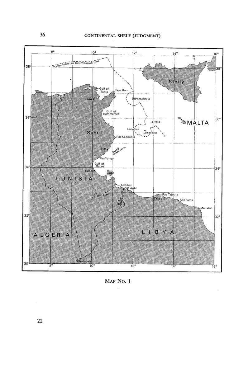
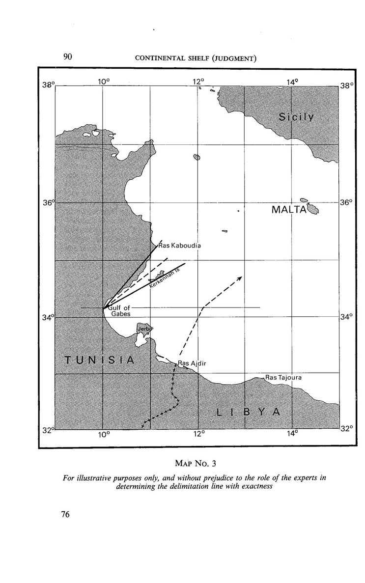